Suck Creek
| Stretch: | Confluence to Knucklhead (or to Highway 27) |
| Difficulty: | Class IV+ to V |
| Distance: | 0.7 miles (or 1.6 miles) |
| Flows: | ~0-2 ft (3-4 inches was low but still reasonably fun) |
| Gradient: | 245 fpm |
| Put-in: | Confluence of North and South Suck |
| Take-out: | Knucklehead Roadside turnout (or 0.9 miles further downriver at the Highway 27 bridge) |
| Shuttle: | 0.7 miles (or 1.7 miles) |
| Season: | Fall/Winter/Spring from rain |
| Written: | © 2018 |
| Featured in Video A Wet State #135 | |
This creek honestly wouldn't be classic if it was away from a city center. But, as it is, it is only 10-15 minutes away from downtown Chattanooga, and it only takes ~1 inch of rain in the previous day to get going. So, as it is, it is a classic for the region as Chattanooga folks can easily get multiple after work laps, or even lunch laps.
The nature of the creek is steep boulder gardens that although verging on being mank, actually manifest in many super fun moves. Also surprisingly with this creek, is that despite the steepness and small stream size, somehow there are great eddies throughout the run. We had 6 in our group, 3 of us having never done it, 2 knowing it well, and at no point did our group size feel anywhere near too big.
It was nice to get back here and finally get this creek. Some 6 years ago, well before Diane and I moved to the SE, I came out to Huntsville Alabama on a business trip and flew early to kayak with my friends Daniel Rucker and Phillip Branch. Earlier in the day we did my first time down North Chick. That river proved to be a blast. My friend from Knoxville Jim Janney came down and also boated with us. Little did I know, that his whole crew would in a few years be my local group of friends. After doing the North Chick lap, Rucker, Phil and I got lunch. It was a cold January day. After lunch we drove up to Suck. However, with the temps, Phil and I opted against suiting back up in the cold gear and instead drove shuttle.
So, this time, after Jim Janney and our friend John finish North Chick, despite a bit of a bum arm, I really didn't want to back out twice on this creek. So I suited back up and we put on. The run was made easier, as at take-out we ran into a local friend of Jim, John Lindsay. He offered to let us tag along, which with beta, removed a lot of the stress of this steep creek. His lines were on point and we were able to stay in our boat the whole run.
This run is interesting, at our flow, most of the rapids were only class IV+, but you would want to be completely in control on those otherwise it could all spiral out of control quickly. I can imagine as flows get to the upper end this run becomes a very solid class V run, if not even getting to V+. Although this run gets run regularly, it should be approached with caution. There are several hazards, some of them are in your face and greet wrong lines unforgivingly. But if you have the skills, and especially if you live in the area, put it on your list. If you don't live in the area, I can't say I would put it high on your primary list. Instead, make it a priority on a day where you come to the area for another run. Add it to a Soddy lap, or North Chick lap, of Bear lap. It will be a nice accent on the day that way.
Note that this riverbed floods regularly and therefore the riverbed (which has a lot of road blast in it) changes regularly. Approach every rapid with caution and scout when necessary.
Mi 0.0:
- Boogie (IV). The boogie starts immediately downstream
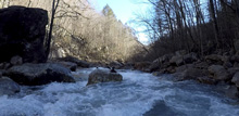
Shitty Shitty Bang Bang (IV to IV+). A congested lead in leads to a small ledge. You want to be right of center currently.
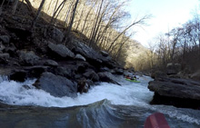
Optimus Prime (IV+). Just below, we enter the main channel and drove far left to enter a slide. There is a piton at the bottom so you want to cut left at the bottom of the slide. Apparently this rapid changes a lot. This is the only spot on the river that the left wall is a shear wall. The rest of the run it is open.
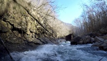
Boogie (III to IV). A mellower section of boogie leads to the first big drop. You can scout on the right when you start to see the retaining wall at river level. Or work down to the eddy on the left at the lip.
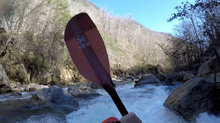
Road Construction (IV+ to V). This drop has a crappy entrance, where you thread a needle and bang down a manky slot. Then, you will want to line up a flake that is just a smidge left of center. This then leads to another drop which you want to boof center, maybe a little right.
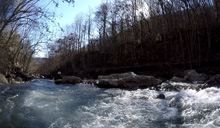
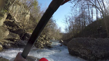
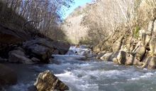
Razor's Edge (IV). I would have just called this boogie as it felt just like that... But apparently back in 1987 the rapid was a little different and there was a fatality here.
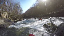
Slow and Low (V- to V). OK, so I have only run the left channel line. This consists of two main rapids. The first goes around a large house size rock, hug right behind it as the left half of the small channel drops into a cave that you don't want to go into. Once clear of the cave, there is an easy boof below. The second half of the drop is a manky entrance that you want to run far right followed by a sick boof that you access by the furthest most right micro channel. Take a righty stroke off the middle. The main line is on the opposite side... but, I didn't run that the one time I was here. I heard it is good to go, but the guys I was with really like the final boof in the left channel.
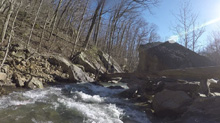
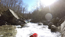
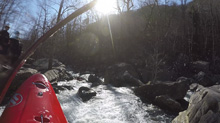
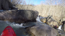
Boogie continues for a short distance until you see the unmistakeable Pinnacle Rock
Pinnacle (V- to V). This is one of the classic drops of the creek. There is a vertical slab of rock that is the "Pinnacle." Just next to it there is a 8 foot tall ledge or so. You want to boof the left side. There are some rocks in the center immediately below that may flip you upon landing. Get back upright quick as the exit needs to be run just left of center in the main channel there. The exit is a nice mellow slide. The right side lands on rock and the far left micro channel results in a pin.
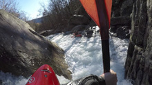
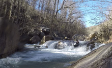
Boogie (IV to IV+). Immediately below there is are two sorta junky rapids that you start left and work back left for.
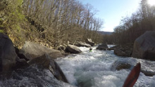
Velcro Zipper (IV+). This was the most fun rapid for me I think. A small lead in ramps you down to a pillow that you can power through and grind the right side of the large center rock, grind well enough that you sale clean of the hole below.
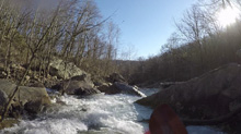
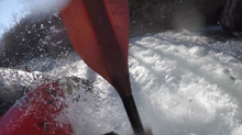
Sheit Bird Alley (V- to V). This drop has some s-turning currents that you run down the middle. The crux is the exit which is plugged by a rock. The ideal line is to go up and over the middle of it. Fading to the left can result in a piton and fading to the right drops into a small narrow slot. Neither are disastrous though.
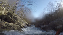
Stan's Rapid (IV- to IV). At our flow we were able to run far left and just slide down the rock. John (our lead) boofed the right side and had a big back ender. This is just maybe 30 feet above Knucklehead. Luckily he flushed and rolled up in time to catch the eddy. The gauge is in this small pool between this rapid and Knucklehead.
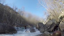
- Knucklehead (V+). Most will just either take-out immediately above this drop on the right, or portage on the right. It is a tall drop that you have to hit just right, driving right to left through a narrow slot and reactionary boil, to avoid dropping 10 feet onto the rocks below.
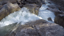
Take-out: If the water is not on the higher side (5" or more), you take out above Knucklehead. If it is higher, you can continue on down for a few more good size rapids. The biggest of which is immediately below. I have not done this section. But Beyond Thunder Dome is a pretty cool name for a rapid... I will say that.
Take-out: From Chattanooga, head out of downtown on TN-27. Follow this for 2.5 miles before exiting to follow Signal Mountain Rd (127/27). Follow this for 1.7 miles and turn left to stay on TN-27. In 4.0 miles you will get to the bridge over the creek. This is the high water take-out option. For the more normally lapped section, continue up another 0.8 miles to some turn outs directly downstream from Knucklehead.
Put-in: Continue up TN-27 for 0.7 more miles. You will see the North Fork and South Fork confluence. Park at the turn out directly at them. There is a trail down to the river.
HTML Comment Box is loading comments...
