Squirrel Creek (Deer Creek Tributary, South Yuba Watershed)
| Stretch: | Pleasant Valley Road to Mooney Flat Road |
| Difficulty: | Class IV-IV+ |
| Distance: | 4.8 miles, 3-4 hours |
| Flows: | ~150-500 cfs (2.2' to 3.5'), no gauge, if it is raining and the South Yuba is up, this may be up. (or ~750-2000 cfs on the USGS Deer Creek gauge at takeout |
| Gradient: | 45 fpm for 1 mile, 242 fpm 2 miles, 104 fpm for 1.7 miles |
| Put-in: | Pleasant Valley Road Bridge |
| Take-out: | Mooney Flat Road Bridge |
| Shuttle: | 5 miles, 7 minutes |
| Season: | Winter from Rain |
| Written: | © 2011 |
As of Friday, I had never heard of this creek. A small tributary of Deer Creek, a creek in and of itself that most kayakers in the area have never heard of prior to this year's renewed exploration by Cody Howard. I was told a few years ago by some Grass Valley locals that the Deer Creek run between Lake Wildwood and Mooney Flat Road was a great run. However, no discussion was ever made regarding its small tributary Squirrel Creek. But sure enough, knowledge that two waterfalls existed and modern satellite image availability, Cody Howard motivated a team for the run. They had 3.0 feet on the put-in gauge and from the photos I have seen, it looked more burley for sure. We had 2.2 feet and it was low for sure. I imagine the optimal flow for someone like me would be around 2.7 feet. However, that would bring some concerns as well.
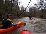
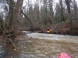
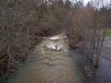
The river starts off in a densely overgrown neighborhood. Blackberry bushes line the river and there are several trees across the river. At 2.2 we were able to get over all but one, and the one that we were able to get over had only a micro eddy above it and thus I got the joy of being swept under it, losing my paddle and requiring a desperation tree assisted hand roll 20 feet in front of a bigger log jam. Good times. At 2.7 feet I think this tree would be a major problem, at 3.0 they were able to just get over it.
After the first flat section, the river makes a sharp left turn and you get to the goods. From here to the end, the creek is great (or at least as good as can be expected for a small drainage in low elevation, so perhaps not classic, but worth doing a few times to mix things up). Mixed in with the class IV-IV+ bedrock rapids are two massive drops that can be portage with minimal effort via small dirt road assist though both still require at least 10 minutes of walking. After the second portage, you will run the biggest rapid on the run and then continue another mile or so of fun boogie. Once at the confluence, you will be deposited into the lead in of a long scary looking class IV+. From the top, it looks a lot worse than it ends up being. Regardless, it is easy to get out and scout on the right if you are so inclined. We hugged the right shore all the way down to the end and dropped down a slide into a good size hole. It is a great rapid, and the fun rapids keep on coming. Though brush is plentiful throughout the length of the run, we always found a channel through it. I imagine the 1.8 miles on Deer Creek is a downright hoot with juicy levels... so much so, perhaps the next time we get rain I will go check out the section below Wildwood...
Thanks to Steve Schmitt for contributing photos from our day on the water... and to Darin for loaning me a Villian to try out (abuse).
Mi 0.0:
- The first 1.1 miles are relatively flat with a few logs. At 2.2 feet we were able to hop over all but 1 log. That one had a micro eddy next to it and it was high enough I flushed under it. At 2.7 it might be sketchy, at 3.0 they could get over all the logs. Just after this log, there was a class II rapid with wood visible that was just barely duckable. I chose to hop out on the left and portage around it as they barely fit under and I am much bigger.
- Diversion (IV+). At a very hard left turn, the river splits around an island, you see a diversion on the left (hopefully no water is going into it). Hop out on the left and scout from below. We ran down the right and stayed right over a few ledges. The left line was run at higher water by Will Pruett but that is stout and rebar was visible at low water.
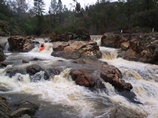
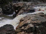
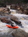
In between (IV-IV+). At low flows there was a nice eddy to catch in the middle of the rapid, at high flows I think you would have to just go with it. The first half had a good size hole as did the bottom, each formed by 4-5 foot drops. This is not a place to swim as Squirrel Creek Falls is just downstream.
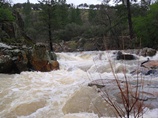
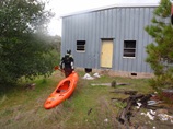
Squirrel Creek Falls (P). This falls is 60-70 feet tall easily. There are three distinct kickers in the cascade and each one lands on the next slab. It looked huge and looked like if you messed it up you might be down for the count. So, get out in the pool at the top on the right. Find the "trail" leading gradually up and downriver. When the trail disappears, just head downriver. You will see a big building, walk around it and follow the trail back down to the water. In 2011 the next rapid had wood, we got the heads up from Darin so we knew to continue our portage through the grass field obviously at one point had some agricultural operation going, and put back in below the rapid.
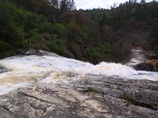
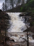
Ledge (IV). A long brushy class II opens up and drops you over a 5-6 foot ledge. We ran center boof left. There is a rock in the landing if you boof right. Also, running far left results in a deep line and a piton, so boof it.
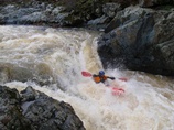
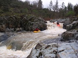
Boogie (IV). The boogie continued. We were able to boat scout everything leading up to the next portage. One rapid in particular where the river split around a large midstream rock was bigger than the rest. We went far right hugging the wall around the big hole. There were also some junky rapids that resulted in a pin or two, but it all worked out.
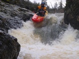
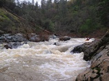
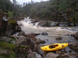
- Squirrel Creek Gorge (P). You will come around a bend and look down to the left and see the river drop into a gorge. Eddy out on the right at the very top. Portage along the "trail," cross the ravine via the trail, and continue walking downriver and slightly up the hill. You will eventually hit a dirt "road" that will drop you down to the river. On your way down, it is worth scouting the drop 200 yards below the put-in. Or you can get out on the left at the top of it. The gorge itself is super ugly and has a good 15 foot drop into a tight, rock filled pinch and that is then followed by another set of rock filled pinches. Just walk it.
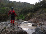
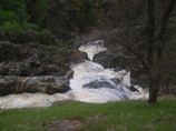
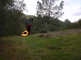
The Pearl of the Squirrel (IV+ to V). From where we put in we had a hundred yards of class IV before the main rapid, we ran down the left. A multi-tiered drop, you want to enter right over a shelf, then drive right over the next ledge with a larger than it looks while scouting hole. Then head right down the next ramp so you are right when it really matters. The third move is the crux and you want to be right of the rock in the middle of the river. This drop falls some 6 feet with a large cross current into the wall, just downstream is another 4 foot ledge with a good size hole. At high water I can imagine this rapid is class V as I was told, but at our flow it was more of a very solid class IV+.
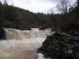
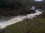
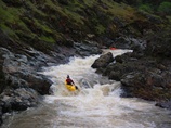
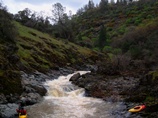
Boogie (III-IV). Below here the river gets much easier. There are one or two more drops on the Squirrel that you may want to hop out to scout as they are marginally blind. One had a rock fence at the bottom, we went far right and were happy went we found a up-pointed sharp rock in the left channel. Eventually, you reach Deer Creek.
- Deer Creek Confluence (IV+). As soon as you reach the Deer, you will look downriver and be a bit intimidated. The rapid stretches on and looks massive. Luckily it works out. There are a couple of easy ledges at the top, though at higher water I can imagine these ledges pack a punch. Figure out the middle however looks good to you, there are a couple of eddies on the right shore, we used these and then hugged right around a weird curler. We finished on the far right on the shore which led to a slide into a hole. It looked like driving across the river and finishing left could work too if you were so inclined.
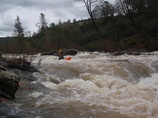
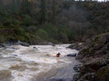
The Corridor (IV). Below here, there was one somewhat blind rapid that had a corridor through willows leading to a small eddy stuck out in the middle of the river. Center looked bad, we hugged a big rock/island on the right and boofed down a 5 foot ledge. From there we went right but then had to ferry back left do to a closure of the channel thanks to willows. Always be ready for willows, don't go around any blind corners etc.
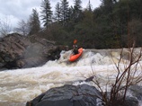
Boogie (III-IV). Lots more fun read and run boogie for the remaining mile or so to take-out.
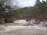
- Whatever you do, do not boat under the bridge at take out... catch an eddy above it. Also, this is likely private property so be quick getting out.
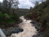
Take-out: Take-out: From Grass Valley, take Highway 20 towards Marysville. Follow for 12 miles to Mooney Flat and turn right and follow for 1.4 miles. Just past the bridge, there is a wide turn out on the right. Just don't block the gate like it request. There is probably room for 2 cars here.
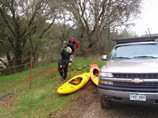
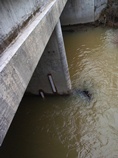
Put-in: Head back towards Grass Valley on Highway 20 for 4.5 miles. Take a left at Pleasant Valley Rd. Follow this 0.5 miles to the bridge, park at the turnout just past the bridge. The gauge is on the upstream, Highway 20 side of the bridge. It is hard to see the numbers from the road as you can only see 3.4-5' and not the 0'-3.3' gauge.
HTML Comment Box is loading comments...
