
Soca (Otona)
| Stretch: | Top of Camp Lazar Rd to the bottom of Camp Lazar Rd |
| Difficulty: | Class IV (harder at higher flows) |
| Distance: | 2.05 miles |
| Flows: | ~15 cumecs to ~100 cumecs (locals run it up to 300 cumecs). Check "The River App" |
| Gradient: | 40.2 fpm average |
| Put-in: | Trail near the top of Camp Lazar Rd. |
| Take-out: | Bridge near Kobarid |
| Shuttle: | 3.3 km (5 minutes one-way) |
| Season: | Spring to Fall (Consistently low in Summer, but can go high off rains) |
| Written: | © 2016 |
Austria & More 2016: Day 4 & 5 Morning
So I will admit that I did not even know there was a great section of class IV downstream of the Cataracts. And from the looks of it, it is also quite popular to do as a standalone run as each time we boated by there were groups putting on.I can understand why. You get an easier version of the cataracts, but all of the same scenery and of course the same beautiful water.
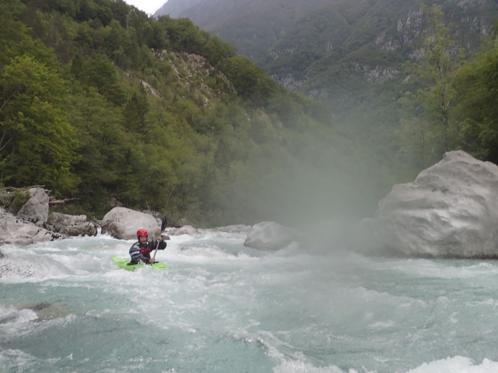
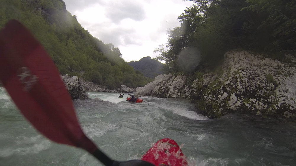
The run starts off with some of the most busy stuff. It isn't that hard, but there are moves to make and a few spots you would want to avoid. The run climaxes in a long rapid that has some holes to boof. Below, things ease up but plenty of splats or boofs are still present. The first day, we took out at Camp Lazar where we were camping (makes sense). The second day, Jim and I continued down another km so we could paddle through the final slot gorge. It was only class II but was very pretty and worth the extra paddle. Parking down there is slim so plan on walking back to camp Lazar for your car.
We had 35 cumecs and I would say this is a nice medium for this run.
Thanks to Harald and Reiner Glanz for sharing photos and for making the trip possible!
Last: Austria & More 2016: Day 4 & 5 Morning - Soca (Cataracts)
Next: Austria & More 2016: Day 5 Early Afternoon - Koritnica (Lower)
Mi 0.0:
- Stay Right (IV). Just below put-in is a rapid that has a nasty spot on the left shore. You go around a swooping turn to the right, just stay away from the left edge of the turn. It then drops into a pinch which is all good.
Boof (III+). Just downstream is a fun rapid that is just boogie to a big boof at the bottom that you can sail a boof off of the left side of.


Cut Left (IV- to IV). Just downstream you are going to start with the deep water on the right. The river then turns left and you want to go with the turn, avoiding the right side of the turn and the rocks it hits.
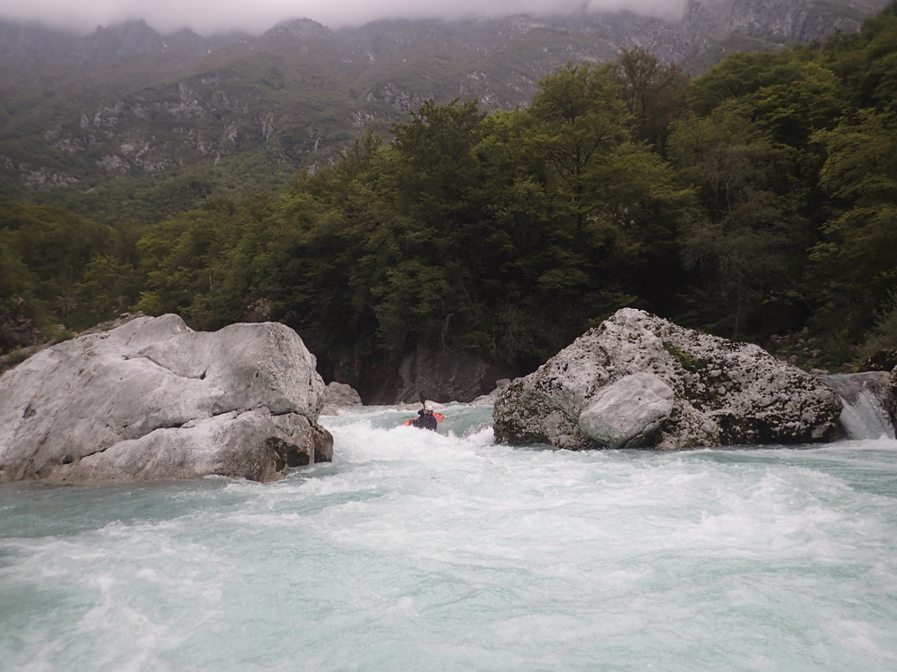
- Biggest Rapid (IV). This then goes into the largest rapid which is all in a straight away but has several nice holes to boof over before it funnels down into a river wide hole to punch at the exit.

Below, boogie just continues. There are some great splats and boofs to hit.
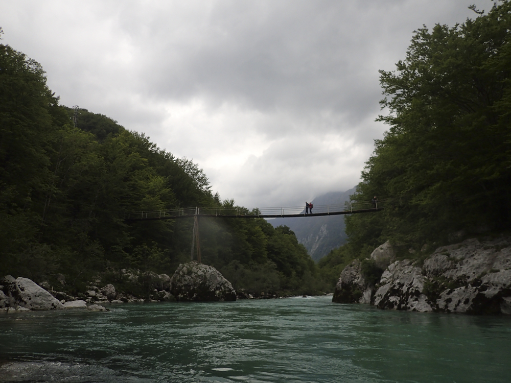
- Foot Bridge overhead marks the upriver side of Camp Lazar
- Camp Lazar Access. Just on the right bend there is a trail that leads up to the downstream side of Camp Lazar. We took out here the first day. The second day we continued on to the lower take-out.
- Final Gorge (II). The final gorge is not hard, but is quick a nice place to paddle. Shear walls rise above you to the roads above.
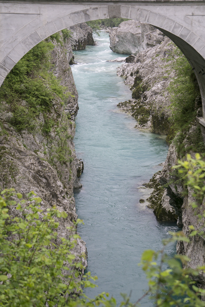
Take-out: As you drive down the Soci, just as you enter Kobarid, take the left to turn back up the Soci river. The bridge you quickly cross is the lower take-out. If you turn left just before the bridge you will quickly get to some parking or in a few hundred yards further you will get to Camp Lazar.
Put-in: 1.7 km East of Trnovo ob Soci there is a turnout on the side of the road. Park there. There is a trail down.
HTML Comment Box is loading comments...