
Snowbird Creek (Upper)
| Stretch: | Hooper Bald Trailhead to end of Big Snowbird Rd |
| Difficulty: | Class IV to V- |
| Distance: | 8.2 miles |
| Flows: | Visual only. Look for 3" in prior 6 hrs. Needs A LOT! |
| Gradient: | 135 fpm average for 4.35 miles and then 179 fpm to the end. |
| Put-in: | Just above the confluence of Snowbird Creek and Bearpen Branch |
| Take-out: | End of Big Snowbird Rd, at the trailhead |
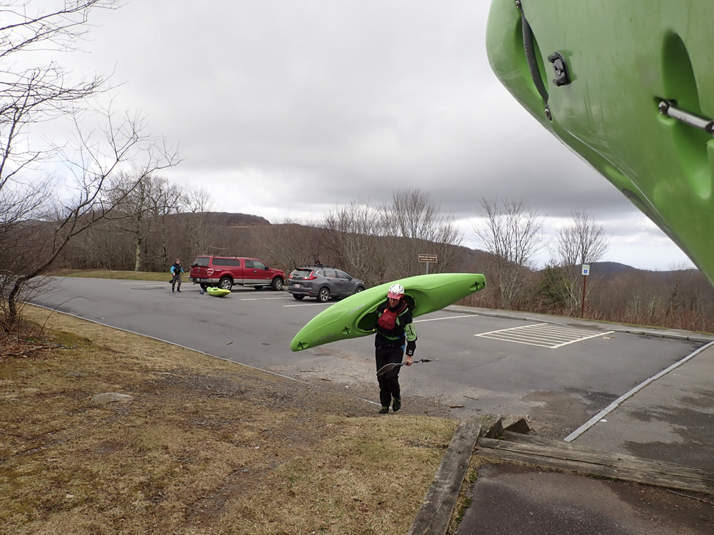
| Shuttle: | 21.2 miles, (45 minutes one-way, some good dirt). Plus ~3 mile hike that took 1.5 hrs knowing where we were going. The hike regularly turns people's days into epics. |
| Season: | Fall, Winter, and Spring from rain |
| Written: | © 2019 |
| Featured in A Wet State #150 | |
Upper Snowbird has been on my radar since we first moved to Tennessee. This, along with Santeetlah and Henderson were highlighted as runs that I likely had not heard of that should be high on my list. The challenge is, of course, that the run is 2.5 hrs from home, has a long shuttle, a hike in that is notorious for getting people lost, and results in people taking off in the dark fairly often. Because of that, it has hardly been high on my radar each time the rains come.
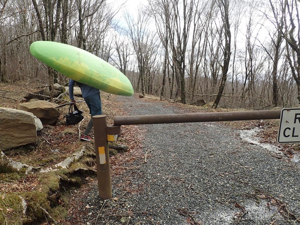
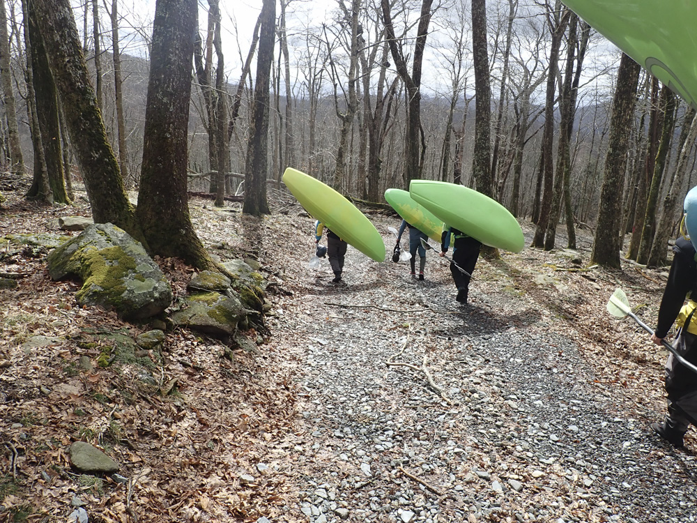
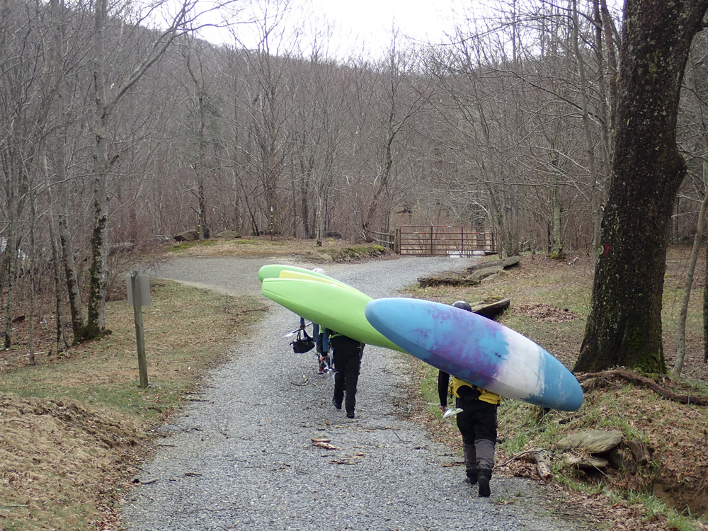
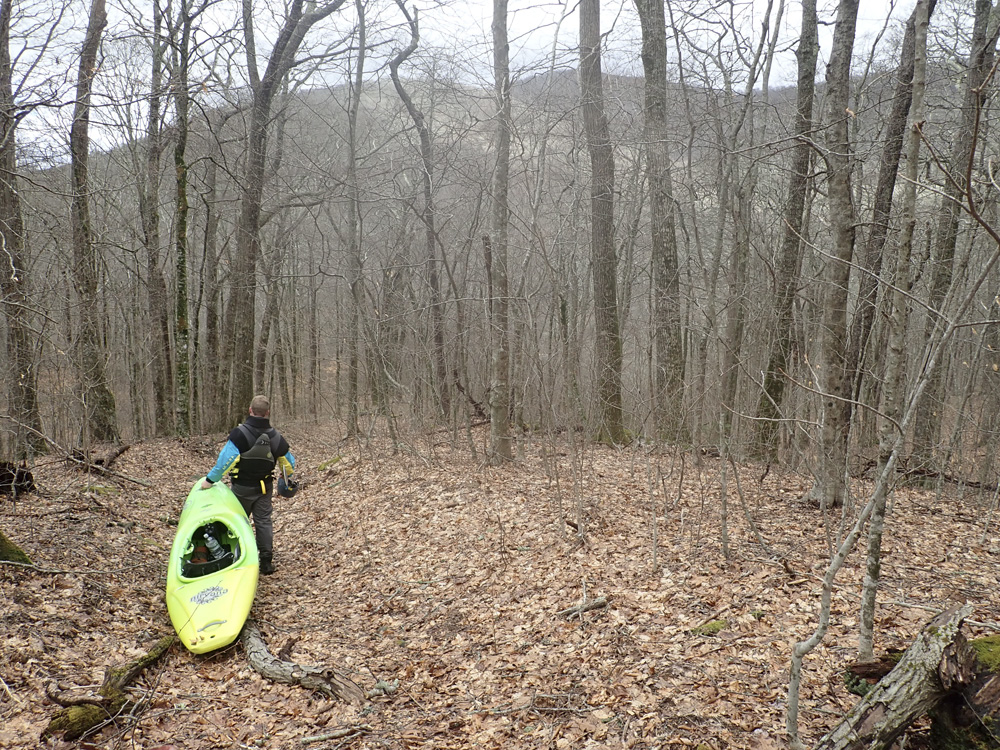
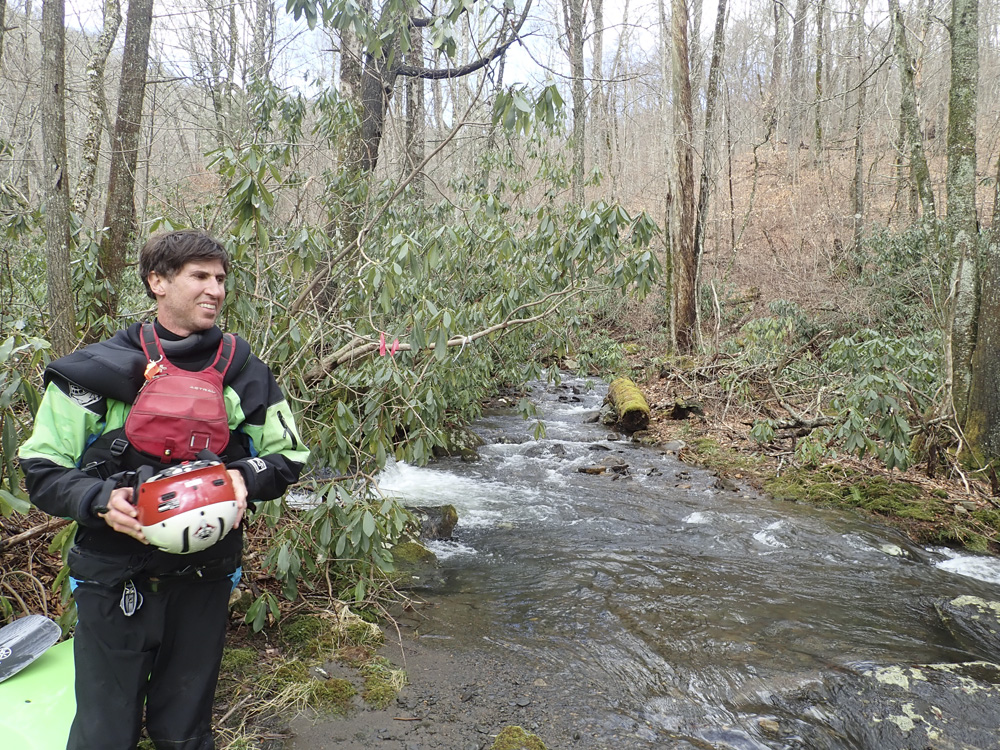
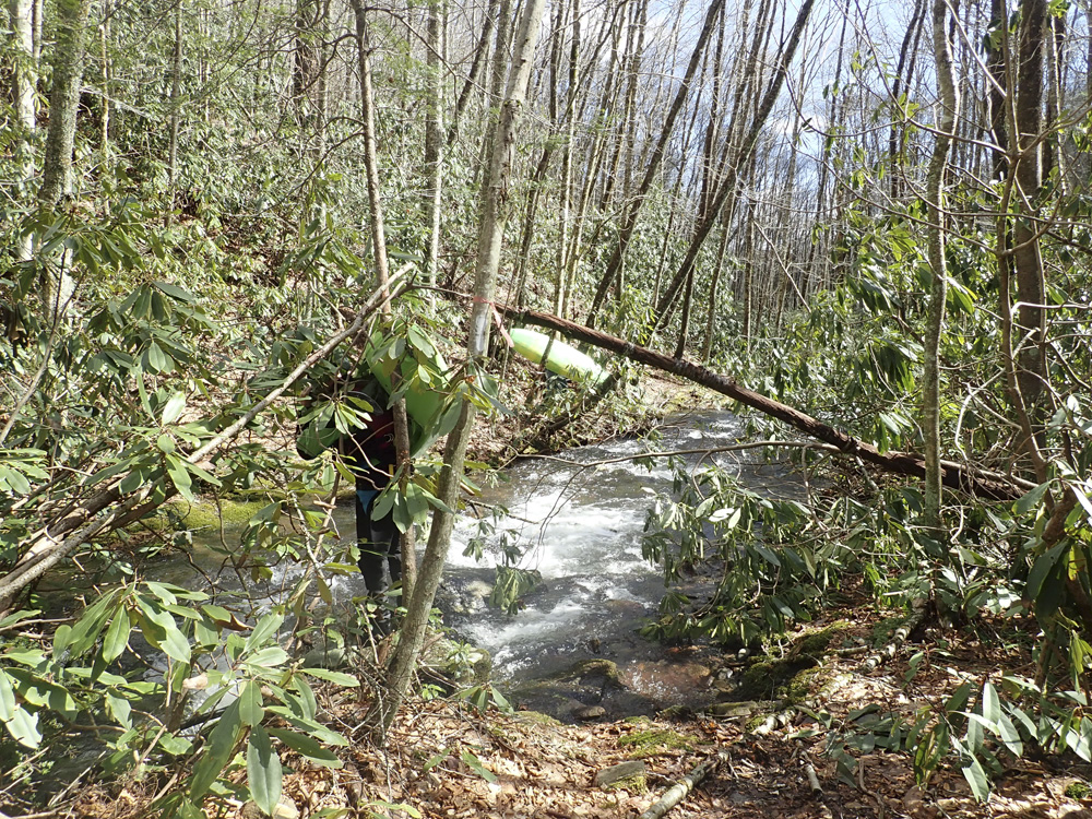
But, this yea, February 2019 we got the rains to end all rains, and with flow likely, the plan was hatched and we departed home at the leisurely time of 8 am. We got to take out, left a car, and drove to put in. This is where we lost a member of our group, who had forgotten a skirt. Long way to drive to not get to boat, sorry Noah! Jim had done the run before, so with his knowledge we found quick work of the hike, quick being 1.5 hrs of steady hiking... but at least we didn't get lost. The hike is all downhill so there is that.
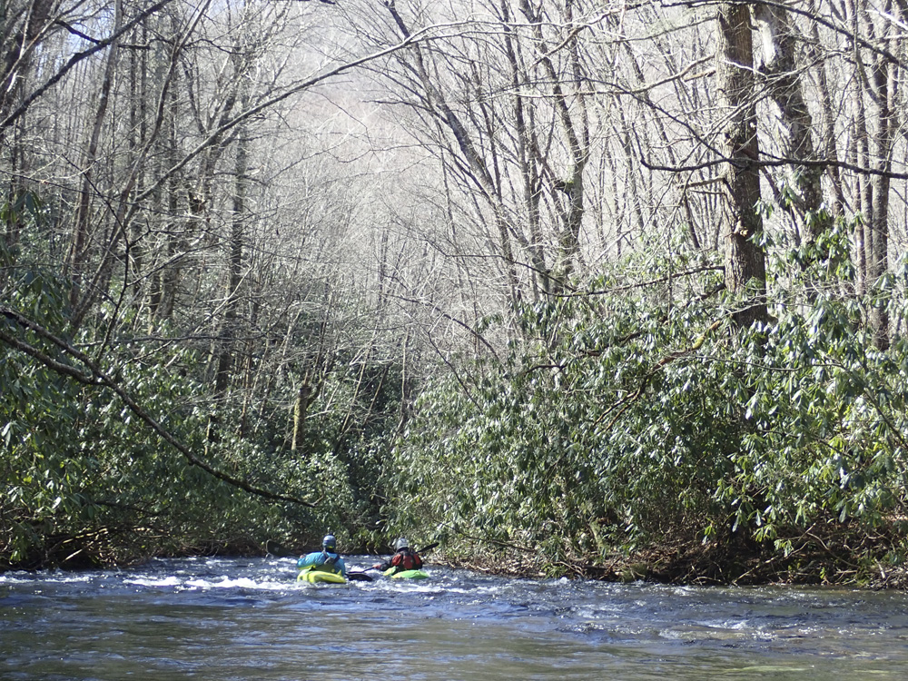
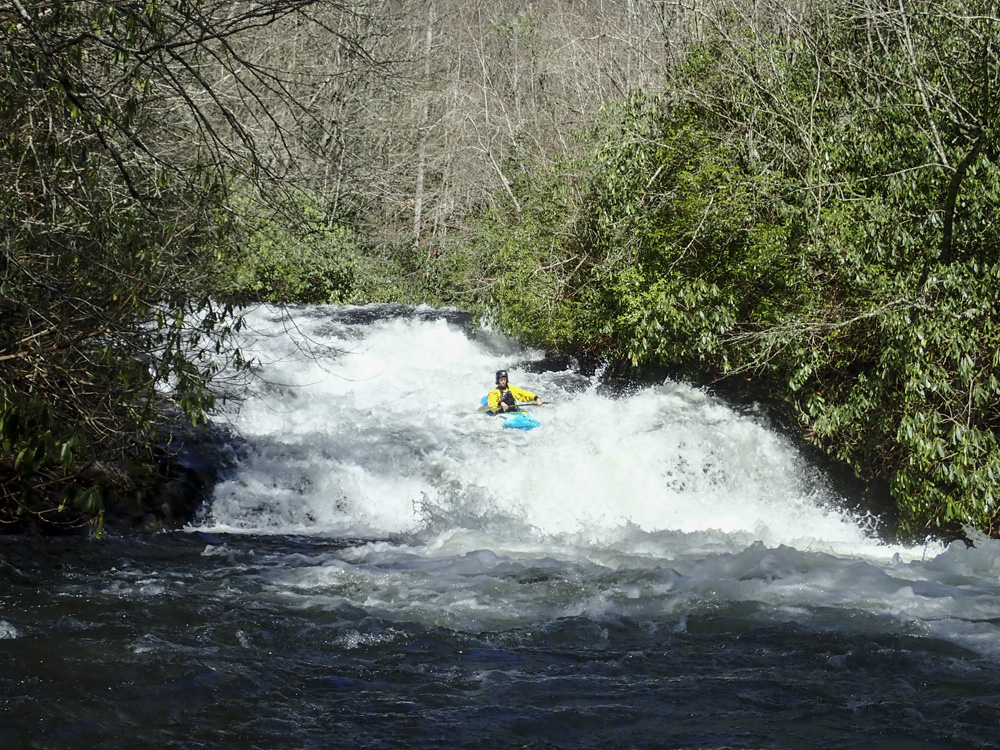
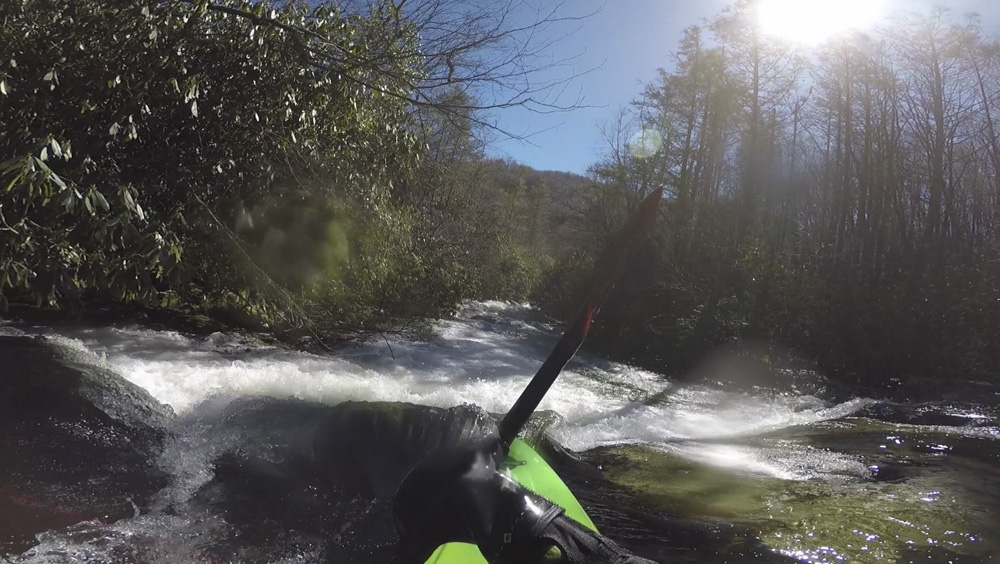
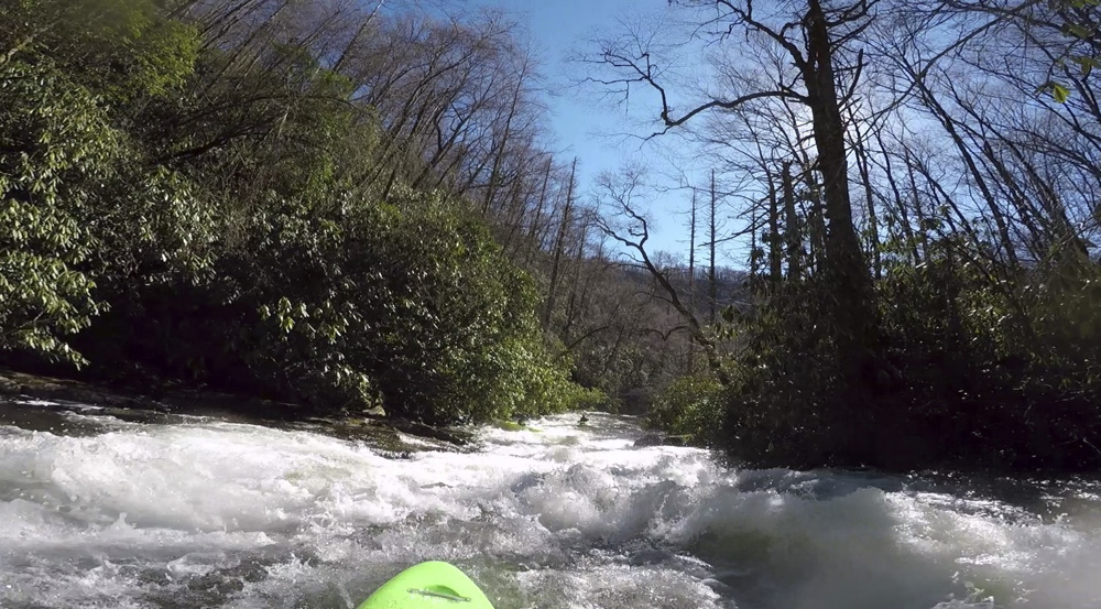
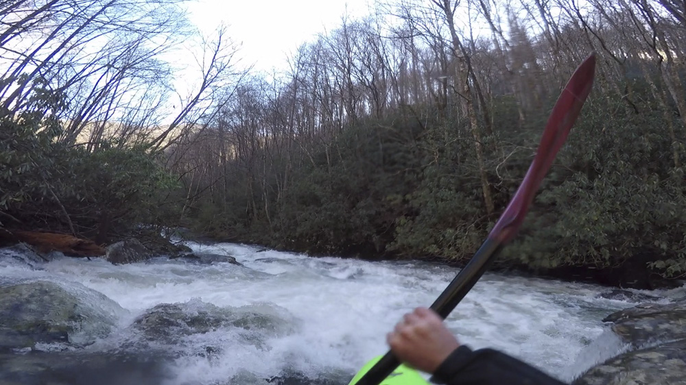
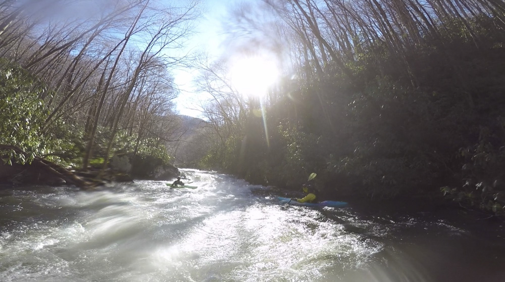
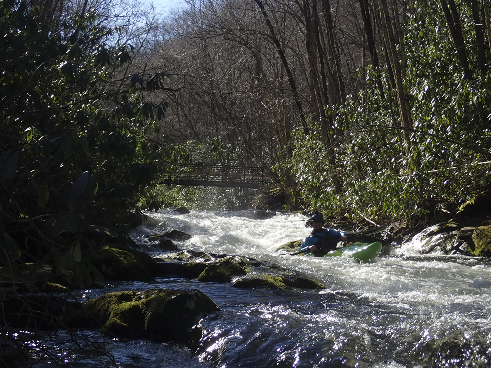
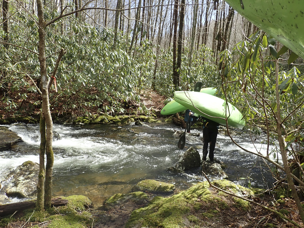
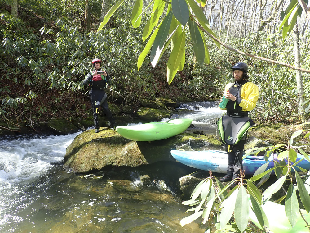
Once at the river, we found flow low, but floatable so we put on before Bearpen Branch and manked our way down to where enough water had collected to begin to feel like boating. Quickly, you get to the first big rapid, a straight forward slide. It is worth having one look at it on the right to ensure it is clear of wood. Below, things continue in the sorta manky manner down to the Middle Falls, which is probably the most time consuming place. For starters, it sneaks up on you, and it has a lead in. So scout early on the left. The lead in goes to a shallow lip of a 20 foot falls that you want to hit in the right spot. Use the trail and spurs to scout it on the left. Below, things get a little better, but are mostly class III. Things change however when you cross under the trail bridge. This is the sign that you are getting to the last two big rapids. The first one reminded me of Staircase Falls on the Horsepasture River, though easier and less tall in each step. The second one is the most complicated rapid on the run, and requires a boof to the left of an island for a tricky ramp down around a large pocket hole at the base of the cascade. Drive left! Below this, the boogie ramps up. Now it is non-stop class IV, which with the wood threat, feels like class IV+ at times. The miles do go fast though, assuming the wood is avoidable and you are able to stay in your boat. And before you know it, you are done.
I was surprised honestly, that the run had so little bedrock. Basically the big rapids, and a few other smaller rapids were bedrock. But, for the most part the run was boulder gardens. I think more water would have left me reflecting more fondly of this run, don't get me wrong, I had fun and was happy I went, but it was also hard on the boat at low water. Overall, I think I would like to go back and see it with a medium flow to make proper judgment.
For comparison, I would also so it is significantly easier than Upper Santeetlah, though I guess I have only run that high, so perhaps it isn't apples to apples. For reference, we had 0.75" of rain in the prior 12, and 1.5" in the prior 24 hrs. This is not the normal... this was after the region flooded for a week. Normally you will need multiple inches in the past 24 inches. You will want the take-out to look high and the rain to be stopping, when you set your car to run shuttle.
Also for reference, the shuttle is 45 minutes one-way, the hike is 1.5 hrs assuming you don't get lost, and the river took us 3 hrs with only one scout and no wood portages. I think this is about as fast as the day can be completed... so plan accordingly. People often push daylight on this one... so error on an early side if no one in the group knows it.
Mi 0.0:
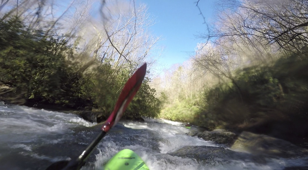
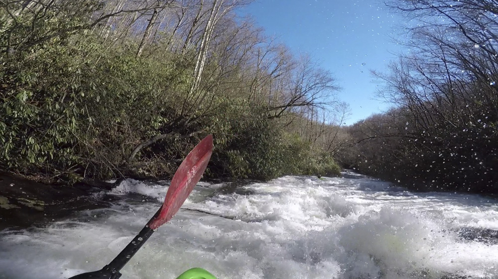
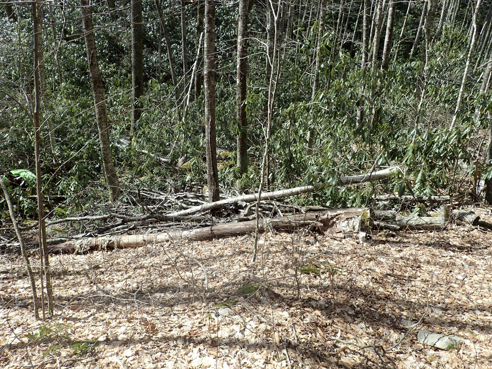
- Micro (II to III). This section of the creek is very very micro. If you aren't hitting rocks, I would be concerened that you have very very high flow. Every once and a while you will come to a nice bedrock ledge or slide. There was also a cool pinch in here as well. You collect water quickly from tributaries though, by 0.35 miles in you should have a small creek's worth.
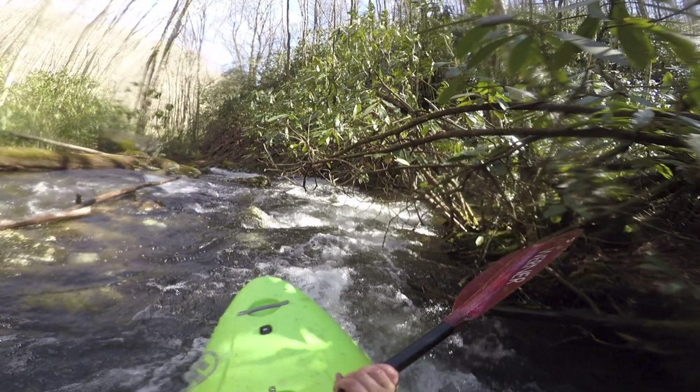
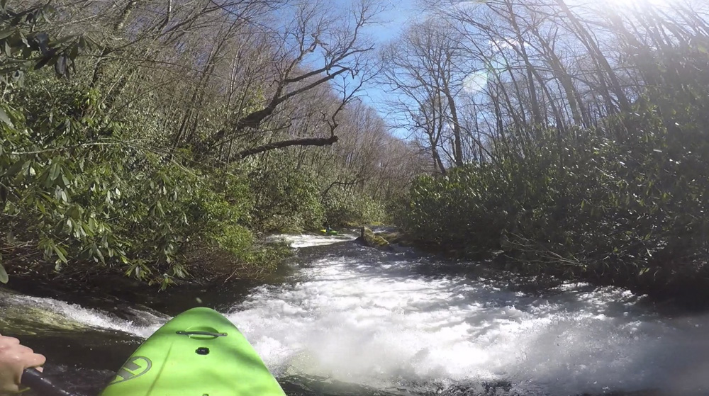
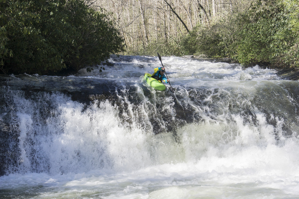
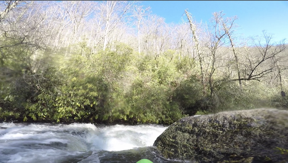
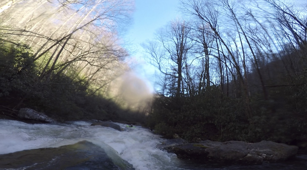
- Upper Falls (IV to IV+). You come around a bend, the river widens, the bed turns to bed rock, trees clear and the sun hits you. You are above this falls. Have one person look from the last minute eddy on the right to check for wood. Everyone, just route down the middle for this long and super fun slide.
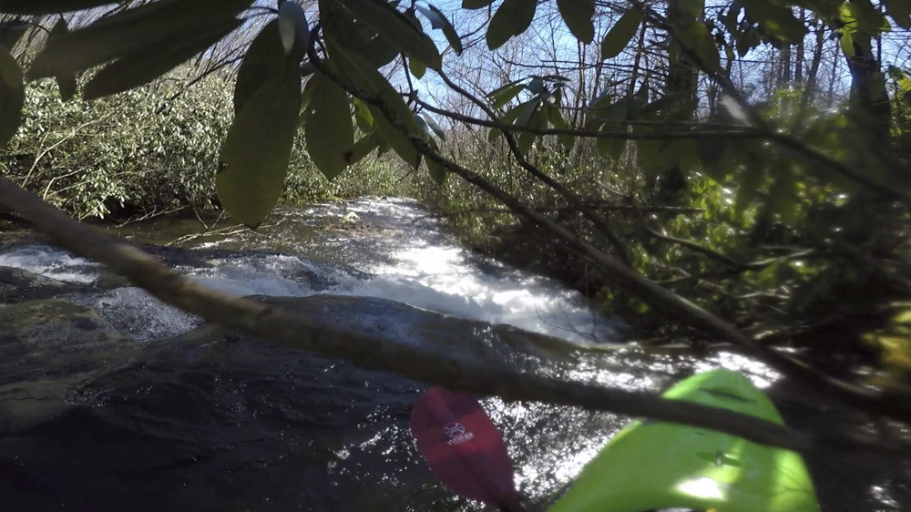
- Bedrock (III+). There is a multi tiered step of bedrock. For us, it was a false alarm that we might be at the Middle Falls.
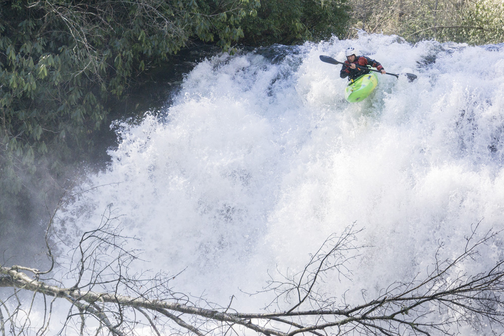
- Middle Falls (V). After a left bend, get out to scout on the left. You can't see the horizon line from where you get out, as there is a lead in. So after the previous bedrock drop, start to be cautious. The lead in has a slopping ledge that moves you left, you want to drive right and boof pretty far right of center in the deepest spot. The drop is 20 feet tall or so, and a few plugged and no one reported hitting anything.
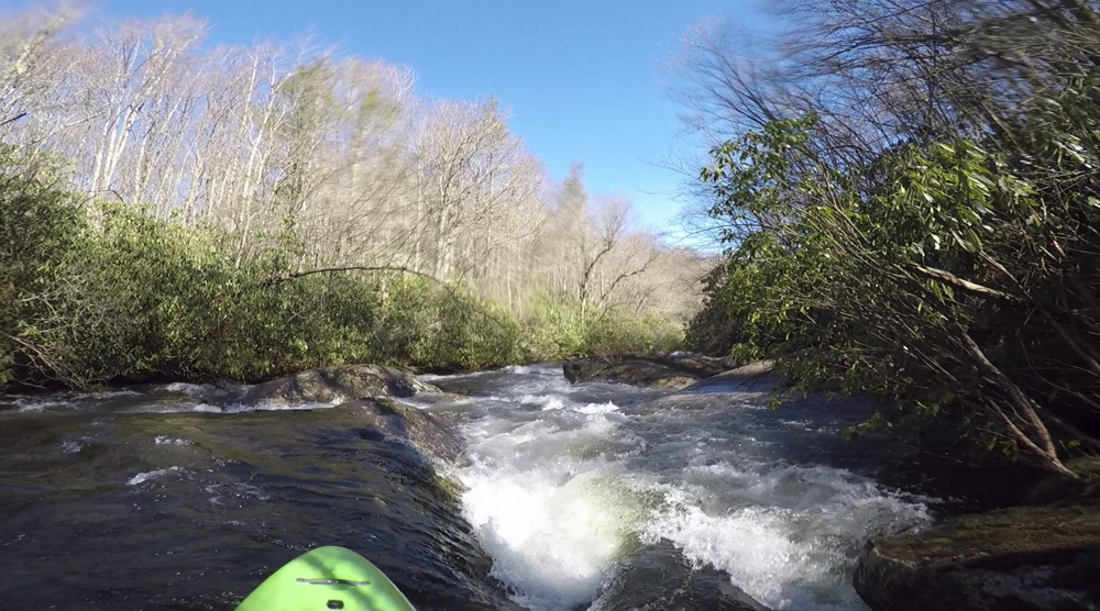
Boogie (III to III+). The boogie here is straight forward, lots of zig zagging on bedrock based boulder gardens.
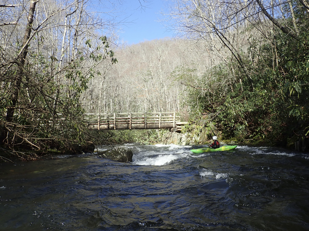
- Foot Bridge crosses overhead. This is your signal you are coming to the next two falls.
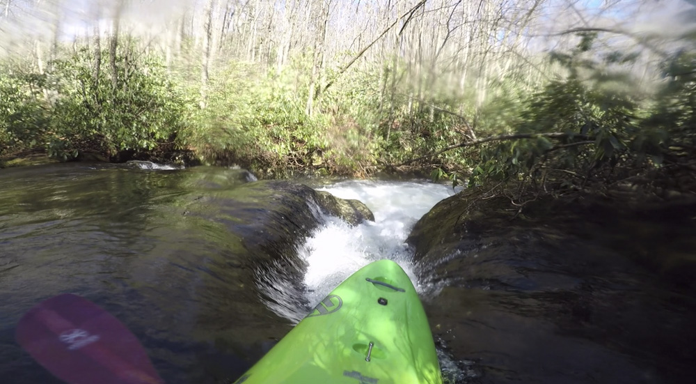
- Big Falls (IV+). Officially I think "Big Falls" is the name for this and the next drop, but for kayakers they are two separate drops. This one reminds me of Staircase on Horsepasture. Slides and ledges leading to a clean ledge at the bottom. We ran down the left through the top and then finished right of center for the final ledge. One smaller ledge was just 40 feet downstream. From there, 100 yards of boogie led to the next drop.
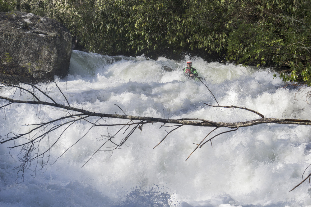
Island Falls (V). The biggest rapid of the run, scouting looked to be a pain due to the rhodo. So instead, we entered and eddied out against the center island. Stable there, we peaked over the edge to one at a time take a peek before running it. Its also probably why none of us had a good line on the top. We all tried to boof left but a tall cushion was present coming off the left which we nearly all struggled getting over and straightening out after. I think entering left (instead of catching our eddy at the lip in the middle) would set you up MUCH better. But to know that, you have to deal with rhodo hell to scout.
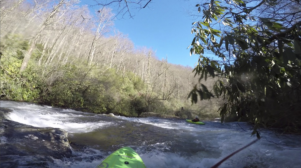
- Boogie (IV). This section is continuous class III and IV rapids, honestly, taken in its entirety it felt more class IV+ just due to the non-stop nature and the threat of wood. There was some bedrock early on, but that quickly gives way to boulder gardens. Every once and while the piles get taller and steeper. There were only occasionally pools to break the rapid up... like 3 or 4 in the next few miles! This goes right up to the take-out just downstream of another foot bridge. This section is also the steepest on the run!
Take-out: From the Cheoah, as you come into the outskirts of Robbinsville, NC on US-129, take NC-143 W to the right. Follow this for 4.3 miles to the T, take a right to stay on NC-143. In 2.2 miles take a left onto Snowbird Rd. Follow this for 2.1 miles and take a sharp left to stay on Snowbird Rd. After a mile, turn right onto Big Snowbird Rd. Follow this for some 6 miles up to the end of the road. It is dirt for the last bit, but was in great shape in 2019.
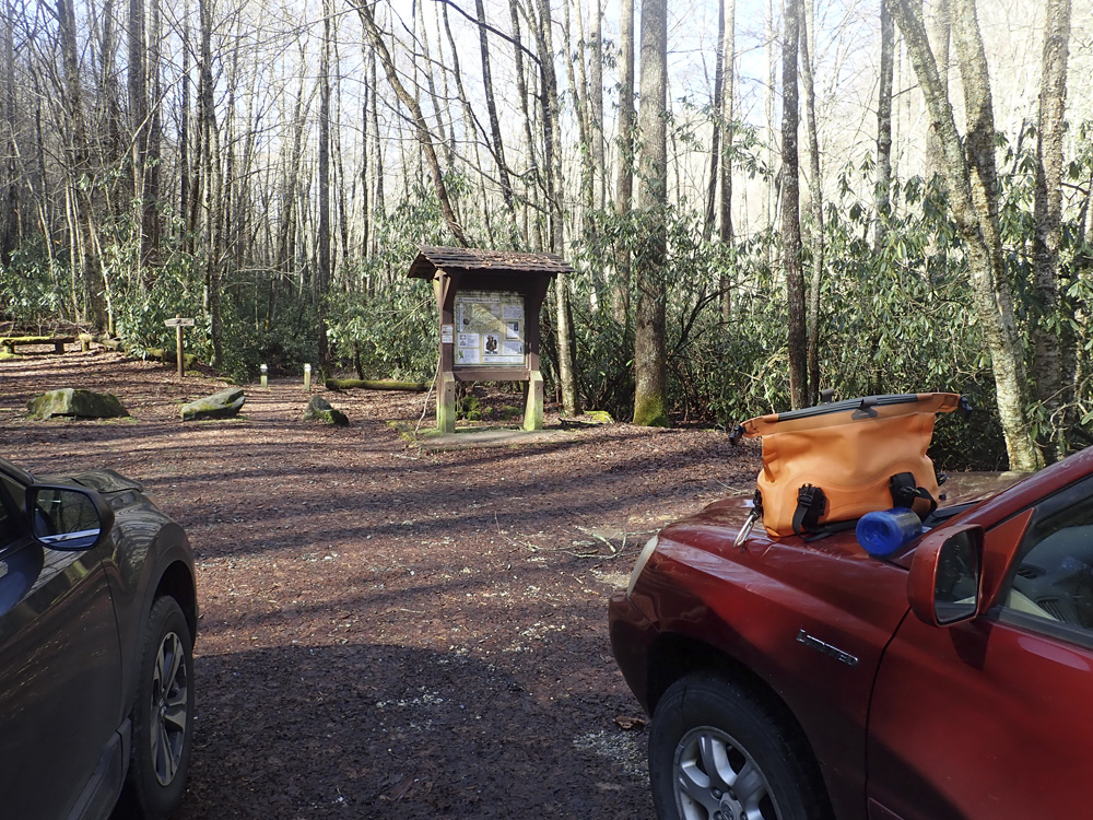
Put-in: go back out to NC-143, and turn left. This is the Cherahola Skyway. Follow this for 14.8 miles to the parking area at the Hooper Bald Trailhead.
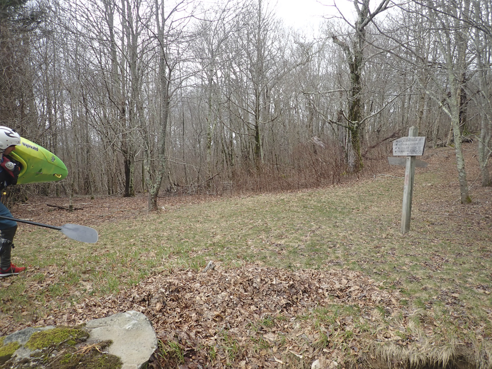
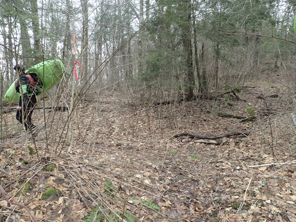
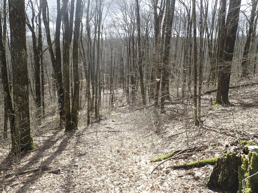
Hiking Directions: From the parking area, head out on the trail which quickly hits a gravel rd that is gated, go through the gate and onto the road.
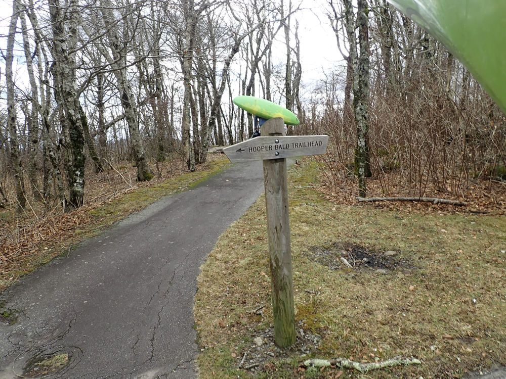
Follow this down, staying to the right at the fork and down to a gated house. There is a trailhead on the right. You are going to take Snowbird Creek #64.
Follow this trail, which at times is faint though also at key times is flagged (2019). It will drop to the left and back to the right, and cross a slabby creek (cross river left to right).
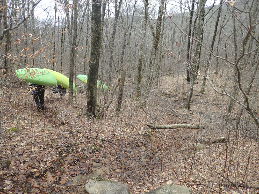
It will then sidehill for a bit before dropping steeply to a branch of the river. Cross the creek (river left to right).
Climb 100 or so feet up on the other side and look for a faint trail dropping to the left, drop down and follow it, side-hilling again to the main snowbird.
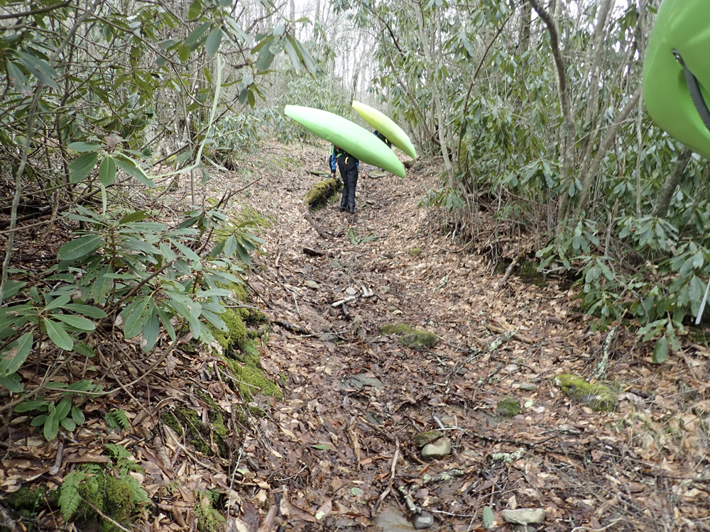
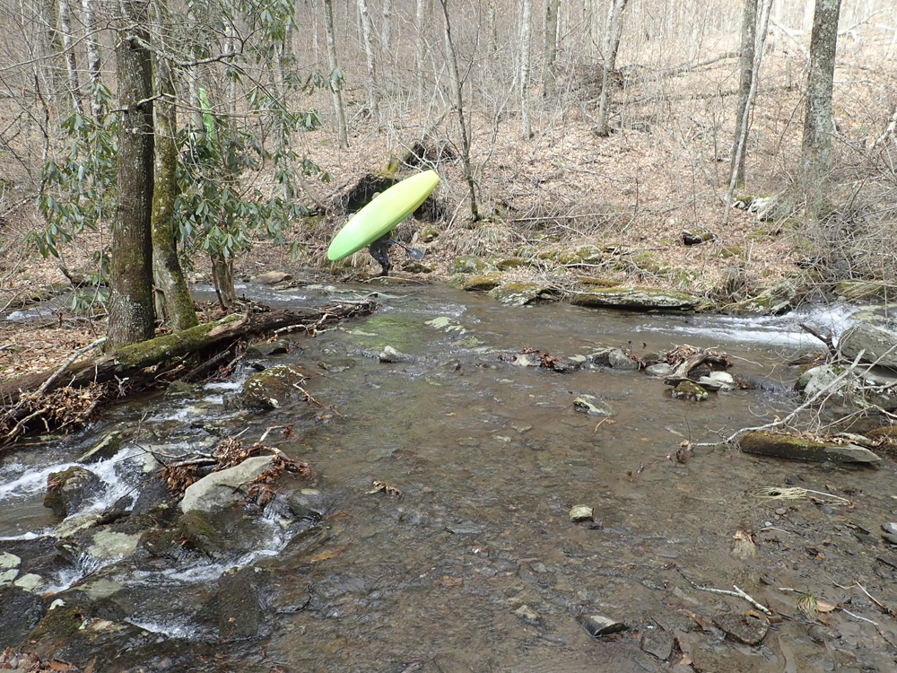
As the trail hits Snowbird Creek, you can turn left and go down river left... this trail follows the river the whole way, though it crosses it often. Walk downhill until you like the flow of water, we crossed a few times and then put on. We manked down for a half mile. We should have hiked a little more as it got much better after Bearpen Branch entered.
HTML Comment Box is loading comments...