Silver Creek (South Fork American River Tributary)
| Stretch: | Camino Reservoir to Forebay Rd |
| Difficulty: | Class V- to V |
| Distance: | 6.0 miles (plus 3 miles on the S.F.A.) |
| Flows: | ~500-1,000 cfs Yea Chris and Hilde Negotiated the gauge to be online again! Current Dreamflows gauge |
| Gradient: | 123 fpm on Silver Creek, then 66 fpm |
| Put-in: | Below Camino Reservoir |
| Take-out: | Forebay Rd. |
| Shuttle: | 35 miles, 1.5 Hours (one way) |
| Season: | HAHA... Very Rarely... spill off of peak snow melt. |
| Written: | © 2011 |
| Featured in Video A Wet State #43 | |
Although Silver Creek has been present in my consciousness, it was not so much for as a potential run but as a source of relief the two times I have descended the Golden Gate section of the South Fork of the American. For once you paddle past the Silver Creek Rapid (the creek itself has always been 100% dry when I have boated by it), you know you have made it and that all the hard stuff is behind you (there is irony in that that I will explain later). The reason that it has never made my list of runs to want to get on, is because it never has water. Furthermore, the guidebook says a measily two lines about it summarizing to good rapids, some brush, some portages, worth doing. Not a resounding endorsement though enough that I thought it would be worthwhile this year as word spread that Camino Reservoir (more of a pond than a reservoir) was releasing.
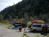
I will start with the downsides. The shuttle is no joke 1.5 hours from take-out to put-in. This is important because if you meet at take-out at 12:30... you are going to get off 30 minutes before dark even if you are boating quickly. Also, if you decide to have non-drivers wait at Taco Bell while the others get the cars from put-in, you will soon find that Taco Bell in Pollock Pines closes its "Lobby" at 9 pm and you will be forced to sit on the curb in sub freezing conditions for the remaining hour of the shuttle. The second downside (in my opinion, which may be a tainted) is that once you reach the confluence, you are likely going to have 3,000-8,000 cfs roaring down the last 3 miles of Golden Gate. Now, indeed all the biggest drops of Golden Gate are behind you (other than F-111, which is rarely run at lower flows), but you will soon find that those easy class IV rapids now have massive holes and you may find that you are capable of being "that guy" who swims twice in 200 yards and needs help to get to shore after one such beating because your hands and arms are stuck in claw shapes due to the severity of the cramp that has overtaken them in response to the severity of the butt whopping the hole just gave you. I guess being able to stick your line only goes so far as the goodness of the line. I stuck my lines, it's just that the lines I choose were just absolute crap lines.
Now for the goods. This runs is spectacular. One of the more scenic sections of river around. It has the overall aesthetic of Golden Gate but the committedness (I doubt that is a word) of Giant Gap. Hiking out of this canyon would be difficult at best. But, that makes the run all the more intriguing and impressive in my mind. Also, this run is none stop. You get 100 yards of class III-IV warm-up before you get to the first class IV+/V- followed immediately by one of the legit class V's. At this point, you can hike back out. Below, the run continues every 100 yards with another class IV+/V- with a handful of V's thrown in for good taste. There really is no relenting for the full length of the run. No paddle out, no paddle in, and no flat section in the middle. It makes for an exhausting day. With 3-4 portages thrown in the run can be a class IV+/V- run, but I would want to feel comfortable on class V as the overall feel of the day, even with the portages, was class V (Taylor's summary of "it is like Golden Gate, only creekier and without the big rapids" was pretty accurate). I thought we had ~600 cfs and I thought this was likely ideal. I think lower would result in some rocky spots and more trip rocks, while higher would make the already mean hydraulics even more grumpy.
In total, I am going to go ahead and say it, that for its difficulty this is probably the most quality run in the area (bold being that I haven't done every run in the area, I know). But the quantity, quality, and uniqueness of the rapids coupled with the outstanding scenery make this a run that every class V boater should hope we can get flows on more often. It really is too bad that the gauge got shut down as of 6 months ago. Though, it isn't like it had water often as the graph shows.
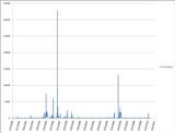
2013 Update, Chris Shackleton and Hilde Schweitzer negotiated the return of the gauge! So, although the river does not have water very often... as we will know when it does!
Mi 0.0:
- Below put-in, the boogie commences with eagerness. 0.2 miles of class III-IV are all the warm up you get, from this point on, it is on.
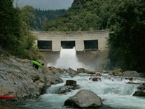
No, This isn't the Big One (IV+ to V-). A small eddy at the top on either side shows the line down a ramp on the right through a few holes and a good horizon line. Run down the right and go off the horizon on the right. This had potential to be a huge hole at higher flows. As the outflow is what I will call "Snaggle Tooth," it is worth a scout to be sure you don't mess it up.
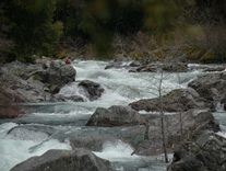
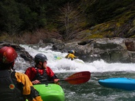
Snaggle Tooth (V). A straight forward ramp leads to a rock in the middle of the river. Go left of it. I have a feeling this rapid may be a no go at low water.
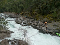
Around the Corner (IV+ to V-). A somewhat blind rapid that isn't that hard, but had plenty of consequence. You can scout right. Run center, then move hard right away from the rock / hole mess in the middle.
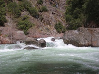
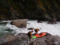
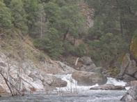
From there, it is a blur of class IV+ and V- rapids with a few standout rapids. I only got pictures of a handful out of the dozens.
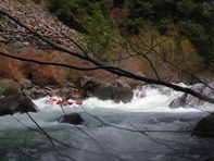
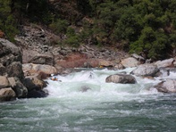
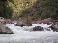
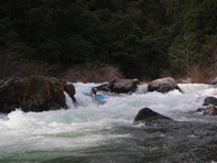
- Lobster Pot (V-). This rapid had a pretty stout long lead in with several large holes to be negotiated that led to a last minute eddy on the left above the main game. Follow the tongue into a cushion that pushes you into the wall. There was also an easy sneak on the left.
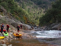
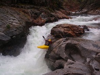
Celebration (V). On a left turn, with a granite shelf on the right, it would be wise to hop out on said shelf and scout. The right side is a massive hole, the left side is a tricky curler boof with some "Celebration Rocks" just downstream that turned out to be sieved out as we had one pinned boat and one upside down boater simultaneously occupy the celebration room. Most of us walked on the right.
More Boogie
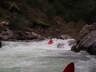
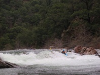
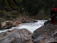
- Fondue Pot (V- to V). A pool leads to an ominous looking horizon line. Scout/portage left. The only line that looked safe was a sneak in shallow water on the left to boof around the hole.
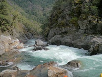
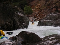
More Boogie
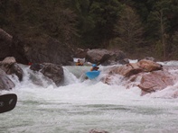
- Last Ugly One (V- to V). After a long somewhat big read and run section, you will come around a corner to a horizon line. It is fairly simple, but looked oh so ugly. After the long class IV+ lead in, catch the eddy on the left directly above the drop. Boof right (next to what appears to be a rock) and land next to another rock, then paddle away from the undercut wall. Or portage easily on the right.
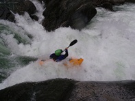
More Boogie
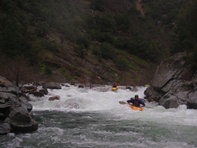
- Confluence Rapid (IV+). Just after you see a gauging station (inactive as of September 2010), there will be a brushy rapid best run down the right. This leads to the South Fork American.
Be wary for big holes as Golden Gate will likely be very large. Just downstream was one that is best run far right... not center.
- The Thing (IV+). Just above F-111 is a rapid that is insignificant at normal Golden Gate flows. At these flows it had a massive exploding curler wave thing. Get right. F-111 is 100 yards downstream.
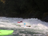
F-111 (V+). Portage right, it is a massive hole.
More rapids with massive holes... avoid being in the center of the river if you can...
Take-out: Heading east on Highway 50, take the Sly Park Rd exit in Pollock Pines. Turn left and then turn left on Pony Express Trail. Take you first (maybe second) right on Forebay Rd. Follow this road (there is a fork early on, stay right). Follow the road 8 miles or so down to the river.
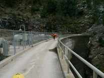
Put-in: Get back to Highway 50 and continue heading east. After 8.2 miles, turn left on Ice House Road. Follow Ice House Rd for 6.3 miles to the top of the hill, at the top, turn left on the smaller paved road (Road 31). Continue going straight, there are some slight rights (not the major right early on to stay on 31, go straight there)... eventually you end up on Jaybird Power House Rd. that leads down to the top of the reservoir (a very pretty end to the drive by the way). Park, and hike down to the dam, cross it, and descend to the water.
HTML Comment Box is loading comments...
