
Short Creek (Upper/Lower)
| Stretch: | Highway 75 to Guntersville Lake |
| Difficulty: | Class III to IV |
| Distance: | 4.4 miles for Upper Short, 2.4 miles for Lower Short, 2.7 miles lake paddle |
| Flows: | 1.5' to ~4.5' on the Alabama Whitewater gauge. Check out Alabama Whitewater's current flow gauge |
| Gradient: | Upper: 15 fpm / Lower: 67 fpm averages |
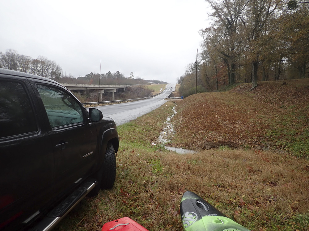
| Put-in: | "Access" on the upstream, river left side of Highway 75 |
| Take-out: | Guntersville Lake access at forest ranger station along AL-127 |
| Midpoint Access | If you have a shuttle driver, you can access the Hustleville Rd bridge access. There is no parking and it is a scramble, but it does allow for the classical "Upper" or "Lower" runs to be run individually. |
| Shuttle: | 11.0 miles, 15 minutes one way |
| Season: | Fall, Winter, and Spring from rain |
| Written: | © 2018 |
| Featured in Video A Wet State #147 | |
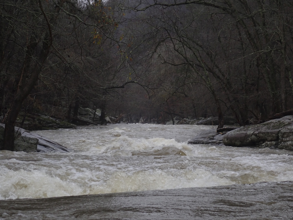
After our morning run on South Sauty Creek, Matt Huddleston, Diane and I went towards Short Creek for an afternoon run. The beta on this one has changed over the years. People used to put in at the Hustleville Rd. But, the parking there is illegal and the access not great. People then moved upriver 3 miles to the access at Martling Rd. This access however is known for break-ins. So, now, people have moved 1 mile further up river to the Highway 75 bridge. This now makes the old Alabama Whitewater's (and American Whitewater's) page's write-up for the Upper and Lower sections of this run one and the same. At the 75 bridge, we found parking enough for 1 car in a culvert cover area, I am not sure where people normally park.
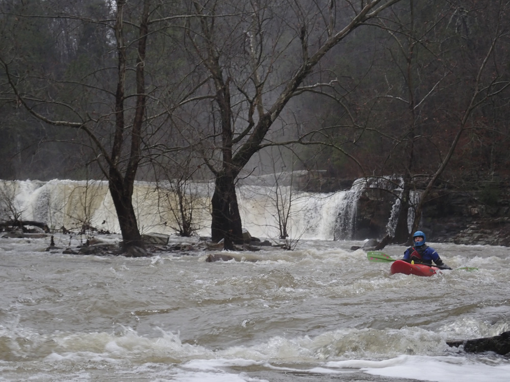
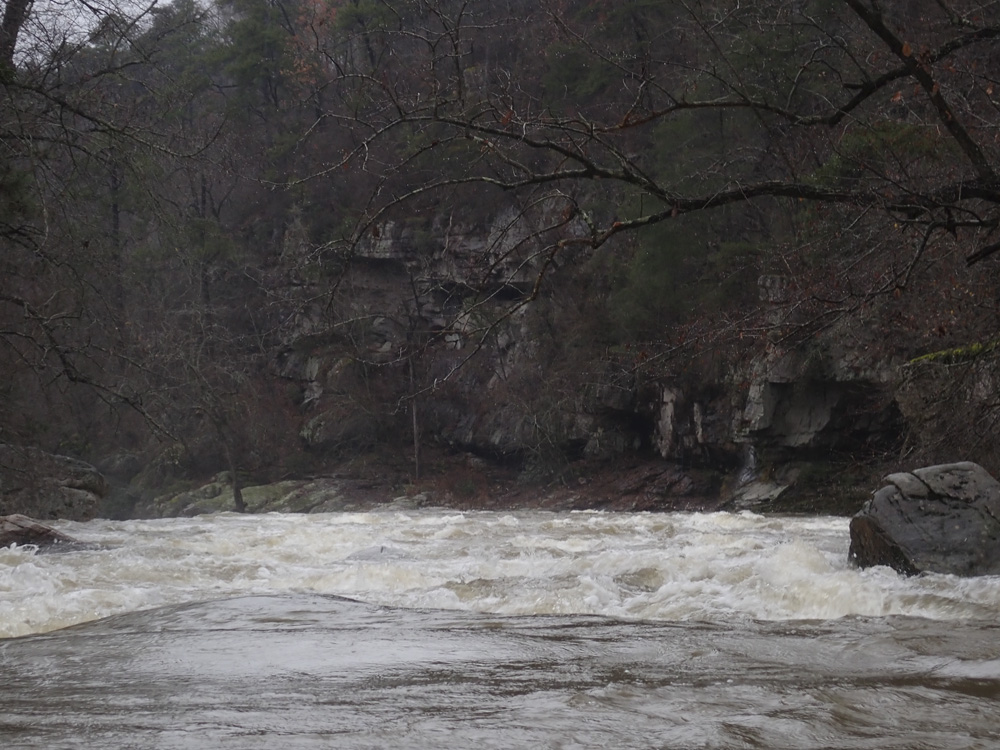
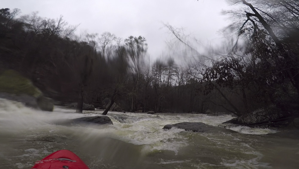
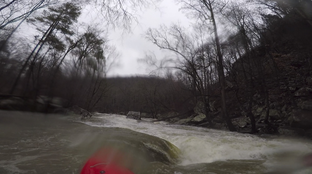
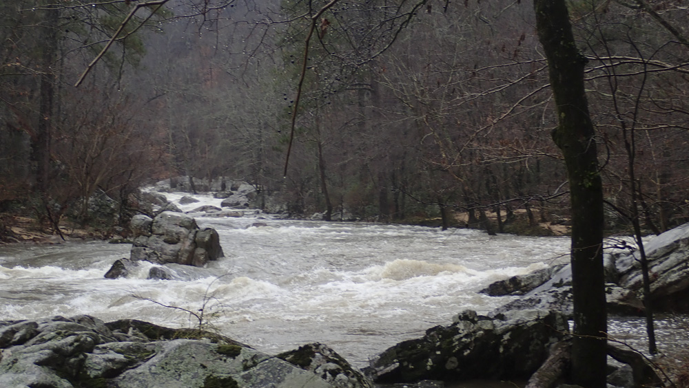
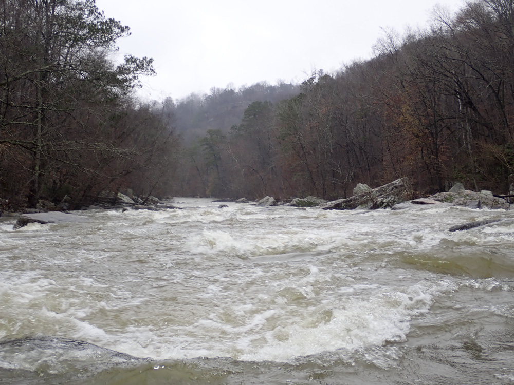
The run starts off with a mile of mellow paddling to warm up on. Once you get below the Martling Rd bridge, action picks up a bit with some class II and easy III rapids which I recall hitting in two spurts. But, the real action hits below the Hustleville Rd bridge. Here, you will find Short Creek Falls immediately downstream. This 15(ish) foot falls is super straight forward and forgiving. Be mindful of the wall on the left which can cause issues. Walk back up for laps on the left. Below, the action keeps going fast, and if you have higher water, you will find powerful holes as this river's ledgy nature doesn't scale as well as South Sauty. We had similar "medium healthy" flow for both, and I thought this run was harder. I have heard, at lower flow, this one does get easier though. Anyways, below the falls, you have another smaller falls not far downstream, and then are greeted with several fun boulder gardens captured between very scenic Sand Mountain scenery.
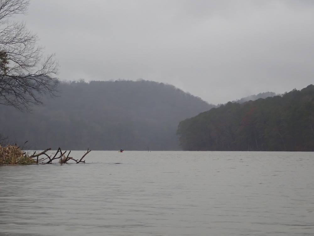
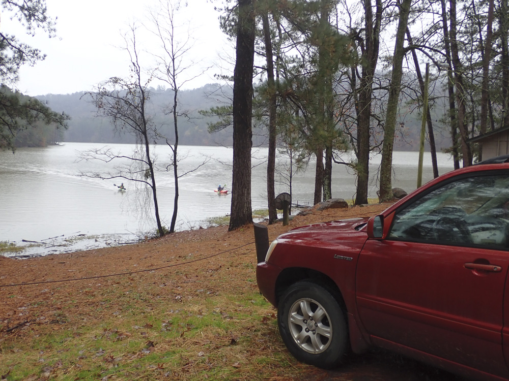
The biggest downside of this run though, comes at the end. Via a 2.7 mile lake paddle. There is no way around it. It goes fast enough, but it is 2.7 miles. For us, we finished it just before it got dark.
I loved this run. I think I liked it more than South Sauty actually. Though, due to the paddle in and lake paddle, I would be less inclinded to do it as often as those two downsides would get old. The action itself is fairly short, and I know for many people who live nearby, that prevents them from motivating for trips more often. But, it is worth while for sure, so don't avoid it because of those downsides!
We had 4.0' on the online gauge. I wasn't aware that there is a stick gauge at the put-in. We looked around in hopes of finding one, but didn't see anything so we didn't look hard.
Mi 0.0:
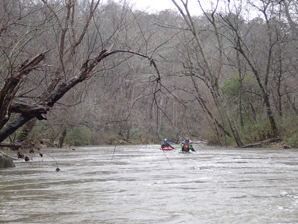
- Flat Water (I). The first section is really mellow, but the water moves at least so it isn't a lake paddle!
- Martlings Rd crosses overhead, this is also sometimes used as put-in but break-ins have been frequent apparently.
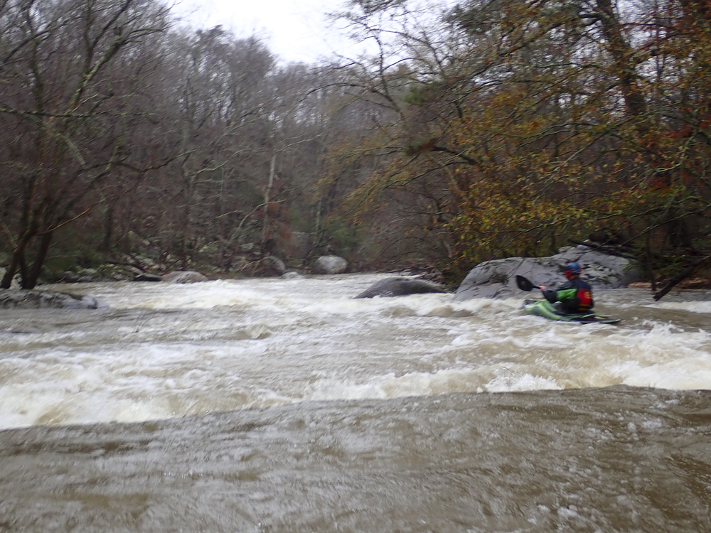
- First Set (II+ to III-). I don't remember the details, it was just boogie in my mind. Go with the flow.
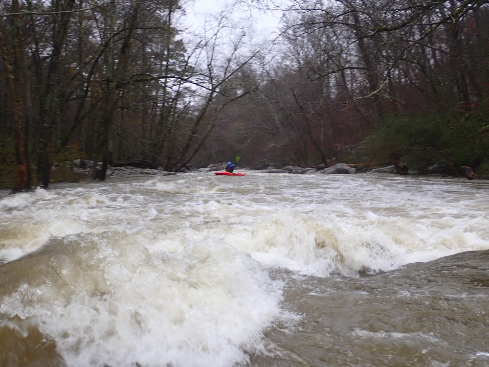
- Second Set (II+ to III-). I don't remember the details, it was just boogie in my mind. Go with the flow.
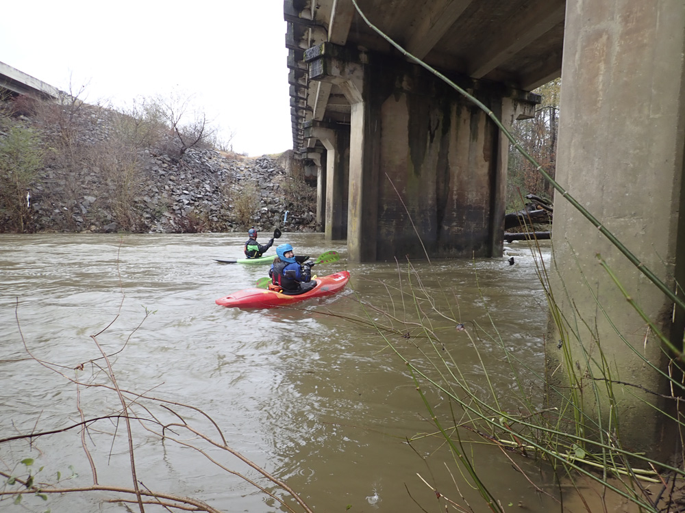
- Hustleville Rd crosses overhead, making the start of the classical "Lower Short" section and end of the "Upper Short" It should be noted, if you have a shuttle driver, you could still theoretically use this access point.
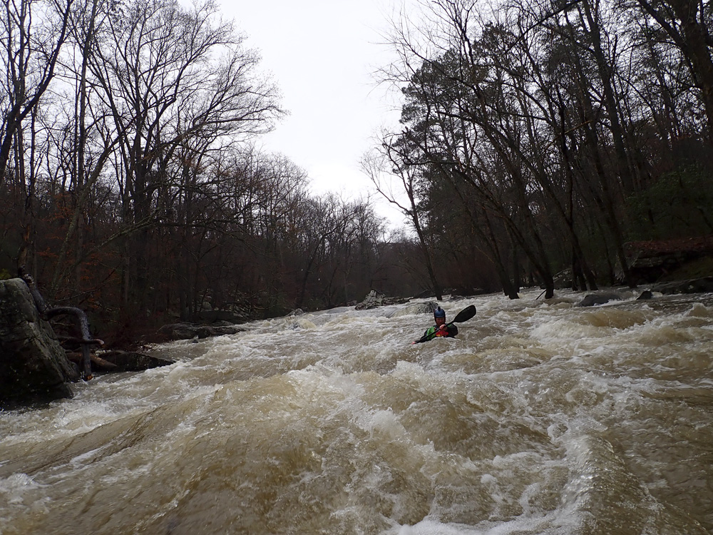
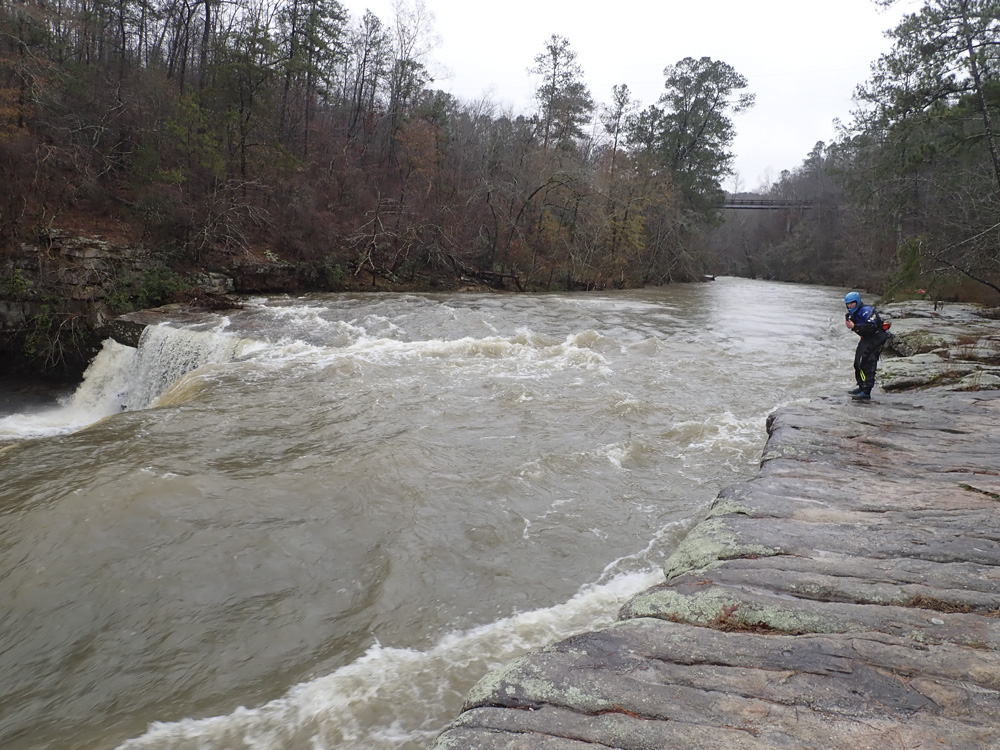
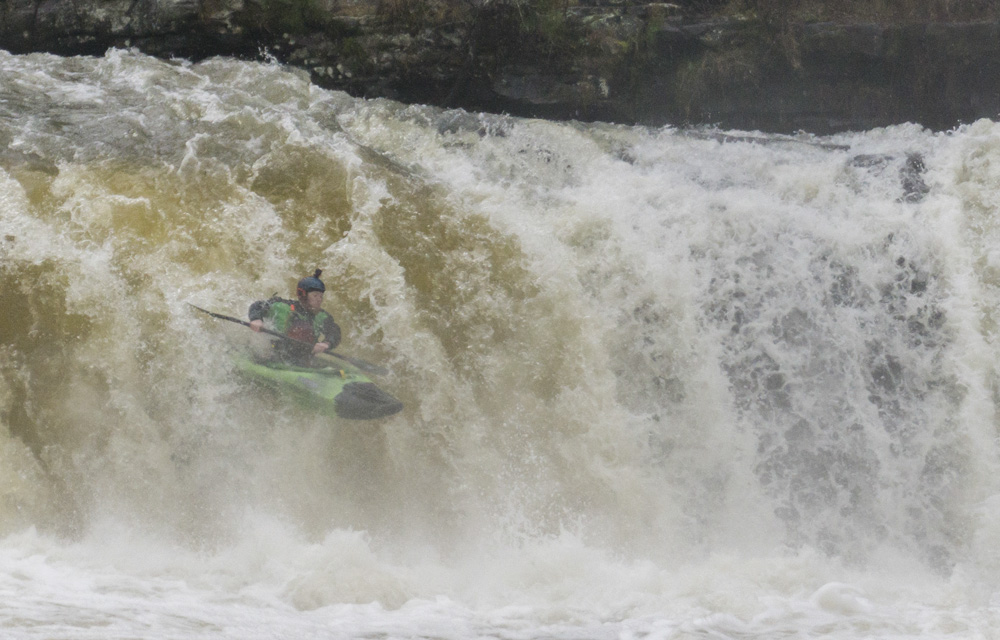
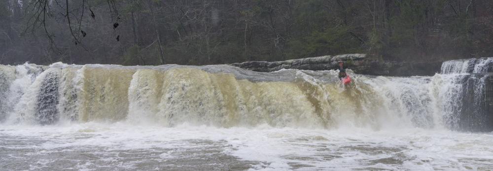
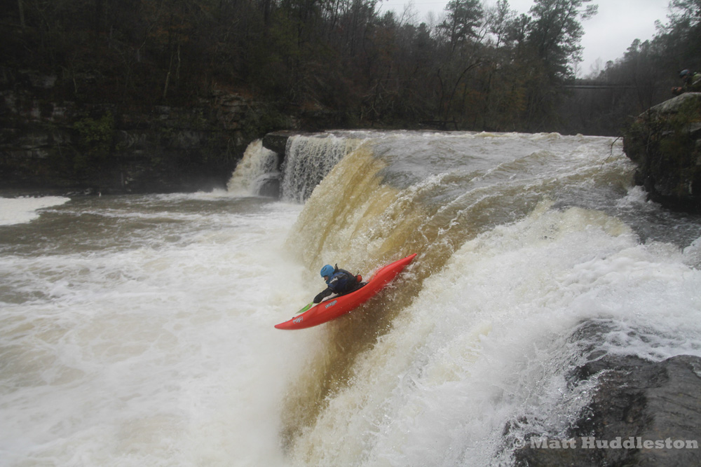
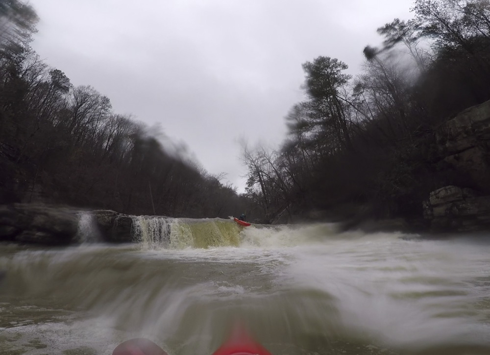
- Short Creek Falls (IV). This is a sweet 15(ish) foot falls. Get out once you see the bedrock forming the left shore. Going too far can pull you down onto the slide that leads to the falls. The normal line is far left boofing the launch spot maybe 6 feet off the left shore. Note, that the left wall immediately below can cause people issues, though the current does flow downstream. Some choose to downclimb the left side (also hike up it to run laps) and set safety there as there is a ledge at river level or just under that you can stand on at most flows.
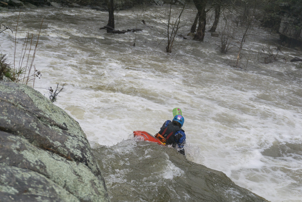
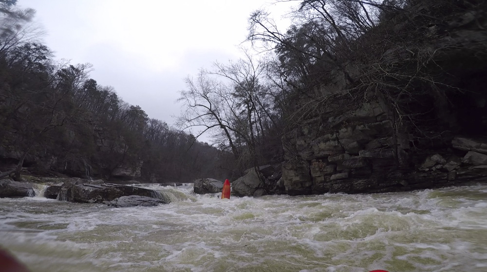
- Grotto Lead In (III to IV-). Not a bad rapid, though there was a punchy hole near the bottom. We ran down the right the whole way and just boofed through that hole. I bet at lower flows the rapid is a non-issue. You just wouldn't want to swim here as Grotto is immediately downstream.
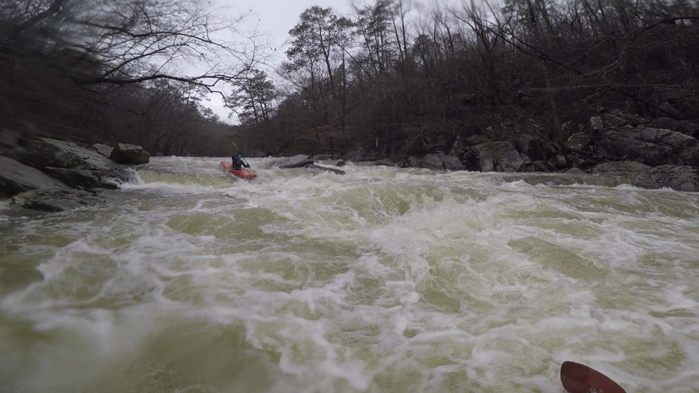
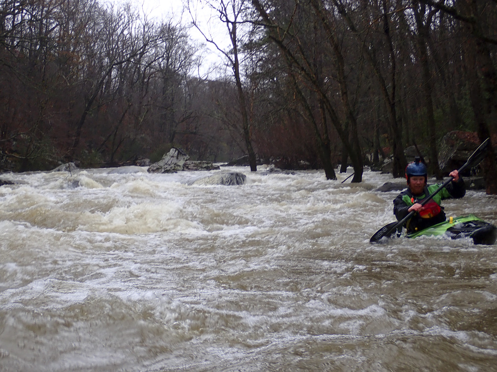
- Grotto (IV- to IV). At really low flows people run down the far left which is basically the only channel. At our flow we ran the left shoulder of the midstream "island" of bedrock which formed a 6 or 7 foot tall ledge. I know at lower flows, people are able to get out on this island for scouting or pictures, at our flow this wasn't possible. Once we ran the entrance, the only way down was down. No scouting. So, if you want to scout and the water is medium or higher, get out early on the left.
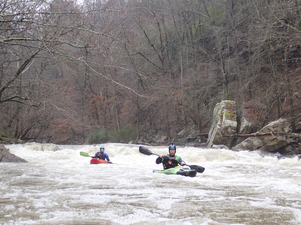
Tornado (III to IV). Immediately below Grotto, was this which I view as the exit to the sequence. The water runs down right to left on the left side of the river. Matt boofed the flake that formed the right edge of the channel and had a nice line. I got too much rock and was popped up rather than out, landing flat at the base of the drop and initiating a back ender. Diane saw me and tried to just boof the hole without the rock, and also got back endered. Luckily, the hole was friendly and we both rolled up downstream of the hole.
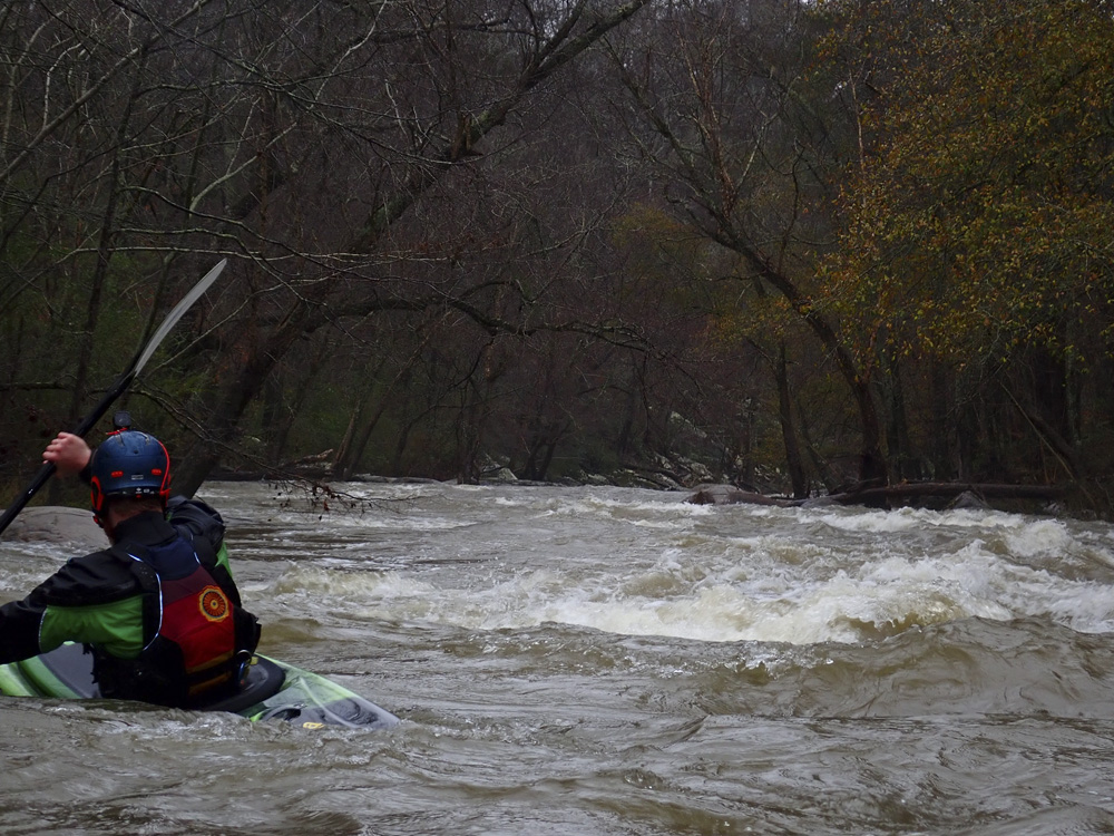
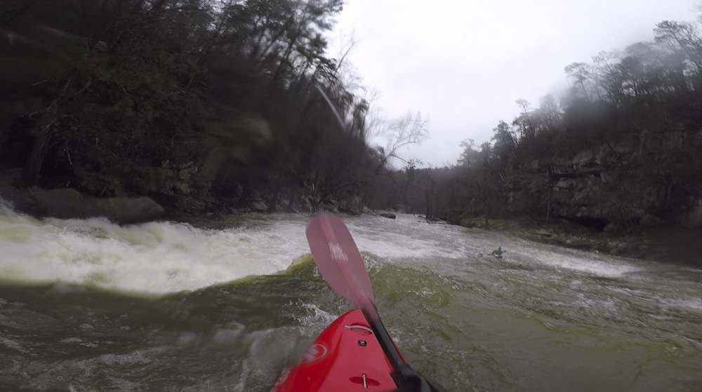
- Double Drop (III+ to IV). A nice right cliff wall continues down from the Grotto sequence, I eddied out far right and ran down a nice tongue and then boofed a fluffy hole. Mind the house size rock on the right, I wouldn't want to get pushed that way. Matt and Diane ran a more direct line which started with a small boof at the top where my tongue dropped in behind.
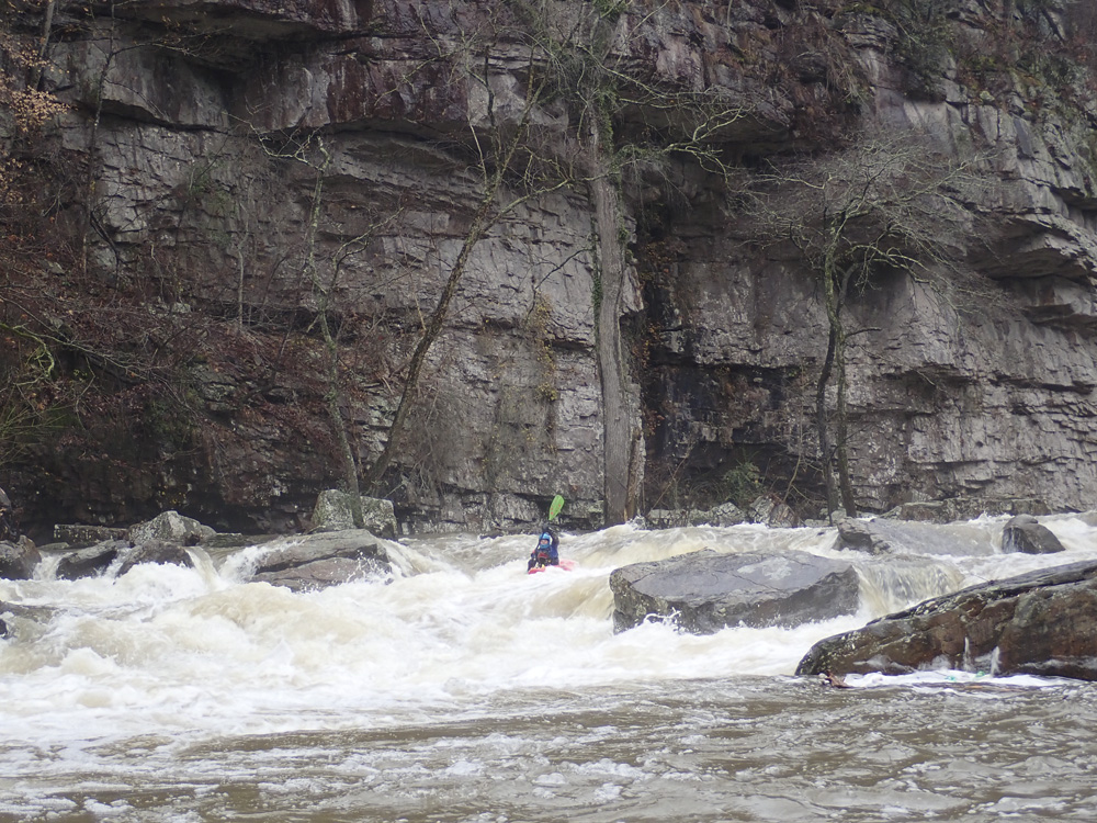
- Confluence Rapid (IV). Man, this rapid was an eye opener as I didn't expect anything this pushy to be on the run. It is a long rapid, and the top isn't bad but hides what is downstream. I entered and worked far right with the current. I then see that the river has a curler and pocket hole forming off the right side of the main current, I go to boof the curler which as I get closer ends up being much steeper, and the pocket to the right, much worse. I got on top of the curler and boofed the small ledge no problem. But, in future laps, I will work further left in advance as I am sure this spot could get ugly. Below this move, work back left again to avoid a rock pile below, and then it turns into read and run from there to the confluence.
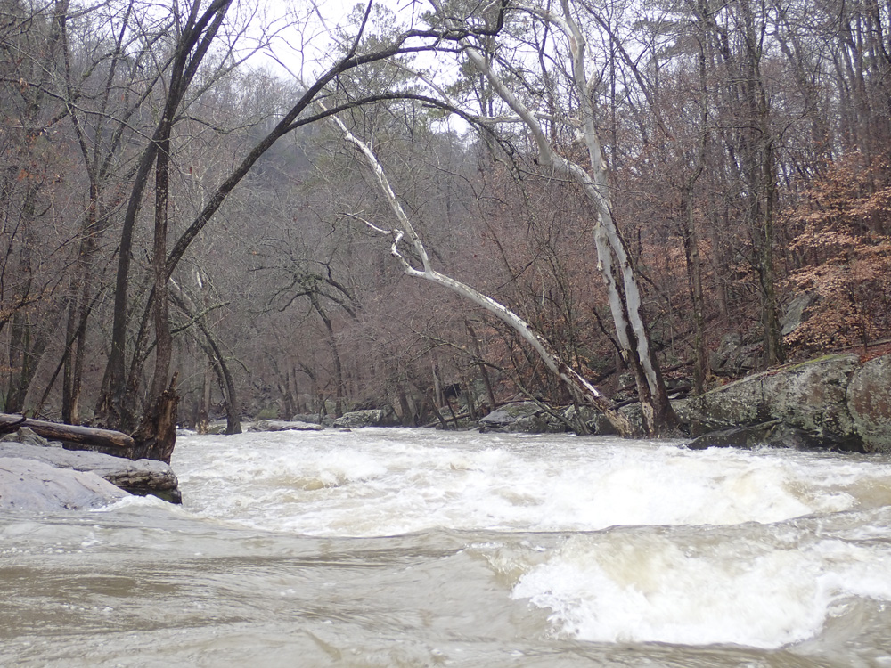
- Scarham Creek Conlfluence enters on the right. Rapids take a noticeable step down after this. When you paddle past Scarham Creek, make sure to look up it. There is a steep rapid up there that is impressive to see!
- Boogie (II). The river again takes a noticeable step down.
- Lake Guntersville. You hit the highwater mark on Lake Guntersville and begin your flat water paddling for the day.
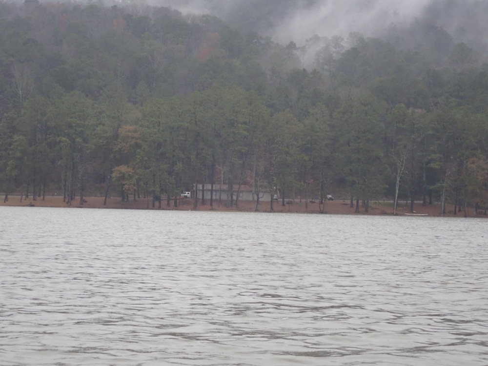
Take-out: From the town of Guntersville, head over the lake on AL-227. Continue for 5.2 miles. On the far side of the second inlet, park at the lake access area. Note, there are small bathrooms behind the forest ranger station.
Put-in: From the take-out, cross the lake to the west side on AL-227. Continue for 1.6 miles before turning left onto Gerald Bryant Rd which in 0.2 miles cuts the corner to Hustleville Rd. Turn left onto Hustleville Rd. Follow for 7.4 miles, if you keep you eyes open, around the half way spot on this road crosses the river and you can get a glimpse down at the falls downstream. Anyways, after the 7.4 miles, then turn right onto AL-75S. Go 1.5 miles, cross the river, make a u-turn and then park in the spot for one car about 100 yards before the bridge. There was easy access on that side of the river.
HTML Comment Box is loading comments...