South Fork of the Yuba River (Washington's to Edward's)
| Stretch: | Washington's to Edward's |
| Difficulty: | Class IV (1 portage) |
| Distance: | 14 miles |
| Flows: | 700-2000 cfs. Current Dreamflows (est) gauge |
| Gradient: | 46 fpm |
| Put-in: | Washington |
| Take-out: | Edward's Crossing |
| Shuttle: | 25 miles, paved 30 minutes 1 way |
| Season: | Winter and Spring, Natural and Spill |
| Written: | © 2006 |
| Featured in Video Seven. | |
Some guide books say that this is the easiest run in the drainage. This compares it to the E to P section just below it (as of course it is easier than the sections below Purdon's and above Lake Spaulding). However I think this is not 100% accurate. The first 9 miles of the run are indeed easy, with only two or three rapids class III or harder. However, from the mile above the portage on down, there is some serious class IV action that requires skill. I would hesitate bringing a newbie to class IV down this run, as in sections, a swim could be develop into a bad situation. There are many bolder field rapids which have channels that would body bin, boat pin, breach a boat and wreck general havoc on the pleasantness of the day. With that said, I also don't feel this run is a run to do more than once a year. The section at the end is a blast, but the nine miles to get to it were long and generally unfulfilling. With this regard, E to P does offer nearly as many rapids in about a third of the distance.
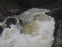
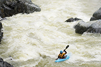
Note: Thanks to Jon Blum for the photos on this page.
Update (2012): A few years late, but I got back into this section with significantly more water, some 3,100 cfs. I found the expected fluffier experience, but surprisingly only a few rapids got harder.
Mi 0:
- Under the Bridge (III+). Your warm-up presents itself at the put in bridge, it is a
steep boulder dodging affair, we ran middle to the left which seemed to be the
cleanest route. The river appears to only be half the indicated flow at the bridge,
as much water came in from side creeks.
Boof (III). The river drops over a rocky class II, or you can sweep around the right side of a small rock out cropping and run a nice 4-5 foot boof.
- Class II boulder affairs make the first 9 miles a boring affair. There are two rapids
to note in this stretch.
- Chute (IV-). The river drops some 15 feet over a slide type of drop. Best run on
the right, but can be boof entered on the left. (not sure where exactly it is in the
stretch, but you wont miss it, it is the first big horizon line after the Boof.

- Slide (III). On a left turn there is a nice slide that drops some 10 feet. There is
a wall on the left, we ran on the right or in the middle...it all goes really though. Update (2017): A group reported to me that they got into what they think is this drop's hole at 1,700 and got wholloped good and solid forcing an expert to swim. Just an FYI.

- First Gorge (IV-). The river gorges up drastically. We ran the first major drop on
the left, avoiding some rocks that were in the middle. Update (2012): Somewhere in here, there is a series of holes that are super sticky. If I recall correctly we went far left of them.
Our Scout (IV+). A boulder choke creates a blind rapid. We ran down the middle, zigging between two rocks that were both barely submerged, this then dropped us off a 4-5 foot ledge which needed to be hit correctly as to not get pulled back in.
- Beth's (III+). This rapid comes on a left bend, there is a tongue on the right, run
the tongue in order to avoid the large hole on the left. The backwash of this rapid
flows directly into two large rocks, swimming could be painful.
FALLS (V+). This drop definitely looked runnable; however there were some rocks in the landing, a large hole in the landing, and a undercut where much water was flowing on the left. The Falls is coming when you come to the second real gorge. The gorge is short, only 20 feet or so tall, and comes on a straight away. Our day we could see mist rising up. There is a tricky rapid below the falls which should be looked at, swimming into it could be really bad.

- Whirl Pool (IV+). This rapid comes at the end of the gorge containing the falls, maybe
2 hundred yards downriver from the falls. The difficulty on the rapid isn't IV+ but
the consequences are. Enter on the left, end up moving right off of a cushion in order
to avoid the whirl pool on the left below. The scout is hard, best if done while
portaging the falls on the left. There is a portage route on this to the right, there is
a small beach you can climb out on, to get to this involves risking being swept into a
vertical drop which would leave you most likely in the whirlpool. So commit and paddle
hard to stay right to reach the beach. Update (2012): At 3,100 the rapid was fluffier but had a line directly down the middle. Apparently at ~1,600 cfs, I have been told a very nasty whirlpool opens up on the right at the bottom, terminal looking even. Suggest scouting, and easiest way to do that is while portaging the falls.


- Corner Wall (IV-). The third and final gorge begins. There is a rapid which
comes on a sharp left turn. We ran left to right, avoiding the corner on the left at
the bottom, while also avoiding the cushion off of which, which pushes you into some
rocks on the right.
Nice Boof (IV-). A straight forward drop. We ran on the left side of center, don't pencil in, I got the feeling it may have been shallow.
Boulder Maze 1 (IV). Kind of blind, we entered right of center, moved behind some mid river rocks and finished left. The move we made was right above a choke point which could be bad if flipped and pulled into.
Boulder Maze 2 (III+). The last significant drop as I remember. We entered center and moved right, there was a small weird hole at the bottom.
Take out: Take 49 to Nevada City, and follow it as it turns left and splits from 20. There is a light within a half of a mile, turn right on North Bloomfield Road. At the top of the hill, the road comes to a "T," turn right and follow this to the river at Edward's Crossing.
Put in: Go back to Highway 20 and turn left, follow for about 13 miles, turn left for the town of Washington. This turn comes after a great view of the valley to your left. Follow this road down 6 miles to the bridge over the South Fork, put in on the right just after the bridge.

View South Yuba, Washington to Edward's in a larger map
HTML Comment Box is loading comments...
