
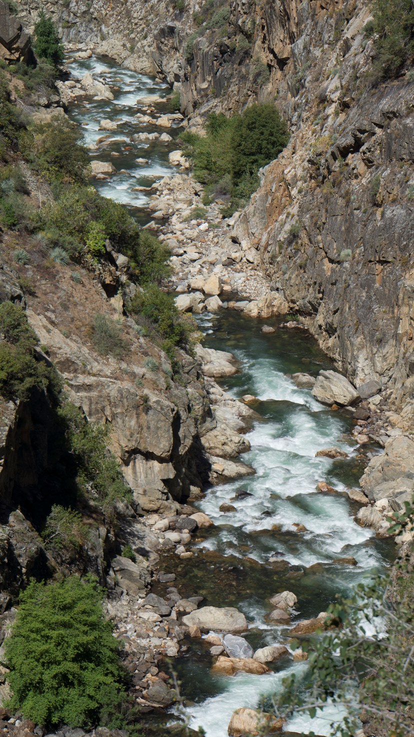
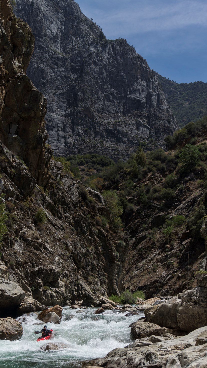
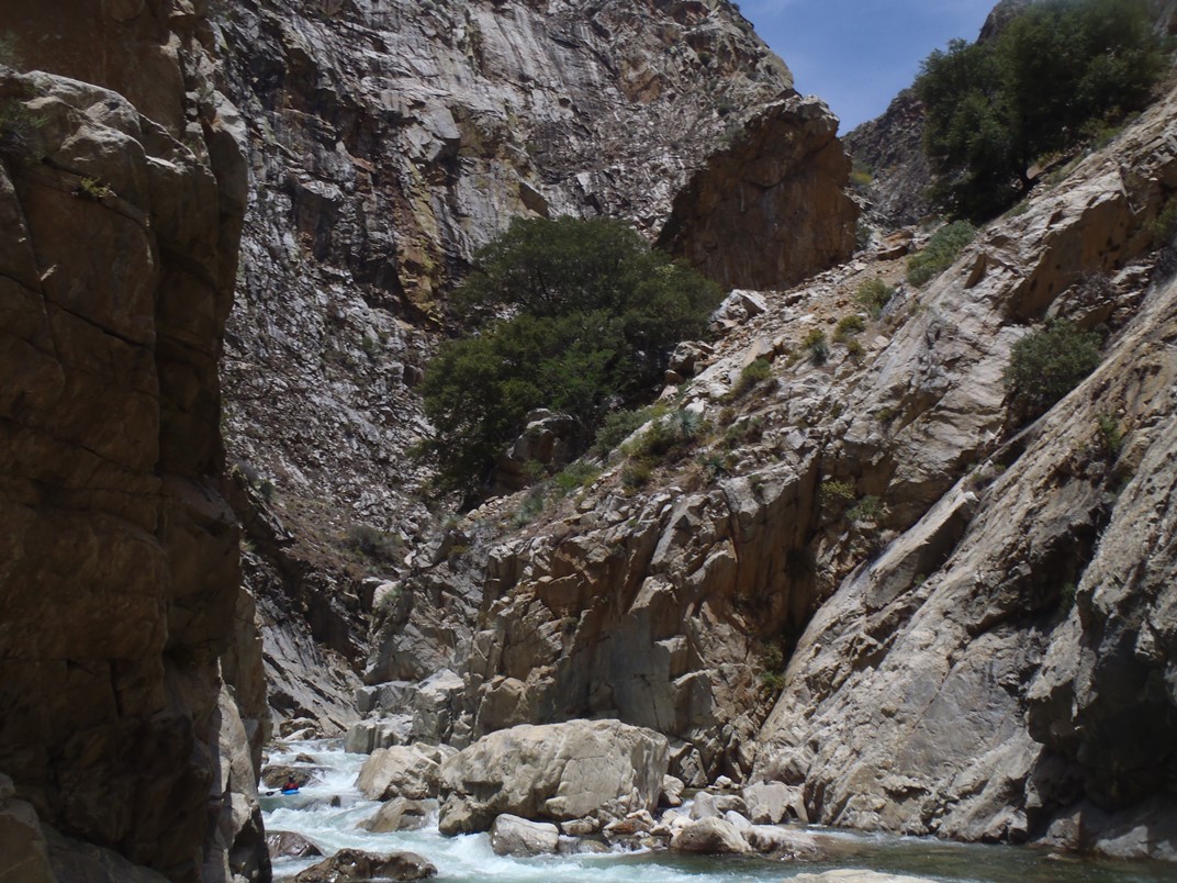
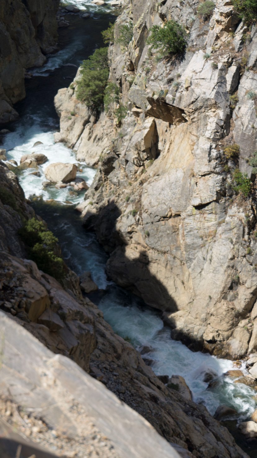
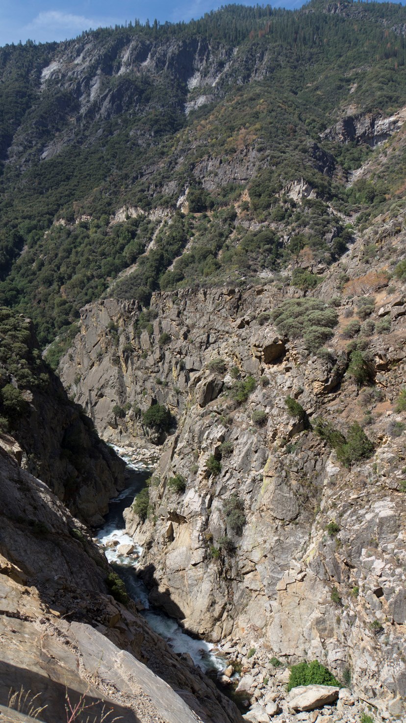
South Fork of the Kings River (Horseshoe Bend)
| Stretch: | Boyden Caves to Yucca Point (or continue through Garlic Falls) |
| Difficulty: | Class V |
| Distance: | 4.6 miles (plus 9.7 miles on Garlic Falls if you are so inclined) |
| Flows: | 600-1,200 cfs (on Rogers Crossing Gage) 400-600 on South Kings Gauge. Current Dreamflows South Kings gauge and Roger's Crossing gauge |
| Gradient: | 176 fpm average (285 fpm from Mile 1.0-2.0) |
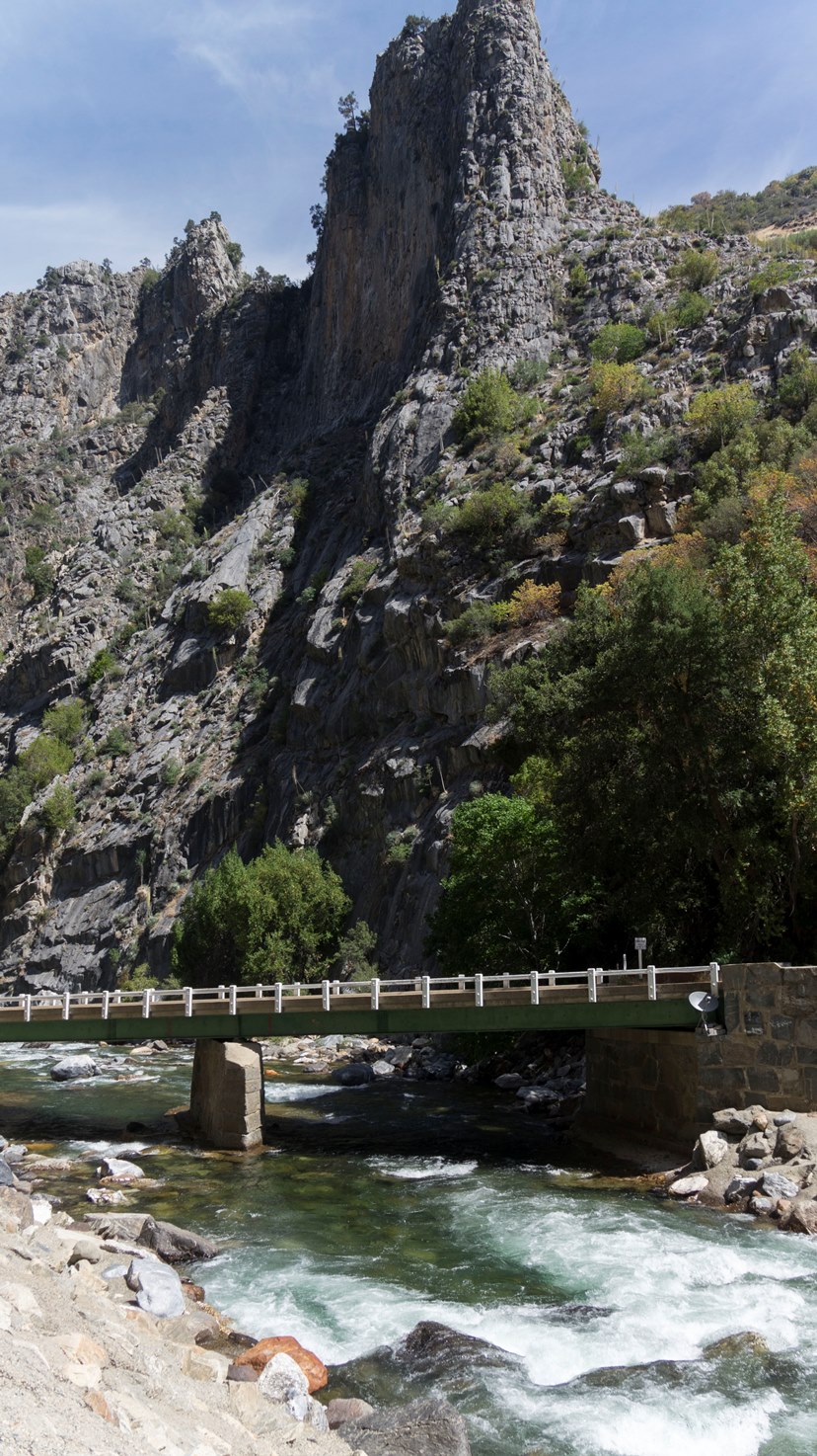
| Put-in: | Boyden Cave bridge on Highway 180 |
| Take-out: | Yucca Point trail or Garnet Dike Campground downriver below Garlic Falls |
| Shuttle: | 6 miles paved road plus 2 mile hike out... or 95 miles and 3 hours one-way (but it is worth it!) |
| Season: | Summer, at the end of the snowmelt. It is run after the Middle Kings, most years it will be the last naturally occurring run. |
| Written: | © 2014 |
| Featured in A Wet State #93 and Gareth Tate's video | |
Prior to 2012, the only information that was available on this run was in the normally dependable Stanley/Holbek. But man, the write up for this section was downright terrifying... implying that you boat down to an unrunnable and unportagable and unscoutable rapid... forcing you to egress back up the last several rapids and then rock climb up and out of the canyon to the road high above. That is enough to scare most people away for sure. However, in the 1997 floods rumor was that the horrible rapid improved... and with that Taylor Cavin put together a group of A-gamers who were also game for an adventure to see what lay in the canyon also referred to by the crux rapid's name... "Fear and Loathing."
In Taylors words... what they found was anything but fear and loathing. And instead found a wonderful class V canyon and one of the best 2 day runs in California. So with that vote of confidence, I began to try to organize groups for these sections. The challenge is though that the South Kings has a small flow window... confining you to a brief window at the start of the snow melt and another brief window at the end of the snow melt.
2013 I failed to find a group but in 2014 my friends Jim and Tom Janney were in town at the start of their 9 month hiatus from their respectable jobs to kayak the globe. On their hit list was BC, Nepal, Peru, BC, Colorado, and of course California. As they bummed internet and hot showers at my house for a few days, we hatched a plan which involved them hitching out from Garnet Dike at the conclusion of their Middle Kings trip followed by us recruiting a friend as a shuttle driver who would drive us right back up to the South Kings to put back on the river. Amazingly this worked out perfectly despite the rafting season being closed down already... they had the fortune of running into kayakers near the end of the Garlic Falls who gave them a ride to Fresno where we were able to pick them up. Who would have thought? So... the next morning we pushed off in hopes of finding no fear or loathing ourselves.
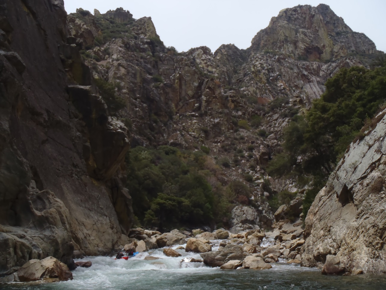
The run itself is only 1 day... but if you are venturing in here, why would you not continue down the Kings below the confluence and run Garlic Falls. That run alone is classic. And really... we spent 4 hours on the South Kings which involved scouting and filming everything. You could take an hour off easily without the filming. Garlic Falls is another 4 hours if you know when to scout... Perhaps 6 hours if you are quick to scout and run more than you portage. So... it could be done in a day... but a long day. But why not enjoy one last overnighter before the season ends? Or you can do what the group behind us on the river did which was to drive down the morning of with a shuttle driver and put on at 4 pm, arriving at the confluence at 8. At least that saves driving down the night before, but also leaves little room for error on the S. Kings.
So we had 725/775 on the Rogers Crossing gauge (350/490 on the South Kings) and thought it to be a smidge low... but not by much. Taylor's group 2 years earlier had 800 on the Rogers Gauge and said it was a great flow. High flow in here though would be terrifying. Walled out and linked up... it would become dangerous quickly.
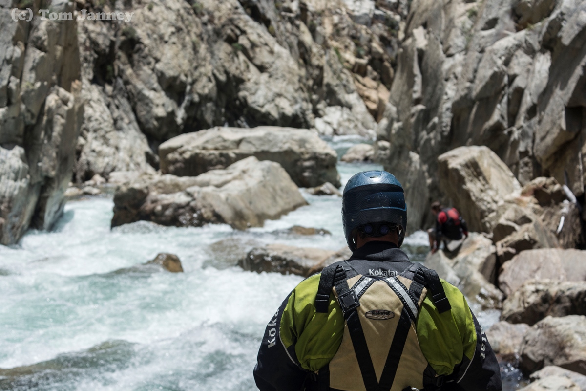
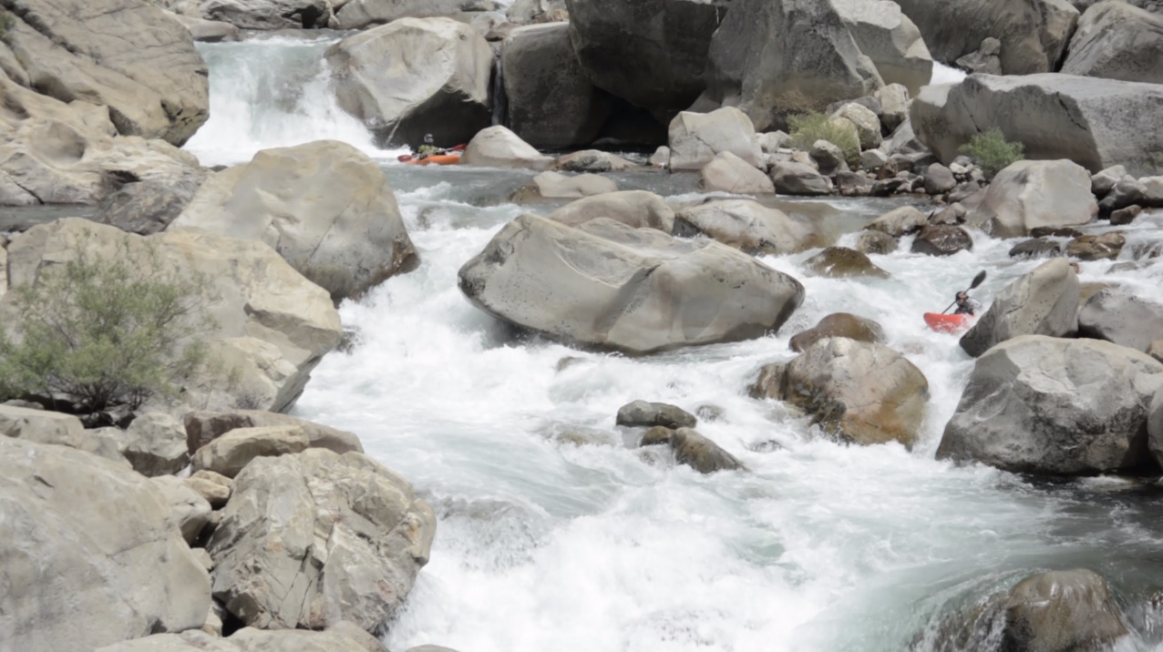
And to clear up the "must run class V+ rapid" information... whatever happened in 1997 cleaned it all up. There is 1 must run... and yea it is hard to scout, but you can scout from the top right and there are many lines that are ok... right or left, both are ok. And if you are really inclined you could even portage the lead in and just seal launch into the exit. Either way, the rapid was only class IV at this flow. The big rapids which are above and below are all walk-able and scoutable... without even that much effort. One that is contrary is just below Porter Falls, though you can seal launch the middle rock (more folks would make this easier, it was really shitty for a loan person). But that rapid too actually went totally fine for our team down the right, much easier than it looked. Below, all are portagable.
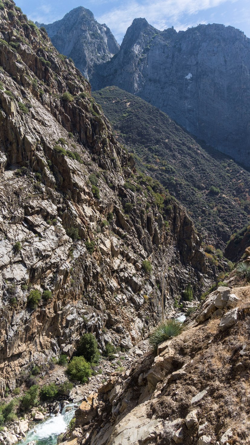
In total though, I would say this run was pretty challenging. Perhaps on par with the runnable sections of the Ramsey's section of the North Stanislaus. The nature was steep rapids that also tended to have some sieves thrown about. But if you are figured up for Garlic Falls, and intending to run all/most of the rapids... this run is a great addition and no harder.
Finally, I didn't give too many rapids class V ratings... but I strongly feel that the day in total felt class V. The committidness (word?) and pace of the rapids was not forgiving for sure.
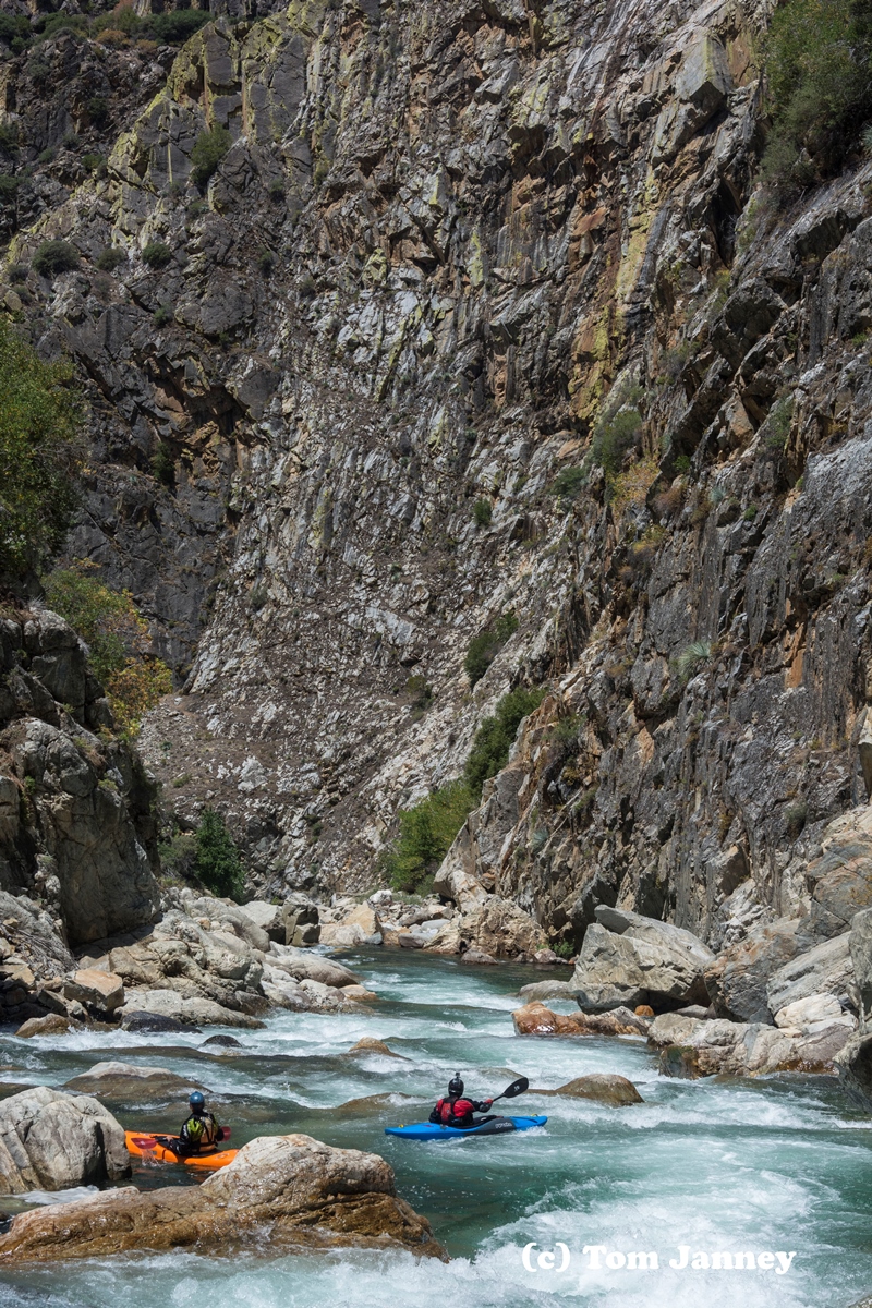
And thanks to the Janney Brothers, Jim and Tom, for their contribution of photos and video from the weekend...
Darin relayed some feedback from a decent with the Kings at 1,200 (%50 more than we had). He stated that the whole river felt like class V and was probably a smidge harder than Dinkey Creek or Upper Cherry (also different style I should add). He stated that it was surprisingly still rather junky, because they had to avoid the meat of holes and that caused them to be skirting around amongst rocks on the edges. At lower water we were able to just go through the meat of the hole. So yea, this one sounds like higher makes it harder, but also not any cleaner or more fun. He walked away stating it was "ok" and not overly enthusiastic. OK, another update for flow, Darin went back in even higher at around 1,400 cfs at Rogers and stated that it cleaned up a lot more than the medium high flow and was much better. Also, Thomas Moore passed along that he pushed off with a dirunal of 420/450 (at Boyden Cave) and found it to be slightly higher than I had, but a perfect flow.
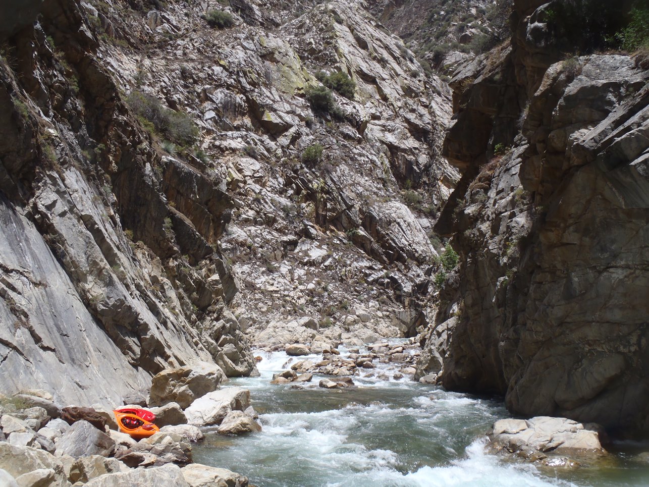
Mi 0:
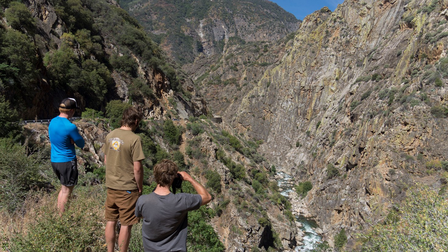
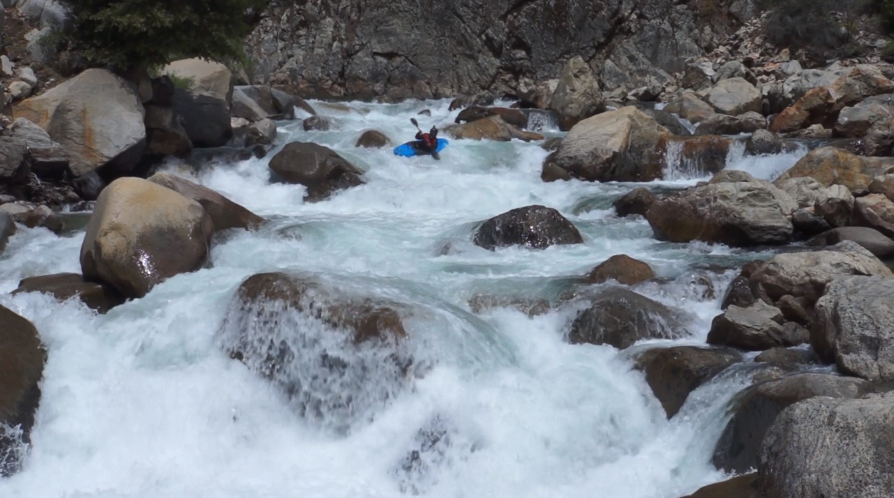
- As you paddle away from the touristy Boyden Caves, you might pick up some spectators. The river starts off mellow with some fun class III rapids to warm up on.
- Ledge (IV). We hoped out quick to scout on the right as the ledge was blind from above. The line was simple enough, just go off of it straight and boof. Sticky hole at the base.
Big Rocky (IV+). Jim scouted quickly for us on the left and we followed him down. The rapid had 3 tiers to it, each were rocky if you were off line. We started right, worked left of center and finished left moving back right. Each tier had a hole to punch, it was worth a scout just to find the right line through it.
Ramp (IV). Just downstream was a ramp against the left wall. We ran it down to the right and got some stern squirts. Tom scouted on river right and set safety for us. A few mellow rapids fill the next quarter mile as you approach the start of the crux section.
- Straight Away (IV+). As the river bends back to the right, you are greeted with the lead in to the hard section. We ran down several ledges on the right before eddying out for a longer rapid below. That rapid we started all over but finished far right.
Not ConVinced (IV+). Scout either right or left. Jim and Tom scouted and set up for pics. I was told to be right and let it move you left to boof. It didn't move me and I plugged and lightly pitoned on the right. After, they both started left and stayed left and sailed wonderful boofs.
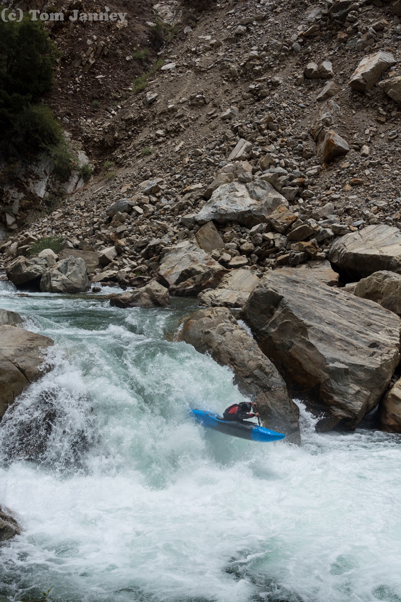
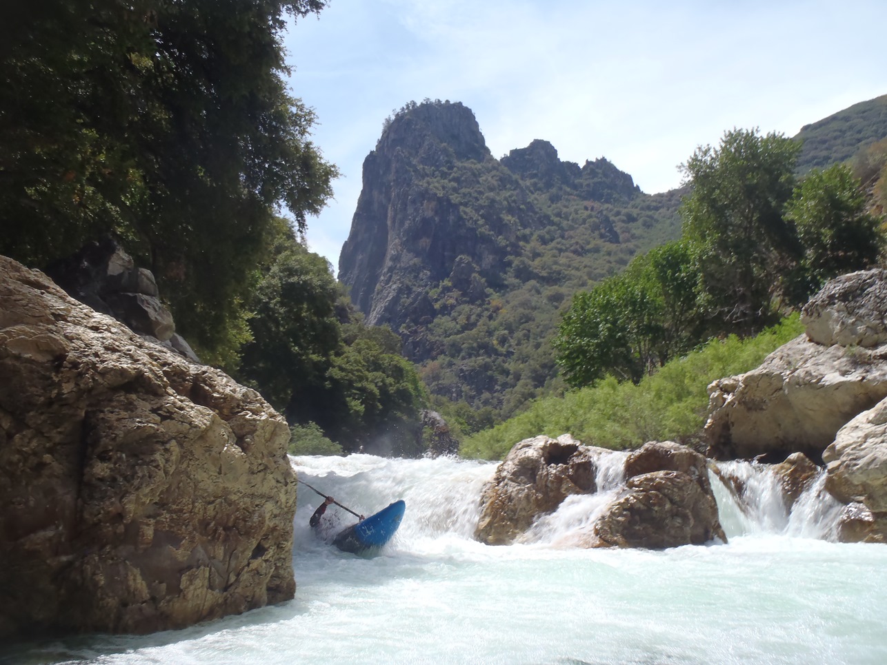
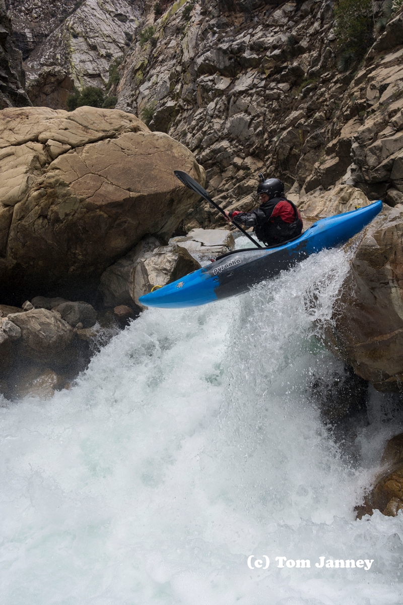
Double Drop (IV+ to V). A fun slide into a off angle ledge was immediately below. Really fun. Just make sure you slide heading right as the left half of the slide dropped off into a no man's land prior to the ledge. Below were a few small ledges that we ran down the right of.
Junky (IV+). Scout from the lip on the right. Or walk on the left. We ran right and hit a boof, turning 90 degrees left in the air just before hitting the wall... worked out great actually!
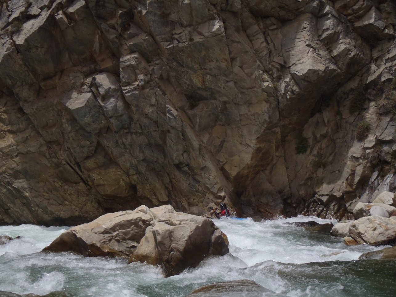
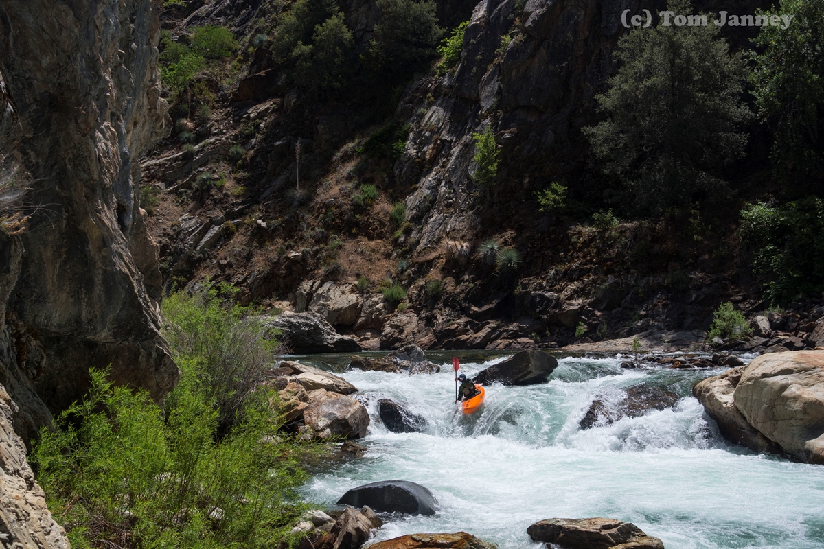
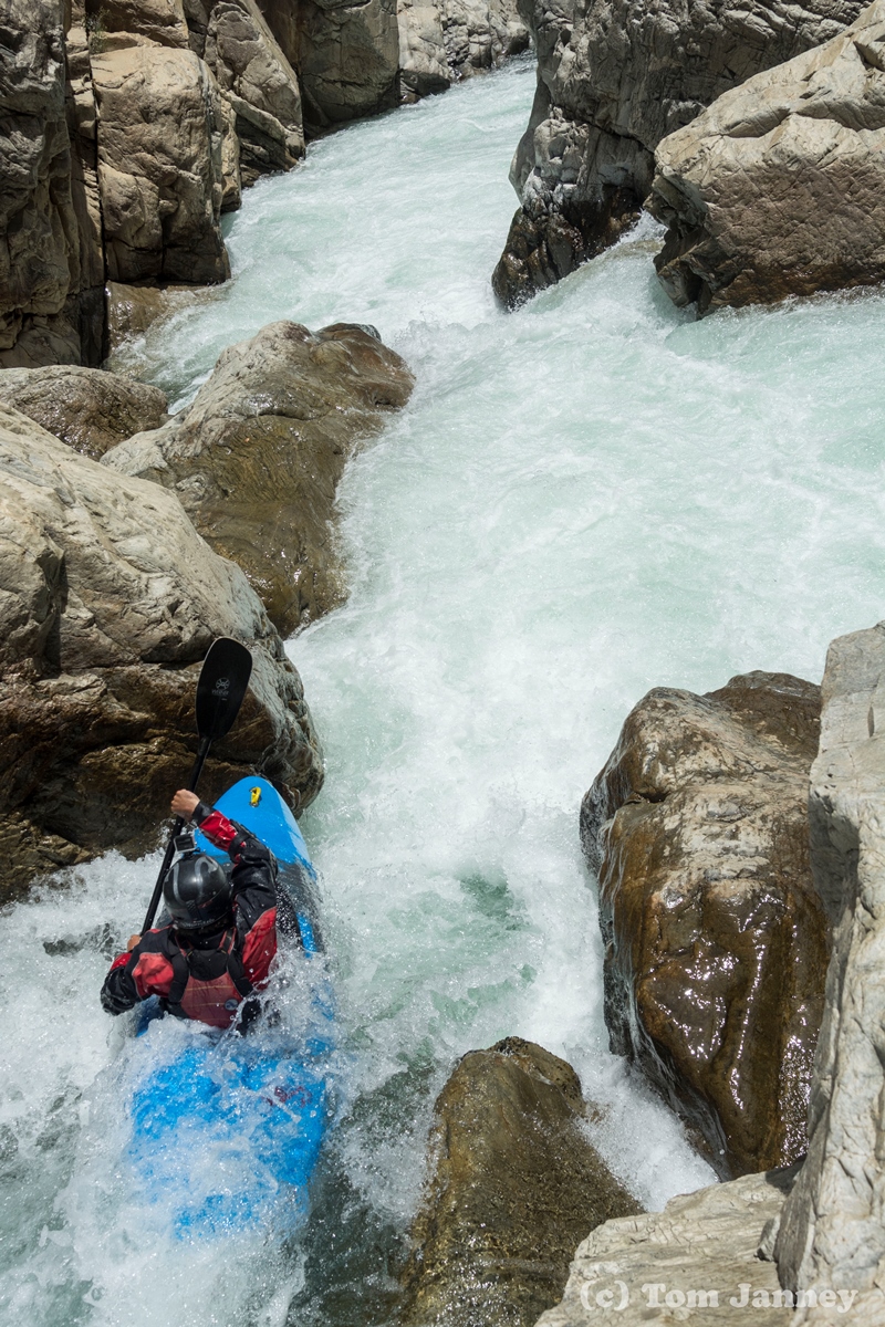
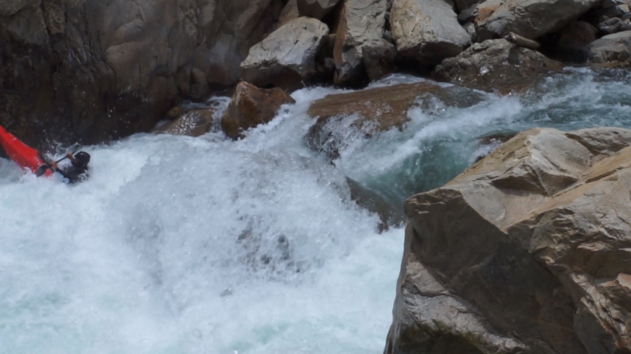
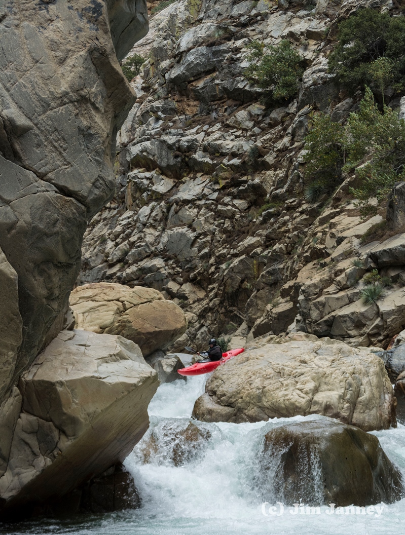
- Fear and Loathing (IV to V). Scout on the right. We entered right and headed right to exit right of the house size rock. The left would have also gone. Eddy out right below. This is the unportagable rapid. Darin relayed to me that at high flow it was a meaty hole and caused them to pause and consider lines.
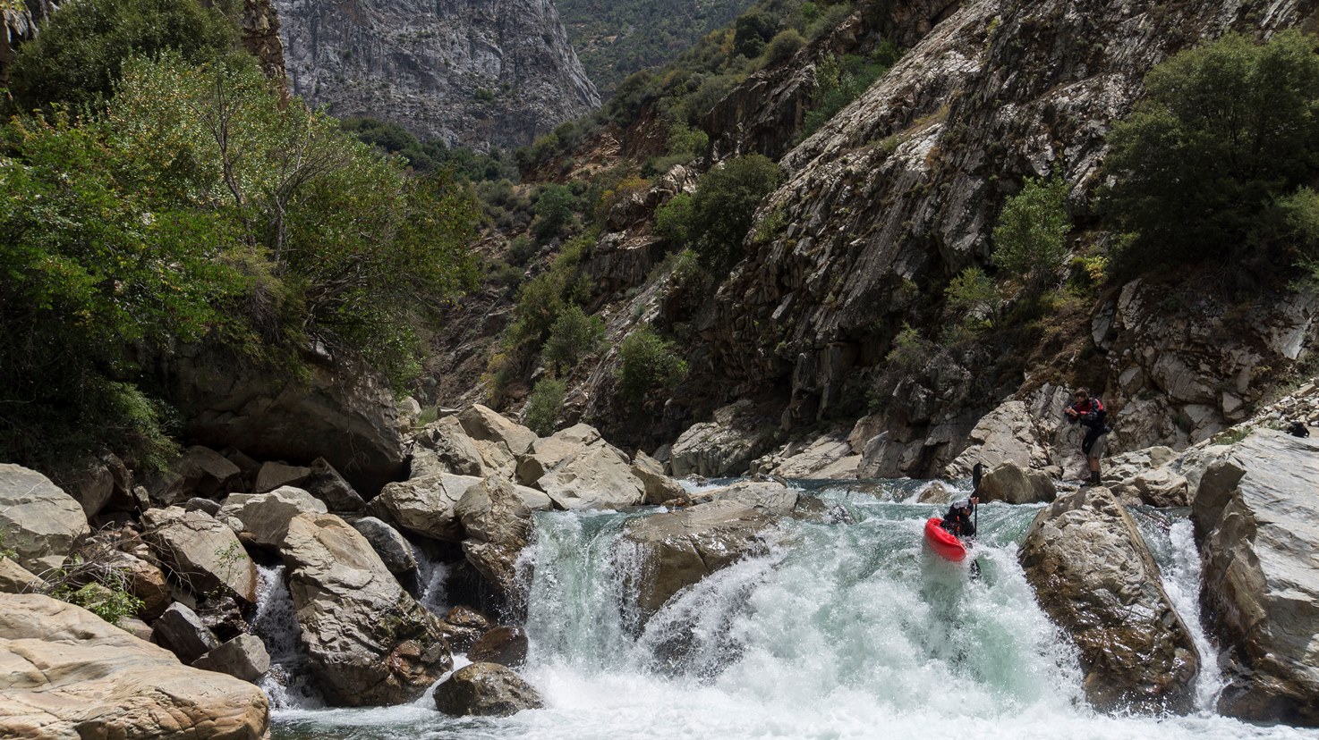
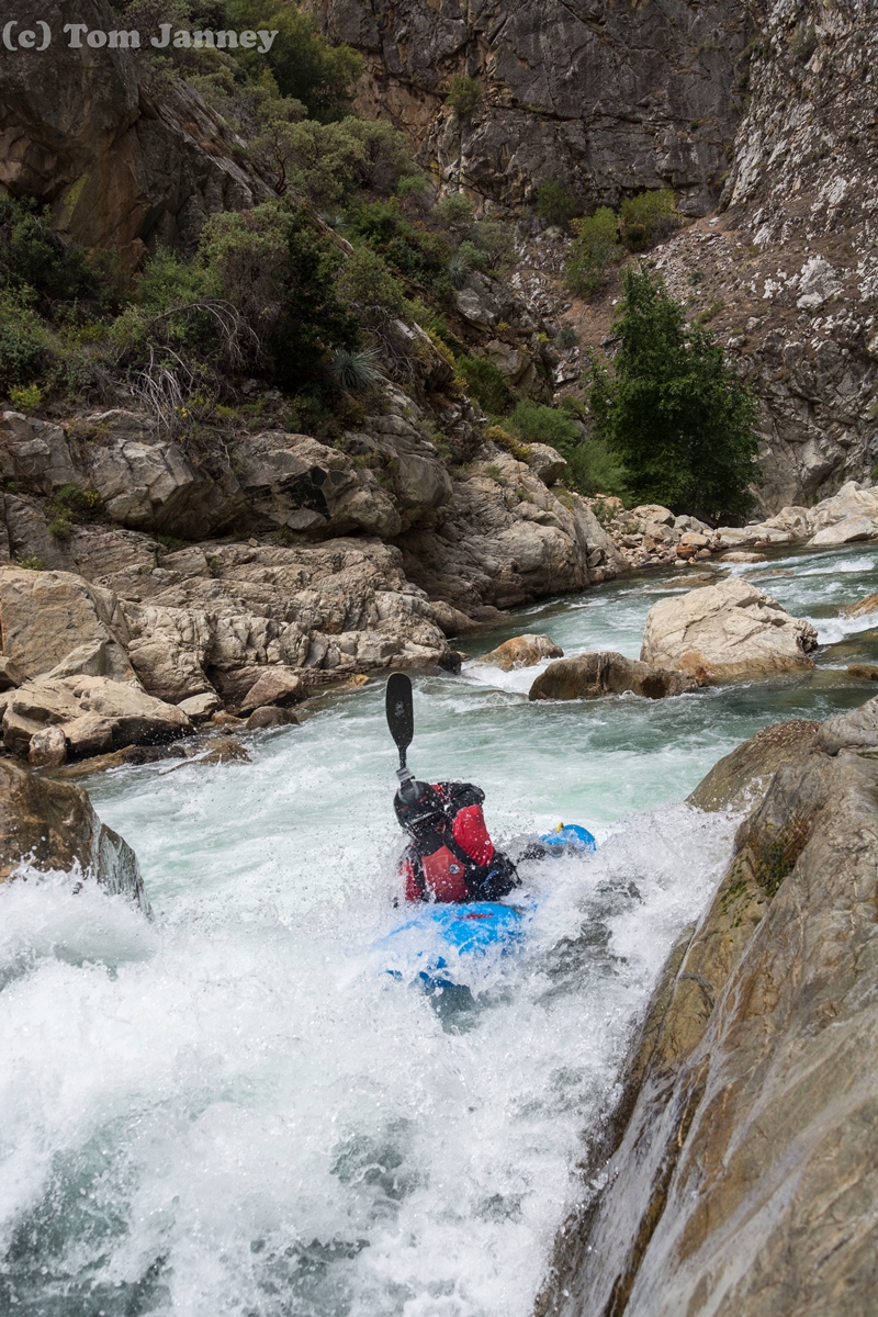
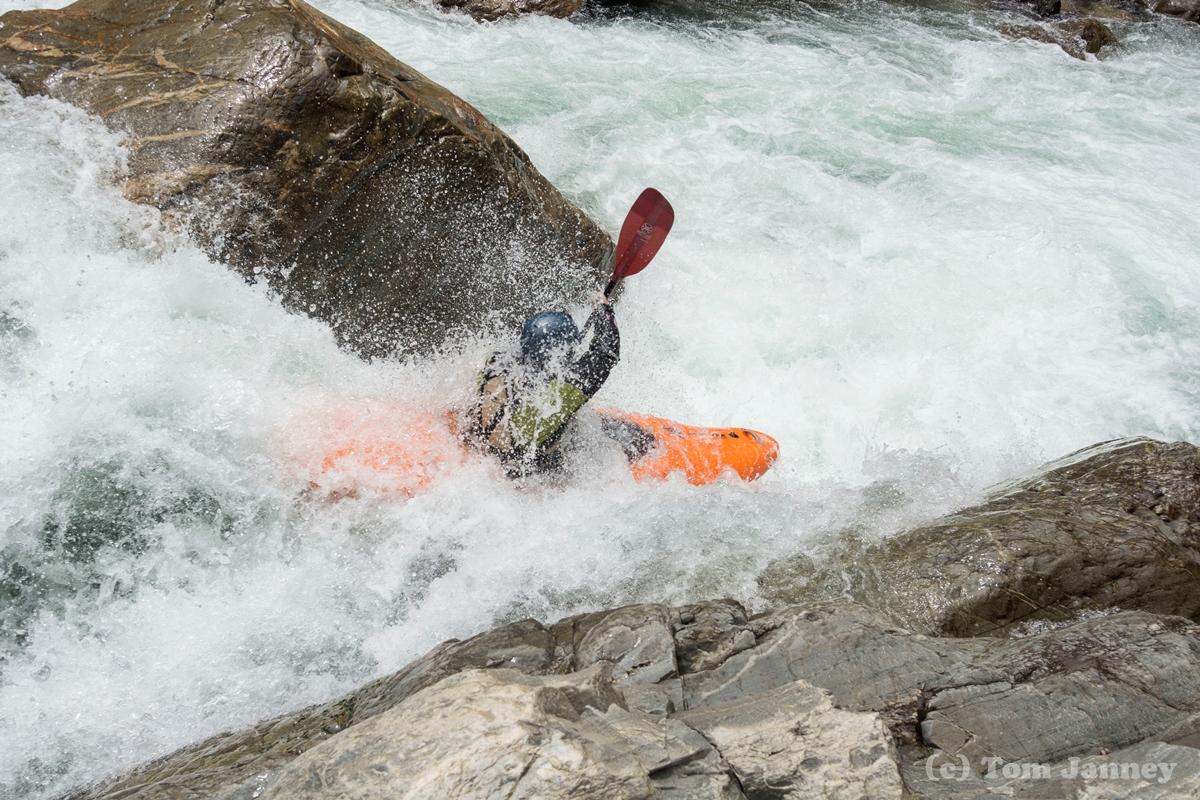
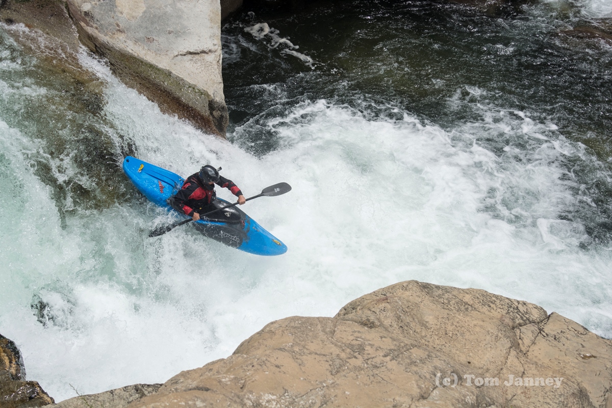
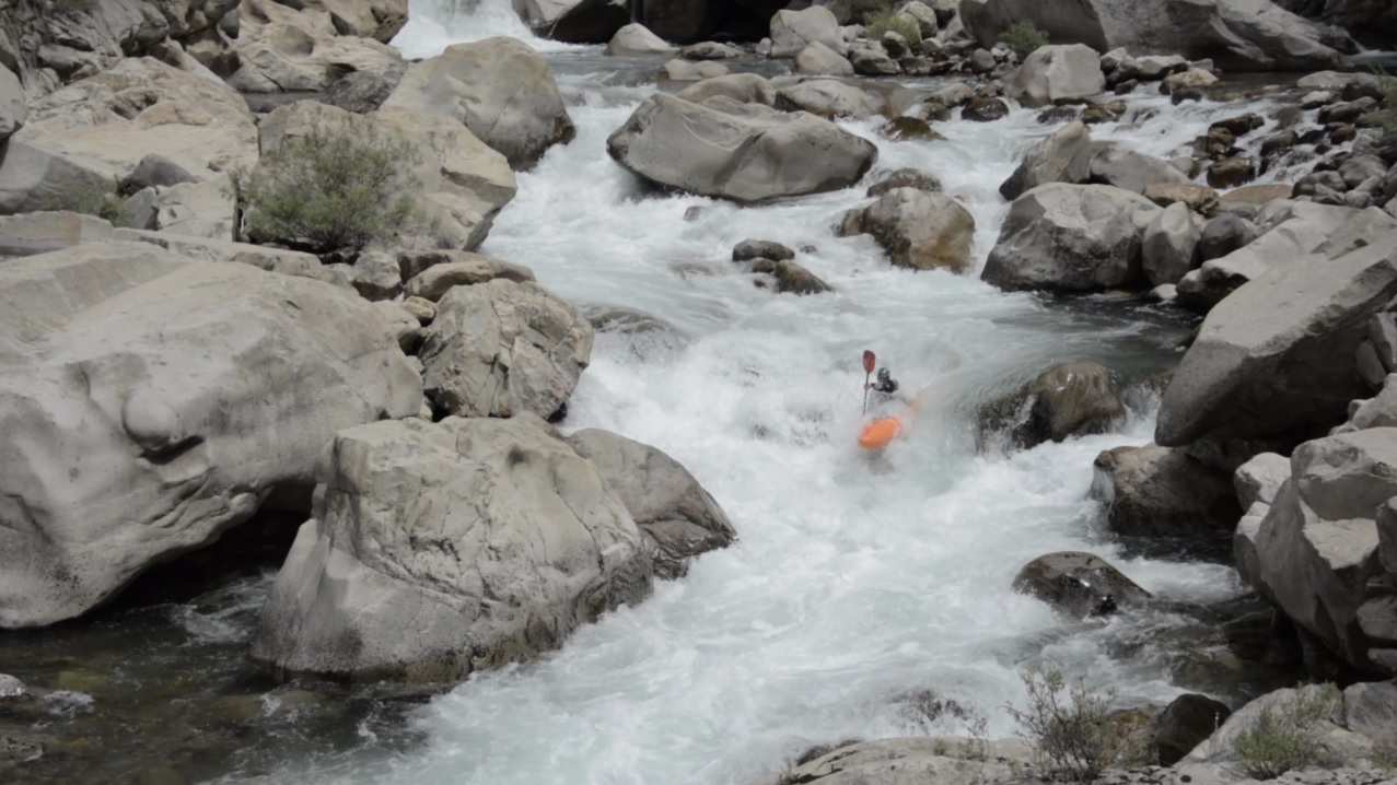
Porter Falls (V). One of the more intimidating rapids for sure. It has a small ledge that leads to the main rapid, don't go left on the main drop... don't. The main drop has a folding falls that Tom was able to boof perfectly, Jim and I sorta plugged through. Don't plug too much as just left of the landing is a sieve, your momentum will clear you through the danger zone if you are straight. Below, boof the left side of the ledge, this one is more forgiving. Scout and portage right if so inclined.
Little Crux (IV+). So at first it looked really bad. Maybe a line down the middle into rocks and through some crappy looking holes. Maybe down the right but you will hit the flake and then piton the wall... maybe... I decided to cut bait and seal launch in off the huge rock in the middle of the river. Scary actually as the slope was into the wall, luckily it was plenty deep so I could just teeter off and plug it. Then Tom ran down the far right and dropped just between the flake and the wall cleaning it... wow. Who woulda thought. Jim similarly cleaned it selling it in my mind.
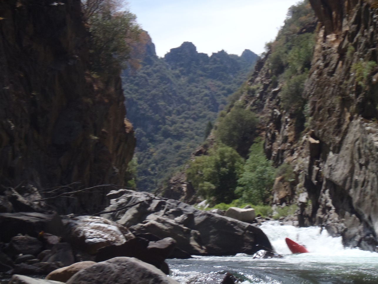
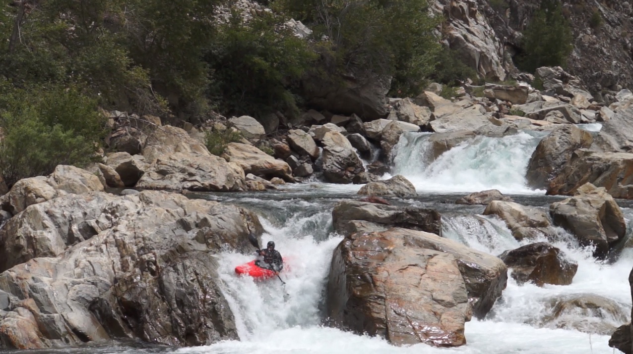
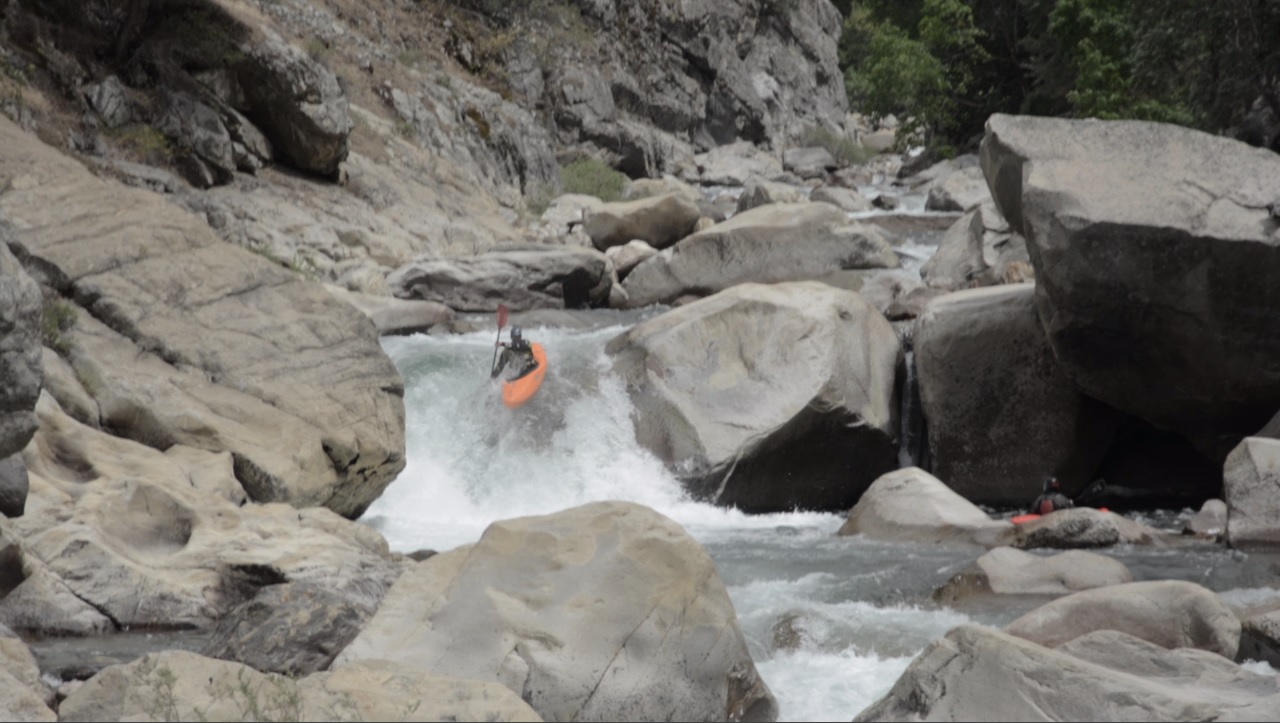
- Exit (V). The final drop of the crux section was one of the better ones. A nice 8 foot ledge to be boofed in the main (middle) channel. Upon landing, book it left away from the rocky crap on the right. Scout left, and portage there too if so inclined.
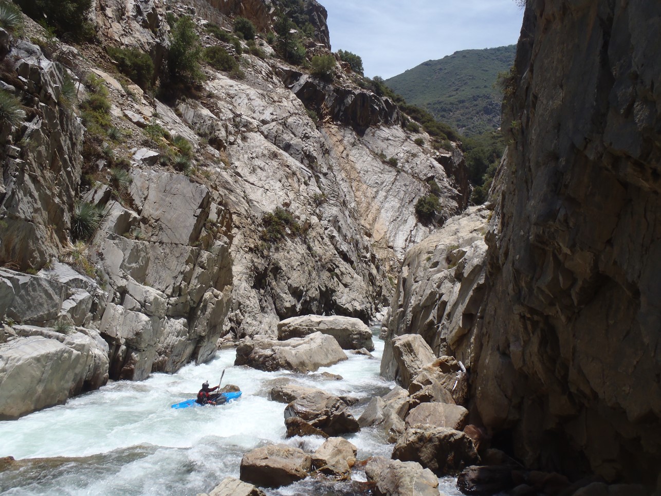
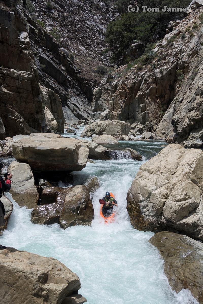
Below are a few fun boogie rapids. We went down the left.
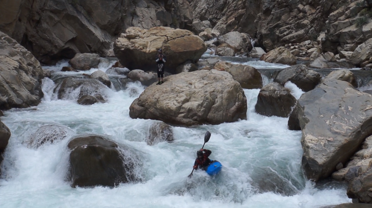
- Redwood Corner (V). Where do all the smaller boulders gets pushed when they are in the tight walled canyon you just exited? Here. Big, steep and bouldery. Scout left, I think more people portaged this in our group and the group that was behind us than any other rapid. Tom ran middle driving left and banged through the exit. Jim eddied out half way on the left and did a nice ferry to the far right micro channel and banged down the exit there. I portaged...
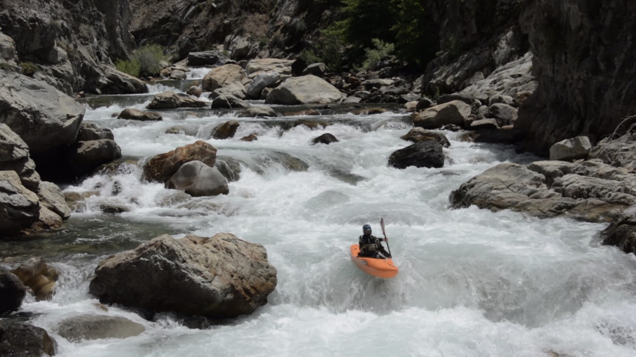
A few fun boogie rapids, a few might need a quick scout to spot the right channel.
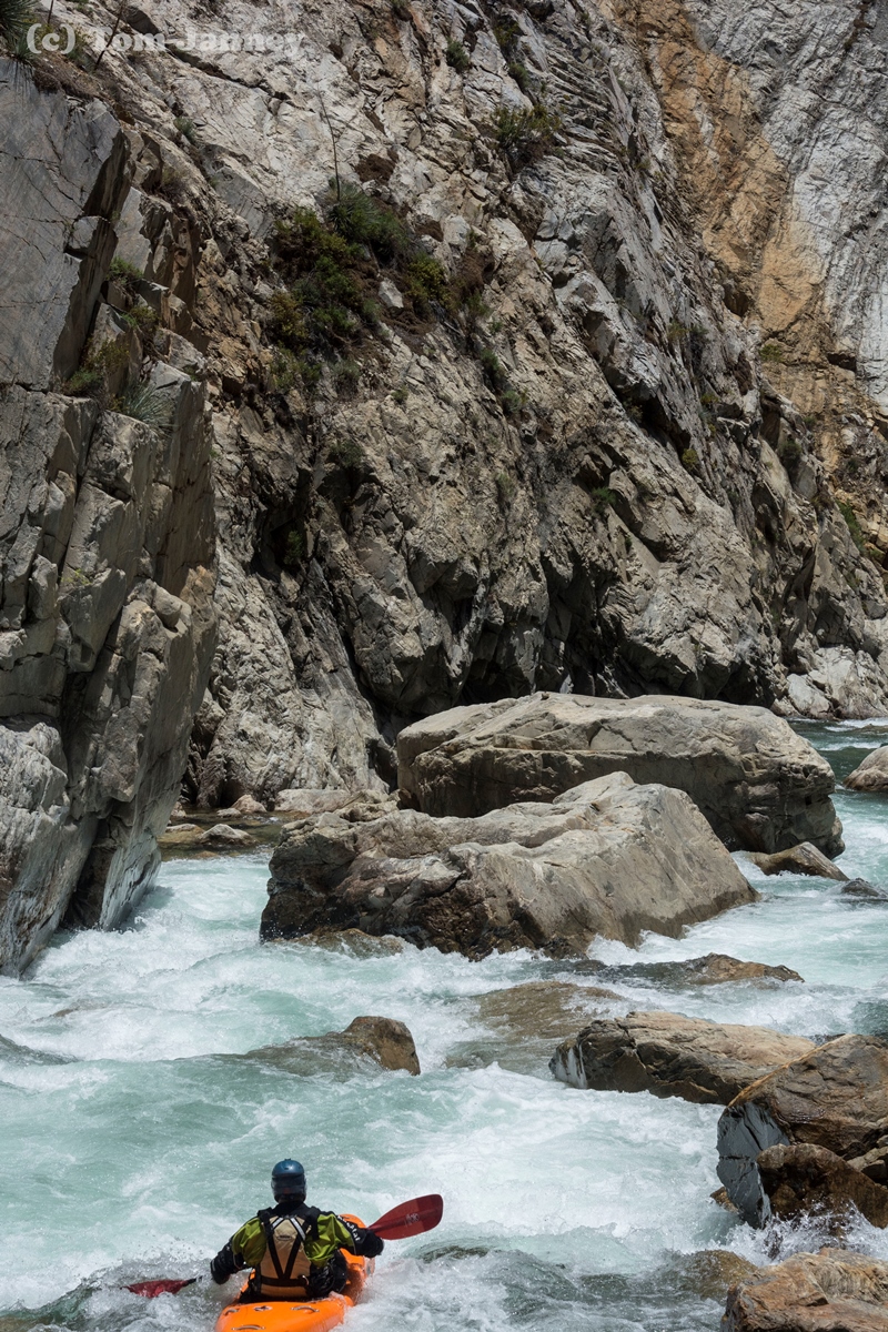
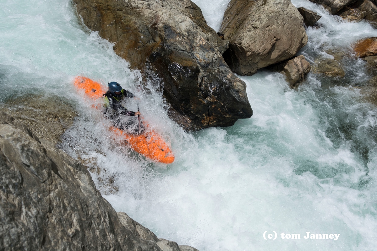
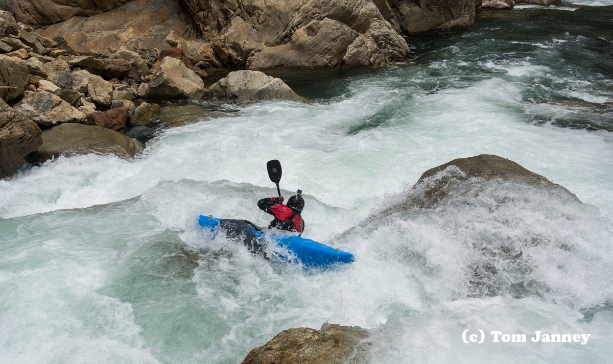
- Bob's Choice (V). A tricky waterfall that goes straight into an ugly boulder pile. The current moves you right across the lip into the meat of the hole. You want to be far left to get a bit of the rock to boof. Scout on the right. Scout the next rapid at the same time too. Per Thomas Moore, with a little more water a nice boof opens on the left side of the river. So that is an option as well!
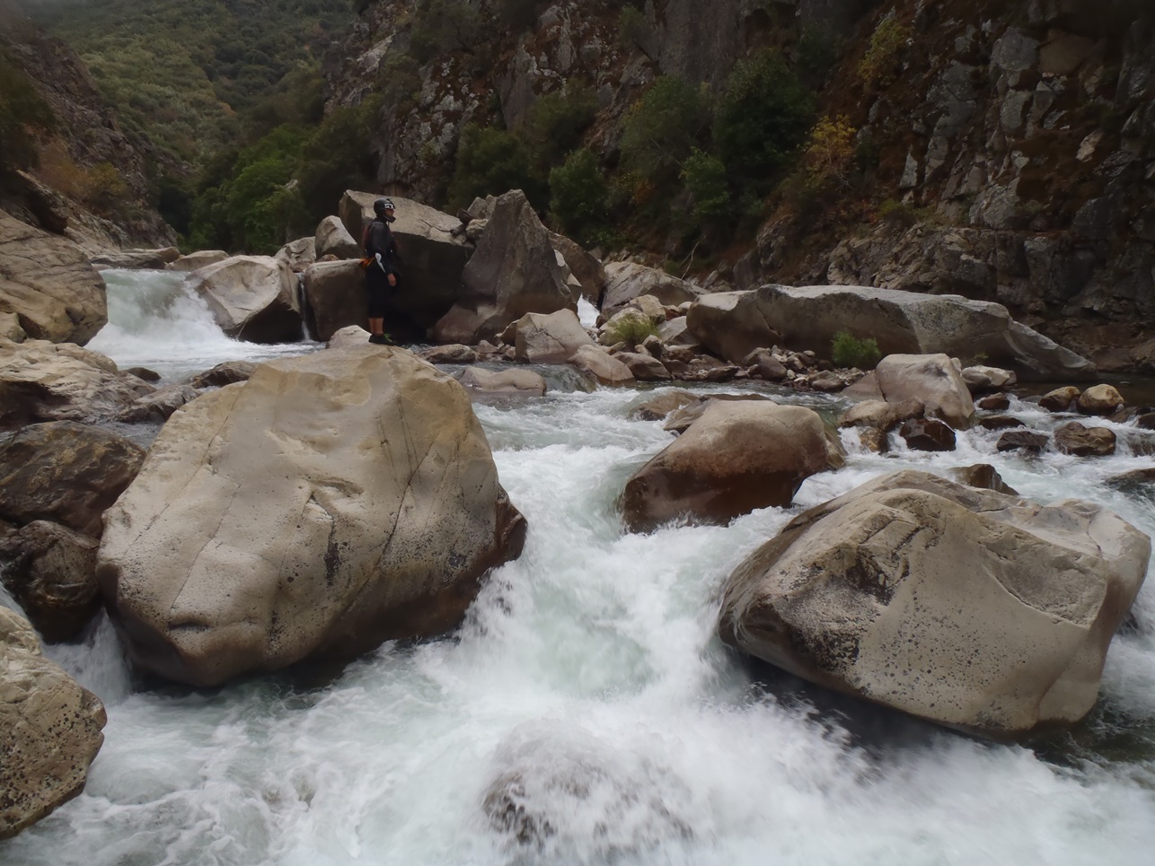
Post Waterfall (V-). A super junky rapid on the right does not look navigable. Instead, go to the far left to a small micro channel and head down it moving back right into the main channel. Then drive left again through the bottom hole. 50 feet below, the exit is runnable anywhere but cleanest on the far right.
- One Last Boof (IV). One last steep drop reveals a nice 6 foot boof in the middle.
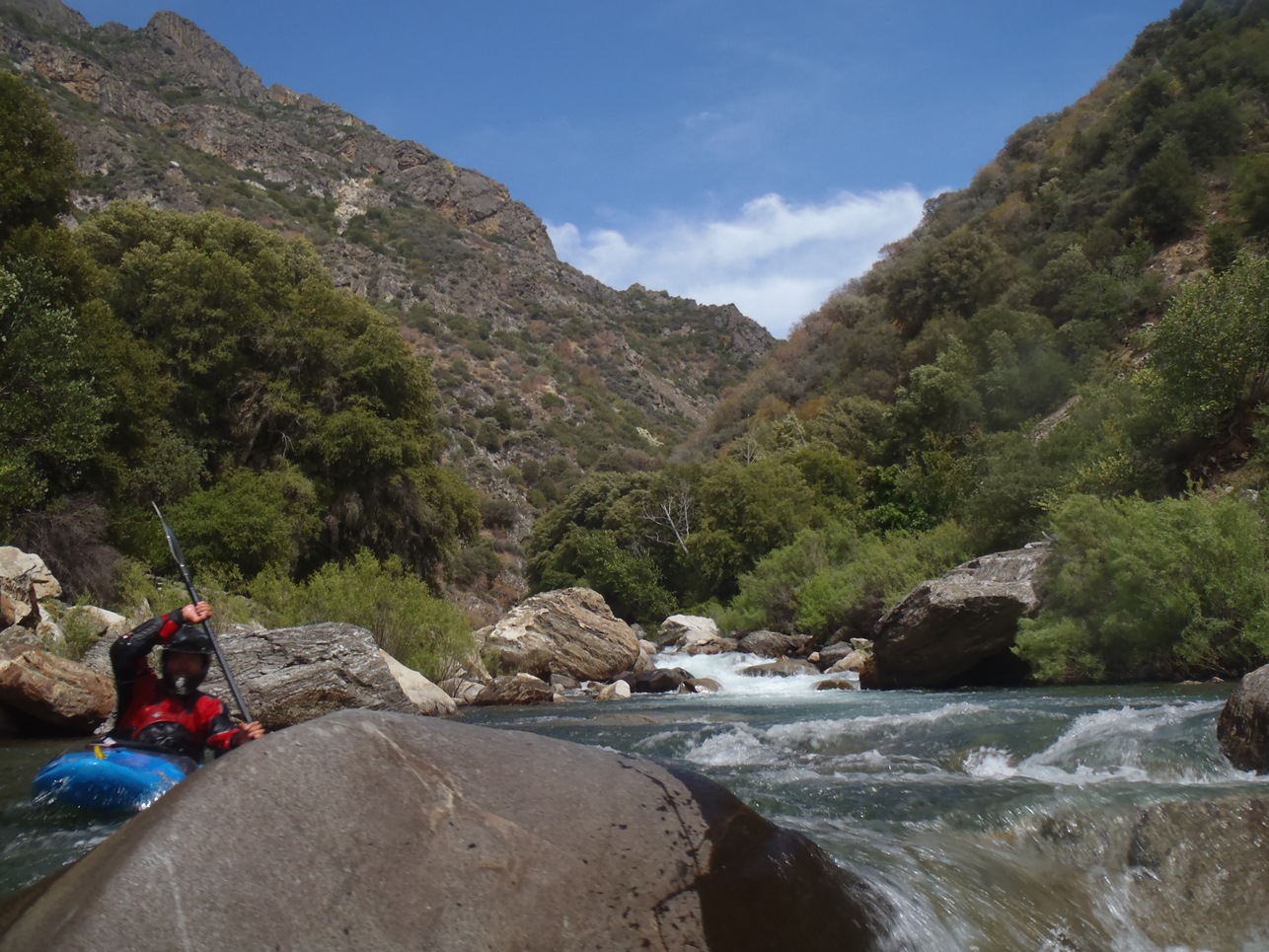
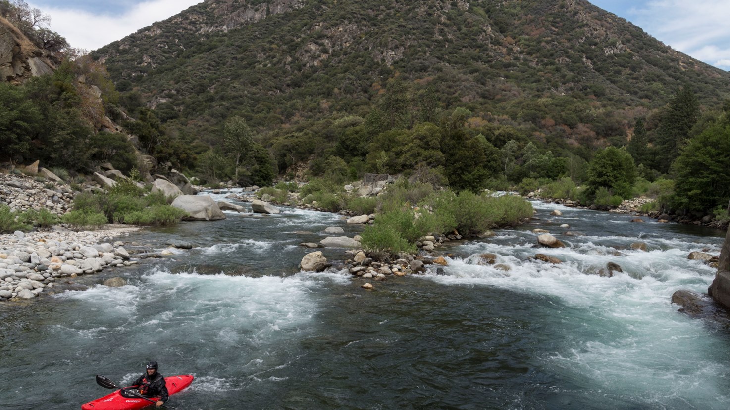
Below the river opens up and eases to class III down to the confluence.
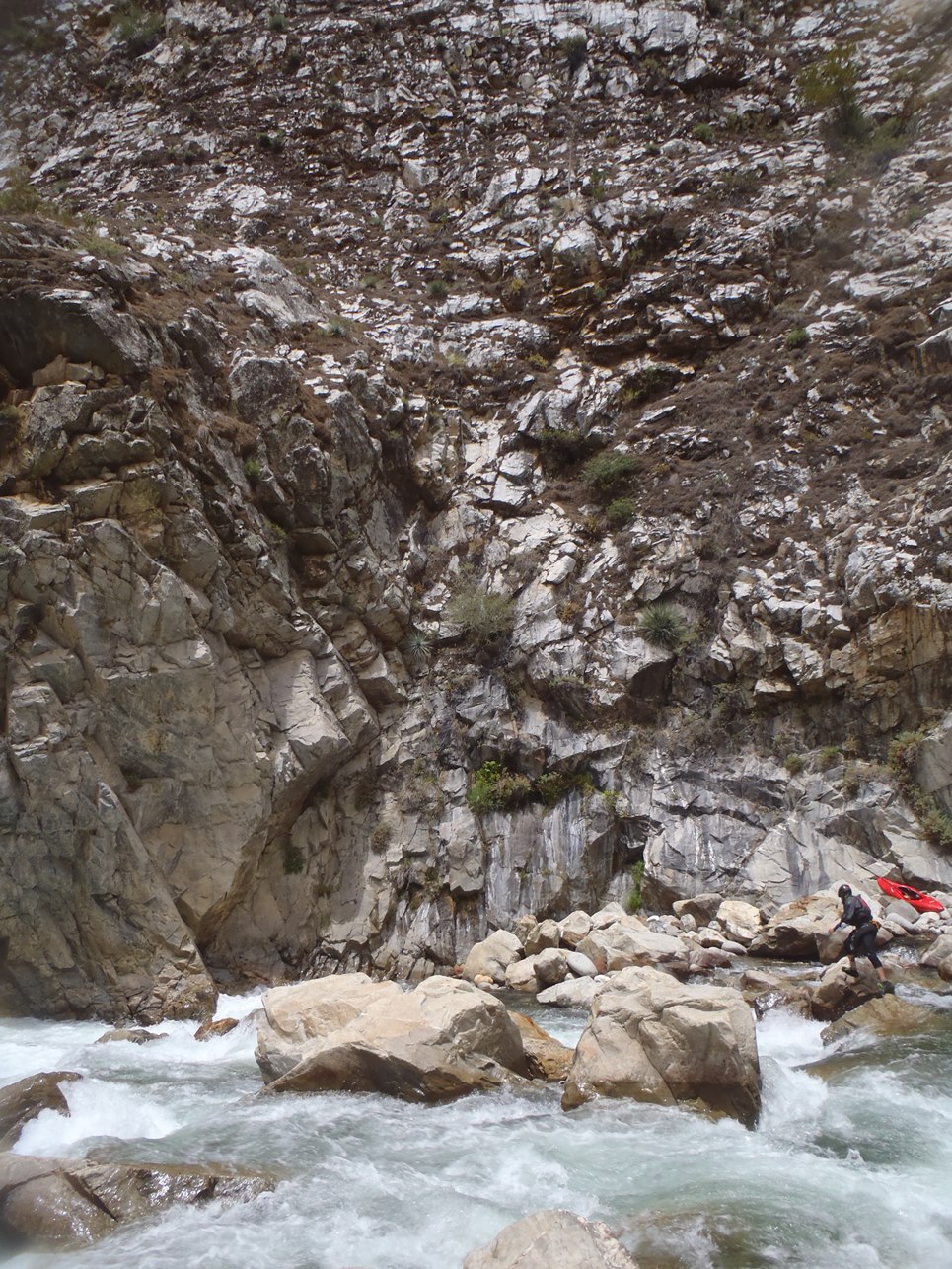
Take-out: Either Yucca Point Trail... which is on Highway 180, 69.5 miles east of Fresno. The trail is just at the confluence, right before you start to drive up the South Fork. There is limited parking on the left. It is a 2 mile hike out from the river.
The other option is to use the Garlic Falls take-out... From Fresno, take Highway 180 East towards King Canyon. Take it through town eventually heading north one block on either Del Rey Ave or North Academy Ave (after 13.5 miles) and turn right on East Belmont. After 6 miles this changes names to Trimmer Springs rd. Follow Trimmer springs around the lake until it begins going up the Kings River itself. Cross the river (2nd crossing, this one on a small metal bridge) and go right on the small dirt road to Garnet Dike Campground (there is a sign) eight slow miles up the road.
Put-in: If you are doing just the South Kings, it is easy... drive up the road another 4.5 miles to the bridge at the caves, park there. If you are doing Garlic Falls... it is longer. There is a dirt road that cuts off 50 some off miles but it is rough and occasionally closed. The more straight forward way is to head back down around the lake via Trimmer Springs for 38 miles or so. Turn left on N Piedra and follow for 0.7 miles before turning left on N Elwood. Follow this 11.8 miles before hitting Highway 180. Turn left and follow for 43 miles or so to Boyden Caves. You do enter the park, so be prepared to pay for the National Park entrance.
HTML Comment Box is loading comments...