South Fork of the American (Slab Creek)
| Stretch: | Slab Creek Reservoir to Rock Creek |
| Difficulty: | Class IV+ to V-- |
| Distance: | 5.4 miles (or 3.25 miles or 7.6 miles) |
| Flows: | 600-3,000+ cfs. Supposedly ELF flow of 400 cfs is still entertaining. Current Dreamflows gauge |
| Gradient: | 88 fpm (The first 4 miles are 114 fpm) |
| Put-in: | Slab Creek Road |
| Take-out: | Rock Creek (or Mosquito Bridge or White Rock Powerhouse) |
| Shuttle: | ~17 miles (30 minutes one way). |
| Season: | Winter and Spring from Dam Spill |
| Written: | © 2010 |
| Featured in Video Twenty-Nine | |
Several years ago I heard that this section of river was going to get releases to support boating opportunities. These flow releases would be in contrast to the occasional spill that occurs in big water years and results in wild fluctuating flows spiking from a few hundred to several thousands and back down and up several times in an afternoon. While the past several years have past, the relicensing of the dam has yet to be complete (I believe it is due later this year, 2010). Instead, with this springs large snow pack, we got to enjoy a natural occurring spill on Slab Creek Dam. This meant that while a group of my friends ran it midweek with a nice 1,000 cfs, by the weekend the flows were up near 4,000 cfs or as low as 800 cfs, jumping between the two. I know of people going in there at 3,000 cfs and reporting that it wasn't too much harder, just more consequential, however we were still unsure of how bright of an idea going in that high would be.
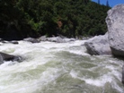
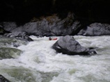
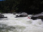
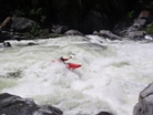
Luckily, as morning broke, the flows were showing fluctuation between 1,800 and 2,300 cfs. Deeming this doable we set off. In total, this flow was great. There were some large hole to avoid, but most were easy enough to do just that. Occasionally you had to work a little harder or ensure that you were upright near the end of a long rapid to avoid the hole. But for the most part I would call the rapids just really big IV and IV+. But that isn't to say that a swim wouldn't turn into a large ordeal very quick. At 2,300 cfs the rapids were very linked together and very long. One hole ride would quickly result in you being several hundred yards away from your paddling buddies. Somehow the two swims our group had both were quickly pulled to shore with all their gear. Statistically I would not expect this.
The rapids were comprised of boulder bars imbedded between granite shores. Very scenic. Some of our group had done the run earlier in the week at 1,000 cfs and reported that the flow was decent, though many rocks needed to be avoided. I think I would agree with the reports that 1,200-1,500 cfs is ideal. Our paddlers who did the run lower said that the run was much better with the higher water than at the lower water. Though the mere mortals (me) in the group thought that we (I) were glad for some A-Gamers (Jonas/Darin) to be probe units and locate the holes for us as we dropped into the rapids. Scouting at this flow would have been difficult on many drops as they are just too long and the water just too high. Though if you were motivated, you could scout and portage most of the rapids.
In total, this river was very fun. I would love to go back, especially a little lower just for the sake of comparison. At 2,300 cfs this was a lot of fun and very worthwhile for a class IV+ to V boater. That is even taking into account that my legs are covered in poison oak right now from the portage of Motherload. Guess more tedious path around the poison oak may have been better after all. Oh well. Anyways, I can't wait to get the releases on this and boat it more often.
The rapids are pretty evenly spaced, at this flow it was hard to gauge how far we had gone or recognize features in Google Earth to measure distance to. Also, I have so far only done this at "higherish" water, a class IV boater may think a lot of these rapids are much harder than class IV. But they really didn't have many moves, they were just amongst big waves and big holes.
Mi 0:
- First Swim (IV+). Within sight of the car we had our first swim. The first big rapid is best run down the gut with some gusto to get through the hole at the bottom.
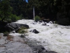
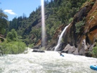
Big Tongue (IV). On a left bend the river steepened and ended in a big hole in the middle of the river. We wanted to be on the right side of the tongue to avoid the hole. Also, there was a large hole just behind it. As Darin gave me the get right signal he dropped in backwards with only one had on the paddle to said hole. Darin being Darin, it all worked out.
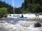
Long Read and Run (III-IV). There was long section of read and run water with a few sneaker holes that left one in our group several hundred yards behind the group before we noticed they were even missing.
Right Wall (IV). A ledge best run on the left leads you down to the wall. Just keep driving left to avoid the wall.
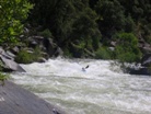
Wallflower (IV+). I think this is the one that Chris has named "Wallflower" in the dreamflows photos page. Though at these flows there were several large hole leading down the left wall to a large curler on the wall that you wanted to partake in in-order to avoid dropping into the rather large hole in the center, mere feet away. We sort of scouted this from river left at the lip, but that only showed so much, so we went on faith since two in our group had already made it down the right side driving left at the bottom.
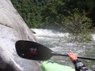
Some fun read and run
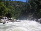
- Scouted on Right (IV- to IV+). There are willows on the right, scout on the right. As the river drops left a good size curler hole leads into a very large wave train with a hole in the middle at the bottom and a large undercut on the right. Luckily the line is pretty wide.
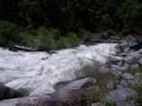
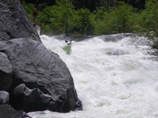
Looked Easy From the Photo Location for "Scouted on Right" (IV). Downstream lay several large holes. We started right and finished left.
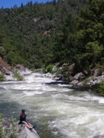
I Love a Timely Roll (IV+). Bigger and harder than either of the two rapids we scouted above, this one we dropped into blind. You can tell there are some large holes in the middle of the rapid and at the end of the rapid. Get right through them and fight the water moving you center. I rolled and snapped a quick one up just in time to avoid getting pushed center at the bottom, then reminded myself to breath.
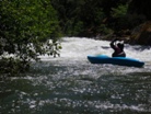
- Mosquito Bridge (IV+ to V-). The read and run steppeneds and drops into to large holes one after the other. We had a swim here that was fairly long but luckily we were able to collect all the goods rather easily. Good thing since around the corner the river starts to fall towards Motherload.
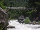
Possible take out, easier just below the bridge on the left though at high flow the eddy was gone and the only option was 100 feet downriver on the right which looked hard and full of poison oak.
Easy Stuff (III). A few hundred yards of easy read and run leads you to the first horizon line below the bridge. This section is the crux of the run.
Ledge (IV). A ramp then leads to a rock that splits the river. We boofed around the rock on the left which was shallow but easy. At lower flows the right probably looks more enticing and a little calmer than it did at our flows.
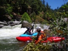
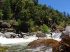
Pre-Falls (IV+). We entered on the right, where a surprise hole caused a few rodeo moves. We then worked left around a rock in the middle of the river and drove hard back to the right to avoid two large back to back holes. Motherload is immediately below so this rapid is a serious one. There is a gig eddy on the right just below to hop out and scout the falls from.
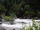
- Motherload Falls (V to V+). Several large holes at the top leads to a big junky exit. To make matters worse there are sieves everywhere. A sneak that is still serious and sieve filled exist on the far left. The portage on the right was not easy, though certainly not hard. Just long and big boulder filled. We also hoped into our boats for 100 feet near the end to get around a friction climb section that would slid you into sieves or the meat of the rapid if you were to slip.
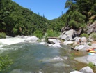
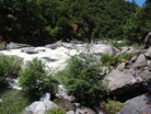
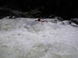
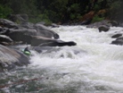
Ledges (IV- to IV). Two large ledges. There was a window for the first on the far left. The second had a window on the far right. Luckily, some space exists between to two.
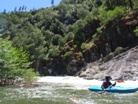
Jonas Grabs a Surf (IV). A good size rapid leads to a rather large hole at the bottom. It would be hard to avoid if not for a curling hole just above it that you can use to push you right around it. Jonas dropped in and went for a short surf. Then to our surprise he paddled up the eddy and ferried back into it this time taking a long surf hooting and hollering with his tongue out the whole time. Crazy German!
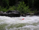
Surprise (III+ to IV-). On a sharp left turn you will want to be on the far left as the right 4/5ths of the river drops into a huge hole. Not hard and fairly obvious from above though.
- As three powerlines come into view, look to the right. 30 yards before they are directly overhead you will find a small beach and a trail leading up to the road. If you paddle past Rock Creek, you have gone a hundred yards too far.
- White Rock Powerhouse, the rapids between Rock Creek and here are easy class II so I have heard, though I have not actually paddled it myself. The hike out is also reported to be about 10 minutes or so. Other folks also paddle across the lake and run the 40 foot Chili Bar Dam, while others portage it up and over some barbed wire to take out at the Chili Bar put-in.
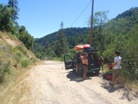 Put-in: Continue going up Rock Creek Road. After a few miles you get to a "T," turn right on Mosquito Road. This crossed the river at the Mosquito Bridge rapid. I didn't see much parking, but I am sure you could find some if this is where you are going to take-out. Climb up the gorge on Mosquito Road, at the T turn left on Union Ridge Road. At the next T turn left on Hassler Road. At the next T turn left at Hidden Valley Road. In 0.5 miles turn left onto the dirt road (with a small sign) which is Slab Creek Road. Be aware that the gate closes automatically at dusk. So don't linger on the river too long! Follow this down a mile or so to the gates. Walk downriver for 5 minutes to get to the river.
HTML Comment Box is loading comments...
