Russell Fork (Upper)
| Stretch: | Flannagan Dam to Garden Hole |
| Difficulty: | Class II to III |
| Distance: | 4.8 miles (3.2 miles if you put in below the Pound Confluence) |
| Flows: | 500 to ?,000 cfs (though even 1,200 felt a little boney at times). Current AW gauge |
| Gradient: | 22.3 fpm average |
| Put-in: | Base of Flannagan Dam |
| Take-out: | Garden Hold Access Point |
| Shuttle: | 13 miles (30 minutes one way, steep dirt road at take-out) |
| Season: | Year Round (rain) (October weekend dam release) |
| Written: | © 2014 |
So I had gone out to the Russell Fork of the Levisa Fork of the Big Sandy (as it is officially designated) several times over the past few years, but have never been able to get anyone to venture into the Upper class II/III section with me. But finally, my luck changed and a group of my fellow Knoxvillians were game.
The run had some very nice scenery, easily on par with that of the gorge. The rapids were generally wide river affairs with shallow rocks, even at 1,200 cfs. I know folks run it down significantly lower, but for an entertaining day I would pass on it at 500 cfs and find something different.
We decided to put in at the reservoir, 1.6 miles upstream of the Russell Fork / Pound Creek confluence. It was worth doing once, but added a good 10 minutes each way to the shuttle... and as it had no actual rapids other than the one at put-in, I think I would pass on doing the upper put-in. Instead, I would put in at the confluence which is on the same shuttle roads but just much closer in to the highway. Below the confluence you are greeted with a low head dam that can be run far right before you start a mellow 1.4 mile paddle to where the rapids start. Once you see a train track high overhead the action on the run starts and doesn't stop until you get to take-out.
Mi 1.2:
- Flannagan Dam (II+ to III-). At put-in the outflow from the dam pushes straight into the first rapid, the water piles into a rock at the end of the rapid, just make sure you get left or right of it.
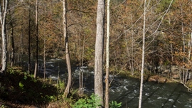
Below is mellow whitewater in a pleasant wooded area
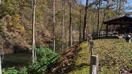
- Russell Fork confluence and alternate put-in.
- Bartlick Dam (III-). A low head dam with a bar reversal on the left. You can run the middle of the right most opening of supports. As flows come up even higher you will want to run the opening on the right shore.
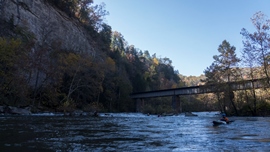
- Bridge (II+). A shallow rapid with the train tracks overhead deposits you in a nice walled out arena. We ran far right which ended rocky. Perhaps the left side could have been less rocky.
- 20 Stitches (III- to III). A nice fun rapid with a few punch holes. We went generally middle and ended right. As I recall there was one larger hole on the right half way down that we went around to the left before moving back to the right for the bottom hole.
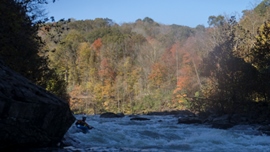
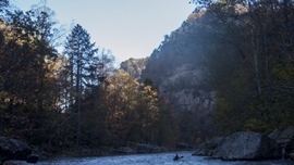
Two rapids of note were below 20 stitches, the first was fairly rocky and we boofed a little ledge at the bottom just left of center. The second was a congested boulder affair that we ran left on. Below that, you quickly paddle across some flat water and get to Golden Hole.
For more details on the run, see the AW write-up...
Take-out: This is the same as the put-in for the gorge section... Get yourself to Elkhorn City, KY. Head out of town SE on KY-80 for 7.4 miles (if you approach from upriver you will need to look for the road 1 mile prior to the stateline). Look for a dirt road on the rising steeply on the right marked "Golden Hole" and turn right. Follow this dirt road for about a mile down to the river...
Put-in: Continue up Highway 80 another 3.9 miles. Turn right on route 611 (at the Flannagan Dam Sign) and follow for an additional 3.4 miles. This will bring you close to the river. You can put in here at the confluence of the Russell Fork and the Pound Creek, or cross the river and continue an additional 2.4 miles. Then turn left on Flannagan Dam Rd and continue for another 1.8 miles eventually crossing the dam. Take an immediate left afterwards and drop steeply down to the river and the base of the dam.
HTML Comment Box is loading comments...
