Rogers Creek
| Stretch: | Above Lillooet River |
| Difficulty: | Class IV to V |
| Distance: | 1.15 miles |
| Flows: | No Gauge, visual only (at the "1 km" marker on the dirt road to put-in, walk 10 feet off the road and check the triple falls... if it is super white and boily, it may be high) |
| Gradient: | 363 fpm average |
| Put-in: | Bushwack down in the old growth between clear cuts on Rogers Creek Rd. |
| Take-out: | Rogers Creek Rd, 100 yards up from Lillooet River Rd. |
| Shuttle: | 2 km (5 minutes, crap dirt road, super steep, 4 Wheel Drive and some clearance required... or just walk up). |
| Season: | End of Summer (July/August) from snowmelt/rain |
| Written: | © 2013 |
| Featured in Video A Wet State #80 and in A Wet State's contribution to World Kayak's Video Guide | |
Washington and BC 2013 Day 7:
I don't think this river needs any introductions. Contained in this creeks walls is one of the most famous sets of drops that has been featured in video and magazines for as long as I can remember. Though this creek is almost as equally as known for its blind hike in and angry land owners. Stories of folks getting cliffed out on the hike in or getting shot at or their car burned are abound. Luckily for us, we ran into none of these issues and instead just had a great day on the water.
There is no gauge on this run, so I think the best bet is to join Whistler Whitewater on facebook and inquire there about the flows. Our day was low, some folks thought it would be too low. But how often do you find yourself 1,500 mile away from home near the river? So we went for it anyways and found a low but boatable flow. There were sections of mank between clean rapids. And in truth, the low water was nice for a small group that hadn't done the run before, made it easier to scout our way down the creek.
To find put-in, drive up the road 2 km past the first clear cut and park at the first good turnout on the right. If you go into a wide open clear cut that is then followed by a fork, go back 100 yards. Walk down the old growth (not clear cut as some beta suggest). The topography will want to push you right, but keep moving left. Eventually a ridge appears, drop down the left side of it straight to the water.
From there, the river has a quick portage then a few fun rapids, then another portage. After that however, it gets more boatable with a handful of other portages thrown in. Perhaps with more water those go, but between the wood and sieves it didn't look great. After a small ledge, the river soon heads left around a blind corner with a sticky backed up hole immediately above the triple drop. Not sure how you would set safety here. Below the falls, the run has one last fun rapid before turning manky.
To avoid confrontation with the land owners (First Nation Indian tribe), I would suggest only taking one car and hiking back up at the end of the day. You do not want to park anywhere on the main road as cars have been burned when parked there. Another option is to boat down to the campground a km or two downriver on the Lillooet River. The option that we chose was to take-out before the bridge and hike up to the car above (it was too steep to bike up the road). The do this, look for the ridge dropping down to the river, as it levels out and merely 15 feet off river level, depart the river and head generally down and away from the river and quickly meet up with the road near its outlet to the main road. This allows you to hang out while one person hikes back up to check out the falls.
Also to note, you can check the flow by getting out of your car on Rogers Creek road at the 1 km sign and walking 10 feet off the road toward the river. If it is white and boily be aware. If it is green it is starting to get low. Oh also, the road to get from Whistler to Rogers Creek is like 20 miles of dirt road... I was not aware of that before hand. And the road up Rogers Creek itself, is pretty rough. My Highlander was just enough car. 4 wheel drive is probably mandatory due to loose rock and steep grade.
Also check out LiquidLore.com for the final word on BC boating...
Also, check out Darin McQuoid's photos on his website, www.darinmcquoid.com
Mi 0.0:
- Portage (?). One small rapid led to a quick portage on the right up and over a boulder. The rapid looked like maybe with more water it could go on the left. It was a pile of rocks at the low flow.
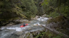
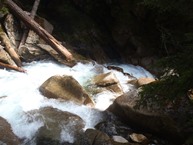
Tight Gorge (IV). A cool little ledge best run down the right is followed by a fun boof on the left. The gorge is super tight here and illustrates why you want to make sure you don't allow yourself to drift right on the hike in.
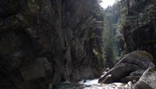
Portage (U). After a few hundred yards of boogie, there is a portage that is easy on the right due to wood choke.
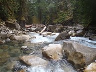
Zig-Zag (IV+). A tight zig-zag rapid that we eddy hoped down. First eddying out right, then left, then exiting through the pillow and hole below. Scout right immediately after the previous portage.
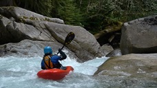
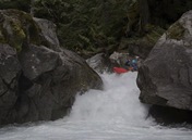
Boogie (IV). Boogie continues and gets a little tighter, more congested, and steeper.
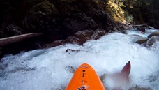
Portage (V to U). We couldn't get a good look at it. There was a log and a sieve in play. Enough that we walked down easily on the left. Perhaps it goes though.
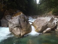
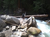
First Ledge (IV to IV+). After a little more non-descript boogie is another ledge. At low flow the hole was not bad, at higher flows I could see it becoming grumpier. It would be worse on the right.
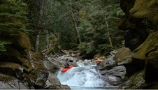
Blind Rapid (IV+). Immediately below is a rapid I hoped out on the right to scout. The middle is blind but looked good enough for Darin to drop into mid rapid eddy just above the crux for a final look to confirm. Enter center and boof center moving right. The left drops into a little bit of a sieve.
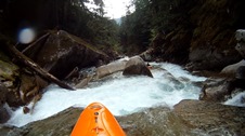
Pre-Triple Falls (V-). This rapid is also totally blind. Darin was in front and was scrambling for an eddy at the lip and barely caught one. The beta was to head down the left and boof the hole at the bottom with our nose pointing right. The nose angle is due to a rock in the landing of the hole. The hole however is backed-up by a pot-hole and recirculates. At the low flow it was not a problem. At higher flow this rapid has dished out problems... and it is immediately above the falls.
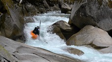
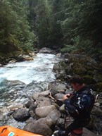
- Triple Falls (V). Scout left. You can also do an extended scout high on the left (and can actually portage if you want as well). First drop run right. Second drop run far left. Third drop run anywhere... though right is hard to get to due to the cross current.
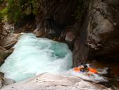
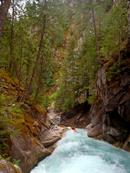
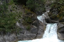
Exit (IV). Not a big rapid... but totally junky at this flow. A log blocking the one good channel made us run the exit far middle to far left where I quickly pinned.
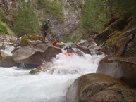
Last Good Rapid (IV+). Other than the Triple Drop, this is the most fun rapid of the run. A fun hole to try to boof (or plug through) leads to a slide and kicker that lands you in a 90 degree left turn. Run the slide pointing left. The slide then continues for the next 100 feet.
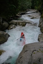
Boogie (IV). Boogie continues with wood hazards throughout. Pick your way down one rapid at a time.
Take-out: From Pemberton, take highway 99 ~7 km to Lillooet Lake Rd (dirt road in good condition). Drive for 43.2 km (yes... ~30 miles on a dirt road that occasionally gets wash-boarded) to Rogers Creek. As I stated in the intro, parking near the bridge over Rogers Creek is a really bad idea. This land is on an Indian Reservation and to say they are not friendly to kayakers is an understatement. Some folks paddle down a few extra kilometers to the campground on the Lillooet. Others do what we did. We only brought one car, parked at the top, and hiked back up at the end of the day.
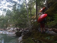
Put-in: Drive up Rogers Creek rd. At the 1 km marker, hop out the car and walk 10 feet off the road to take a peak down at the Triple Falls to check flows. Continue up the steep and dirt (not in good shape, my Highlander was just enough) road for 1.65 miles (2.7 km). You will have passed one large clear cut and reentered old growth. There is an obvious wide spot to park on the right just before you enter and even bigger clear cut. If you reach the fork in the road, you have gone too far by a hundred yards. From this turn out, start down the hill (no trail). The hill side wants to push you right, keep moving left. Eventually we came to a ridge and dropped down the left side of it straight down to the water. Ended up not being too bad at all. If you end up on the right side of the ridge... it cliffs out and you would have to backtrack.
View Rogers Creek in a larger map
HTML Comment Box is loading comments...
