Roaring Creek
| Stretch: | Shaver Rd to Pikeville |
| Difficulty: | Class IV to IV+ |
| Distance: | 7.8 miles |
| Flows: | -8 to +2 (give or take) on the take-out gauge. Look for 2 inches of rain in the past day. If it looks ok at take-out go for it. |
| Gradient: | 125 fpm average (max over 200 fpm) |
| Put-in: | Gated road off of Shaver Rd |
| Take-out: | Bridge on Pikeville Rd |
| Shuttle: | 19.4 miles, 30 minutes one way. Plus 5 minutes of walking to put-in |
| Season: | Winter and Spring from rain. Occasionally Fall from rain. |
| Written: | © 2018 |
In the week following Hurricane Florence (2018), the Tennessee Plateau got substantial rain. The day before, I was worried about the rivers spiking on us, so we just did Daddy's Creek rather than risk getting flashed on. This day, I woke up and saw a significantly lower forecast of rain accumulation, and thought it would be a good day for off the beaten path run. I pulled out Kirk's book and looked in the Walden's Ridge section, as that area had gotten 2 inches or more of rain in the previous 18-24 hrs. Reading the Roaring Creek description I was intrigued and put together a plan to go look at it. Figuring, worst case, Richland was in as a backup. As we drove, I got word that Richland was still actually fairly high. Made me feel better about the prospects about this creek being in. Arriving at take-out we found the water to be low, but it looked runnable low. Texting Jim he agreed, and mentioned a gauge, which I found. The gauge was out of the water by an inch or two at this time, concerning, but we stuck with the plan, betting on the fact that it looked runnable.
This day, joining Diane and I was a new Knoxville transplant (originally from here, but moved away for 20 years) David Lew. Once we drove up to put-in, we found our way to the river quick enough. The beginning of the river is in a wonderfully pretty tight canyon similar to Island creek, with walls around you and fun class III- to III slides to entertain yourself on. After a short distance, we hit Cupp Creek which entered on the right and doubled our flow. Below here, pushier rapids started immediately. They are excellent slides and ledges. A few we had to hop out to scout to ensure we didn't find a too juicy spot on some of the ledges. Other times, we had our suspicions increased that we were on a healthier flow than anticipated as stopping between slides was impossible, and holes that were mandatory were spicier.
The half mile or so as you approach Polecat Hollow things pick up more. Steeper drops, more powerful features finally led to our first walk of the day. I believe this rapid is likely the one called "Crunch-n-Munch." This drop was a constriction between walls that dropped maybe 8 to 10 feet down a slope into a wall to wall hole. The hole formed a nasty hydraulic that also had right to left movement into a deep pocket against the undercut left wall. We all walked easily on the left. Not too far downstream you get to a steep slide with a powerful hole at the base that marks the entrance into the crux section. On a strong right bend, stay left to eddy out and portage what I think is called Fuzzy Bunny. Here, the river splits around an island. Apparently some times the left channel is runnable. For us it was full of wood. Kirk calls it unrunnable, I would agree more with the latter and was surprised to hear people "sneak" this rapid down the left. Maybe those people are mistaken... Anyways, below, we seal launched in and ran one small ledge before the next big drop, the class V waterfall. This waterfall is serious due to the undercut left wall that the main flow wants to push you into. I think at low flow it would be safer. Diane and I portaged, David had a great line but still ended up pushed and pinned under the corner of the undercut. If he had been a few feet further upstream it could have been life threatening. As it was, he quickly stabilized himself and we were able to extract him before he went full under the wall. Thankfully. The exit of this drop was a class V in its own right, powerful holes with some wreck yourself rocks as consequences.
Below, things began to get easier, one more s-turning slide was IV-V before the river changed to boulder gardens and quickly petered out as you arrive at take-out. Upon arrival, we found that the water had indeed rising a bunch. We were left with what felt like high water, where the river was surging between 1.5 and 2 on the gauge. A full ~2 ft higher than when we arrived at take out earlier that morning!
At this flow, I feel the run, though still mostly IV, was like Island Creek at 2'. I.e. Probably not a place a class IV boater will feel comfortable. Plus, unlike Island Creek, this run is actually long and non-stop from the get go! Because of that, at the higher flow, I would say it was IV+ with a few Vs. I imagine at lower flows, per the pictures I have seen, that the spice is quickly taken out of the run as the flow drops down. But with that said, this run is well renowned as a "when everything is high, go here as it handles high water." So the high water experience is not rare on this one. And I agree, I walked away wondering why it isn't more classic, why Island is the sliding Mecca, and this one hadn't ever even been mentioned to me. I thought that this run was every bit as good as Island, and actually... better. One warning though, careful about wood. There were a few pieces we had to portage, a few were in spicy locations too. All of that at the high flow also added to the IV+ feel for the day for me.
Note: There are too many rapids to name them all, it is seriously all one big slide that runs together in my mind. There are a couple of ways to break up the run though and a few standout rapids. So that is what I will highlight. I am also sure at low flow a lot of what I am calling IV is only class III as the holes become mellower and the current slower between the main moves. Also, I do not have detailed mileage as the river is completed forested over on google earth. So I can only go off of landmarks like tributaries.
Update 2020: Got back in there yesterday. After 5 heavy days of rain, the river still had water with nearly no rain for the previous 24 hrs. It was a much lower flow (0.5) which resulted in much lower stress! Sorta strangely, the flow at put-in was the same, it was just that without the fresh rain falling the tributaries were all much lower. I honestly think it may be hard to get this immediately after a rain and 1) have enough water down to Cupp Creek without 2) having high water below Cupp Creek.
Mi 0.0:
- This first section starts in a beautiful walled out micro canyon. After a short ways, the walls open up and you begin to get low angle slides. There was only one horizon line that I recall in this section, which we ran down the left.
Boogie (II to III-).
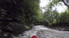
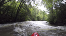
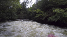
Down the Left (III-). We just plopped off the left, it was a little blind from above. This is immediately above Cupp Creek.
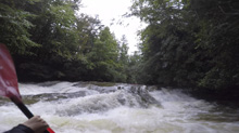
- Cupp Creek (III+ to IV+) enters on the right. Our day, it more than doubled out flow. The river immediately began to feel on the higher side of medium. Low angle slides continue downstream, however now there are some meaty holes at the bases of the slides, and you begin to get more ledges that can pack a punch. I am giving this section the upper end of IV+ due to high water, some of the holes really do pack a punch, and gear could easily be lost in a swim as the current is unrelenting for the course of the river. There were a few horizon lines of note.
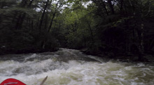
Boogie (III to IV-).
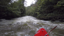
S-turn (III). This one, though not hard was blind from above. We eddied out left and saw a line and just boofed down the left channel moving towards the wall and then off the wall. Update 2020: At low flow we boofed the right shoulder of the left channel. A very nice boof.
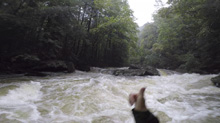
Boogie (III to IV-).
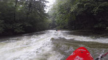
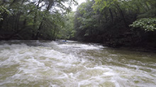
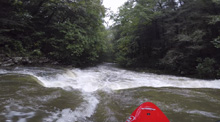
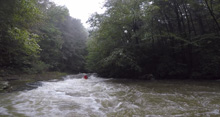
Log Jam (III+). There was a log jam that I bet is going to be there for a while. The rapid wasn't hard, but we had to portage the top part. Below, a beautiful creek came in on the left. This also marked the when the river begins to get a little harder. Update 2020: At 0.5 we were able to duck the logs.
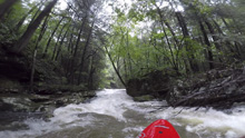
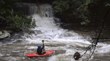
Boogie (III to IV). The boogie in this section gets a little harder. More stout holes to punch through.
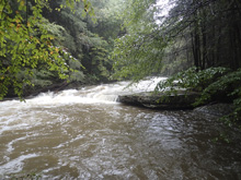
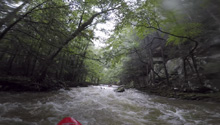
Hole (III to IV). After a short tight section of river that was boogie, you bend left and enter a multi step slide. We started left with the main flow and then got right to boof over a rather large hole, using a shelf ledge over there.
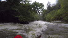
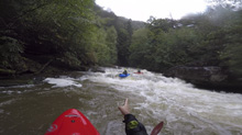
Ledge (III). Blind from above, one of us scouted on either side. Plenty of lines though. We all ran right off the broken ledge.
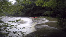
- Accelerator (IV to IV+). This drop was two part. The top was a slide into an off angle hole, go far right and hit the hole with left angle. The second part was the first bigger slide on the run, if there was wood in it we would have been hosed as it is hard to stop between the two. The river drops maybe 10 feet going left to right into a cushion on the right wall. Super fun rapid! The runout is a few hundred yards of class III sliding.
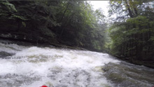
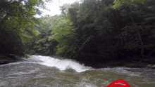
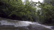
Horseshoe Hole (III- to III+). A river wide horizon line is a horseshoe shaped ledge. We went far right and stayed away from the meat. There was a line for sure down the middle, but without scouting it wasn't worth hoping for a nice launch point.
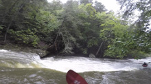
Smaller Horseshoe Hole (III- to III+). This one was in a more open setting. The left side had a meaty shoulder boof that was available. The right side was a broken slide that moved you around the hole.
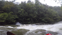
- Crunch and Munch (IV to V-). A large horizon line happens at a constriction with a large prominent bit of bedrock on the right shore. Scout on the left, which involves climbing a few feet out of the river to the rock ledge above. We walked on the left. It is a steep ledge into a powerful hole between very undercut walls. The hole had a big right to left movement into a pocket against the river left shelf. It looked possible, but not that fun. I bet at lower flow it is mellower. (I am assuming that this is the first bigger rapid mentioned in the AW write-up). Update 2020: At 0.5' this rapid was much easier. I recommend scouting right and from below as that is easiest. And from the left, the hole looks bad until you get down river level and next to it.
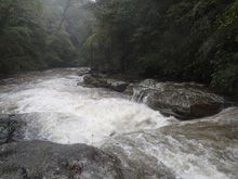
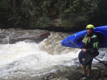
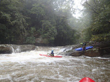
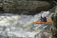
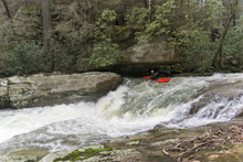
Sneak (III to IV). The next horizon line had a main line through some holes on the left. It would go but you would want to scout. We boat scouted our way down the right which was lower volume. Update 2020: At 0.5' the line was two distinct ledges with a small eddy between them. We boofed right of center on the first and then left of center on the second.
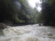
Ledge (III+ to IV-). We had to hope out to scout a quick horizon line. And found a nice boof on the right right.
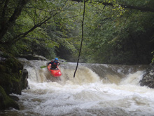
Steep Slide (IV to IV+). The rapid starts with 100 yards of big boogie and then the river ramped down into a sticky hole. We all aimed left for a softer part. This is also the sign that you are about to be at the portage. Update 2020: At 0.5' the rapid was much mellower than I expected. The entrance holes are all easy to manuever through and the slide is shallow and the hole is very small on the left. It also wasn't nearly as steep as I remembered!
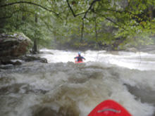
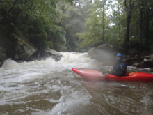
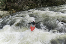
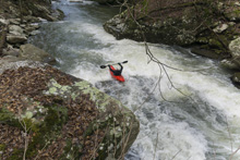
Boogie (III+). A few hundred yards of boogie (and one wood portage) led to a hard right turn with bedrock formations on the right. This is the portage.
- Fuzzy Bunny (U). There is some confusion as I read Kirk's write up and read the AW write-up. One refers to the portage by this name, and the other implies it is a rapid that they run... which would imply it is the falls just downstream. I am not sure. We ran the entrance on the far left in a small chute. Be careful here as the rapid below is death. The river splits into two channels, the right is completely unrunnable. I was told by a friend that they usually "sneak" down the left, but at this flow it was no sneak, it was V+ in its own right. But, it was also full of wood... so it was completely unrunnable. Walk on the left up and back down on the slippery slope. You might need to pass boats as it really is slick and the rocks loose.
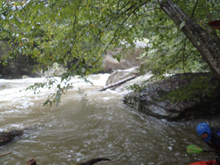
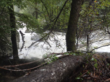
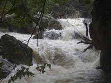
Between (IV). We launched back in and ran two stout hole. Far right they passed fine. There is no room for error here as immediately below is the biggest commonly run rapid of the run. Eddy out left to scout/portage.
Falls (V). This drop is stout, not because of the moves, but because of the undercut that most of the outflow goes into. The falls is shallow on the right, and ramps down on the left into a kicker against the left wall. The line is to hit the right side of the kicker and boof out with right angle to exit away from the wall, and be able to maintain an angle against the strong current moving left into the undercut. Please scout from below as the danger isn't obvious from above. Diane and I walked. David ran it, hit the right spot, but plugged just a little and his bow resurfaced heading straight into the wall. He luckily got to the edge of the undercut as his bow was pulled under. I really think this is a life threatening location. For David, he was able to arrest his motion by partially flipping and pinning his paddle and his bow under the rock to stabilize himself while Diane and I scrambled to pull him out. He got himself out and then we vertically extracted him as immediately downstream on the left shore is another, but smaller, undercut. Update 2020: At low flow, scouting left (portage side) still doesn't look great. Scouting from the right though shows the line to be much easier.
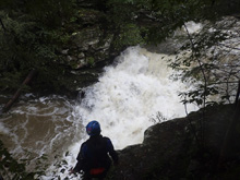
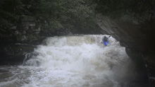
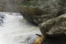
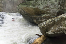
Exit (IV+ to V). Below the falls, is this stout exit drop that warrants a scout. The river cushions up on the right and lands with hard current moving back to the left. There is an exploding bit of water on the left where the river slams into a submerged rock, our goal was to be to the right of it. There are a lot of rocks, so the key is to launch the curler, try to get right for the bottom, but no matter what, keep it straight through the rock fence to not broach and also to punch the holes that are between each rock. But mainly, try not to get pushed left for the exploding feature. I dropped immediately to the right of it and it went fine. Diane was less fortunate and pitoned the rock, but luckily flushed over rather than broaching against the left wall. Update 2020: This rapid actually looks worse at the low flow. The rock fence looks very pinny. We all walked on the right.
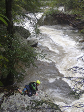
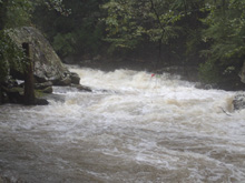
Final Slide (IV+). Immediately downstream was one last section of bedrock. First, we portaged some wood on the right in the immediate runout of the above rapid. We scouted on the right as the bottom move packs a punch. The top part had a nice ledge that you wanted to boof center which leads to a eddy on the left. I hoped out there to portage and set safety for the bottom hole, at this flow it was a recirculating hole and I didn't feel comfortable with anyone running it without a rope on it. The line was an s-turn moving right then left. The top had big holes on the inside, so go wide right. Then go straight down the right side of the exit to avoid the meat of the hole. Mind the right wall below as it is also a little undercut.
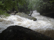
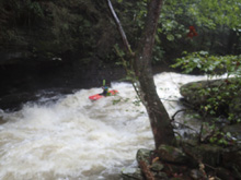
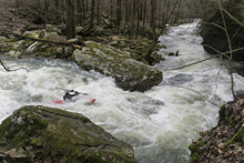
- Brush Creek enters on the left, the river is substantially easier than the past mile below here, but stay on your toes for wood.
Boogie (IV). Stay on your toes for wood
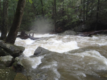
Bridge (IV). Below, things got easier, and turned into boulder gardens. There was an old bridge site though that had several large pieces of wood bridging the river. I scrambled for an eddy. Our newly transplanted from Denver friend learned that here, wood is a bigger issue and luckily found a small line on the right side of the left channel, over a piece. This could have ended very badly. And for some inexplicable reason, Diane followed. I portaged. At lower flow, portage would be 100% mandatory with that wood placement.
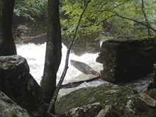
Boogie (IV). There is some fun boogie that continues down to just above the take-out.
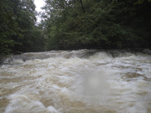
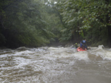
Take-out: From Dayton, head south on US-27 for 4.2 miles befor turning right onto Dayton Ave in the town of Graysville. Head up 0.4 miles, jog right one block on Dayton Ave, and continue heading back up on Pikeville Ave. In 1.7 miles you will get to the bridge over the river. There is a parking area on the right, 100 yards back the way you came.
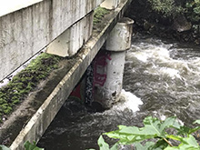 (very low water, prior to rain spike on our first trip)
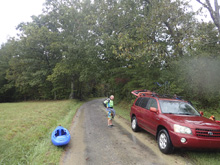
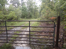
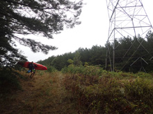
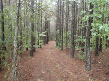
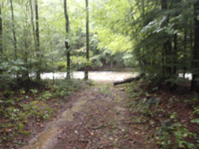
Put-in: There are two ways to come into this river, both take about the same time according to google. We went back towards Dayton, so that is what I will describe. Head back towards Graysville, after 0.9 miles, turn left onto Long St which cuts the corner to TN-303. After 0.8 miles, turn left onto TN-303 N. Follow this for 4.7 miles and turn left onto TN-30N. Follow this another 2.6 miles before turning left onto Ogden Rd. Follow this one for 6.9 miles before turning left on a smaller road, Shaver Rd. After 1.4 miles, you cross some residential farming areas and hit two gates. We parked just outside the first one, not wanting to get locked in. We then walked down the road to the right, between the two gates. In 200 yards you get to a powerline and a clear cut beneath the cut. We walked down the powerline cut to the left. At one point, it gets a little overgrown as we climbed over a small hill. On the other side of the hill, there was a road that dropped down to the right. We followed this to the river. The hike was maybe 0.75 miles and took maybe 10-15 minutes. I think you could also just stay on the road rather than cutting under the powerlines and hit a bridge, I am not sure what that half mile of river is like though, perhaps it isn't work trying to access up there.
HTML Comment Box is loading comments...
