Rio Grande (Upper/Box)
| Stretch: | River Hill Campground to Ingals Gulch |
| Difficulty: | Class III to IV |
| Distance: | 6.4 miles |
| Flows: | 350 to ~2,500 cfs. Colorado DWR Rio Grande at Thirty Mile Bridge near Creede gauge |
| Gradient: | 39 fpm average |
| Put-in: | River Hill Campground |
| Take-out: | Bridge on Co Rd 38 |
| Shuttle: | 9.6 miles, (30 minutes one-way) |
| Season: | Spring off snowmelt |
| Written: | © 2021 |
-
Colorado Road Trip 2021: Day 8
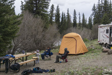
The prior day after our change of plans to the Lake Fork of the Gunnison, we had planned to camp prior to the turn up the Upper Rio Grande. But Windy Pass lived up to its name and was windy, rainy, hailing, and cold. So instead we went an extra 15 minutes down the mountain to get to a campground on the Rio Grande just before the town of Creede.
In the morning, we drove to take-out to make sure it was passable for my parents who would drive our shuttle. The road was a bit messy after some overnight rain, but nothing terrible. The gate that was mentioned in a write-up was no longer present, so the step of opening and closing the gate was a non-issue. The road to take-out does go through private property but driving the road and accessing the river at the bridge is allowed. The shuttle takes longer than you would expect as it is all dirt road, but it is good quality. You quickly see the fire damage from the 2013 West Fork Fire Complex which burned a whole lot of this upper drainage. The scars will be visible all along the length of the run.
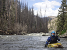
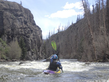
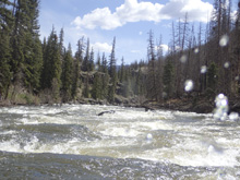
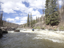
Once on the water, you start in a wide open valley. As the valley begins to end you have the first class III rapid which ends in a pretty small canyon, very small, like a 15 foot tall box canyon. Is this the box? A fisherman called me over 100 yards downstream to ask me just that question. I couldn't give him an answer other than “I hope not!” Not too far downstream you get to a proper canyon section which at our flow had long sections of III- which gave an overall feeling of class III. But it was fairly non-descript so it wasn't my favorite style of whitewater honestly. The canyon was pretty though, and as the river rounds the corner to take-out and you see across the valet, I think the scenery hits its peak.
We got a little unlucky with flow on this one. It had been running a little over 1,000 for the previous several days. But then about 20 minutes before we got to put-in, the flow dropped to 870. This was a low but fun flow for the section. I would imagine at 1,500 the real fun is had, and it can start to get the III to IV character which the book described. For us, I would say there was nothing in the class IV range at the low flow.
Mi 0.0:
- Put-in (II+). Directly below put-in is the biggest action of the first 2 miles. Its just some big waves and in 2021, a tree duck. But it mellows out not far below and you have the section that you saw on the drive in as it meanders through the valley with nice views if you look back upstream. It is too bad this all burned back in 2013 as the burned trees do take away some of the aesthetic.
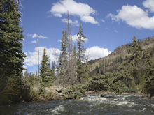
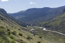
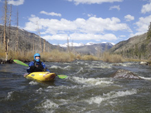
- Small Box (III to IV-). Maybe at higher flows it gets to IV-, but it was just class III for us. But by far the biggest rapid of the run thus far. We hoped it wasn't an anomaly and that it would continue like this. I see pictures of this being referred to as “the box” but the downstream box is only 10 feet tall and maybe 100 ft long. A fisherman we ran into inquired if there was more downstream, I of course had no clue but hoped there was! As far as this rapid, we ran down the center. Lots of lines to choose from at the top, but they all funneled down into a decent hole at the bottom to punch. Below, the river goes into the small box that is flat but very scenic. Things then mellow back out for a bit.
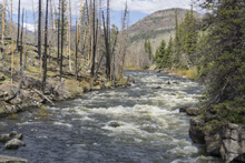
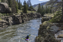
- Upper Canyon (III to IV-). Woohoo! Sustained rapids! We had just begun to doubt that the run was going to have any. Large boulders block the view of the straight away, just follow the flow and eddy out behind them to get a lay of the land. The entire straight away is one long rapid but is straight forward read and run. Just move around the rocks and small holes as need me. I bet at higher flow this section gets busier into the IV- range.
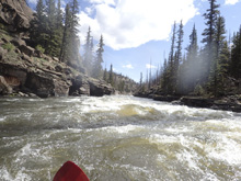
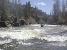
Boogie (II+). It then mellows back out for a short distance.
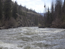
- Lower Canyon (III+ to IV). The hardest section of the run is continuous in nature and packs a few busy sections. The crux is a near river wide ledge that we punched that has more bite than expected.
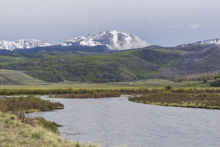
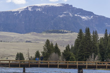
- Valley (I). You round the corner and the valley opens up in front of you and you see some spectacular views for the last two tenths of a mile.
Take-out: From Creede head north (west) on CO-149 for 19.5 miles. Turn left onto County Rd 18 and drive for 1.6 miles. Turn left on FS 520.21 / Co Rd 38. This is private but there is an easement through the property so be respectful and close any gates you come across behind you. Park at the bridge.
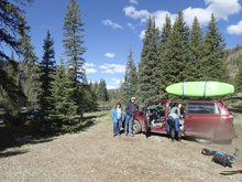
Put-in: Go back out the 1.3 miles to Co Rd 18 and turn left. Follow this 8.1 miles, along a small lake and then over a small hill, to River Hill Campground.
HTML Comment Box is loading comments...

