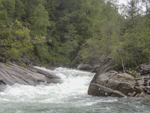
Raundalselvi (Play Run)
| Stretch: | Morning Glory to The Gorge |
| Difficulty: | Class IV to V |
| Distance: | 2.0 to 3.5 miles |
| Flows: | 20-60 cms |
| Gradient: | 132 fpm in the upper section, 25 fpm in the lower section (seems steeper) |
| Put-in: | Bridge over the river in Urland or upriver at the next road to the right with a bridge |
| Take-out: | Bridge just before the gorge. Hike out to the road above. |
| Shuttle: | 2 to 3.5 miles (5 minutes one-way) plus a steep hike out that takes 10 minutes |
| Season: | May and September |
| Written: | © 2015 |
| Featured in A Wet State #102 and Substantial Media's (minute 3:51) | |
Norway 2015 - Day 8 Afternoon
So Harry had done this a few years prior, and before he headed off to Bergen for a day with his family he gave us some of the beta. The "upper" put-in has the goods, three big rapids. The first of which is Morning Glory and should be scouted, same with the second. The third is a 20 foot steep slide with a clean line on the right that has a nice window through the hole. He reported they had high water when he did it. As we drove up the valley we find what we think is the upper put in, but aren't 100% so we continue up the road. Quickly we find a 20 foot drop that has a massive hole and definitely no window. Seeing that there is plenty of eddy time prior to the drop and Harry had reported that you want to scout early due to lack of eddies (or scout prior) we assumed this could not be the drop. We didn't want anything to do with this. Driving up another 2 km we did not see another obvious road with a bridge so we assumed the first spot we tried was in fact the upper put in and the 20 footer must be a different 20 footer on an up river and harder and obviously too high section of river.
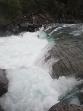
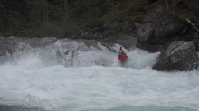
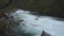
Putting on we were told Morning Glory comes just 200 meters down river. So around the first corner we get out to scout. But nope, just a class III. Around the next corner... another class III. Then a straight away. We realize, we had to of used the lower put-in. Making quick time downriver we quickly arrive at the biggest rapid on the lower section. Daniel and Will eddy out low on the right. Diane and I high on the left. Harry mentioned a huge hole with a sneak on the left (the hole has seen a fatality and it is obvious why, super big with a huge pocket) and then a hairy fairy from left to right in front of a river wide hole to the window on the right. Daniel and Will are forced into portaging it due to the sketchiness of ferrying across the lip of the first drop. Diane and I run it and then deal with the ferry in front of the river wide hole below. This honestly got my heart going more than any other drop on our trip. Just a ferry, but long and in very fast moving pushy water. Once below, the river quickly ended.
We would have considered doing laps... but to run this river you have to hike up and out of the gorge on a paved road that you are not allowed to drive on. It only takes 10 minutes but it sucks enough a lap did not sound appealing. After hitching our shuttle we decided to go site see at Nose Breaker which lies a few miles upstream. Heading up we see a group with Eric Deguile who are running the 20 footer and report the least amount of time that someone has disappeared is 10 seconds. And the worst was a swim and 30-40 second recirculation. Another member of the group reported that all the top drops were portages for that individual. Over the next few days we saw video pop out of Sam Sutton running Morning Glory and it confirmed that our accidental lower put-in fortuitous as we would have just portaged the three big drops up there. Too bad, they sound fun when the water level is more manageable.
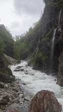
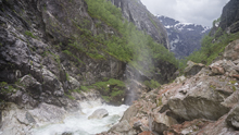
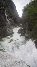
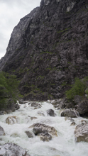
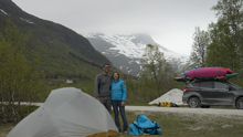
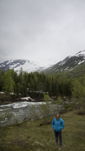
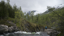
That night we decided to drive up the Jordalselvi to check on flows. Driving up the canyon is super impressive. You are in Fjord land at that time, with granite walls rising high above you and waterfalls pounding down all around as if the valley floor is a great sink hole that all water must work its way down into. The river at the bottom is a huge congested mess of boulders and grade V+++ whitewater... "it looks high" we quietly say to ourselves. Driving up we enter a dirt road tunnel that steeply climbs up the canyon, with brief glimpses into the canyon via windows in the tunnel. "Well, that is class V++++++ (notice the extra "+'s"?)" we think to ourselves growing more timid. Soon though we crest out of the tunnel and enter a valley and more manageable gradient. We find the 30 foot waterfall and see the water is certainly higher... but by no means "high." Just padded. Driving up further we see that perhaps at the top the water may even be a little low as several large tributaries were assaulting the river banks that were attempting to channelize them as they cascaded down the mountain walls. We quickly decided that this would be the best option for the following day. Now that we were 30 minutes up the canyon we also decided we didn't want to drive down to meet up with Harry to find camping so rather we decided we would set up camp in the Jordal valley and I would drive down to get cell service and let Harry know 1) the Jordalselvi had good water and 2) that we were going to camp up in the valley. No sooner did we park the car and open the trunk to unload the camping geat than Harry drove up. He had been calling me for a while and when I didn't answer he had assumed that rather than being back at the Brandsetlevi campground where I had service, we were up in the Jordal valley. I have to say, I was impressed by his deduction, and grateful I didn't have to spend the evening driving around to get a cell signal!
The drive into the Jordalselva....
Last: Norway 2015: Day 8 Morning - Strondelvi (Money Drop)
Next: Norway 2015: Day 9 - Jordalselvi
Mi 0.2:
- Morning Glory AKA Timberhole (V). A big drop with a ramping hole into a slide with a big hole. Scout left.
- Church Drop (V-). Just around the next bend, either boof right over the 8 foot ledge or bomb down the middle. Scout from the right.
- The One Next to the Road (V). A 18 foot drop into a huge hole at our flow. At lower flow there is a better window apparently well right of center. Scout right on the drive up.
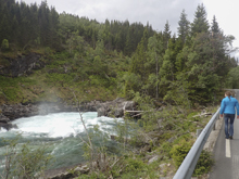
- Alternate Put-in. Some choose to put in on the last big rapid just upriver. Below is some boogie to this bridge.
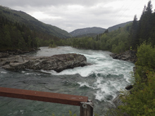
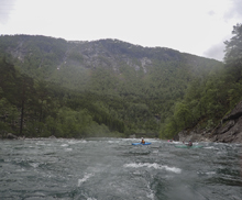
Class III Boogie (III). Downstream you come to a rapid with some large bolders, we ran down the left. On the next bend is another fun rapid that we stayed left on as well. The river then bends right and gets mellower but still fun.
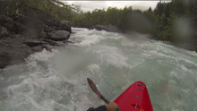
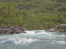
- Big Drop (IV+). Just downstream from the Urdlandselvi is the big drop of the Lower section on the Play Run. After a busy lead in down the right of center we eddied out left to scout. At the high flow the middle was a huge hole, probably similar sized to the day the fatality occurred here. So we snuck far left down a double drop around the main drop. This was still a fun move with sticky holes at this flow. Do not be right at this flow. At lower flow people boof the left side of the ledge. Downstream was a river wide hole. At the high flow, you didn't want to mess with it... so we had to do a big ferry across the river to run the drop far right around the ledge. Downstream, we quickly got to take-out.
Take-out: Just east on E13 2.5 km from Vossevangen there is a road just before a small narrow lake, look for the left just before the small dam onto Tjukkebydvegen. Take this road upriver for 5km. At the end you will be driving up a very steep walled V-canyon. Just near the end there is a turn out on the right 100 yards before a small dirt road drops down to the river. Park in the turn-out. The dirt road is private and marked with "Kayakers, do not drive down the road." It is a 600 meters up from the river.
Put-in: Continue driving up the valley for an additional 4.2 km. You cross the Urlandselva which is another run in the area that was too high when we were there. When the river gets close to the river there is a small dirt road just past a house (Marianne's), this leads quickly to a the access. Park before the bridge.
Upper Put-in: Continue on the main road for an additional 2.2 km. Scout the last rapid on the drive up to make sure you want a piece of it. It is obvious from the road with a big turn out just before it and a small one 100 yards further past it. After 2.2 km there is a road to the right. I think you park on the main road and walk down 400 meters to the river. We didn't actually find this but now looking at google earth it is obvious. Go figure.
HTML Comment Box is loading comments...

