Rio Puesco (Upper)
| Stretch: | Above Tres Troncos to the Bridge |
| Difficulty: | Class V |
| Distance: | 1.6 mile (additional 3.8 mi possible) |
| Flows: | ~500 to ~1,500 cfs |
| Gradient: | 246 fpm average / max 267 fpm (Top). 169 fpm average (bottom) |
| Put-in: | Above Curarrehue, Bridge over the Puesco |
| Take-out: | Side Bridge Downriver |
| Shuttle: | 1.6 miles, 2 minutes (or 5.5 miles, 5 minutes) |
| Season: | I know people run it in November high, and we still had plenty of water in late December. |
| Written: | © 2011 |
| Featured in Video #36, Chile 2010 Installment Four | |
Along with the Rio Maichin, the Rio Puesco forms the headwaters of the of the Rio Trancura. Lots of footage has been filmed of groups running the crux section of the run, the Tres Troncos rapid named after the three trees that block the river right channel at the bottom. The reason for the quantity of films isn't because the rapid is easy to scout or portage at river level, but because many folks choose to put in below the rapid, and from the dirt road that leads to the base of the rapid, those not inclined to run the rapid can film. This was the case for our group as well. None of us decided we wanted to push it on this particular day but the Demshitz crew were putting on at the same time and of course they did want it.
After the Tres Troncos the river is easier, however still very challenging. Essentially, it is one continuous class IV rapid. And no I don't mean class III difficulty but longer, it is class IV moves for a mile straight. To add to it, there are several channels with end in rock piles and require you to make the correct move. We had low side of medium flow which was nice because it made the hydraulics much friendlier. I am sure at high water this run (even below Tres Troncos) would be downright terrifying. Regardless, at any flow, a swim would be a dangerous situation and it would be hard to get the swimmer and gear to shore prior to running a few hundred yards of river.
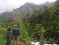
Finally, I have been told that the scenery is very pretty on the Puesco. Our day however, was the one rainy day of our trip. Thus, we could see the bases of tall canyon walls, but could not see how far nor how high they went. Still, it was very nice. One final note, this run is as road side as can be without being able to see the road. So if at any point you decide it is not for you (one in our group came to this conclusion), you can hike off to the road above. Oh, and one more note... The run is really short, I would plan on doing two laps (that will still go very fast) or continue down river another 2.5 miles to extend the run. We were hoping to get back to run this lower section on a more energetic day but ran out of time. I was told that instead of being continuous class IV, it has more distinct rapids that are closer to class V with easier continuous water in-between. This run is really impossible to do a mile by mile for. It is absolutely continuous with only one or two short, fast moving lulls in the section. However, there did seem to be a couple of distinct sections.
Mi 0:
- Tres Troncs (V). This is a legit class V rapid. Steep, rocky, and consequential. Scout before putting on as there is a dirt road that drops down off the main road right at the rapid. If you don't want to bite it off, you can put in at the bottom of the rapid.
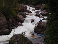
First Section (IV+). We had low side water, which made the river continuous class IV moves though that made it feel harder than class IV as it was non-stop class IV. At higher flows this could all get upped a step I would imagine. The first section started with a cool boof just below Tres Troncos and then had a long runout down to the biggest lull of the run.

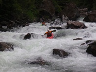
Second Section (IV+). The next section we ran down the right, over a nice boof, and then ran down the middle. The river then went around a left corner. Before going around the corner, we eddied out on the left and scouted. At this point, one in our group hiked up to the road and called it a day.
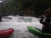
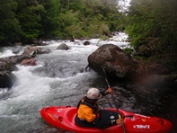
Third Section (IV+ to V-). This section was long and exposed. The river split around a house sized rock. You want to be on the left side. Then, behind the rocks, move right. Now there are apartment sized rocks splitting the river. Take the channel to the right over a steep rocky drop. The run out has two good size holes, both are run down the left. This section I can imagine becomes stout at high flows. At the low flows, the hydraulics all flushed. This is the end of the hard section of whitewater.
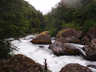
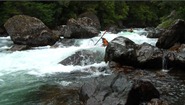
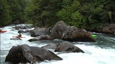
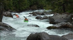

- Until the End (III to IV). From here down, the rapids take a huge step down in length and difficulty. Continue until you see the bridge. This marks the take-out for most.
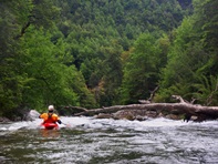
- Downstream are more rapids, I was told that hydraulics are bigger than anything on the Upper, but the rapids have more distinction between them as there is a bigger gap between the "hard" moves and the "in-between" sections. We had hoped to go back on a more energetic day to get on the bottom, but our trip quickly filled with other classic runs and soon we were on our flight back home. Next time...
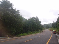
Take-out: From Pucon, head to Cuarrehue. Keep going through town and continue on the same road. Don't cross the bridge over the Puesco on the far side of town (toward the Maichin). Just stay on the same road and head up the Puesco valley. It is 7.8 miles to the Lower Take-out or 11.3 miles to the Upper Take-out. The lower take-out is a gravel bed where you can see the river about 100 yards from the road. The Upper Take-out is at a bridge and bus stop on the left of the road.
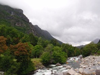
Put-in: Continue up the road. After about 1.4 miles you will see a gate and a steep dirt road leave the paved road (sharp back towards downriver). This is where you scout the Tres Troncos from. Continue up river to the turnout on your left to put-in immediately above Tres Troncos or head to the bridge another 0.2 miles up the road.
HTML Comment Box is loading comments...
