Potomac (Great Falls - Virginia Lines)
| Stretch: | Dam to Fish Ladder - Virginia Lines |
| Difficulty: | Class V- to V+ |
| Distance: | 0.9 miles |
| Flows: | 2.8 to 3.5' (people go higher but it is significantly more consequential) - 3.0 ft is ~2,850 cfs. Current American Whitewater gauge |
| Gradient: | 70 fpm (falls drop ~38 ft total) |
| Put-in: | Diversion Dam |
| Take-out: | Just below the Fish Ladder |
| Shuttle: | 0.55 miles (walking) |
| Season: | Year round |
| Written: | © 2015 |
| Featured in A Wet State #104 | |
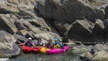
After running a lap on the Maryland lines, we climbed up the flake (sorta a pain in the ass honestly) to get a lap on the Maryland lines. At this point, I was getting tired of being in the heat. Diane and I had walked around DC for 8 miles in the morning prior to heading out to boat. Because of this I began to get some heat stroke and soon found myself throwing up a little. I quickly decided one lap this day was going to be plenty. The rapids have plenty of various lines on them to keep you entertained, whether going right, far right, or left at U-Hole, depending on which eddies you try to catch in S-turn, or which side of the ledge you take at the Spout, the river entertains despite its short duration.
A note: I just finished writing up the details of the rapids for this and the Virginia Lines, I am sure I am going to get an earful from locals. But let me say... although I don't think that the rapids individually are class V or V+, the rapids are all tight together. You want to have class V skills to run the drops, even if most of them I rated only at IV+. It is a consequential place, and why the run is rated at V- to V.
Mi 0.0:
- Dam (III-). Just after putting on and paddling 100 yards, you drop over a 6 foot tall damn.
You then paddle another third of a mile or so of boogie that leads to the lip of the falls. The lead in is class III- so make sure to know where the eddy is on the left as it is not mindless to catch it.
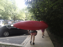
- U-Hole (V-). The first rapid is probably the hardest of this section, although not the biggest. There are a few different lines. The easiest line is the far left line, boofing a small slot and then sliding down and around the u-hole itself. Note that the rock jut downstream on the left is a big undercut. You can also boof the point of the rock that makes that slide. The bigger line is to run far right down the main channel and boof the pad over the meat of the hole. Messing this one up would suck! At higher flows there is Norman's Leap which can be run in the farthest right channel which boofs back into the main channel immediately below the U-hole. Just at the lip of S-turn, catch the eddy on the left.
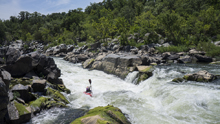
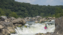
- S-turn (IV+ to V-). From the eddy, peal out and boof the left channel back into the middle. Straighten it up immediately as there is a powerful hole to line up. From there, straighten up for the bottom hole as the river zags back. There a bunch of fun eddies to try to catch in this one. The pool below is decent size too which is comforting. At lower flows you can boof the far right into the zig of the zag.
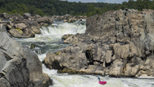
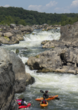
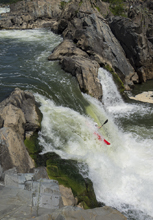
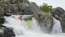
- The Spout (V- to V). My favorite rapid of all the lines we ran. This rapid looks big and intimidating but goes oh so well. The river drops over a 20ish foot tall waterfall, the far right lands on a shelf and reflect water back to the left. The fun line is to boof the curler right of center at the lip coming back to the left a little and dropping into the seam where the reflected water comes back. So fun to air that out. Another line is to run the far left side of the drop which is a vertical drop. This apparently can be painful due to lack of aeration there. Also, a rock becomes exposed in the curtain as flows drop. At really high flow, apparently another line opens up further left call "The Crack."
Around the corner are two mellow wave trains that lead you to take-out.
Put-in: From DC, take the George Washington Memorial Parkway to Us-495. Cross the Potomac on US495 and immediately exit to take Clara Barton Parkway and head upriver. This quickly T's with MacArthur Blvd, turn left and continue heading up river. In 3.4 miles you will get to the park entrance. It is ~$30 for a year pass for the park, or ~$10. Park, and walk down to the canal water. Cross the canal and get out using the stones on the far side (to limit erosion). Then head on the small trail down to the river just through the woods. Put on here.

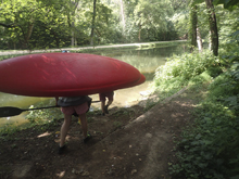
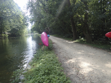
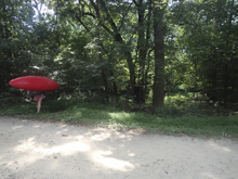
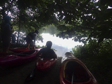
Take-out: Just below where the Fish Ladder rejoins the main flow, head far left around a large island. There is a beach with a trail that leads up to the canal trail which you can follow back to your car up at put-in.
HTML Comment Box is loading comments...
