Potomac (Great Falls - Maryland Lines)
| Stretch: | Dam to Fish Ladder - Maryland Lines |
| Difficulty: | Class V- to V+ |
| Distance: | 0.9 miles |
| Flows: | 2.0 to 3.4' (people go higher but it is significantly more consequential) - 3.0 ft is ~2,850 cfs. Current American Whitewater gauge |
| Gradient: | 70 fpm (falls drop ~38 ft total) |
| Put-in: | Diversion Dam |
| Take-out: | Just below the Fish Ladder |
| Shuttle: | 0.55 miles (walking) |
| Season: | Year round (requires the lowest flow of all the lines) |
| Written: | © 2015 |
| Featured in A Wet State #104 | |
My first attempt to get on this river was this past April when Diane and I went on our roadtrip to the North East. The original plan was to boat the Great Falls the first day on the drive up to Vermont. However, due to some spring rain the river spiked to levels too high for even the Fish Ladder (highest water lines). So that plan was scrapped. But to my good luck, a week later my company began offering the company apartment for us to stay in. So quickly I reserved a week and made plans to drive north during the summer months. As the week approached the flow was getting low to the point where we were thinking only the Maryland lines would be in, but again to our luck a summer thunderstorm brought the river up just a bit, also opening the Virginia lines up for us. I must have stoked up on some good river karma somewhere for so many good things to align for us on this one!
Joining us was our friend Laura Farrell who moved to DC and therefore we had not gotten to see as much as we had grown accustomed to. She invited her friend Margaret Williams with her (the following day we were also joined by our friend Michael McWhirter and their friend Moriah Heaney) to show us the lines as this river is a great one to have someone who knows the lines. The reason being that there are lots of hazards throughout the run... mainly by way of sieves and a few bad holes. The river has taken several lives of kayakers, and many more of tourists so the guidance of locals was much appreciated.
We had 3.0' on the gauge, this was a nice healthy flow for these lines. Pummel was some solid fun, Charlies hole was horrible looking, Z-turn had some fluff but not too much consequence, and Horseshoe had enough water to hit the left boof. A great first time flow in my book!



A note: I just finished writing up the details of the rapids for this and the Virginia Lines, I am sure I am going to get an earful from locals. But let me say... although I don't think that the rapids individually are class V or V+, the rapids are all tight together. You want to have class V skills to run the drops, even if most of them I rated only at IV+. It is a consequential place, and why the run is rated at V- to V.
Mi 0.0:
- Dam (III-). Just after putting on and paddling 100 yards, you drop over a 6 foot tall damn.
You then paddle another third of a mile or so of boogie that leads to the lip of the falls. The lead in is class III- so make sure to know where the eddy is on the left as it is not mindless to catch it.
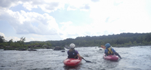
- Pummel (IV+). At the higher flow we had this was a sick boof that was easy to line up and allowed you to sail over the hole no problem! Just don't get beat here as just downstream is a dangerous rapid. As flows drop, you launch further right. As flows get really low you go through the notch on the far left. I give this IV+ because it is an easy move... consequential, not a place to swim or even carp a handful of rolls. But the rapid itself is not hard.


- Z-turn (V- to V). This is actually one rapid, but with three different lines. Z-Turn is the normal line when flows are on the higher side (what we ran). You go down just to the left of the large exposed rock in the middle of the river. This then zigs and zags into a few big curlers and flushes out below. Just to the right of the big exposed rock is Charlie's Hole. That line apparently used to be run frequently but after several close calls and one fatality, it is avoid these days. If you end up there, the line used to be to boof off the left landing in the eddy on the left. The line on the far left of the river is called Pencil Sharpener, this line recombines with the bottom of Z-Turn but starts off in a small chute on the left shore and requires a boof over a hole as well as a daft angle to avoid a nasty sieve/crack to the further left. At higher flows this is a powerful line so people usually only run it as flows drop.
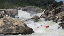
- Horseshoe (IV+ to V). This rapid too has varying lines for different flows. At the higher flows (what we ran) you want to boof the far left rock, just off the right side of the tip. The landing however is shallow so this should be avoided as flows drop. As flows drop, head to the far right bank of the channel and ride the wall down and around the hole. This line was just dropping in so two out there the weekend we were there ran it. The place to avoid at all but the lowest flows is the center, a big horseshoe hole that has the power to change your life... and not in a good way
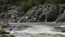
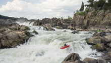
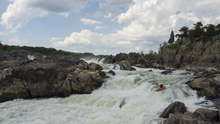
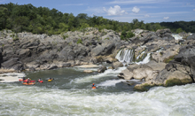

Around the corner are two mellow wave trains that lead you to take-out.
Put-in: From DC, take the George Washington Memorial Parkway to Us-495. Cross the Potomac on US495 and immediately exit to take Clara Barton Parkway and head upriver. This quickly T's with MacArthur Blvd, turn left and continue heading up river. In 3.4 miles you will get to the park entrance. It is ~$30 for a year pass for the park, or ~$10. Park, and walk down to the canal water. Cross the canal and get out using the stones on the far side (to limit erosion). Then head on the small trail down to the river just through the woods. Put on here.
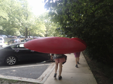
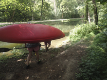
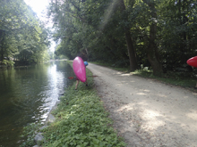
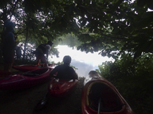
Take-out: Just below where the Fish Ladder rejoins the main flow, head far left around a large island. There is a beach with a trail that leads up to the canal trail which you can follow back to your car up at put-in.
HTML Comment Box is loading comments...
