New River (Lost)
| Stretch: | Fayette Station to Teay's (or Mill Creek) |
| Difficulty: | Class III (IV) |
| Distance: | 1.6 miles (or 4.55 or 5.1) |
| Flows: | 1,000 cfs to ??,000 cfs. Current AW gauge |
| Gradient: | 17 fpm |
| Put-in: | Fayette Station Rd |
| Take-out: | Teay's Access |
| Shuttle: | 2.0 miles, (10 minutes one-way) |
| Season: | Usually under lake water. |
| Written: | © 2020 |
| Featured in Video A Wet State #156 | |
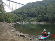
Really this is just an extension of the Gorge Run. Put-in above the Fayette Station rapid to get an extra rapid, run down Old Nasty and the uncovered New Nasty, and paddle past Teay's take-out. Then, on the next bend is New Love, run it, portage back up on river left, and attain back up to Teay's where your car is.
The catch? Half the run is usually under Hawks Nest Reservoir. It has been for 100 years or so. But, this year they lowered the lake 25 ft to do maintenance. So, this "extra" section opened up. It is so short, I would just add it on to the Gorge rather than do it as a standalone, but it does have a relatively short shuttle so as an evening special it fits the bill nicely.
The alternative take-out of Mill Creek was closed down due to the silt of the reservoir lowering, but perhaps if dam was gone this would make a good access point. Though, then just continue down the Dries in that case!
The run was fun, we did it at lowerish flow of 1.82' at Fayette Station or 3,900 cfs. I think this was good though since we did it as standalone... at high flows it would go by in a blink. Plus, the attainment back to Teay's after New Love would be more difficult. We did the gorge a few days later, and didn't bother setting the shuttle for this section as it was Grandma driving our shuttle and the hassle of getting her to take-out just didn't seem worth it to us to get these 1.5 rapids again, so you have that data point. These rapids are certainly a bit of a novelty. Though, also leads you to wonder what is below the rest of the lake...
Mi 0.1:
- Fayette Station (III to III+). Honestly this is the second best rapid on the run. A great wave train is right of center.
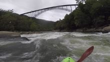
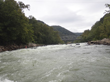
- Under the Bridge (II+ to III-). Just a small rapid with plenty of easy lines to avoid the few rocks that will form into hydraulics at higher flows.
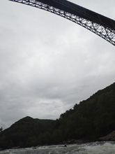
- Old Nasty (III- to III). Pretty much down the center which is a nice tongue with some waves and diagonals. The right side might have some challenging lines amongst the rocks at some flows, I didn't look. The left side had a decent ledge hydraulic at our flow.
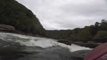
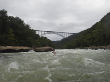
- New Nasty (III- to III). This is usually underwater. The river split into two main channels. The right side slopped into a hole. From below it looked ok, from above it was blind. So instead, we went down the straight forward left channel.
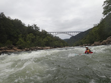
- Teay's Access: Leave your car here.
- New Love (III+ to IV). Around the next bend is the highlight of the section. This big rapid has a number of lines. Technical high water lines on the right, a fun line left to right down the biggest waves of the rapid, or the most straight forward line right to left. Whatever way you choose, the main objective is to avoid the hole in the center of the river.
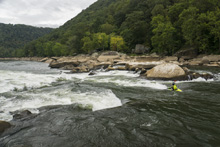
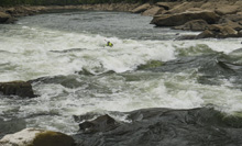
- 2020 Lake Level: Most will portage back up New Love on river left and then attain the short distance back to Teay's.
- Mill Creek Access: In 2020 this access was close due to the silt issue of the lake level being lowered. But, the access makes sense if it is allowed.
- Hawks Nest Dam: In the past some people have portaged the dam on the left to continue onto the Dries. However, construction in 2020 and the silt, made this a difficult endeavor and was not recommended.
Take-out: From Fayetteville, take US-19 over the New River gorge and turn right at the first right, which has signs for the visitor center, onto Fayette Mine Rd. In 0.3 miles turn sharp right onto Lansing Loop, and in 0.2 more miles sharp right again onto Fayette Station Rd (note, if you have a very big truck, you might just go to where Fayette Station Rd hits Fayette Mine Rd instead of these two sharp turns). In 1.0 miles, stay left to continue on Fayette Station Rd. and in 0.2 miles turn sharp right onto a dirt road. Follow this for 0.7 miles to where your gps map will end. Take a sharp left onto a smaller and crappier dirt road. This will then cut back right and quickly, but steeply drop down to another dirt road (this may be a continuation of the dirt road you were on a few moments before, I am not sure, if it is then it would be better to have not turned onto the shittier dirt road which my 2-wheel drive minivan barely handled exiting on). Anyways, turn left on the better dirt road and quickly drop through a small tunnel under the railroad and park at the open area at the river.
Put-in: Go back to the pavement at Fayatte Station Rd. Continue to the right on the pavement for 1.2 miles, heading up river at river level. Turn sharp right to cross the river. There is a small dirt lot on your right not long after the crossing which is best to access Fayette Station rapid, or you can use the large parking lot just downstream and walk up to run the rapid.
HTML Comment Box is loading comments...
