New Haven River (Top)
| Stretch: | Grimes Rd to S Lincoln Rd |
| Difficulty: | Class IV to V |
| Distance: | 1.6 miles |
| Flows: | 400 to 700 cfs coming from the top. Base judgement on rainfall vs snowmelt and accrual between the top and the gauge well downstream. (700 during late snowmelt is good, 1,300 from rainfed was low).USGS New Haven River gauge |
| Gradient: | 165 fpm average |
| Put-in: | Bridge at Grimes Rd (I think) |
| Take-out: | Shoulder along S Lincoln Rd |
| Shuttle: | 1.4 miles, (3 minutes one-way, some good dirt) |
| Season: | Spring off snowmelt, summer and fall off of rain |
| Written: | © 2021 |
| Featured in Video A Wet State #158 | |
-
North East Road Trip 2021: Day 12 Midday
Let it be noted, if you try to scout the Waterfall which you can see from the road, ask permission before walking past the no trespassing sign and down the stairs to the river level. Diane said "I think it will be ok, lets go quick" and it wasn't ok and the guy's dog alerted him to our trespass and he was not stoked. After some talking he cooled down and said he didn't think it was runnable but next time just ask.
Ok, so I had first heard of this section 5 years ago when we kayaked the Ledges downstream. That day, Nick Gottlieb saw Diane and I as we were setting our shuttle and joined us for our evening lap. We then went off to meet a college friend for dinner, and he went to do the Top section of the river.
So this year, after doing Patterson Brook with Culley and Karrie, we were going to have a mellow day on the Lower New Haven. We were tired... physically and mentally as we have not boated much these past two years since Aster and Covid (no that isn't the name of our second child). But while sitting in Bristol picking up some sandwiches to go, I hoped on google and realized we should drive up to check out the run... just cause. So, we decided it would be better to check it out first as we were likely to lose motivation if we did the Lower, and then had the decision of whether to stay in our wet gear to check out a run we may or may not decide to run.
Driving up, it is a bit further than expected. The books and AW just say "drive up to above the first drop." In hindsight we should have kept driving until it became clearly flat. Instead, the river dropped into the gorge, we scouted, and we drove up until it came out of the gorge at the top. But, apparently that was too low and we missed one rapid because or it. Oh well. You are going to benefit from that knowledge, so lucky you. There were only a few rapids on the run, so because of that every rapid counts.
Regarding flow. We had a rain fed 1,300 cfs or so on the gauge. The rain part is important because the flow was coming in from tributaries along the way. I thought it felt low. Not quite too low, but not too far off. When Nick ran it 5 years ago, we had like 750 cfs and he said he has never run it low, that was snowmelt all coming from the top. So,,, take those two data points into consideration when planning your run.
So, we skipped the first drop on accident. The second one was nasty. The third was a cascade we snuck due to wood. The forth was the waterfall. The fifth had a NASTY undercut in it but was also straight forward. And the sixth was a mellow enough drop you can see from the road. That isn't many drops. But the run is short and is easy to combine with other things, like the Ledges. So is it worth doing, yea of course, there weren't any portages, the drops were fun, and the gorge was fairly pretty. Is it worth making your destination, nah... not that good. But add it to a day with the other near by rivers!
Mi 0.45:
- Stairstep (?). We didn't see it nor run it or even know about it. On google earth it looks cool though.
- Slots (IV to IV+). Just above where we put-in was this little rapid. More water would have been much better for it. It was mislined slots with some hip checks rock. It wouldn't have been as bad if not for a tree complicating lining up the best option to exit. Easy to see from the road, right at the bridge that we put in under.
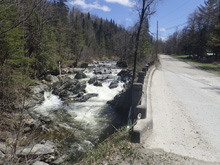
- Cascade (IV to IV+). The left side was for sure the main line, but it had a big tree blocking it so instead we banged down the right side. It was still fun. Diane wanted me to go first because there was a bit of a rock fence at the bottom but as I expected, our momentum just bumped us up and over those rocks with no issue.
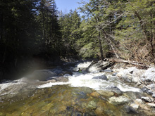
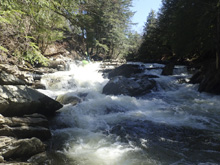
Boogie (III to IV-). Immediately below Cascade starts a cool little boogie rapid. Just got with the flow and stay in your boat as 100 ft downstream with moving water is the Waterfall.
- Waterfall (IV+ to V-). Scout right, maybe ask permission (see my story above). I can imagine at high flow it gets much harder. At low flow we were able to enter center and then boof the center with some right angle. But the issue is that the landing is a 90 degree turn and a pocket on the far left. The result is the landing has a boil and a hole. I can imagine at high flow it becomes more serious. To boof the right side and be clear of the boil, the falls sorta of melts off awkwardly meaning I think it would be hard to boof and project away. So yea, pretty straight forward at low flow, but perhaps something worse at high flows.
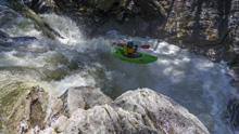
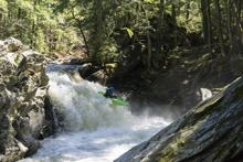
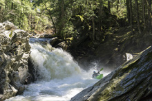
- Zig-Zag (IV to IV+). Class III to IV moves with IV+ consequence. This is absically two s-turns, connected by quickly moving water. The first one kinda pillows and airplane turns on the left as the river goes right. We hugged the inside (right) to boof through the small hole in the notch rather than dealing with the weird airplane turn into the hole. Diane told me to eddy out right just after, which I had no shot in hell at. Luckily I breached myself thanks to the low water as the next s-turn looked sinister. I was able to get out and looked to see that at the top you need to be far right on the wall as the left 75% of the narrow slot goes under the left wall. Below the notch opens up and is fine. Just don't be left at the top, it is bad.
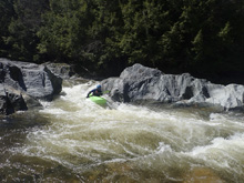
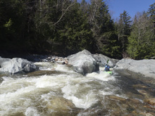
- Exit (IV). Two lines exist. A slide down the left or a double drop down the right. Both went just fine. You can see this easily from the road while setting shuttle.
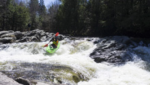
Boogie (II-). The river mellows out, find a place near the road to take-out without trespassing.
Take-out: From Lincoln, head south on East River Rd. Follow for 1.1 miles and after crossing the river (optional take out on the left after the bridge) immediately turn right onto S. Lincoln Rd. Follow this for 0.5 miles. We took out on a shoulder just past the last house before the river is roadside for a stretch. Not sure how legal it was honestly. The lower takeout is likely better if you have enough water.
Put-in: OK, so in full disclosure we didn't use this put in because we didn't realize we were missing a rapid. So you might have to ad lib a little with these general directions. From take out continue south on S Lincoln Rd for 0.5 miles. We turned right onto Ripton Rd which is a dirt road which follows the river, so you can catch a few glimpses in at the heard of the gorge including the waterfall. In 0.4 miles you cross the creek, that is where we put on. However we missed the first rapid, so I believe you could continue for an additional 0.2 miles before turning right onto Mill Rd and going 0.5 miles to the T at Grimes Rd and the bridge to the left, over the river.
HTML Comment Box is loading comments...
