New River (Gorge)
| Stretch: | Campsite Near Denny to Hawkins Bar |
| Difficulty: | Class IV+ to V |
| Distance: | 8.2 miles or 11.6 miles |
| Flows: | ~400 cfs to ~1,750 cfs. Current Dreamflows seasonal gauge estimate |
| Gradient: | 48.4 fpm for 6 miles, then 141.4 fpm to the Trinity |
| Put-in: | Retired Campsite at Panther Flat |
| Take-out: | Greys Falls Campground or Hawkins Bar |
| Shuttle: | 14 miles, 35-40 minutes one way |
| Season: | Winter from rain, Spring from snowmelt |
| Written: | © 2011 |
| Featured in Video A Wet State #39 | |
I first remember hearing about the Lower New as I drove to the Upper New back in 2004, unready for the mini-epic that awaited me downstream. I remember hearing stories of unportagable and runnable rapids. The seriousness of the run was only reinforced in my mind when Paul recounted his epic a year or two later.
Finally, last year (2010) came around and I had the chance to run the river at optimum flows of 1,000 cfs. However, thanks to a flare up of my bummed shoulder while boating Lower Hayfork Creek the prior day, I decided to play it safe and resign myself to shuttle duty. This year however, Darin, Diane and I went up North for a friend's Baby Shower BBQ Extravaganza and decided to bring our boats along. At the take-out of Burnt Ranch after a Friday run, we ran into some friends who suggested doing the New on Sunday. They assured that despite its low flows it would still be fun.
As it turns out, the river was still very fun. I can imagine with more water some of the badly placed rocks clean up making it less about rock dodging and more about avoiding the hydraulics. Still though, at the low flows there were very unique lines that offered a challenge and the scenery was still superb. All of this made for a wonderful day.
Plan for several hours on the water. Especially if you don't have anyone familiar with the run. Luckily, all the rapids (other than Blind Faith) are easily scoutable at river level. At low flows the paddle in to the gorge took over an hour. At optimum flows I have been told it only takes about 45 minutes. Also, keep in mind that the shuttle takes nearly an hour. It seems this run has a high percentage of folks who don't plan their time accordingly, take extended scouts, take extended portages, or just won't run Blind Faith on blind faith and attempt to scout it and thus end up with a night spent on the river. So I would plan ahead and bring a few provisions for a night... matches, space blanket, power bar, etc in case you end up being one of these stories.
Thanks to Darin McQuoid, Ben York, Jim Janney and Diane Gaydos for sharing photos.
Mi 1-6:
- Class I-II rapids. We saw two Bald Eagles during this stretch. When you get to a wide section of the river with what looks to be a plateau just over the rise from the river, followed by a cabin on your right, you know that you are close to the goods.
- One (IV+). The first rapid is obvious, scout from the right (also an easy walk). I know folks normally go down the right side. However a tree blocked the route in 2011. Also, the low water resulted in us going center. I have also seen pictures of folks going far left with more water. Below is a class III-IV rapid that we ran far right.
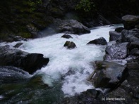
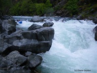

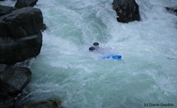
Two (IV+ to V). Scout on the right (also an easy walk on right). A double drop into a large hole then has 100 feet of fast moving water to the lop of a penalty box. A river wide hole with a rock backing it up and a cave sort of deal on the right needs to be avoided. The best way is to just head far right. At low flows this wasn't too bad. At higher flows the two sections link together and become less forgiving.
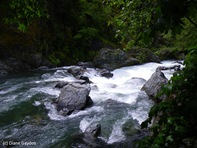

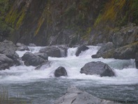
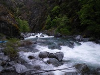
Three (V- to V). Even at low water this rapid was hard. Scout left or right, portage on the right. Get through the initial ledge either by boofing one of the rocks in the middle or by grinding the left shore. The water moves to the center hard where some sieves await. At high water you can go right, at low water it looked junky over there so left was the best option. Left involved threading the needle between two rocks and then s-turning back to the right to avoid the hole at the bottom on the left. And there was a tree if you somehow managed to get far right on the s-turn.
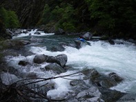


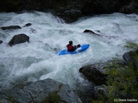
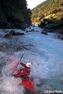
In Between One (IV+). A waterfall falls down from the left wall. We boofed down the left side and through a good size hole.
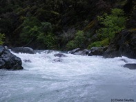
In Between Two (IV+). We boofed a double drop on the far right side. There was a rock in the landing however so next time at low water I would want to finish further center.
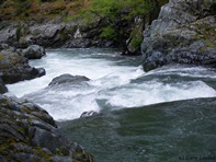
Portage (V to V+). Two in our group ran it. It honestly looked totally doable, I would just really hate to mess it up. The entry was a tight slot into a boxed in hole. The exit was a steep ramp among many rocks. Scout and Portage on the left. There is a large rock on the shore, the path goes underneath it through an opening. Before seal launching back in, take a look downstream to see the lip of Blind Faith.
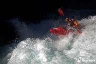
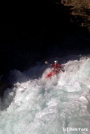
Blind Faith (V- to V). Enter and drop the 8 foot ledge down the left channel pointing a little right. From there, punch a few meaty holes in the run-out. There is no way to scout it nor portage it. Not unless you start hiking from well upstream perhaps...
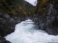

Hump and Undercut (IV+). Just downstream was a rapid that had a hump. We ran left of center though I was told that that forms a large hole at higher flows, thus apparently folks run just off the hump with more water. Just downstream the river slams into an undercut house-sized rock with a large reactionary hole forming off of it. Easy scout on the left.
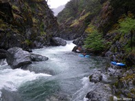
- Tombstone (V- to V). At high flows people enter right and keep staying right. At our low flows this was not possible. So the team started far left and cut to the right. A few of us also portaged on the left down into the crevice. It was a bit unstable in the eddy and putting on our skirts was a challenge as we were floating into the current.
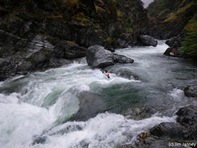
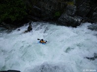
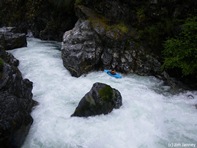
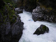
In Between Three (IV). I remember another S-turn with a piton rock that you wanted to avoid to either side in it.
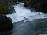
Final Falls (IV+ to V-). With water, you boof a small ledge on the right, followed by a bigger ledge on the right. As I got out to film on the left (also the portage side) I see that it is really low over there and the boof lands on rocks. Thus Diane and I ran down the left side into a few large seams and holes.
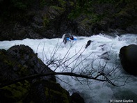
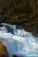
- Gorge Exit (IV+). The final few hundred yards of the river is continuous whitewater. A few sticky holes await you. The second to last move is very sharp s-turn that you want to heads towards the wall for to be moved away from the ledge hole in the middle, this holds true at higher water too. The confluence apparently also forms a large hole when flows are up.
- Trinity (IV+). From the confluence down you have Thread the Needle and Grey's Falls before the river lets up. Some choose to hike up just below Grey's or some paddle to Hawkins Bar adding a few miles of class II. If the Trinity is going high, paddling is quicker than hiking. At 1,400 hiking would have been 10-15 minutes quicker.
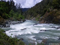
Take-out: Either, take out at Grey's Falls Campground between the small towns of Burnt Ranch and Hawkins Bar, this requires a steep 15 minute hike out of the canyon. Or take-out in Hawkins Bar river access just past the gas station.
Put-in: From Highway 299, in Hawkins Bar take the turn over the Trinity towards Denny. Follow this some 15 miles, at the summit make sure you stay right. Not far past the first meadow with houses you will see a dirt road leading sharply back on the right. This leads a few hundred yards down to the take-out.

HTML Comment Box is loading comments...
