
North Fork of the Yuba River (Wild Plum)
| Stretch: | Wild Plum Campground Bridge to Shangri-la |
| Difficulty: | class IV to V- |
| Distance: | 9 miles, 1 day (feels like 18 miles) |
| Flows: | 300 - 1200 cfs. Current Dreamflows (est) gauge |
| Gradient: | 109 fpm average |
| Put-in: | Bridge between highway 49 and Wild Plum campground |
| Take-out: | Shangri-la resort turn out |
| Shuttle: | 9 miles (15 minutes) one-way |
| Season: | spring, from snowmelt |
| Written: | © 2006 |
| Featured in A Wet State #11 and in A Wet State #128 | |
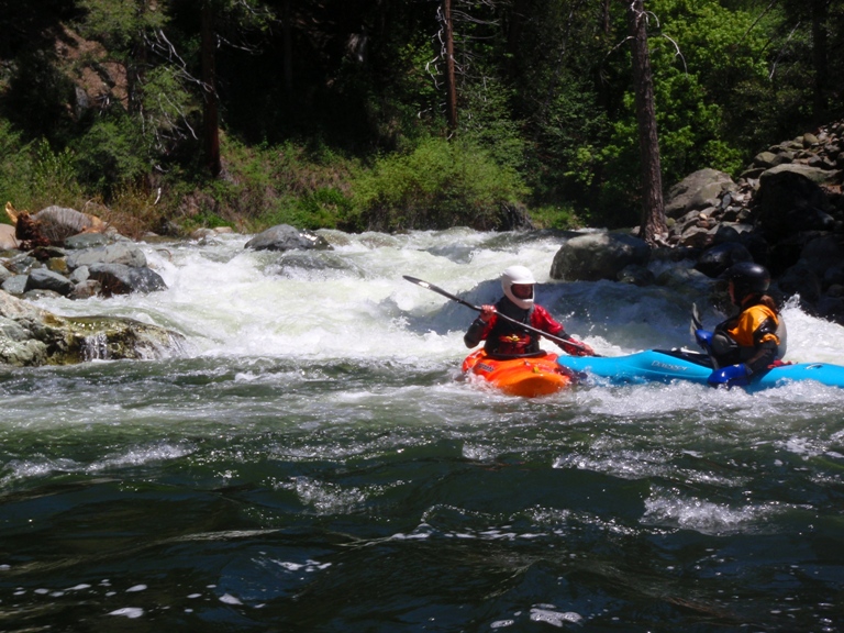
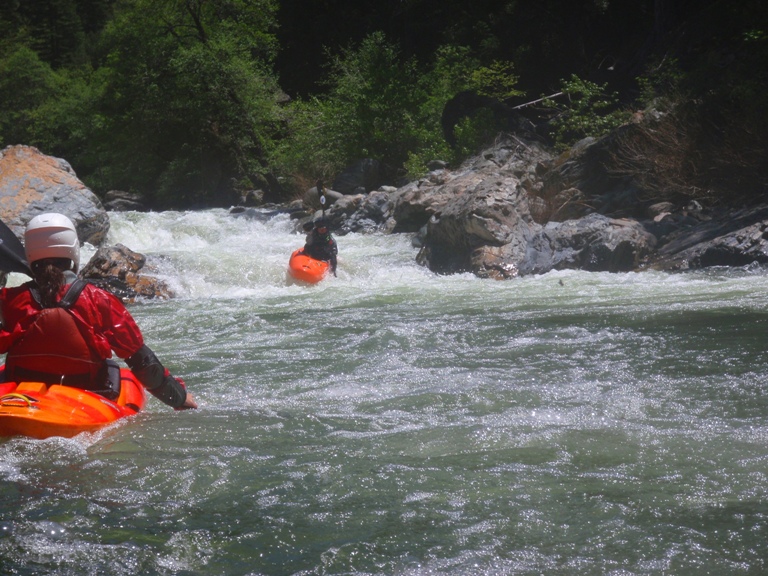
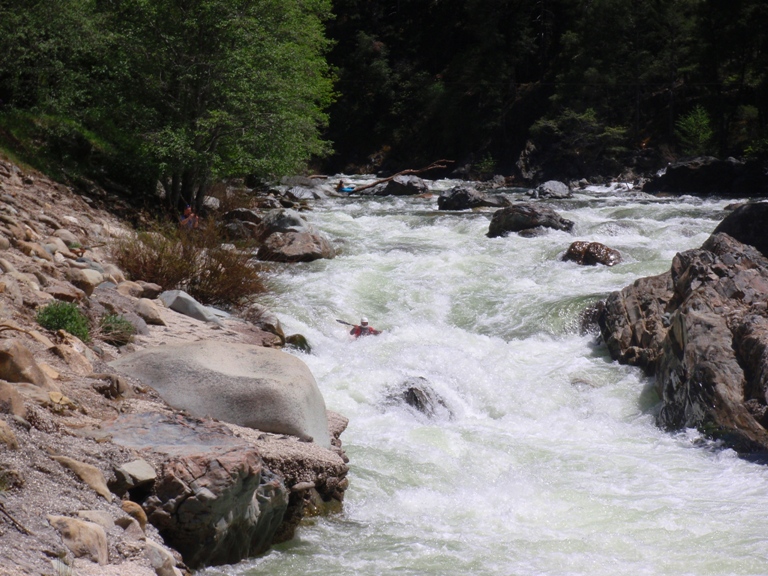
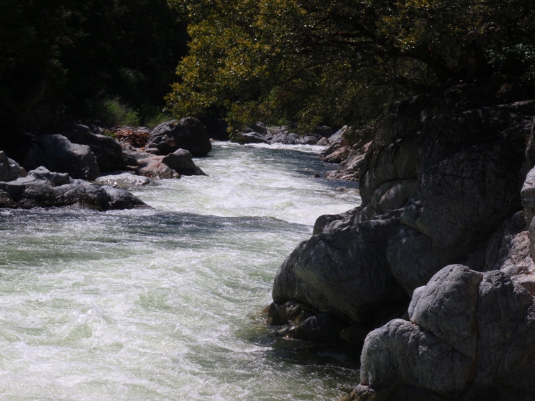
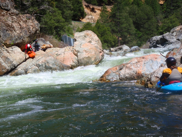
My first attempt on this river ended in failure. Paul, Kevin and I put-on on a hot Memorial Day weekend to higher than desired water (1,750 cfs). This coupled with our complete lack of knowledge of the rapids, led us to walk off after what we thought to be at least 2.5 miles. A year later I returned with a different crew, pointed by Shackleton who had some experience on this run. This was the key to a better experience. As the rapids fly by, class IV after class IV, I feel like I have gone a few miles, I see the beach that I took out at last time, and expect to run a dam (mile 3) at any moment. To my surprise, we had only gone nearly a mile, and the rapids continued non stop for another 2 miles to the dam, and another 2 miles below it. This led me to conclude that my group the year before made the correct decision in walking off. In all, this run is full on and a classic. The rapids are far too numerous to recount or even number. There were some 20-30 class IV to IV+ rapids, not to mention all the class IIIs. When I say the rapids are continuous, I mean just that. There is no stopping. After every set, you eddy out, to peak at the next set directly below you. This cause the miles to tick by slowly even though you feel as if you are full on. Finally, after about 5 miles the rivers lets up to be continuous II with a few IIIs. After about a mile of this, it drops in to Ladies Canyon, a fearsome gorge with a huge lead in hole. Following another mile or so downriver is Moss Canyon, a good gorge with a man eater hole at the end. Both should be road scouted before hand, and reevaluated again from river level. All in all, this run is great at 1,000 cfs and will be repeated for sure. What a great day... just don't plan on having energy the following day to go full on again.
The rapids are way to continuous to name them all, but I will give a few which I remember...more for my own memory for next time I go down.
Since the original write-up, I have gone back at a more medium flow (775 cfs) and have found the run to be much easier than before. When I say much easier, I mean it. It was still continuous, but the rapids were more class IV in nature, only one or two class IV+. Furthermore, Ladies Canyon had most of her teeth (other than the entrance hole) taken out. We took out after Ladies and before Moss Canyon, so I can't so how much easier that got. But don't get me wrong, for a solid group flows in the 1,100 is a classic flow!
Mi 0:
- Boof (IV). The first major test comes at the end of the first straightaway. A
bolder garden lead-in leads to a cascade which seemed runnable, we decided to run
down the extreme left, eddied out, then charged off the boof rock on the left shore.
Island (IV-). The left side is a rocky mess (ran it first time down), the right side is much easier and is read and run.
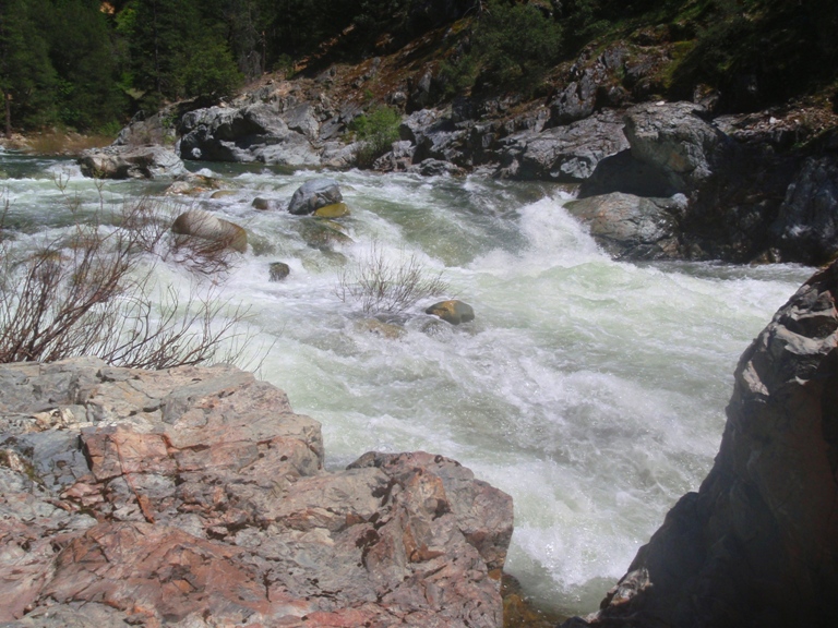
- Center Rock (IVs). There are a number of rocky rapids in this. The one that sticks
out in my mind is one where there is a large pour over left of center. We ran down
just to the right of it, then worked left at the bottom.
Rapids continue but blended together in my mind.
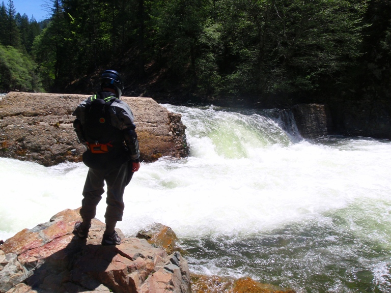
- Gillespie Dam (IV+). A eight foot dam with killer properties. There is apparently
debris in the middle along with a huge keeper hole. We all ran far left to some
success.
- Island II (IV). Another larger island this time forces a choice. We went right.
From here we entered the rapid moving right to left and pulled hard to the right shore
in the middle. The next tier was good to go on the right chute, or the left, the left
however put out onto a gravel bar and a strainer, but was still ok to run.
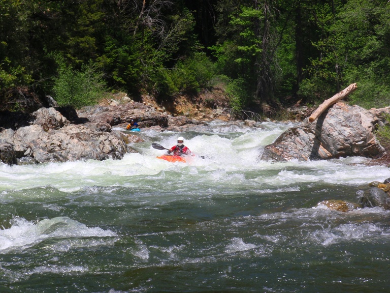
Island III (IV+). Possibly the biggest of the non-gorge sections, this rapid is full of holes. We ran right around a large mid-stream rock. There were so many holes, the name of the game was on the fly, try to brace, power stroke, and lean your way through them. I entered right of center and have no idea from there. There was a rock midstream below to hit if you flipped.

- Highway Rapid (IV+). A big one seen from the road, just upstream of Lady's Canyon is worth
looking at. This rapid has a boulder lead in, mixed with some huge holes. The crux is
making your way either right or left of the mid-river wave (actually a flake rock I think)
which is backed by a submerged rock which is backed by another flake rock. Once you power
away from the first the rest should be fine. We all went right around the first
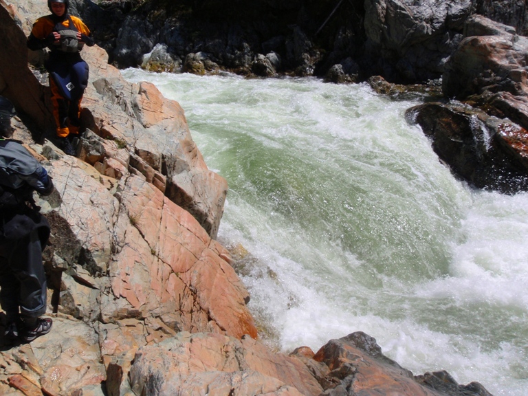
- Lady's Canyon (V). The entrance is a massive hole, which is then followed by other
massive holes and a few ledges to run out about a third of a mile stretch. You can
portage the whole thing on the left or just the hole on the right, neither is easy.
We all portaged the hole. The line down the rest of the rapid was like this, enter right
just below the hole, hit a hole, hit another hole, hit another hole, hit another hole, move
left, hit a hole, move right hit a hole, now see a horizon line and go off it. Ok so in
all seriousness, all I know is that there are huge holes, we entered right, next thing I
know after many holes I see a horizon line. I know that I went far left on the shore and
did a six foot boof drop into a very large hole. I think the right was even worse. This
rapid is not for the faint hearted. At 775 this rapid was amazingly easier.
- Moss Canyon (V-). On a right then left S turn begins Moss Canyon. In total this gorge is
easier than the one upstream as it actually splits up into distinct rapids, however it is
not to be taken likely. The first rapid was run down the right. We then scouted on the right
and found the line down the next section. I think the next three rapids were left, right,
right (don't remember exactly, they were easy lines to decide on when scouting). The last one
went on either side, but we eddied out before what we thought was Boss Moss on the right,
which would have been very difficult if we ran left on the rapid directly above. However it
wasn't Boss Moss, but it was a tricky class IV that was a lot larger in person than in our
scout. The line was on the right into some meaty holes. Again we eddied out on the right.
Scouted Boss Moss which is a massive hole, portaged on the right and continued our day.
Boss Moss at our flow was a massive hole with a huge boil, back by a rock on the one
somewhat window, in all, none of us considered running it, unlike Lady's Canyon Hole.
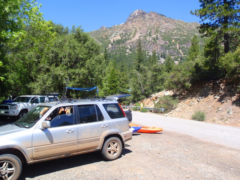
Take out: From Downieville drive north on 49 for 4 miles. Turn off when you see the Shangri-la signs. Park immediately on the right, there is a bridge to mark this take out when on the river. You can also take out in Donieville for several extra miles of class II or even between Moss and LAdies canyons to make the day a 7 mile one instead of 9 or 10.
Put in: Just on the far side of Sierra City, you will see a "Wild Plum Campground" sign on the left side of 49. Turn right here to go down to the river, there will be a fork, stay right, park on the far side of the bridge, next to the creek. There is a path leading down to the creek then down 100 feet to the Yuba.
View North Yuba, Wild Plum AKA Sierra City in a larger map
HTML Comment Box is loading comments...