North Fork of the Yuba River (Love's Falls)
| Stretch: | Pacific Crest Trail to Wild Plum Rd. |
| Difficulty: | Class V to V+ |
| Distance: | 1.1 miles (additional 0.2 miles possible) |
| Flows: | ~300 to ~500 cfs . Current Dreamflows estimate |
| Gradient: | 284 fpm average (but the hard section is 384 fpm for 0.5 miles) |
| Put-in: | Pacific Crest Trail |
| Take-out: | Wild Plum Rd |
| Shuttle: | 1.9 miles (5 minutes) |
| Season: | Spring from snowmelt |
| Written: | © 2013 |
| Featured in Videos A Wet State #71 and in A Wet State's contribution to World Kayak's Video Guide | |
I remember the first time I saw Love's Falls. It was the first time I went to Downieville as a scared aspiring class IV boater, looking to push my horizons on Pauley and Lavazolla Creeks. As my friend Brian and I looked down at the cascade of water I thought to myself that you would have to be insane to try to kayak the section of whitewater. Over the years, each time I boated the Wild Plum section downriver, I would migrate upriver with my friends to look at the falls and enjoy the terrifying beauty. Of course, normally if you are running Wild Plum then Love's is too high, so perhaps that is why the fear and trepidation lasted so long. Whatever the cause, it took much longer than it should have for me to finally have gotten this section of water (2013).
The run is short, though your first time down, unless you are a mad bomber, you will likely need 1.5 to 2.5 hours for the 1 mile of water (and of that, only 0.5 miles are hard!). Once you have the lines figured, runs can be as quick as 15-20 minutes. The rapids themselves are interesting. Most (at the lowish flow we had) were not harder than class IV+. The problem lies in that they are stacked on top of each other, even at the low flow the pools in some cases were nothing more than fast moving aerated water rushing to the next lip with only a small eddy to allow you a moment of reprise. The result was a section of water that felt very much class V due to the unforgiving pace of the rapids and the potential for issues if holes are not punched correctly. And if that weren't at all bad enough... as with any class V river, boulder piles inevitable result in sieves. So, don't swim.
The run itself is sick though. Not many runs sport a quick shuttle with a half mile of nearly 400 fpm rapids with minimal paddle out and no bullshit factor. If you know the lines, there is no reason why you can't get 3 or 4 or 5 laps in a day. It is like Tobin with that regard... except bigger, steeper, more beautiful and just plain better.
Thanks to Diane Gaydos for her contribution of photos.
Mi 0:
- You can put in above the bridge by crossing and going upriver. This adds a class V stack up. This is also considered the "First Falls" and is notorious for swimming folks.
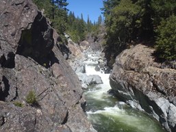
Love's Falls (IV+). At the low flows, you are less able to get to boof on the right, thus requiring a right to left to the center. At higher flow you can just boof far right.
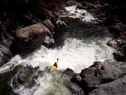
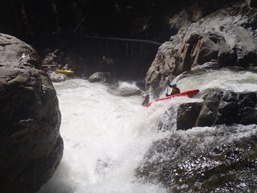
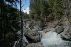
Junky Rapid (IV+). A junky rapid run right to left, easy to scout while walking in on the trail to put-in.
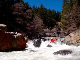
Third Falls (IV+). From 2009-1012 there was a tree in this one, but thankfully in 2013 the tree was washed downstream. No you can run it worry free... though you still want to be driving left. And there is no recovery room below, so if things go wrong you are likely swimming the next rapid.
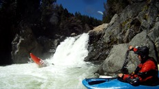
Falls Exit (IV). The exit of the falls is a center then moving right down a straight forward rapid.
Pre-Big One (IV). The next rapid isn't that big, but it does have two good size holes in it and it is immediately above a possible portage. Just run center heading right.
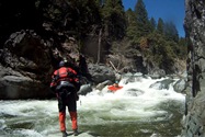
Possible Portage (V). Scout on the left. Hard Portage on left, easy portage on the right... however getting out of the boat is harder over there. The rapid is a ramp into a big curler which drops you over a parallel to the river ledge backed up by a rock, and then flushes into a good size hole. It also appears some of the water is going under the boulder. It seems to boat better than it looks.
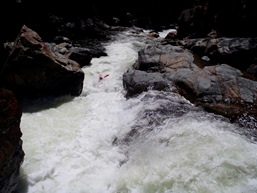
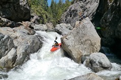
Double Hole (V-). One small class III leads to an eddy on the right that you can scout the next drop from. Start right and stay right. Boof the first hole. Exit the second hole on the left.
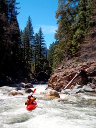
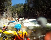
Thumbs Up (V). A steep cascade run down the center with a small boof at the top before the river turns left and falls over a two step drop into a good size hole. Scout right. Don't flip at the top of the final drop or you will likely bust something, like your thumbs ;)
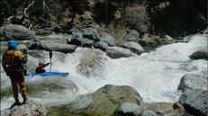
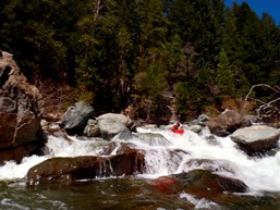
Small Ledge (III+). An easy ledge, just make sure you are far left on the main channel, otherwise you will piton your brains out.
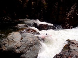
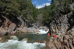
Best Boof of the Run (IV+). the next rapid has a sick boof at the top, left channel. It then drops off an off angle ledge that feeds into a hole. You have more than enough speed to blast through. Easy scout on the left.
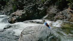
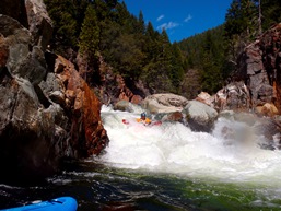
Read and Run (IV). A few hundred yards of class IV read and run. Just after the river makes a 90 degree right turn, eddy out to scout on the right.
Pinch (V). A shallow lead in that we scrapped over on the far left leads to a ramp into a good size hole with most of the water slamming into an undercut left wall. You want to move hard left to right in this ramp. Eddy out below on the right. Below, there is a sizable hole run center before eddying out again on the right. The next tier is run far left down a slide into a hole and then either left or right around a large boulder, boofing through the bottom hole
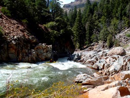
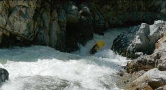
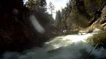
The river then mellows out to class III.
Take-out (IV). The very last rapid starts with a pinch on the far left shore that you want to make sure you have right angle, otherwise your bow drops to the left and can lodge under a tree there. You then come into view of the bridge.
Take-out: Take Highway 49 from Gassy Valley to Sierra City. Just on the far side of Sierra City, you will see a "Wild Plum Campground" sign on the left side of 49. Turn right here to go down to the river, there will be a fork, stay right, park on the far side of the bridge, next to the creek.
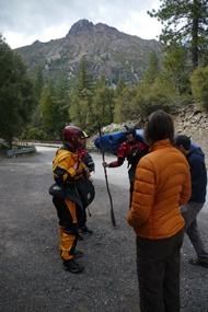
Put-in: Head back out to highway 49 and turn right to head upriver. Continue for 1.3 miles to a turnout on the river-side side of the road (one turn-out past the one that has a gate on it). There is a trail that leads quickly to the PCT and turning left on the trail leads to the bridge. Put-in on the far side of the bridge.
HTML Comment Box is loading comments...
