North Fork of the Tuolumne (Lower)
| Stretch: | Riverside Camp to Ward's Ferry |
| Difficulty: | Class IV to V- |
| Distance: | 11 miles |
| Flows: | 300 to 1,000 cfs. No Gauge, but we ran it when Clavey was at 675 cfs and on its third week of >600 cfs flows. |
| Gradient: | 168 fpm average (2 miles are ~200 fpm) |
| Put-in: | Riverside Camp, outside of Tuolumne on road 1N01 |
| Take-out: | Ward's Ferry Bridge over the Tuolumne River |
| Shuttle: | 15 miles (30 minutes one-way, all good roads) |
| Season: | Spring from snowmelt |
| Written: | © 2004 |
So this run was completely under my radar. My friend from the East Coast had mentioned it a few years ago as a run he wanted to do but that never panned out. Occasionally I would look at the pictures that kevsmom.com had online and think that some of it seemed entertaining. But none of it was enough to get me motivated, not even the cacreeks write-up stating that this is one of the best runs around. It wasn't until Ian, Chris, Culley, and Nathan made the trip last week and reported it to be fun and provided some pictures that I began to think of it again. And then thanks to the road closure making me back out on driving out the 2010 Salmon Fest, this run and the newly online gauge for the Clavey seemed like the perfect fall back plan. Both are a bit out of the way, but at the same time near each other. So it seems like the logical plan to knock them both off in two successive days.
So now for my impressions of the run. There are some great drops in here. Super fun boofs or slides or multi move rapids provide excitement and scenery. However, there are also long stretches of willows and manky class III-IV. In fact, it was in one of these willow gardens that Diane got pinned upside down against a rock and had to ditch her paddle to roll up off the rocks. The paddle disappeared never to be seen again. Luckily I (and only I) had a breakdown saving her from what would have surely been a very long and arduous (and poison oak infested) hike out.
The intense gradient also results in many rapids and therefore makes this day a long one. With very aggressive boat scouting we got to take-out in 6 hours. If you wanted to scout all the blind class IV you could easily add 2 hours. Also note, there is a portage on the run that will almost certainly get you a case of poison oak. If you want to run the bottom half of the rapid (which contains numerous sieves, but is certainly runnable on the left) you will avoid the worst of the oak. After the portage you get a nice gorge containing Devil's Slide and finally a little more rock bashing down to the confluence with the main Tuolumne. Our day the Tuolumne was running about 4,000 cfs for 2 miles before we hit the lake and about a 1 mile paddle out. From the time we hit the confluence it took us 45 minutes to reach take-out.
So in summary, I think this run is worth doing. I would say it was a little easier than the South Feather though just as abusive on the boat. I would not call this run a "classic" or be hard pressed to think of better runs. I will however be likely to return to the stretch of river though I will wait until I have forgotten about how bad this case of poison oak is that I currently have.
Also, there is an upper run which apparently has a few good drop in it. It is located above the bridge on Buchannan (between Buchannan and 1N01 there is a road side class III run) though Ian Buckley tells me that if I thought the lower had a lot of willows, then the Upper run is not for me as it is a whole different level of willow slalom.
Also, it is hard to tell where the drops are on google earth so I was only able to pick out a couple of locations to anchor mileage to.
Mi 0:
- Dam (II+). The small concrete "dam" at put-in is a good flow gauge. We had about 14-16 inches from the top. I know groups went in about 4-6 inches down from the top and also said it was a good flow.
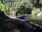
From the get go you have many class III-IV rapids in and amonst the overhanging trees.
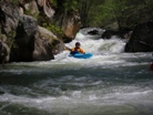
Possible Portage #1 (V- to V). A good size class IV lead in will bring you to the brink of a tight drop that drops some 8 feet between a large rock and the wall. The wall has a cave in it. Jonas and Taylor ran down it and dropped over the ledge. As I charged down the lead in and went to drop over the ledge I began to quickly see what I was about to do and opted for the last minute eddy on my left and cowardly portaged on the left. Big drop though it goes fine I guess.
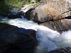
Leads to a Ledge (IV to IV+). A fun rapid rapid that if I remember correctly had a fan rock to avoid before then powering over the ledge at the bottom. This one will get your heart pounding as the ledge is around the corner from the top so as you drop in blind you will get the moment of doubt as to how wise a decision that was.
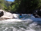
More read and run class III-IV leads to a bed rock section.
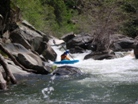
- Bed Rock Slides #1 (III). An easy set of slides each with small holes.
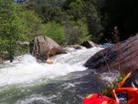
Bed Rock Slides #2 (IV-). Larger slides with larger hydraulics though all are straight forward and fun. There is a fun boof just below this section and a small rapid will lead you to one of the more unique rapids.
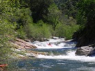
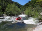
Boof to Slope to Hole (IV to IV+). This rapid has always stuck out as one of the cooler rapids in the cacreeks write-up. However, from above I did not recognize it. It wasn't until I hit the boof and began to slide that I pieced together that it was that drop. Too bad I didn't get an angle that did this drop any justice. The run out was also fun.
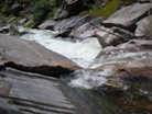

Slide (III). Just downstream was a nice slide into a good side hole.
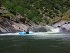
Double Drop #1 (IV to IV+). A sweet drop is pretty straight forward. Boof the first hole and then work left for the second hole. Good fun and easier than it looks.
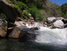
The willows start to get bad for a while though there is an occasional fun and somewhat clean rapid. After a mile or so bed rock reappears.
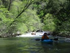
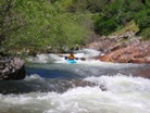
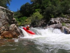
Double Drop #2 (IV+). A steep drop is then followed by a small but sticky hole. We all opted for going right down the first drop though many other drops go more to the center.

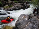
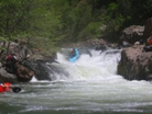
Fun class III-IV rapids lead to a right turn where the river makes a sudden fall over many rocks. Be wise and hop out to scout.
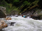
- Possible Portage #2 (V). A rock jumble that is very intimidating. Many rocks to push you off line and mess things up for you. Portage left though it may require some team work to pass boats over exposed sections of it shore.
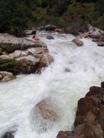
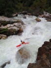

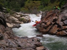
Several more fun bed rock class III-IV rapids will eventually lead you to possible the best drop of the run.
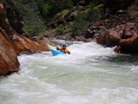
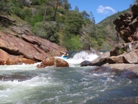
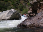
Terminator (IV+). We entered left boofing down the entry before hitting the pillow, turning 90 degrees left and dropping 8 feet into the rather large hole below. I personally went to China and popped up in a huge tailstand many feet downriver with a huge smile on my face.
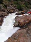
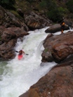
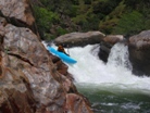
Ledge (III). At the end of the pool below Terminator was a fun boof on the right.
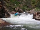
Snickers (IV+ to V). A long complex drop involves boof the entrance and moving around several large boulders. At this time you will note that from your scout from the top you didn't notice the large drop at the end. You will probably catch the eddy on the left and scout the final drop as it is a 6 foot drop into a good size hole that flushes to into a small pocket on the left. As I dropped into the pocket attempting to brace off the wall I am greeted by Jonas and Diane in the pocket sharing a snickers bar.
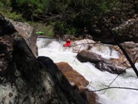
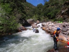
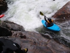

Junk (V- to V). A junky lead in with several undercuts leads to a junkier rapid with some sieves and undercuts. I opted to portage on the right and was aided by many red ants. Some of the others scouted the top from the right, ran it and then scouted the remainder from the left.
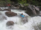
- Hunter Creek Falls (IV+). A small lead in hole (which had a tree in the middle in 2010) then led to a 6 foot drop into a good size hole. We took lunch just below. Hunter Creek comes in on the left 50 feet downstream.

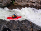
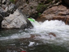
Left to Right (IV+). A sweet though intimidating junky rapid involving boofing down the left channel just next to the boulders on the right.
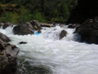
- Stanley Falls (IV). A fun 10-12 foot waterfall best run left of center off the nub of rock. Apparently there is a rock in the landing on the right. Easy to scout on the left.

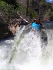

Portage (V+). A rock and sieve pile with many death traps. It would be runnable if it weren't for one badly placed rock on the right channel. It still may be. None of us tried it. Jonas put in just below this part and ran the bottom half of the top drop. Faced with a cliff, the rest of us opted to put in at the bottom of the initial cascade and ran one good hole before again getting out to scout on the right. I think the scout is easier on the left if you want to run the bottom section. There is certainly a line though the right half of the river goes into many sieves. The middle also flushes into sieves. So if you are going to run it stay far left. Most of us walked this section on the right which is where I got my case of poison oak from, it is completely unavoidable.
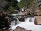
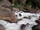
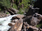
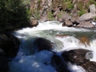
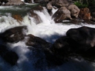

Several fun rapids take you to the final gorge. One of these rapids was on a right turn and shot you between cushions before then turning 90 degrees left and flinging you off a ledge. This was one of the more fun drops though it was only class IV just because you got flung with such speed you easily fly over the large hole at the bottom. We were all smiling after that one. Several other rapids in this section are fun as well.
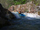
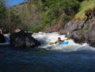
- Devils Gorge #1 (III). A fun drop into a good size hole.
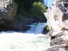
Devils Gorge #2 (III). A large vertical drop though easy to sweep far left around the rock pile.
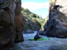
Devils Slide (III). A fun slide into a nice size hole.
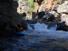
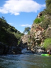
The remainder of the drops are rocky read and run class II-III.
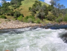
Take-out: Turn off of Highway 120 onto Ward's Ferry Road (at Big Oak Flat, a couple of miles west of Groveland). Follow it seven miles to the bridge across the New Don Pedro Reservoir. Or come in the other side from Jamestown off of Main to Seco to Algerine to Ward's Ferry Road.
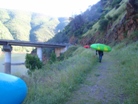
Put-in: Take Ward's Ferry North (back towards Jamestown, not Groveland) and turn right on Tuolumne Road. Follow to the town of Tuolumne. Turn on Carter Street and in 0.3 miles turn right on Buchannan Rd. Follow the signs to Cherry Lake and the North Fork of the Tuolmne. After 2.3 miles you will see a bridge branch off to your right. Cross the bridge and go down the road a hundred yards to the Riverside Campsite. Excellent spot to put-in.

HTML Comment Box is loading comments...
