North Fork of the Stanislaus (Boards Crossing/McKays)
| Stretch: | Sourgrass Bridge to McKay's Point Rd |
| Difficulty: | Class IV then IV+ to V- |
| Distance: | 5.0 miles or 7.4 miles |
| Flows: | 700 to 2,000+ cfs. Current Dreamflows gauge |
| Gradient: | 62.8 fpm for 5.0 miles then 107.1 fpm for 2.4 miles |
| Put-in: | Sourgrass Bridge |
| Take-out: | McKay's Point Rd |
| Shuttle: | ~20 miles or 35 minutes (4-Wheel Drive recommended for steepness of road at the end) |
| Season: | Spring from snowmelt |
| Written: | © 2010 |
| Featured in Video Twenty-Eight | |
After two years of trying desperately to get folks to join me on this run, I finally succeeded. I have to admit though, I was a bit nervous that the run may turn out to not be that great (since I had had trouble getting folks to join me in the past) and that my group would hold me accountable for a wasted spring day when so much else was going. Thankfully, this run ended up being really good fun and very much worth the time. Put this run on your list if it isn't there, you wont be disappointed.
So now I am left to wonder, why did folks not want to join me over the past few years? I am left to conclude that the last two years were low water years and the North Stanislaus only exceeded 1,000 cfs a few days each year. We had 1,200 cfs and I think this was an ideal flow. You may feel like some of the rapids have holes that border to juicy, but thankfully these holes all flushed straight out (though I did take one or two rides in the earlier section, but I deserved both of them). I have heard that at lower flows the end section turns into a rock bashing affair. At the higher flows the lower few miles was continuous read and run with 3 larger drops thrown in. The in between stuff was amazing continuous read and run class IV to IV+. It is really good fun.
For those of you looking for a step up class IV run the upper 5 miles are perfect. There is a IV+ or two in there at good flows plus several fun class IV. Many though will take out after the first 5 miles. For those who are looking for a fun class IV/V experience the final 2 miles will surely satisfy your appetite. Furthermore, the scenery alone will leave you satisfied. I am beginning to think that the Stanislaus is my favorite drainage in the state. Between this run and the Donnell's run, I just can't think of an area I like more. Ok, so that is a complete unsupported claim because I would almost certainly say the same thing about the Yuba and Feather drainages. Anyways...
The run took us about 2.0 hours not including the scouting/running of the put-in drop which most will portage (half of us did, and one that ran it had to walk off with a possible concussion) nor a short lunch break on some warm rocks. This run could easily take longer with more scouting. We scouted 2 drops in the bottom section mostly to get photos. If Jonas, Darin, and Laura weren't there we would have almost certainly scouted another 4 or 5 times throughout the course of the run. I am also sure that with 2,000 cfs the run would be significantly harder.
Thanks to Darin McQuoid for sharing photos. Also check his site for more photos.
Mi 0:
- Sourgrass Ravine (V to VI). The runnability of this rapid depends on the flow. I think 1,200 cfs that we had was ideal (though I still chickened out). There is a rocky entrance that slides into a large curler that must be punched in order to drop into a huge hole that is backed up by shallow rocks and 2 more holes and of course the obligatory undercut wall. One in our group took a rock hit when rolling in the first hole and had to end his day due to a severe bruise forming just over his ear. Easy scout and portage on the right,
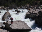
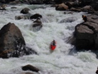


Beginner's Luck (IV+). Just downstream a hundred yards brings you to where most people will start their day. This four tiered drop is stout and starts with the hardest of the moves. The first drop wants to push you right which will drop you into a riverwide hole. Luckily the hole will surf and flush you out of the left side. If you drive left at the top you can hit the window on the left and avoid the surf. From there, there is another 3 to 4 foot ledge that can be taken nearly anywhere, followed by a zig-zag curler that then leads to the last hole. Great rapid,
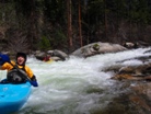

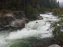
A few more class III rapids lead to an easier stretch of class II.
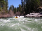
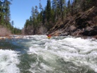
- Boards Crossings Bridge crosses overhead. This is a private road.
- Claw (III+ to IV). A sweet boof on the right leads to a 90 degree left turn in the river and some fun runout. The boof looks scary but dang it was good!
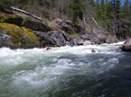
Slot (III+ to IV). We ran down the right punching through some laterals and letting it kick us right to avoid a large hole at the bottom. Well at least that is what everyone else did. For some reason I thought people were getting pushed right so I worked harder to the center only to realize the error of my ways too late as I drop in to the hole nearly backwards as I try to paddle away, luckily it surfed me out quick enough.
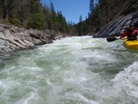
- The Thing (IV- to IV). On a left turn you will see a severely constricted river in front of you. Lucky just about all the lines go. We ferried to the middle, then back to the right before boofing a ledge at the bottom.
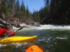
Several fun rapids that I am sure have names for the raft companies, the rapids range from class III- to III+ range.
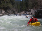
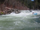
Upper Sequoia (IV). A busy rapid leads to a rocky ending. It seemed that the cleanest exists were either on the far right or far left.
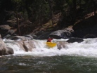
Lower Sequoia (III+). This one looks big and intimidating but at the flows we had was mindless fun. Just ride the ramp down into the deep trough and through the large breaking wave, what a kick. You are now under the optional take-out bridge that lays within Big Trees State Park.
- Big Trees State Park Bridge.
McKays Run Starts
Devil's Horn (IV+ to V-). 0.4 miles below the bridge you will come to a dramatic and obvious horizon line. At our flows this rapid was a solid IV+, but I imagine as water gets high the bottom hole would be less friendly and the rapid would get more serious. As it was, there was a fun class IV lead in to a slopping 5 to 6 foot drop. The drop looks like it may have a big hole at the base but it just passes you right through. There is also a small eddy on the right just above the finish that you can use to split the drop up. Scout from either bank.
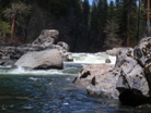
Goalposts (IV+). Another great rapid and obvious horizon. Due to some rocks in the middle of the rapid it is hard to boat scout. We hoped out quick to verify our line on the left. We were correct in thinking you wanted to end up on the right, achieved by a hard drive across the river. Plan B was down the center moving right to avoid the rocks on the left in the center.
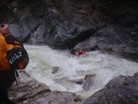

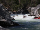
Fake Waterfall (IV). There was a rapid that I totally thought was "The Waterfall" from the pictures I have seen. It had a rocky entrance into a small ledge. I thought, "well that was easy for a class V." It wasn't it. This ledge could be taken anywhere and made for a fun rapid. It should be noted that about 100 feet upriver was a significant pour-over that had to be boofed. You might have been able to go far left around it, but if you boof it get your nose up, it could tow you back.
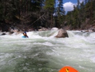
The Waterfall (V-). I feel ok giving this rapid a class V rating. You could make the rapid easier, but we went for the meat of the cushion into the meat of the drop below. This hole was fluffy we all passed straight through, several staying on the top of the water and not even getting their head wet. From there the rapid continues for another 100 feet of class IV read and run. This would be a bad place to be upside down for long.

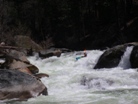
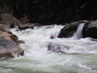
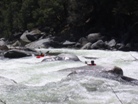
- Breathless (IV to IV+). The next 1.5 miles is nearly one continuous rapid to take-out. Some sections are class III and some step up to class IV. The length and continuousness of the rapids make it feel class IV+ in my mind. What a great read and run section of water. This river leaves you will a great smile on your face as you reach take-out.
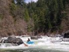
Take-out: From Angel's Camp, drive 18 miles on Highway 4. Turn right on Moran Rd (be aware, 5 or so miles down Highway 4 you will come to the other end of Moran Rd, if you see a big pond on your left you are on the far end of the road). Drive 1 mile on Moran Rd and turn right on Love Creek. Follow this for 2 miles and stay left at the "Y" and follow for another 2 miles. Turn right at the Y that also has several Residential signs pointing the way to peoples houses. Quickly this road forks again, drive right (away from all the residential houses) and climb steeply for 0.5 miles to the top of the ridge where there is a 4 way intersection of dirt roads. Go straight and descend steeply to the river. The road down gets somewhat bad at the end and is very steep. I would recommend 4 wheel drive as it is so steep. The CRV did fine. Park at the bottom next to the river.
Put-in: Go back to Moran Road and follow it for 4 more miles back to Highway 4. Turn right on 4 and follow it for 4 or 5 miles until you get to town and see Boards Crossing Road on the right. Follow the signs for Boards Crossing Road for 4 or 5 more miles. You will cross a bridge and be able to park at the day use area on the other side of the river.
HTML Comment Box is loading comments...
