North Fork of the French Broad (Lower)
| Stretch: | Macedonia Church Rd to Alligator Rock |
| Difficulty: | Class IV to IV+ |
| Distance: | 5.1 miles |
| Flows: | 0.75' to ? on the bridge at the turn off. Look for 500 to 1,500 cfs on American Whitewater's gauge. |
| Gradient: | 71 fpm average (187 fpm from mile 2.35 to 3.05) |
| Put-in: | Macedonia Church Rd |
| Take-out: | Parking and beach near the Alligator Rock formation |
| Shuttle: | 4.4 miles (5 min one way) |
| Season: | Winter and Spring, rain (and occasionally off of thunderstorms) |
| Written: | © 2016 |
| Featured in A Wet State #110 and in A Wet State's contribution to World Kayak's Video Guide | |
I was a little less than fired out to drive the 2.5-3 hours back to the region after having to return home to Knoxville for New Year's Eve celebrations. Because of that I did not motivate for a New Year 's Day mission. Instead, the following day Zach and Katie Dean and I schemed an idea up. Laps on the North Fork of the French Broad followed by a lap on the Thompson. After Overflow, they had stayed in the area so it was convenient to them... and it was two good runs that I had never done so it was a good idea from my standpoint. As the alarm went off at 6 am however, I admittedly had some doubt... especially since I had no carpool partners with me.
We ended up running two laps on this section. The first time we hiked out of the gorge just below Submarine. This expedites the laps... when people are in good shape. In my case currently, that is not what happened and as I lay on my boat half way up wheezing I decided I wasn't going to do a second lap. Lucky for me (or perhaps because of me) the group had decided by the time I topped out that on the second lap we would run down to Alligator Rock. This adds 2 miles of class II+ river and about 3 miles to the shuttle. The hike-out shuttle is only about a half mile... so crazy short.
Both laps we put in at the optional put-in to cut off 2 miles of paddle in, though that also bypasses one fun rapid. The hike is short to the river. And quickly you find yourself in some fun boogie which then leads to Boxcar. If you want a bunch of warm-up... use the top put-in. Below the rapids come one after the other, fun moves, a few sticky holes, and a few great boofs await. As you approach submarine, approach with caution. I anticipated this drop being easier than the main line was. We all decided to sneak around it rather than get shoved into an undercut. The short hike out is immediately downstream less than 100 yards. That would result in a very short day once you know the lines. Even our second lap when we went down to Alligator Rock, I found the run a little too short. It took less than an hour. Probably closer to 45 minutes. But if you are pushing your level and catching eddies I am sure it can be extended to fill 2 hours.
We had just under 1' of water at the bottom bridge. I thought this was a great mellow first time flow. It did not feel pushy. Boxcar was perhaps a little scrappy but that results in it having a wider range or acceptable lines. Higher and I bet some of the holes get fluffy, lower and trip rocks would be a nuisance. But the run is worth doing. The mile of rapids is very worthwhile for boaters looking for some class IV.
Mi 0.0:
- Sandpaper Falls (III+). I haven't actually run this section. So I can't speak to the rapid. The pics I have seen look fun though!
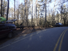
- Alternate Put-in. Use a turn-out just before a big left hand turn in the road. The turnout is followed 100 feet later by a smaller turn out, both on the river side prior to the left turn.
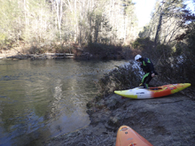
Fun boogie fills the first half mile below the alternate put-in. When the river bends hard right and goes into the shade you know you are getting close!
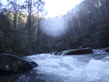
- Boxcar Falls (IV+). What a fun drop! Scout from the right. The jist is to enter right or right of center. There is a small step down at the top onto a slide. Keep it straight, it wants to spin you because the rock is grippy so don't let your bow catch too much of the shore as you go. At the bottom, boof to the right. Some of us had nice boofs and tail stood, others didn't and plugged deep (me). My first lap I grinded the wall and kept my head dry. Just be careful for melting off left into the pocket. There is a left line called "Blind Date," which looks very tough. Set safety if your group isn't strong.
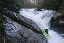
Island Rapid (III). A fun rapid, we boofed in right of center and punched a few mellow holes.
- Typewriter (III+ to IV-). A straight forward move. You could go far right and avoid the hole or go left of center and boof a sticky slopping hole. I can imagine at higher flow this hole is meaty and the boof becomes more legit.
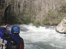
Razorback (IV- to IV). This is a fun rapid. I found that just staying far right made it a nice mellow ramp. The difficulty is in that if you let yourself be center ridges of rock form and trip you and flip you or knock you off angle and the hole below then swallows you.
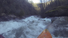
- Clog (IV to IV+). I am not 100% sure I want to give this a IV+... but I am also not 100% sure I want to say it is class IV. We entered via a fun little boof on the right of center. We then worked left down a fun ramp. This is where you have a decision. At the bottom awaits a sticky hole in the middle of the river. You can either junk down the left or go for a seam on the right. First lap we all went left and it was junky at 1'. I spun around on a crappy rock and nearly got stuck in the hole. The right had a wide open line. If you are straight, you could even punch the main hole. I would just go right and keep it straight.
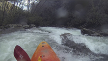
Vortex (III+ to IV-). A fun drop just below Clog. We started right and worked far left through a hole. The river then jogs back right and slops back left through a soft hole. You can drive right across the slop to avoid the hole or just straighten out and punch it!
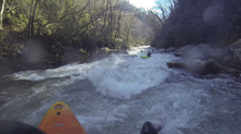
Quarter Mile (III+ to IV-). The next quarter mile is full of high quality boogie. Really fun little section with nice hole dodging and a fun boof or two. This takes you to the lip of Submarine.
- Submarine (IV+). Pool to pool it is one move, but it is a bit messed up. Scout on the left. The slopping drop lands in a hole that will be hard to keep your nose up on. The current entering from the right will push you left into the undercut/cave combo. We didn't like it. So instead we ran a small channel in the middle going from the right channel back to the left just downstream of the hole. It worked great.
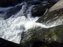
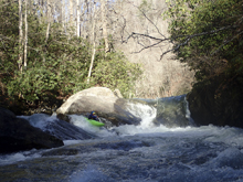
- The Alternate Take-out is one class II+ rapid downstream. Look for a "beach" on the left where the trail leads steeply upriver.
Downstream is fun class II boogie for 2 miles to take-out.
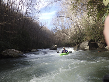
Take-out: From Henderson, head West on Us-64 for 49.4 miles. Just after the town of Rossman look for the outdoor retailer on your right as you get to NC-215. Turn right and go up 215 (Parkway Rd) for 1.7 miles. Just after the flat rocks that overhang the road (Alligator Rock) look for parking on the left near the beach. If you want to hike-out, go 2.4 miles farther up the road and look for the turnout on the left just prior to the electrical lines going overhead
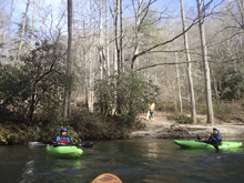
Put-in: From Alligator Rock, continue up NC-215 for 2.9 miles to a turn-out on the left just before a very large left turn in the highway.
HTML Comment Box is loading comments...
