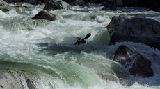
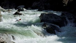
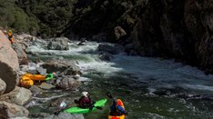
North Fork of the American River (Giant Gap)
| Stretch: | Euchre Bar trail to Iowa Hill Road |
| Difficulty: | class IV+ with 3 class Vish rapids, |
| Distance: | 14.5 miles, 1 or 2 days |
| Flows: | 500 - 2500 cfs. Current Dreamflows gauge |
| Gradient: | 54 fpm average, 120 fpm in mile 4, 100 fpm in mile 6 |
| Put-in: | down a 2 mile trail to Euchre Bar |
| Take-out: | Iowa Hill Road Bridge |
| Shuttle: | 19 miles (30 minutes) one-way, some on dirt road |
| Season: | spring, from snowmelt |
| Written: | © 2004 & 2005 & 2014 |
| Featured in Videos Twelve and Fifty-Eight | |
The first time I went to run this run, I was still a class IV boater, and this was the furthest that I had pushed myself to date. Because of this I don't think I ever looked up and around to see some of the most amazing mountain views that can be seen in the Sierras. The other stupid thing about that day on the river is that my memory of it was quite skewed from reality. I remember the three big rapids and a few of the smaller rapids, but do not remember there being as many class IV rapids in between and for such a distance. After my second run I have decided that this run is a classic as many have always thought. The run does however have a two-mile hike in, although all downhill, it is still a pain. Furthermore, the last five miles or so is down easy class II and occasionally class III which after the long day up to, gets a little boring and tedious. This would be a horrendous run if you either: don't have someone familiar with the run, or aren't a capable boat scouter. There are many rapids which are technical (20+ class IVs or so). Many of the rapids are long affairs that have no individually hard moves but a mistake in the top would have reverberations which might not be pleasant. There are many sections hundred yards long or longer, which require eddy hoping and picking a new line once you can see the next section. With this said, the final class V rapid has a choked off entrance, so be wary of bombing into every drop as it may just be Dominator.
Also, I have never done it all that high, but have been told that above 1,600 it is for sure class V, and that swims would be long, keep that in mind before venturing in at high flows. 1,200 on the other hand is a GREAT flow.
Update 2014: You can tell I was really nervous about this run when I first wrote it up. Now I am of the feeling that at flows below 1,000 it is just class IV with 2 class IV+ drops... one of which being Dominator which is intimidating and thus may be a portage for a class IV boater. At flows up to 1,4000 I think only Dominator turns into class V, but you can sneak it and make it class IV real easily at the higher flows. The rest of the run starts picking up to be more and more class IV+. At 1,450 of pure spring run off (flow is much less than the gauge during the winter), Locamotive becomes a very serious hole with a lot of tow back, and to compound the issues setting safety and portaging is much harder. head up the slab in the "eddy" and walk up and around to get below. At flows above 1,600 I have heard of really good boaters portaging or being scared to death while bombing into it. Finally, as I briefly mentioned, flows during the winter will be much much less than the gauge way downstream at the dam. I look for 1,200 minimum to get about 700 cfs in river during December-February. It then slowly starts becoming more and more accurate as the river turns into all snowmelt.
Thanks to Darin McQuoid for his contribution of photos.
Mi 0:
- First Gorge (IV). The first mile is one gorge. The rapids are all easy enough.
The first hard section requires you go left of a plug rock at the top, then go either
way around a house size boulder below.


A little below there is a boof that be taken on the right of center, but has a rocky landing, not bad though. The rest is easy to figure out.
- A few tenths into this mile there are two easy rapids with house size boulders at the
exit of them. The second has a tree spanning the river. You have to sneak to the
right of this or get beat down against it. It can be looked at from the right shore,
there is an eddy to peal out in on the right to avoid the tree. This marks the
beginning of the Gap.


First Rapid (IV). There is a boulder bar rapid shortly below here that isn't bad. At the top is a river wide hole, sneakable best on the left. From there tyou can go right or far left, it is a little rocky but easy to figure out.


Grater (IV+). Another boulder choked rapid (notice the trend yet?) best run on the left. We ran into the left, then middle, then ended on the left again. The far right (top down) is really chunky) As long as you enter on the left you should be fine, although being upside down on this would be very painful.


Just Below (IV-) Just below grater is a fun rapid that I usually boof left around he rock. About 100 feet below this rapid, is Nutcracker.
- Nutcracker (V-). This rapid seems easier to me than what everyone rates it. Although
I can imagine at high flows it is nasty. You can either enter on the far right,
hugging the wall, making a sharp turn right around the corner, or run straight in,
either is fine. Once in it, there are three or so holes. The first I let push me left
to avoid the second, then powered right to avoid the large rock poking out from the
left in order to just skirt the left edge of the hole at the bottom just off the left
shore.


After (IV). After Nutcracker there is a long rapid who crix move is in the middle. The ledge is best run on the left where there is a tongue. The run out leads all the way up to Locomotive.

Locomotive (IV+ to V). At low flows this rapid is not a problem. Over 1,400 cfs it gets stompy. At low flows you can either go right along the shore and head right off the boof, or go left at the entrance and ferry to the right for the boof over the hole. At higher flows it is a huge stompy hole that can only be portaged with some effort on the slanted slab of rock angling upstream on the right shore. Update 2018: Thanks Darin McQuoid for providing me an update, apparently this one changed in this winters floods. Now it is a class III ramp... down the middle. No hole, no need to go right. The pics are of the old version. I will have to get some new pics.


Many rapids between here and the last rapid, "Rocky Rapid." Some of them are worse than others. But all can be boat scouted if not listed here.
Dragon's Tooth (IV). Two lines for the top section, you can either boof off the flake in the center, make sure to have right angle as there is a rock backing it up and a hole underneath it. Or you can run down the left side along the shore.

Five Alive (IV+). A chute which at low water needs to be hit on the far left side of as there is a rock in the center. At high flows it is go anywhere, you pick up speed and blast through the bottom, I still edge to the left side of the large wave. Update 2017: Per Gavin Reiser, this one apparently has changed and now has a piton in the center where the curler used to be. Avoid to the left.


Fun One AKA Allen's Gap(IV). A bolder garden. After the first group of boulders, a right channel boof will appear. I like that line. After that you can go right into the churning water below or head left, there is a fun 4 foot boof on the left wall, just be at least 2 feet off the wall or you land on a rock. You can also run right though it is jucier. 2024 Update: Via Greg Rodriguez, the name Allen's Gap comes from the BLM map they made in the 1980s and makes the route to the high and low trails out of the gorge.

- Dominatrix (IV). A long rapid which ends with a river wide ledge one hundred feet above
Dominator. The rapid is long, but the idea is to start in the middle or so, and move all the way left.
There is a nice little slide boof which leads to the ledge. A good line for the ledge is right of center
moving left. Be careful, even at low flows my complacency got me surfed for a bit.
Dominator (V). The hardest rapid on the run, the crux of which is the final drop. The final drop consists of three ledges, one left, one center, one right... go right. The left two go into a walled in cove and are massive holes which are fucked up ...trust me, I have been in it. So to get to the right side at the end, you can sneak the whole thing on the right down rocky junk, or you can ferry across the river just above the largest middle chute. Just make sure if the ferry is your move, don't get type-writered into the chute backwards and drop into and get ripped a new one. The drop on the right lands on some rocks that are underwater, so make sure that you boof the drop.
Update: In 2010 (or so) the middle rock that formed the large hole fell over. Now the typical "main line" is to cut from the middel to the left straight through what used to be the no go area. It is all good to go now, just moves you right around the rock and you can keep your head dry. The sneak on the right now also needs more water as a small crack channel opened up at that causes the water to drain at low flows rather than spilling over the ledge at the bottom on the right. At flows over 800 or so the sneak is filled in enough and good to go.


New version of Dominator as of 2010:


Just Downstream I (IV). Just downstream of Dominator is a straight forward rapid. We ran right, there is a ledge that drops out from under you and leaves you in a huge hole, you could easily get surfed in this one, At high water it may be terrifying.
Just Downstream II (IV). A channel which leads down the right shore is turbulent and hole laden. There is a great surf wave at the bottom. Update 2017: Per Gavin Reiser, apparently the bottom waves are now a large ledge hole. Work left to avoid.

Lunch Spot at the water fall just to the right.

- Chute on the Right (IV). There was a rapid with a chute on the right, this is the way we
ran then ran out the holes.
There is a rapid in here that seems like nothing, but has a massive hole in it. Avoid it or face a swim.

Captain Jack's AKA Nasty Jack Slater(IV+). A boulder field with a visible house sized flat faced rock announces this rapid. There is a large gravel bar on the right, so you can scout if wanted. The current piles into the flat face rock which is not only undercut but has a room-of-doom to boot. We junk our way down the right side of it. Half way down there is a rock, to the left you end up in the undercut, to the right you are totally good to go... make sure you are right, at 1,000 cfs it is just a half foot out of water.
My thanks to Greg Rodriguez for the correct name of Nasty Jack Slater, named after an old miner that lived near this rapid. I had not heard this name prior to 2023.


- Rocky Rapid (IV). The last of the biggest as I remember it, this rapid is a boulder choke.
We ran in the right moving to the center and running down to the right of a fan rock. There was a
chute to the left of center of the midterm rock at the end, however the hole was sticky... but
doable.

Rapids gradually get easier and easier.

On a left turn there is a class II rapid. In the middle you might see a little water fanning up. Avoid this. It is a bad pin spot that has already claimed one life.

- You will see a large wood jam up on the right shore, it is about another 30-40 minutes of lazy
paddling.
- Pin Ball..No? (III+). After some 5 miles of class II water you think that the horizon line is
the last big rapid, however it is not. The line is straightforward and down the right side.

- Pin Ball (IV-). After a long day, this rapid is known for getting people off guard. It is
straight forward, enter on the left and work your way right, real simple, more III+ then IV-
but you are tired by this point and error/injuries have been made.
Take out is just a half mile or less down the river.

Take out: Off of Highway 80, take the Canyon Way exit and turn left. Follow to the top of the hill and turn on Iowa Hill Road. Follow this road down to the river, across the bridge, and park at the parking on the left in the dirt lot.
Put in: Get back on 80, and drive east. Take the Alta Exit, turn right on Alta, and take an immediate left on Casa Loma Rd. Follow for 0.9 miles to the fork and go right. After a half mile, cross the railroad tracks and continue on Casa Loma. At the next railroad tracks 1.4 miles later, turn right to cross the tracks and continue on Casa Loma Rd. Follow for another 0.7 miles to the permanent bathrooms. Most people park here. The trail starts down the road another 200 yards.


HTML Comment Box is loading comments...


