Moose (Bottom)
| Stretch: | Fowlersville to Goulds Mill |
| Difficulty: | Class IV to V |
| Distance: | 3.9 miles |
| Flows: | 2 to 8 ft. (Scheduled release required for the bottom half) . Check out American Whitewater's current flows and North East Paddlers Message Board for the scheduled released |
| Gradient: | 87 fpm average |
| Put-in: | Bridge on Fowlersville Rd |
| Take-out: | Either Lowdale Rd or just upstream of Shibley Rd |
| Shuttle: | 5.4 miles, 10 minutes one-way |
| Season: | Releases in May and October, upper half runs off of rain |
| Written: | © 2016 |
| Featured in A Wet State #118 | |
NY and Quebec 2016 2016: Day 1 Morning
This trip was first discussed this spring, while Jim and I were in Austria paddling. At that point in time, the plan was to head to the Magpie for a long trip far up North. When we came home, we briefly began to plan that trip before Jim backed out. With Jim out, my friend Culley pushed for a trip to the little explored area of Labrieville. That area has recently been opened up more, and Culley had some beta on the area so it sounded like a fun trip. However, a few weeks before the trip... Culley too backed out along with his beta. So, now it was to me to continue the trip. I have two guidebooks with info for mostly the Southern part of Quebec, which in addition to a few contacts in the area, we diverted our attention while simultaneously praying for rain as that part of Quebec is normally pretty dry during September.
As I began to have more freedom in the planning of the trip, I realized that Beaverfest along with its releases on the Taylorsville, Moshier, and Eagle sections of the Beaver, as well as a release on the Raquette an hour farther north would make for a great first stop to 1) break up the drive, but also 2) experience some runs that have long been on my wish list. So the plan was made. Spend Labor Day weekend in New York before continuing further north to Quebec Monday night.
As the week of the trip came around, although our luck was not aligning for rain in Quebec (rained a week prior and everything was dropping out) we did luck out a little with recent enough rain on the Moose for the top half of the Bottom Moose to have water. So that would be our first stop. Nice. Now... to get the car on the road. Easier said than done.
On Wednesday, 2 days prior to our departure, I made a beer run to the local gas station and heard the unmistakable sound of a failing bearing. I made some calls, found a shop that said they could replace it in just a few hours and made the plan to take it in first thing Thursday morning. So Thursday morning, I am waiting when the shop opens. I plan to wait at a café (McDonalds) nearby so I can work using their free wifi while I wait. A few hours later, I call for a status to find out they haven't even brought it in yet. So much for the few hours. I take a taxi home. As that day progresses I get vague "a few more hours" response until finally it is a "tomorrow morning, for sure before noon." Dang. Ok. Still ok. So, Friday morning, the day of the trip comes around and I call the shop around 11 and am told "whoever told you by noon was wrong, probably 1.5 more hours at least." They say they will verify as they needed a part and will call me back. They don't. 2 hours goes by. I call. It is now 2 pm. They say 2 more hours at least. I am getting angry. At 4 I have Chad drive me down to the shop. When I arrive they explain that they had to do a whole bunch of extra work... a CV joint, a new hub, etc... and that I won't be charged for any of it. WTF. 1) How do they not explain any of that as they went and 2) WTF did they do that all that shit broke while trying to do the repair and in such a way that I wasn't going to have to pay for it? Finally, around 6 pm I get my car... and take it home to quickly load up. Though, now a VSC (like the check engine light) is on. Ah fuck it. No choice but to continue on. We leave down around 6:30, certainly later than we had hoped but still with plenty of time to drive through the night and get the Moose as well as the Taylorsville section of the Beaver before the water there turned off.
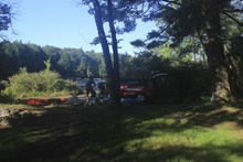
The drive went well... half way through it though the AC crapped out. Not ideal when you begin a road trip that will see you driving for ~56 hours in 80-90 degree humid heat. I assume that is what the VSC light is for. I still haven't had a moment to take the car in yet. Anyways, taking turns driving through the night, Chad, Steve and I took turns at the helm and arrived just after sunrise to the take-out, a beautiful little bond with pine trees growing off of rocky promenades in the center of the body of water, and with steam rising and engulfing every inch of the void between us and the last rapid of the run. At that moment, I felt like I was on vacation... car troubles be dammed. Hope for rain and perfect flows be dammed. Disappointment of altered end destinations be dammed. The three of us were on vacation, and not at work. We were going to get a week of rivers that I never thought I would get while living in California. I was going to sleep on the ground, drink beer, go to sleep early or late... whichever I wanted with no regard of early meetings or errands to run in the morning. In that moment, I let go and embraced the moment.
We quickly took our bicycle off of the car and set it in the woods near the take-out before heading to put-in. Arriving at put-in we were surprised to find some 10 cars all camping at the put-in. WE could tell that they were not running the Moose... so we quietly went off to scout the first falls a bit, to see if it was stupid low. Later we found out those folks did a few laps the night before and were planning on heading north to the Raquette race that day. But we found that out a day later. For now, we hiked around for a few minutes as they packed up and hit the road. We then geared up, and slid into the water around 9 am. The first falls is the main reason to do the run at the low (non-release) flow. In such cases, the river is only runnable to the first dam. This means that you don't get Agers, Crystal, or Magilla. But do get Razorback, Fowlersville Falls, and Double Drop. One thing to note, if the guidebook has info that says careful for a pothole that has caused a fatality at low water, take note. Don't drop in and pin... yea, lesson learned on that one. Close call for Chad.
Ok, so, quickly running the river, we found ourselves at take-out at 11 or so with the bike shuttle still to do. By noon, we were loaded back up and making the 45 minute drive to the Beaver. That would be an eye-opening experience... from the solitude of having the Moose to ourselves to full blown Beaverfest, I began to wonder if the New York leg would be worth it.
Next: NY and Quebec 2016: Day 1 Afternoon - Beaver (Tayrlosville)
Thanks to Chad Christopher for sharing some pictures from the trip!
Mi 0.2:
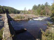
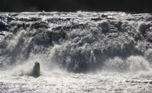
- Fowlersville Falls (IV+). This run starts off with a bang! At release flows you want to go far left. As flows drop multiple lines open up, we started middle and ended far right. At release flows, you want to avoid the middle at all costs. Scout from the left before putting on.
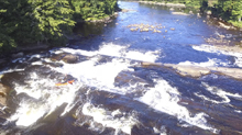
- Boogie (III). A small boogie rapid ended with a ledge or an s-turn depending on which line you choose.
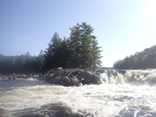
- Funnel (III+). Just around the corner began this nice bedrock drop. A small rapid led to it down the middle and then there were eddies on the left side at the lip from which we were able to scout. The easy line was down the far right which was a nice slide. There was also a boof line on the far left.
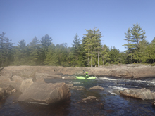
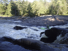
- Knife's Edge (IV+). After a big of mellow paddling, the bedrock tightens again and you are greeted by a few small class III rapids before this bigger drop. You can scout from the middle island at low flows. The right side is junky at low flow, you want to drop off with right angle pretty far right. Being left would be bad. Note, the pothole in the exit pinned Chad... and we later find out that in 1987 someone pinned in that spot and died. There is a sneak around the whole rapid in the left channel, on the otherside of the island.
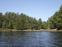
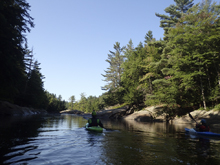
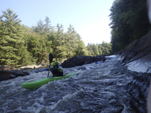
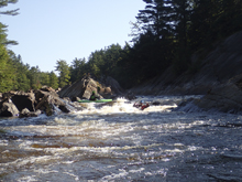
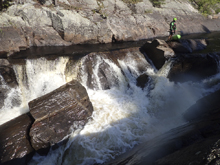
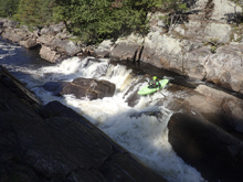
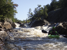
- Double Drop (IV). Pretty straight forward at our flow... enter right moving left. And exit any number of places, we chose the middle boof. At higher flows I imagine the holes become stickier.
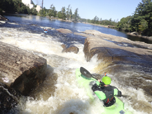
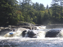
- Optional Take-out. We took out on the left on the far side of the pond, just at the dam. This is normal if it is a non-release weekend
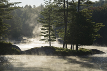
- Ager's (III). An easy 18 footer....
- Surform (IV+). Long and busy...
- Powerline (III+). Read and run...
- Crystal (V). Damn I want this drop. It looks so cool. Multi-move and big. Sigh
- Take-out. People either take out above or below Magilla, on the right.
- Magilla (IV+ to V). An easier right line exists with a slide to a 15 foot falls. Or the main middle line is a boof into a tight spot on an exploding landing zone. Looks interesting. Needs an additional dam release for flow to be present apparently.
- Compression Falls (V). Needs high water... sketchy drop apparently.
Take-out: From Utica, head North on NY-12 for 39.1 miles. As you enter the town of Lyons Falls turn right onto Franklin St followed by an immediate left onto River Rd. In a quarter mile turn right on Laura St (route-39) and cross the Black River. After 0.8 miles turn left on Lyonsdale Rd (route-39). Follow this for 0.4 miles to Shibley Rd, turn left and cross the Moose and then turn right to get to the parking at Magilla. In full disclosure, I actually didn't use this take-out as we were only able to do the upper half. If the damn is closed to drive over, take Kosterville Rd in on the North side of the river.
Put-in: Go back to the Southern side of the river and turn left on route 39 (Lyonsdale Rd). Follow for 2 miles. This leads to the upper take out (for non-release days). Or continue up the road for another 0.3 miles before turning left onto Hunkins Rd which you will follow for 1.1 miles before turning left onto Fowlersville Rd. Follow this for 1.5 miles to the parking just before the bridge over the Moose.
HTML Comment Box is loading comments...
