Middle Fork of the Yuba (Plumbago)
| Stretch: | Plumbago Road to Our House Dam |
| Difficulty: | Class IV to IV+ |
| Distance: | 13.8 miles |
| Flows: | 600-2,000 cfs. If Our House has flow below it, then add 600 cfs and that should be the flow above Our House. Current Dreamflows "Our House" gauge |
| Gradient: | 68 fpm (The goods are still only 77 fpm). |
| Put-in: | Plumbago Road |
| Take-out: | Our House Dam |
| Shuttle: | ~30 miles either way (1 to 2 hours one way). Need 4-wheel drive car with clearance of a 4-Runner as a minimum. |
| Season: | Winter from Rain, Spring from snowmelt |
| Written: | © 2010 |
| Featured in Video Twenty-Nine | |
Finally after several years of trying to motivate a group to do into this run, I succeeded. As Saturday morning began, my group was set at 5. Soon, two more were accompanying. Within minutes, another would join. Once near put-in we ran into other friends and the group grew by 4 more. Is 12 people too many when trying a 13.5 mile run that none of us had done before and had supposedly 4 portages? Meh, perhaps. In reality, we knew the big group would slow our progress so we set out and paddled quickly through the first several miles. A few hoped out to scope the first major horizon line but reported it good to go and the team dropped through. The only slow progress was made in mile 5 which will require several scouts and possibly a few portages. After that, more quick progress was made down fun read and run class IV with an occasional IV+. Although the run took us 4 hours, I think without the large group size and without a C-1er who needed to stretch often by the end of the run we could have finished the run in 2.5 hours or so.
The shuttle is the only draw back to this run. We went from Our House Dam North through Alleghany and down Plumbago Road. This road is steep in places and can be muddy. You want at a minimum a car like a Highlander or 4-Runner with 4-Wheel Drive. Due to one spot that was slick mud on a steep slope, we decided to get the cars out via the South route. Though I won the Ro-Sham-Bo and didn't have the drive the shuttle, it was reported to be very steep but on a rock base allowing for better traction. I was told that the Mercedes SUV had marginal ability to navigate the road. Doing the Southern route also opens up the shorter option of taking out at Foote Crossing. This saves a few miles of class I-II water at the end of the run. In all, we took about 1.5 hours to drive the shuttle one way taking the North Route. It then took the guys about ~2.0 hours to drive in from the North and Out from the South at the end of the day. So plan accordingly, it would be wise to get an early start. We met in Grass Valley around 9:30, got to put-in around 12:15, on at 12:45, off by 5, and all together eating pizza by 7:30.
In all, this run is very worth while. Great scenery awaits. For a class IV-IV+ boater you can expect several scouts and a few portages but will likely have to run several read and run class IV due to the length of some of the rapids and surprising nature that the drops come at you. Luckily, they are all good to go and have forgiving lines. For a class IV-V boater, all are runnable though you will likely make 1 portage. I also know of groups pushing the levels higher and going in at 1,700 cfs. They reported that the easy sections felt like Cherry Creek at those flows, though it never got unmanageable and was still good fun. I think the ~1,000 that the gauge was reading for us was a good first time flow. The rapids felt optimal though many of the in between sections felt a smidge low. I think 600 cfs would be boney though 800 would be good. Let me know if anyone finds out differently.
Mi 0:
- The first 4 miles are pretty mellow. Several class III to III+ rapids await including a very scenic gorge. I agree with whosever write-up it was who said this run feels like it is constantly on the verge of gorging up, and yet never actually does.
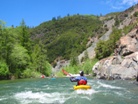
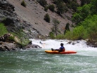

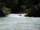
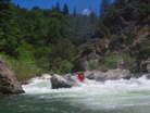
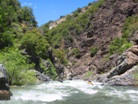
- Possible Portage (IV). An easy rapid best run down the left at our flow. Drop left, hit the cushion and you are done. Scout easily from the right though this won't show much about the line. Scouting on the left is a little harder.
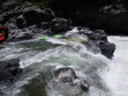
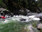
Easier rapids continue for the next 2.5 miles, mostly class II+.
- Portage #1 (IV+ to V-). Scout from the right, through poison oak or from the left though there is not really an eddy to get out at over there. A two tiered drop, the first tiered needs to be boofed as the water in the hole deflects under the undercut. A few stuffed or endered boaters were seen here our day. From there, drive to the ledge hole below. Don't go far left as there is a bad hole, but you can boof any where else. Just left of the rock there is a ramp that is a good line but there is a rock in there to find. The portage was on the left and involved going across a small shelf on the rock and seal launching in from 6 feet. As flows come up I would imagine this one getting worse.
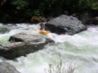
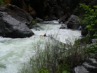
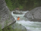
Avoid the Sieves on the Right (III). We went right, I know, the name would lead you to think otherwise. Maybe the rapid changed since the last write-up was made. A nice tongue leads to a small hole. Eddy out on the right below.
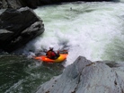
Portage #2 (V+). Ok, so this one was pretty nasty. A ramp led down into several holes with several pin or smashing rocks in the middle of the stream. There was a small eddy right at the lip on the right that made the portage on the right very short. Jonas ran this drop but was so successful that he inspired the other 12 of us to walk.
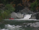
Portage #3 (IV+ to V-). Before you quickly bend left just below the last rapid, get out on the right for a brief scout. The entry class III is a quick S turn and there are is a small eddy on the right if you drop into this. The line is not clear if boat scouting. You want to boof the right entry ledge and head right to exit over a small drop. The rest of the rapid is pretty rocky though hero lines do exist. As flows come up this rapid would certainly get harder.
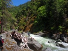
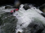
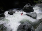
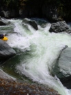
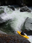
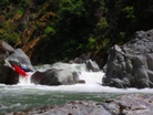
Tree Duck (III-). If the tree moves this is nothing. But as it were, it was entertaining. Duck the tree and immediately get your nose over the hole. Harder than it sounds as we had two boaters spend some surf time in it.
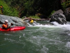
Alices's Rabbit Hole (IV to IV+). Such a good rapid! The river gets nearly completely blocked off with willows, find a clean route in the middle. On the other side you will find yourself very abruptly dodging holes and rocks with some very fun read and run class IV.
Lead in to Triple Drop (IV). Some fun read and run class IV leads you to a right turn and small moving section of water before a large looking rapid. By the time you scramble into eddies you will be scared (since there are no good eddies to scout from).
Triple Drop (IV to IV+). Run the entry hole either down the right or left. There is a good eddy you can hop out in on river left to scout the end of the rapid. The end bends right and drops into a big hole and then splits around a rock. The hole is friendlier than you would think and either side of the rock is good to go.
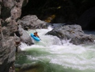
- The next 3 miles have many good class III to IV drops with a few in there that approach class IV+. The goods basically continue until you get to Foots Crossing.
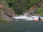
- Hang On For the Ride (III+ to IV). A sweet ramp that just whites you out amidst the exploding waves. So good, scout on right if so inclined.
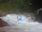
More fun in between stuff.
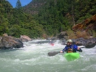
- Ledge (IV). A good size drop ends in a split river wide ledge. One in our group dropped over the right and took a swim. The easiest line was down the ramp on the right.
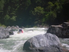
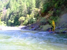
Air Time (IV-). Somewhere in here was a super sweet boof. A small channel to the right of a house size rock led to a submerged rock standing tall in the water. We all boofed the crap out of this for some good airtime. I think this is described as a wrap rock to inflatable craft enthusiast.
- Foote Crossing (III). Two more fun class III rapids in quick succession. Read and run stuff. From there the run is class II at best.
- Take-out
Take-out: From Nevada City, Take 49 towards Downieville. After 20 some odd miles (look at a map) you will cross the Middle Yuba. Continue about 4 miles and at the sign for Pike City and Alleghany, turn towards Pikes City. Follow this road 4 miles or so to Pikes City. A quarter of a mile after the fire station (on the left) and at a 35 MPH sign, turn right on a one lane road and descend a mile or so down to the river, park at the gate.
Put-in: To get to put-in from either side 4-wheel drive is needed plus clearance of an SUV. From the North (described here) you will also need dry roads. I didn't drive when they went south, but just look at a map to figure it out, it isn't hard, is much rockier meaning it is better when wet but also requires more concentration while driving, though a 4-Runner is still ok.
Get back to the road to Alleghany and follow it to Alleghany. Just on the other side of town (just past the mine on the right) turn right on Kanaka Road. Follow this, at one point a road leaves to your left, stay right and descend down and over the creek climbing very steeply on the other side. Keep climbing. In the first flat there will be an over grown road on the left, pass this and continue to the next flat spot at turn left on the road marked "OHV." Continue climbing until you get to another clearing. Take the second of two successive right's. The first is hard core OHV, the second has a sign labeled "German Bar 5 miles." Take that one. Follow this road down to the river.
HTML Comment Box is loading comments...
