Middle Fork of the Stanislaus (Donnels)
| Stretch: | Clarks Fork Bridge to Donnels Dam |
| Difficulty: | Class IV-V |
| Distance: | 3.7 miles (plus 2 on the lake) |
| Flows: | 400-1,000 cfs inflow to Donnels. Current Dreamflows gauge |
| Gradient: | 137 fpm (the goods are closer to 165 fpm) |
| Put-in: | Clarks Fork Road Bridge |
| Take-out: | Donnels Dam |
| Shuttle: | 23 miles, 10 on crappy dirt road, bring an SUV or Outback (1 hour, one way) |
| Season: | Spring and Summer from snowmelt |
| Written: | © 2009, 2013, 2015 |
Where should I start? This has got to be one of the best class IV-V runs in the state. The scenery is leaps and bounds above any other run I have ever done, it makes Giant Gap and Burnt Ranch look like the Lower American. The granite surrounds you and rises high above, only the trees lining the forest block your view of the mammoth Dardanelle mountains that surround you. The view as you look down the final gorge, shear walls rising from the river with a large granite peak in the distance down the straight away, will leave you breathless. But be aware, catch your breath, for that gorge will surely leave you breathless from exertion. The final gorge has 3 distinct sections to it, all linked into one rapid via class III-IV moves between them. The section is no less than a third of a mile and the biggest of the moves is at the bottom. What a rush, I only wish I had my wits about me to look around a little as I was screaming down the rapid.
Once you are done with the rapids, you are dropped (literally) into the lake. Normally I am not a fan of lake paddles, but the 2 miles on the lake are actually an added bonus in my mind and worth doing the run if for no other reason that to see the huge granite cliffs surrounding you to accompany several waterfalls falling directly into the lake. The most impressive of which is Little Niagara Falls which is a three tiered falls that drops some 700 feet into the lake. The paddle takes you along the base of a thousand foot vertical cliff that is literally vertical and drops straight into the depths of the lake.
Finally, once you are done with the paddle across the lake, you walk over the dam, looking down the 291 foot tall overhanging lip, then along the spill way towards your car until you look back and see one of the most majestic views I know of. Sure it is manmade, but well done man!
So enough ranting and raving and to some actual specifics for those who are looking for more substance to the description. The Stanley/Holbek have the put-in listed as the Clarks Fork Road Bridge. In reality most choose to put in upstream either at, just above, or just below Brightman Campground. This adds the final 2 miles (and only worthwhile miles) of the Dardanelles run. Adding the add-on miles makes the run long enough that you don't feel so bad about having a 1 hour each way shuttle on a crappy dirt road. Furthermore, I honestly don't even know why those miles are added to the Dardanelles run. The rest of Dardanelles is class III-IV with 2 mandatory portages, then Brightman Campground, and the bottom drops out from beneath the river and doesn't stop until the final drop into the lake 6 miles downriver. Anyways, I would highly recommend putting in up here if you are going to do the run, it makes for a complete day.
So when you put in at Brightman, or nearby, you will come to a huge log jam, if you don't, it means that the huge log jam has washed away and there is likely going to be wood in every rapid for the following several years. Let's hope this doesn't happen anytime soon. After that you will have a short warm up before all at one the river drops and continuous class IV+ rapids continue unabated to just below Clarks Fork Bridge. There are a few sections that are worth catching an eddy and scouting. Our year one set of drops had a large curler just above two very dangerous log jams that strained the majority of the river. We were able to run right of both, but in future years I offer no promises. At our level, ~825 cfs we portaged the drop just below the bridge as it looked like the chances of ending up in one of the cracks was pretty good. After that the river eases up to continuous class III and eventually eases further to class II. It will be obvious when you get to the gorges as it starts with a portage around a steep and boulder strewn class V+ drop. After that, the class IV and IV+ rapids just continue. The river is absolutely continuous and rarely offer recovery pools, instead after several sets of rapids there may be recovery eddies. Great fun though. We scouted 4 or 5 times including one near the end that required walking down the whole gorge along a thin shelf in the rock wall, a third of a mile to see the final drop of the absolutely continuous and perfect gorge. After that, there is a ledge drop, a boulder garden, and the lake drop before you are ready to start some flat water sight-seeing. I would say half of our time on the river itself was spent from the final gorge on, in other words in the final mile. The final gorge could be portaged, but it would be a long and high above the cliffs. To portage on the scouting route is possible, but is also exposed and with lots of brush and boulders to climb around.
Your first time down, you will want to give yourself plenty of time. Setting the shuttle the night before is a great idea. It really is at least one hour each way, no joke. We put-on at 10:30, had already run the first 2 miles the day before, and had two people in our group that run everything 2 weeks before. We still scouted 4 or 5 times for the pair of us that hadn't done the run and still hit the lake around 3:30. Then added with the one hour paddle across the lake, the 30 minutes looking over the dam, and 15 minute hike to the car, and the hour drive back out, we weren't at put-in again until 6:00. Also, we had 825 cfs and thought it could have used a smidge more, though our 825 cfs was much lower than 775 cfs that Larry had a year ago, so the gauge can be all over the place.
For comparison, I thought this run was on par with the difficulty of 49 to Bridgeport on the South Yuba at 700 cfs. There weren't as many class V, but the continuous nature of the class IV to IV+ made it challenging and consequential.
Anyways, I can't recommend this run more. An absolute gem, sure you have to work for it, but in my opinion it makes the day that much better. You really walk away feeling like you saw something special that day. Great run. Great day.
Also, for some great historical footage of the dam's creation in 1957 see the tri-dam project's website. It has footage throughout the survey of the valley and construction of the dam, very interesting to watch. There is also the number there to find out if the roads are open and it is often displayed on this page.
Chris Tulley sent this opinion my way..."I would compare the run to a cleaner lovers leap or spicier sierra city or shorter S Feather. 49-BP is ok difficulty comparison wise but Donnels lacks many of the one move rapids and recovery pools of S Yuba. I think that a group of class IV or IV+ boaters could get in over their head in there real quick. Especially has Med to high flows."
Thanks to Mike Ward, Ben Carter and Ian Buckley for contributing lower water photos, the portage looks much better with less water.
Update 2013: In 2013 I got to get back on this run and we had a little less water. In all, it made the run a little easier and less linked up. Also, the fact that the we had a record low snow pack year, the lake was really low and we got to boat an additional gorge. Yippy!
Update 2015: Thanks to Will Boyer for providing some updates on the wood situation.
Mi 0:
- Crack (IV). We actually portaged this, it looked to need a little more water to make the boof more of a sure thing. It was a knife's edge to not fall into cracks on either side. It occurs just downstream of the bridge.


Boogie (II+ to IV-). There is some boogie that continues for a little ways. It gradually gets easier until it is continuous class II+.


- Portage (V+). Half way through the mile, you will notice the walls tightening. Across the gorge were several trees, we ran around them, boof a hole and got into the eddy. The hole was not big but flipping in it would have resulted in being swept into the portage. The portage itself has a nice ramp between rocks that leads directly into another rock buried in the pillow. If it weren't for that rock it would be much more runnable. At lower flows you can put-in one eddy down and run the drop with greater ease. Portage right.


From there, there are a few easier III+ and IV- rapids before you get to the Class IV+ section of river. The only rapids prior to the gorge that stuck out in my mind were the two we scouted.


Right then Left (V- to V). A sticky ledge hole to enter, then cut left to avoid the rock pile in the middle. Then cut back right to hit the window in the massive hole. The run-out was class IV read and run down the middle. The right side was horrible looking and when one in our group didn't make the move left, flipped and took a beating on all the rocks. Very lucky to be alright. While we were chasing that person, another in our group entered the drop to help and got surfed badly in the entrance while no one noticed and had to fight hard to get out... It took us a few hundred yards to get to the boat. Either the rapid went easily or not easily at well, so I am not sure how hard it actually was, did I get lucky? The photo from below shows only the bottom three quarters. Scout left.


Lots more class IV to IV+ sections.


- Left then Right then Left (IV+ to V-). Boofing the ledge drive right into the curler pushing towards the midstream rock. Then boof the shallow rocks and punch the holes. Exit on either side of the pour-over below. Scout left.


Lots more class IV to IV+ sections.
- Gorge (V). 0.4 miles of gorged out goodness. We entered right driving right over two ledges. The left has a large hole and is followed by another pour over. (Update 2015 The left has a tree in it making it unrunnable, this has been here since 2013). The second step was a smear on the far left wall. Then there was a little boogie around some holes, In the middle of the boogie is the one and only eddy in the gorge, catch it on the right or blow by. The final 100 yards is boogie that leads to an 6-8 foot ledge into a large hole that flushed us all through. Eddy out immediately right just below the house sided rock as there is another big drop just downstream. The scout is on the right, work up the slab and follow the top of it just beneath the wall. This went down to the water where we hoped in and waded across the lone eddy and finished the scout below. You can also go high above the cliff which would be easier if you have a boat on your shoulder. We were blue angels on it so no photos of boats in the drops, thanks to Kevin Smith for contributing the final ledge picture.


Ledge (IV+ to V-). A 4-5 foot ledge lands on rocks, there is a thin line to avoid the rocks or the completely boxed in on all sides holes. From there run out the remaining two holes. They made it look easier than it seemed to be, maybe it is only IV+. Scout on the right.


Boulders (IV+ to V). We entered in the middle in a shallow channel and swung around the left. From there we boofed the center ledge which led to a small channel between rocks. We followed this channel down to the right where there was a double drop with sizable holes. Scout on the right. Update 2015 There is now wood in the center boof making it unrunnable until the wood clears.


Into the Lake (IV+ to V+). Depending on the flow, lake level and wood, this can either be a fun s-turn into a ramp, a huge hole, wood filled, or horrible gorge (see the low lake level photo). Scout on the right.


Normally Underwater Gorge:
-
Into the Lake (V+). So... at the low lake level, this rapid grows in size. The ledge gets taller and hole meaner. Then it goes off a slide that piles into rocks and sieves and has a thin line far right. Totally hairball... but runnable.
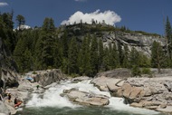
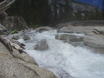
Boof (IV). A small lead in best run left moving right leads to a super clean boof. There is a small eddy on the left before the river goes off the next junky rapid. I would recommend scouting before dropping in.
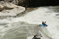
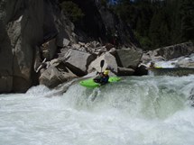
Blinds (IV+ to V-). The left side was sieved out. The right was juicy and led to a piton rock in the middle. Scouting though is hard. I climbed up the cliff a little and got to the lip, but still couldn't see. I think I should have gone higher. It went just fine, just start center and move left.
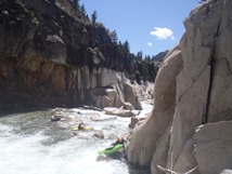
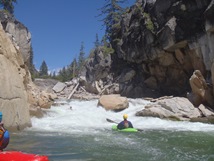
Exit (IV). So, not the hardest rapid... but a dangerous one. There was a tree blocking the right left exit. I dropped over a small hole and eddied directly in front of the log and the only other exit on the right. Note, half of the right side actually drops into a sieve. Not in play unless you pile up in that eddy if for say a log was blocking both channels. Again, scout before dropping in perhaps or with binoculars from the overview off of the Highway!
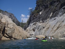
Take-out: 10 miles or so West of the Donnels Vista on Highway 108 (or about 30 miles East of Sonora), take Beardsley Road. Follow for exactly 1.0 miles and turn right on the dirt road that has a gate on it. This is 5N95, the sign is 50 yards down the road. Follow to the T and turn right on another gated dirt road, 5N09X. Follow the 10 miles or so to the fence. Park there, it is a 3/4 mile hike to the right side of the dam itself. If these are closed, there is also a hike that can be done but I am not sure the road on that one, the hike would also be heinous.


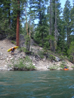
Put-in: Get back to Highway 108 and head East. Take Clarks Fork Road and drive the mile or so to the bridge of the Middle Stanislaus. Or continue up another mile or two to Brightman Campground to the turnouts above and below the campground for the extended run.

HTML Comment Box is loading comments...
