
Middle Fork of the Salmon River
| Stretch: | Shortly below Dagger Falls to Main Salmon confluence |
| Difficulty: | Class III at most flows, with two class IV drops (one on Main Salmon) |
| Distance: | 100 miles (including 4 on the Main Salmon), 5 to 8 days |
| Flows: | 700 - 6000 cfs. Current USGS mile 34 gauge |
| Gradient: | 27 fpm overall, 40 fpm initially, 23 fpm below Indian Creek |
| Put-in: | Boundary Creek Ramp |
| Take-out: | Ramp at Cache Bar on the Main Salmon |
| Shuttle: | 210 miles (4.5 hours) one-way, some on dirt roads |
| Season: | spring into late summer, from snowmelt and springs |
| Written: | © 2006 |
| Featured in Video Twelve. | |
For information on rafting the Middle Fork of the Salmon please check out (click for link):
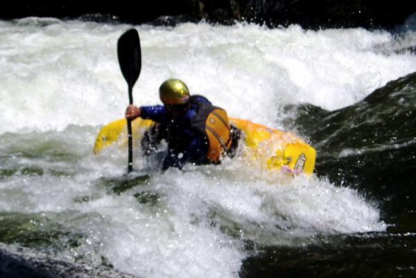
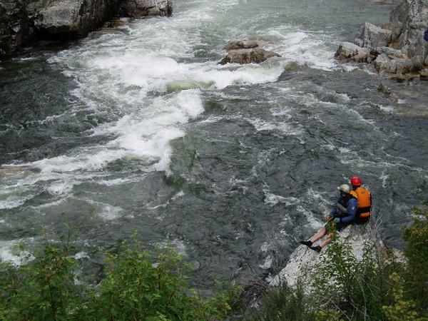
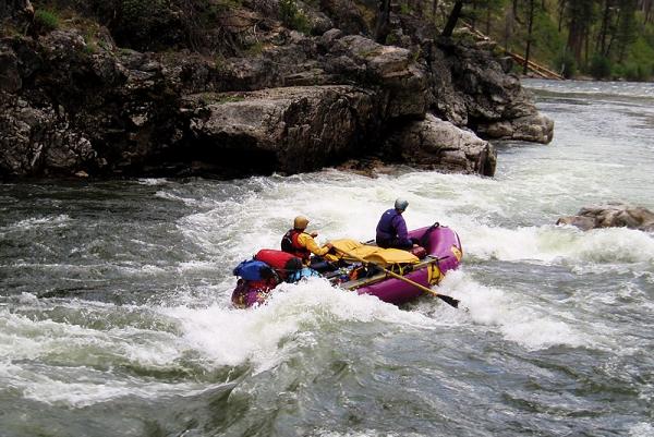
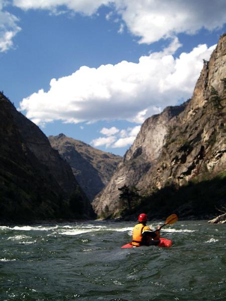
I did this run with Diane, her family and some friends. This run should not be done if excitement is your cup of tea, instead it is a peaceful float that should be shared with enjoyable people. With that said, my trip made me aware just how important a good team is, and how after a week on the river how a few annoying people could be a downer. With that said, I didn't enjoy the first and last two days of whitewater, along with the first two and last two days of scenery. The middle two days were a bit uneventful. The gorge where Tappan Fall is located was a nice break from continuous class II and let the blood flow again, but the second and third day are no joke continuous class II with hardly even a plus being put on. There were some nice creeks you can hike up to creekboat, along with many nice hot-springs. The hot springs were nice in the afternoon as the afternoon thunder storms rolled in but not so nice early in the morning when it was hotter than a stove. With this all said, I don't think I am going to go out of my way to kayak this run again, it just wasn't good enough for the money cost and time cost. We had 3.8 feet on the gauge and from what people said it was as easy of a flow as it gets, so who knows, maybe if it is near five or six feet it may be more interesting. So anyways, without further ado, here is the trip as it was for my group.
Update 2018: OK, so, I just read this blurb now 12 years later... man, I really let the few folks who drove me crazy affect my overall view of the trip. I think I did expect more class IV, so I think that the fact it was mostly III also surprised and perhaps disappointed me. I also think I may have just been a little ungrateful at the time. So let me try this again.
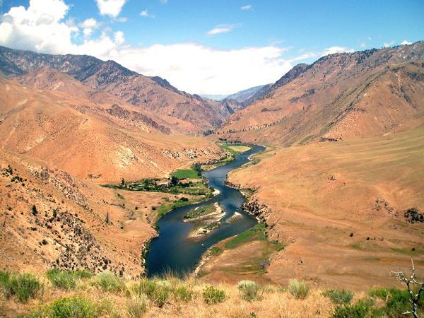
This trip actually has a soft spot in my memory now 12 years later. The very first time my (now) wife invited me over to meet her family, we all sat around the dinner table, her dad asked me if I knew about their older daughter... I guess he wasn't a huge fan early on, and we talked and got to know each other a bit while all filled out applications to the various Idaho lottery rivers. As it would turn out, Diane's mom would win the Middle Fork Salmon permit. The trip formed with a few random people, some raft support which Beth arranged, as well as a few random kayakers. The raft support would turn out to resent the kayakers a little, and Diane and I doing out own thing in our budding relationship would also draw the ire of one of the kayakers. But that is the negative. The positive is much more powerful. I always speak fondly of this trip, which is why the negativity in the above section suprised me in reflection. I remember three sets of special scenery. The first few days being alpine in nature, the middle days more rolling hills with beautiful views from above if you fancy a side hike, and finally the termination days in the impassable canyon. That canyon is something else, hikes up to towering waterfalls which you stand under in awe. It is truly a journey through quite the various ecosystems. One of the things that I think is special about this river, is that it is 4-6 days long but still accessible to a wide range of skillsets. You don't need to be a class V expedition boater to enjoy this one. You can be a class III-IV boater and experience living on the river for the first time. There really arent that many rivers in the US that maintain a consistent difficulty in this range over this sort of distance, unbroken by roads and access points. So anyways, fond memories. I will be back... I look forward to the day that I get to share this river with my children... and perhaps a less random group of people (i.e. friends this time) who I know will share the river in a great way.
Mi 1:
- Ledge (III-). Somewhere in this area there was a nice ledge on a left turn, it
looked intimidating from above, but as it turned out it basically all went, with
the exception being the dead center which looked a bit shallow.
Lunch was had on a straightway on the right side, not a beach though because we were resituating a raft.
- Sulfur Slide (III). Just after a left bend, there is an entrance rock, I went right
of it then there are holes and rocks which have to be read and run, there are many
lines.
- Ramshorn (III-). A straightforward rapid with powerful weird eddy lines, I entered
center and went left which worked well.
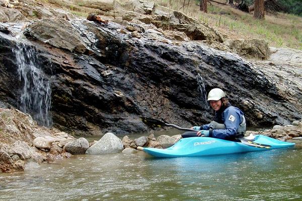
- Velvet Falls (III+). A fairly straightforward drop, the idea is hug the right wall
or head left onto the pillow forming off the left shore. You want to avoid the
center as it is a macking hole.
- Powerhouse (III+). This is a long rapid with many holes to avoid. I entered center
and working right for the partial bend. From that point, I moved left a little for
the run out.
- Scout Camp. There is a trail just up the embankment which heads downstream to a hot
springs. The main springs are not that great but apparently there are a number of
pools below the main one, some of which are classics apparently.
- Pistol Creek (III+). After a right bend you will see the river split around a small
island. To the right there is a sneak which may be a bit hard to get too. Just to
the left of the rock island is a large hole. Above the left channel is a curler
wave and some strong eddy lines. WE hit the curler wave and then road the eddy line
around the hole. In hindsight, (once we looked at it) the hole looked ok to go into.
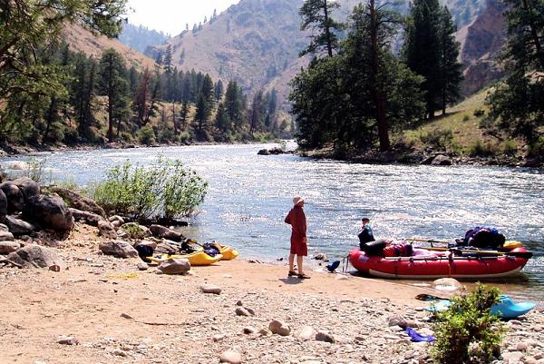
Lunch was had just after Pistol Creek Rapid at the creek itself on the left shore, a nice spot.
- Marble Creek (III). A nice surf hole backed up by a large surf wave in the center.
For rafts it was best to scoot right and try to hit the seem between the large wave
and a smaller hole to its right. Kayakers have eddy service on the left but eddy is
hard tog et into and a short twenty foot walk was usually needed for each ride.
Marble Camp #2. Just down and around the bend from Marble Rapid on the right. A nice camp but camp #1 would be much better for kayaking as it is right at the wave so you can surf up to dinner, then again after, then again in the morning with no hassle at all.
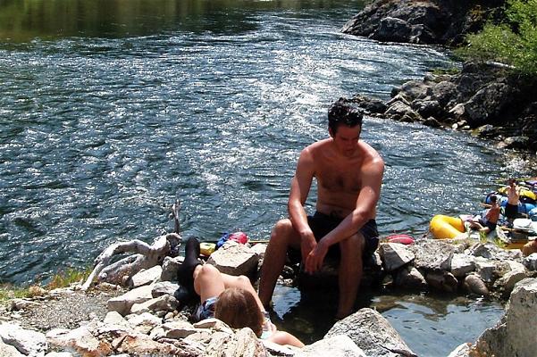
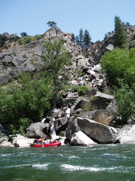
- Sunflower Flat. Hot-springs on the right side. Made up of 4 or 5 small pools, the last
of which has a bark plank coming out of it making a natural shower for those down at
river level.
- Jackass Rapids (III-). There was a hole followed by a lateral which was then backed up
by a pour over, the idea was to get left of the pour over.
- Whitey Cox Hot-Springs. On a big bend with a nice large eddy on the right, park on the
right beach and hike up to a nice large hot springs.
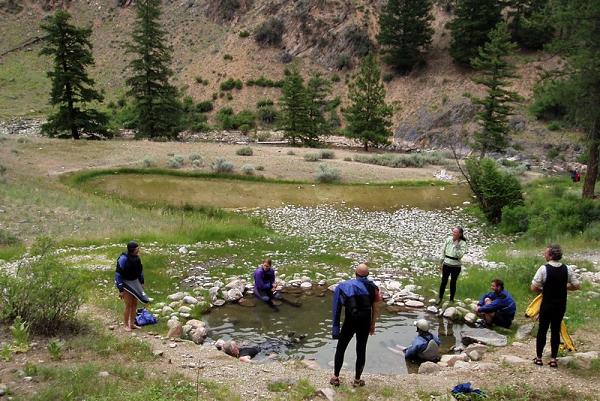
- Cow Camp. On the right bank in a long and narrow stretch. Very cramped camping, but a
nice hour hike across a ranch, down to the creek, up the creek and up to a hot springs
(Loon). Loon Creek also looked fine to kayak, class II+ or so.
- Hospital Bar Hot-Springs. This spring is located on the left side just before a large
campground backed by a small hill on the left. If there is highwater this springs wont
be there as the source was only 4 feet out of water with 3.8 feet, and the pool was a
mere inch out.
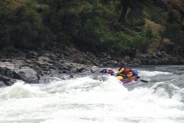
- Tapan I (II). At our flow this was a basic wave train.
- Tapan Falls (III+). A large wave train, supposedly holes at lower flows is best run right
of center. You can go further right and sneak it a bit. Downstream 50 feet there is
another large hole which we "surfed" in.
- Tapan II (II+). There were some tricky eddy lines caused as the water moves around a
midstream boulder, the water then moves back left out of a cove.
Tapan III (II+). Just downstream, Tapan III looks worse from above than it is. You can either run down the right or left side, there are small holes as you exit.
- Camas Creek. Camas Creek comes in on the right side just before a turn, it is a fairly large
tributary and has a nice beach just before it. You can hike up the trail (upstream side of
the creek) and run this fun class III- creek.
- Apareja (III-). A cascading rapid, there are some holes on the right at the bottom, at low
flows the right side would prove to be rocky I think.
- Sheep Creek Camp. Kind of a dry camp, no eddy surface for our off day, the only way we were
able to keep ourselves occupied was by hiking up the peak just downstream of the camp.
The creek we had hoped was kayakable, but was not.
- Flying "B" Ranch. Fill up on reasonably clean water, ice cream, ice and ridiculously
expensive beer. Located on the left side of the river.
- Haystack (III-). Apparently this rapid used to be more difficult, now there are many routes
around large boulders. It is located on the first turn outside Flying B Valley.
- Jack Creek (III-). The gorge has many decent rapids, boat scout easy.
- Rattlesnake Cave/Creek has pictographs on the right side of a left turn.
There are many good class III- wave trains in this stretch.
- Big Creek. Big Creek comes in on the left. The creek itself has some fun kayaking on it and an easy trail
to access it. As far as the surrounding stretch on the Middle Salmon itself, there are
numerous III-.
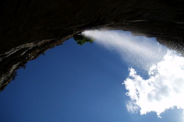
- Veil Falls is high up on the right cliff. A "hike" up the boulder field is worth the effort as
the view from below the falls is amazing.
- Redside (IV-). A right to left zig-zag is made around rocks with large holes or eddy lines.
- Weber (III). Large wave train with a hole on center left.
- Ship Camp on the left provided a long sandy camp to end our trip with. One of the best on the
trip.
There are more rapids from here down that I never wrote down and didn't ge to typing in until 2 months later and have forgotten the details of.
- Cliffside Upper/Lower (III-). The river turns twice piling the water against rocks. It is
not hard to stay off the cliff walls.
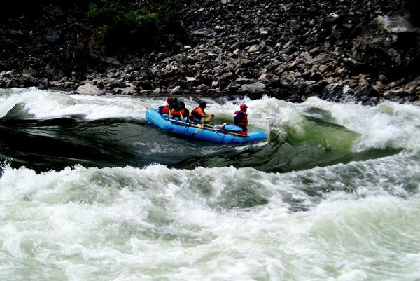
- Rubber Rapid (III+). This rapid had some large and tricky hydraulics that had to be hit.
We ran the rapid down the center of right side into an area that didn't look all that great but
worked out just fine.
- Confluence with the Main Salmon River.
- Cramer Creek (IV-). I do not believe this rapid to be actually class IV, but it is impressive
and scary as the volume is huge with the addition of the Main Stem. If you run it center right
into the main waves, the consequences are negligible hence it is not quite a class IV in my
mind, but for pucker factor I give it IV-.
- Take out on the right shore at the boat ramp.
Put in: From Boise we took 55 Northeast to the town of Banks. We did this so we could kayak on the South Payette on the drive up, also if the water were lower you could do the famed class V North Payette at the same time. At Banks we turned towards Lowman on Banks-Lowman Road. Once in Lowman we turned East on 21. 37 miles past Lowman take the Bear Valley Road which has a large dirt entrance lot to the road. At the rest area turn right on Dagger Falls Road and continue on this to the put in. Everything once you get off of Highway 21 is dirt, usually good dirt though.
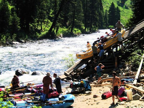
Take out: Use a shuttle service to take care of this for you. It is a 4-5 hour drive one way to run the shuttle.
View Middle Fork of the Salmon River in a larger map
HTML Comment Box is loading comments...