Middle Prong of the Little River (Tremont)
| Stretch: | Confluence to the Institute |
| Difficulty: | Class IV (gets harder as flows come up) |
| Distance: | 3.2 miles |
| Flows: | ~3.3' to ~5' on the Little River at Townsend (~1m> on Tremont Gauge). Check out American Whitewater's current flow gauge. for the Little. |
| Gradient: | 231 fpm for the upper section, 151 fpm average for the lowere |
| Put-in: | Lynn Camp Prong and Thunderhead Prong confluence (end of the road) |
| Take-out: | Tremont Institute |
| Shuttle: | 3.2 miles, 5 minutes one-way. |
| Season: | Winter and Spring, rain... maybe after a huge summer thunderstorm |
| Written: | © 2015 |
| Featured in A Wet State #97 and in A Wet State's contribution to World Kayak's Video Guide | |
What a great run. If nonstop class IV moves that get pushy as flows come up is your cup of tea... then pack your bag and head this way. We got this little section two days in a row, the first at a medium low flow and the second with more water, perhaps a medium-higher flow. I thought that with this style of river, the higher flow of course draws a limit on the type of boater wanting to get out here. Although only a one or two rapids actually become any harder, they are pushier, more continuous, and less forgiving. And I can see that at high water this run would be a step harder still. But as it was... damn! So much fun!
Putting in at the confluence of Lynn Camp and Thunderhead Prongs the river quickly picks up speed to the first rapid at Staircase. Below, is one boof or slot after another for a non stop 3/4s of a mile down to the bridge which offers lap potential or an alternate put in for those who might not want to bite off the whole meat of it. Below, the river turns into non stop class III with an occasional class IV set... with the crux being "Stop Sign" which is a great long rapid starting with some nice slides and feeding into a macking hole. This is one I am glad to have a boof for as the hole is mean, it will backender you and then beat the snot out of you. Set safety / scout from the road on the left. Downstream a few more nice slidey sections and a few fun rapid sets keep you busy all the way down to the Tremont Institute.
The only thing I can compare to this run is West Walker or Coffee Creek in California. Those are the only two rivers with this sort of continuous nature in the state. However, this is sustained at a harder pace than either... it is just so good. I guess y'all will have to travel to the SE and experience it for yourselves!
Mi 0.0:
- Put-in (III+). A nice hundred yards of boogie leads to a right bend with a boof on the left side of the main channel. This then puts you above the straight away leading to Staircase.
Staircase (IV). Staircase has a long boogie lead in around either side of an island, left carries more water. In March 2015 we had a wood portage in the class II part of the lead in. the river then constricts and then gets wide. Stay far left. Boof a nice shoulder boof on the left edge of the river and then work your way right to punch a few holes and catch an eddy on the right. A flip here would sorta suck due to the hole just downstream.
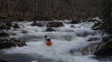
Staircase Exit (IV). The exit of staircase has a river-wide ledge that is best boofed far right. It is sticky but a nice ledge allows you to boof over it on the right. Just don't blunder down the left unless you want to on purpose. You can now eddy right before the final chute or straight shot it. Just go just to the right of the midstream boulder and angle left to avoid some rocks.
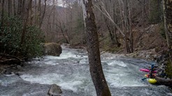
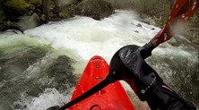
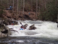
Boulder Island (IV). At the end of the straight away below, the river splits around several truck size boulders that form an island. Going just to the left of them has a nice clean ramp followed by some fun hole dodging. Below, some more read and run comes to a log jam that has been present for several years. The jam is obvious and easy to portage on the right, eddying out just in front of the logs.
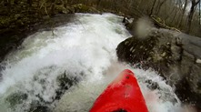
- Fang (IV-). Just below the log portage you enter a cool long rapid. The first part is sorta shallow with a few nice holes, just read and run it. Then the river bends left and you see a flake forming a hole, you can go to the left around it and then work back right for an eddy above a small horizon. The line on the horizon is to be in the right channel, and cut back in behind the boulder moving left. You can boof the fang but the rock is gnarly looking. Fading off left is better for the longevity of the boat!
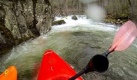
Finale (IV). I think this is probably the hardest rapid, or at least it can be depending on the line. After a nice section of boogie, you can either catch and eddy far left above the crux move or straight shot it. There is a ledge that you can bang down right on (safe and easy) or you can boof the left edge of it. Boofing the left edge is threading the needle between landing on rock (boof too far to the right) or getting pushed towards a sieve (boofing too far left). But if you thread the needle right you can land and use the edge of the hole to move you back to the right and punch a few nice holes amongst large boulders (don't be upside down).
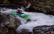
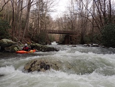
- Bridge (III). As the bridge comes into sight, just work down the left side and finish far left due to a f-u rock at the bottom.
This is an optional put-in to take the teeth out of the run. Plus you can hike back up to the top easily and run a bunch of laps.
- Stop Sign (IV). The big one on the bottom section has a hole that deserves respect... but is also a great boof for those who are confident. A nice lead in slide can be run down the middle with the final boof being run straight off the middle. At higher flows the line will change as the hole is super mean.
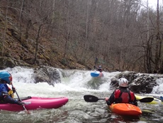
Spruce Flats Prong (IV-). Just downstream from Stop Sign, a nice waterfall drops in from the right and the river has some nice ledgy drops and slides. I just remember going with the flow here.
The river tapers off but a few nice drops still await, but I don't recall any other class III+ or harder rapids.
For more details on the run, see the AW write-up
Take-out: Heading East out of Townsend on US-321 continue to the Y and turn right (turning left takes you up the Little River Gorge). In about 100 yards turn left on Tremont Rd to continue up the Middle Prong. Continue for 2.0 miles until you see the Tremont Institute on the left. There is a nice parking area across the road on the right. For an alternate take-out, you can continue 0.8 miles father and use a turn out on a tight bend in the road. There are other turn-outs that are riverside as well, but this one covers all the good rapids.
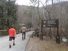
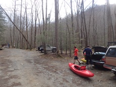
Put-in: From the Institute take-out, continue up Tremont Rd. In 2.3 miles you will get to the lower put-in when the road crosses the river. To access the Upper put-in, continue another 0.8 miles to the dead end and park there.
HTML Comment Box is loading comments...
