Middle Fork of the Cosumnes (Upper)
| Stretch: | Sopiago Creek to Rocky Bar Road |
| Difficulty: | Class V to V+ |
| Distance: | 3.6 miles |
| Flows: | 150 - 850 cfs. Current Dreamflows gauge |
| Gradient: | 227 fpm average (The gorge is 420 fpm) |
| Put-in: | Sopiago Creek |
| Take-out: | Rocky Bar Road |
| Shuttle: | ~15 miles, bad dirt road, 4-wheel drive recommended (30-40 minutes one-way), plus 30 minutes hiking to put-in |
| Season: | Winter from rain and a short spring season from snowmelt |
| Written: | © 2010 |
| Featured in Video #37 and videos by Stephen Wright, Nick Troutman and Jared Noceti | |
Until last year this run was never on my mind as something I may want to do. I had known about the run ever since I first saw it in a Cali Product video, and always thought that it looked ridiculous. Perhaps that is due to the water levels that they use to run it at, I have heard it was upwards of 800 cfs (compared to the normal 200-350 cfs that folks run it at these days). Things changed last year when Darin invited me on the run and I psyched myself into it and made myself believe that if I were in the right mood and fired up, I could go big and portage everything. Well, that day we ended up running Golden Gate and I waited for another day that I might feel the desire to go big.
Flash forward a year, I am sleep deprived from too much business travel, I am tired and looking forward to sleeping in and running some class IV. Then the phone rings and Darin invites me yet again on the run, perhaps too tired to fully comprehend what I was saying I said sure. Later Darin even said that he was surprised he didn't have to do any convincing. I guess I was too tired to play hard to get if you will. So anyways, around this time my heart beat began to pump, the butterflies in my stomach began to fight with each other, and I slowly became 8 hours more sleep deprived.
The next morning, too tired to call and cancel I decided I would wait until the opportune moment to back out. I figured if I waited until we got to put-in there would be a limited amount of time for them to talk me out of my choice. As we arrive at put-in I realize I am losing my nerve to lose my nerve (if that makes any sense) and I begin to get excited for the sights I am about to see, the rapids I am going to walk, and the sleep that will be oh so fine after a hard day of portaging.
Well anyways, the day ended up being a huge surprise. Not only did I not sleep well the following night (nor any night since due to a very badly bruised tailbone I received due to miscommunication with my feet on the way into the Box Canyon on the Sacramento the following day), but I actually ran every drop that is not a mank pile portage. I know, you are gasping in surprise right? To my surprise I found this run to be a solid step down (at low water) from Golden gate (also at low water). However, if you are not going to run the big drops, the in between on the Cosumnes is much more mank filled than Golden Gate. So if you are not going to run the big drops, be prepared to see an amazing canyon, but do not expect to run classic drops.
In parting, I will say that although this run is a lot of work, despite the hike into the canyon and the 4 or 5 portages, this run is well worth the effort and I am eagerly looking forward to my next run down the "UMC." Though I am going to look for similarly low water (we had 240 cfs) as the eddies would get a bit small for my taste over 300 cfs. I should also state, that although I do not rate the individual rapids all that hard, the run has plenty of sieves and the first miles drops some 400 feet. It is no place to be swimming and the continuous nature of the river demands a class V mindset.
Thanks to Darin McQuoid for his contribution of photos. Also check out his write-up for many more great pictures!
Mi 0:
- Slides (IV). No warm up here, slides start 1.5 feet downstream of the put-in. The third slide of the set lands you into a decent size hole. All of these would be larger and faster with more water. We then eddied out on the right.

Down the Right (IV+). A fairly clean boulder garden run down the right side for a ways.
Slide (IV+). The first big and clean drop presents itself. We boofed in through the middle channel and headed slightly left. You go through a hole, over a ledge, and down a slide into the pool below. Great fun and no real need to scout if someone knows which slot to boof into.

Right to Left (IV+). A fun rapid with a few ledges as I recall run down the left. Eddy out left as the next drop is a portage. Once you eddy left, ferry right and hop out of your boat.
Tony Hawk (P). What used to be one of the best rapids on the run was ruined when a log dislodged itself from the main drop. Now instead of water pushing up and around the log and sliding down the wall, the water just drops into a bad pothole. Walk on the right. Bring good shoes as this portage is a little sketchy. At the base of the portage, paddle across the pool and hop out on the right.


Portage (Mank). It has been run, but most just walk on the right. Before putting back on, scout the next drop.

Left-Left (V- to V). The first of the big rapids. This one is best run be ignoring the right side of the second drop. What you want to do is wall slide the left side of the first drop, landing with left angle. This will insure that your momentum will take you to the left on the next drop which is a nice sliding 12-15 footer that is best run on the left with your nose pointed slightly right.


Boof (III). A fun boof in the center. Boof the right side of the rock, avoid the temptation to boof the left side of the rock to the right as it lands on another rock.

Slide (III+). A slide into a good hole can be avoided by hitting the rock in the center and skipping right over the hole. This is where the step mank begins and the part of the run that makes me nervous to think about.

Down the Right (IV+). Go over the rock ledge boof to the right. Immediately move back left and avoid as many of the rocks as possible. Eddy-out right.
Left or Right (IV+). With more water folks cut hard right, boof right at the entrance. Stephen however found we lacked enough water and pitoned followed by pinning. The rest of us banged out way down the right through some mank and into a boxed in hole.
Boof (V-). We boofed the first four foot ledge on the left and eddied out left to boat scout the lip of the next drop. The fun 10 foot boof had water pushing lateral across the lip, but boofing the center was straight forward and great fun. There were a few small holes just downstream followed by an eddy on the right. The water keeps moving past it into the next rapid if you have problems.
Don't Mess This One Up (V-). So the rapid is only a class IV+, but the fact that even at low water you only have a roll attempt or two before being pulled into a sieve portage makes this rapid one of the most nerve racking in my mind. The river bends hard left just below the Boof. You want to be on the right side. The river splits around a rock in the center of the river and drops you against the right wall into a hole. Run through it and try to stay upright. Get into the eddy on the right to portage.
Portage (Sieves). Portage right and put in just above the rapids run-out. The rapid at the end of the small pool is a big one.
Skate Park (V to V+). One of the classic UMC rapids. Boof off the peak of the ledge. Sometimes you will not get your head wet, other times you will melt through and pop up half way down the rapid. A few holes are then dodged before you slide down another 10 foot drop into a friend hole (at low water, at high water this hole gets some teeth). Eddy out.


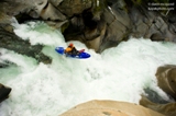

Portage (Mank). Easy portage on the left..
Boulders (IV to IV+). I vaguely remember a few boofs and a boulder bar or two. On is directly down the center moving right. I flipped when I pitoned the bottom drop into the hole.
Lar's Holbek Drop (V). This has got to be the most blind waterfall I have ever seen. The slopping nature of the drop leaves you completely unknowing as to where you are launching from. At the low water you can drift up to it slow enough to spot the general area of desired take-off. Make sure whatever the level to get your nose up as there is a shallow rock somewhere in the landing that have ruined a few boaters' days.


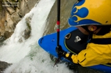
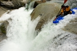
Brace For Your Face (V). A short pool leads to one of the junkier rapids that is often run on this river. A short slide leads to a 90 degree turn and a steep drop. You don't want to be left as it lands on a big rock so you just stay right and plug on through. At higher water the entry pushes hard against the rocks at the top making a clean line a little harder and therefore the rapid more dangerous. There are a few rocks just downstream of the landing that give the rapid its name. Just downstream is the last rapid of the canyon.

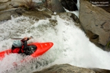

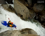
Maurier Left (V- to V). This rapid use to be called Transition Rapid as it is where the steep canyon widens and the pace slows dramatically. You want to head down the left and wait longer than expected to move left away from the massive undercut before ending in a slide. Moving left too early often results in a piton and less than clean finishes. Luckily plenty of people go into the undercut and pop up unscathed.

- Easy But Junky Stuff (III-IV). The rest of the run full of inconsequential rapids that are all read and run with the exception of 3 or 4 drops.
- V-Slide (IV+ to V). A small low angle slide leads to a steep slide with two fans of water coming in from either side resulting in a challenge to get your nose up. At low water the entry was much slower and the hole much more tame, but either way, once the hole has you it rarely lets you go while still in your boat. Luckily the swim is into a nice large pool.


- Blue Angle Slide (V- to V). Two distinct slides separated by a short corridor of moving water. The first is easier but still flipped me, the second starts with a very large hole before sliding down another 10-15 feet. At high water this links directly to the next slide. At low flows there was a nice large pool here.
Cheese Grater (IV+ to V-). Not a place to be upside down. Boof onto the slide heading right and keep heading right, sliding down the 20 or so feet to the 90 degree turn. At this point, all the big and fun rapids are done.

Undercut (IV to IV+). In the boulder bars comes a rapid that pushes you towards the left wall that contains many sieves. Just downstream is a good undercut that a few people have gone under and popped up well downstream. After this rapid, the run is basically done so enjoy the white iceberg looking rocks that appear and enjoy the memories of the day.

Take-out: From Sacramento take Missouri Flat exit off of Highway 50 and turn right on Missouri Flat Rd. After 1.7 miles turn left on Pleasant Valley Rd. After 5.2 miles turn right on Bucks Bar Rd. After 4.8 miles you come to Mt. Akum Road, turn right. After 2.9 miles take a left turn on Fairplay road. Take your first left on Perry Creek Rd. After 3.5 miles turn left on Slug Gulch Rd. Continue for 1.1 miles and turn left just past Vineyard View at the unmarked dirt road that looks like it is a driveway to a house. Darin has a great picture of this turn on his website. Follow this dirt road staying on the largest most defined of the roads. You will need a 4-wheel drive car to navigate this road as it is washed out in many places.


Put-in: No Longer Kosher Get back to and continue driving up on slug Gulch Rd. After 2.3 miles turn left on Omo Ranch Rd. Continue on Omo for 1.1 miles until you reach Mill Rd. Darin actually says it is Indian Diggins Rd but I think that road is actually only on the right, on the left I think it is Mill Rd. Either way, I wasn't driving so look for either sign. Continue it down what is residential so please go slow. At the Y go left and park at the gate. This is private property but the owners have been very welcome though also very nervous about the growing popularity especially during fire season. Though we of course wouldn't be there during fire season but that is besides the point, please respect the folks by keeping your music quite and your speed slow. Thanks. From the gate, walk down the trail about ¼ to ½ a mile. Once the creek is next to the trail, hop into the creek and float ¼ of a mile on the water until there is a drastic change in gradient. Get out on the right and follow the trail down the cascading creek to the Middle Cosumnes, Plan on the hike taking 20-30 minutes and also plan on getting poison oak. In 2010 the locals at put-in decided they didn't want us on the put-in road. I have yet to go in the river right side but am told the directions are easy to figure out on google map. Or check out Darin's directions.


HTML Comment Box is loading comments...
