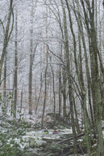
Lynn Camp Prong
| Stretch: | Kick Yer Dog Falls to Confluence |
| Difficulty: | Class IV to V |
| Distance: | 0.45 miles |
| Flows: | ~3.0' and rising to ~4' on the Little River at Townsend (~0.7-0.8m on Tremont Gauge). Check out American Whitewater's current flow gauge. for the Little. |
| Gradient: | 400 fpm |
| Put-in: | Above Kick Yer Dog Falls |
| Take-out: | Confluence of Lynn Camp and Thunderhead Prongs |
| Shuttle: | Hike 0.5 miles, 15 minutes one way. |
| Season: | Fall, Winter, Spring, and early Summer from rain |
| Written: | © 2018 |
| Featured in A Wet State #150 | |
The plan was to head out after work for a lap on Thunderhead and Tremont. We all anticipated the flows to be juicy. The rain had been falling all day, the Little was going vertical past 3.9'. By all accounts, that should be a healthy flow on Tremont. As Diane and I drove past the West Prong of the Little, I noted it seemed to be carrying much more water than the Middle Prong that "Tremont" lies on. As we get to the gauge on Tremont, I find 0.8', which I know to be on the low side of good... as in, just barely worth running. Jim talked doubt into my mind as he stated the gauge changed, however, I think it changed before our moving here. Anyways, as we drove up, we saw plentiful water falling in via tributaries like Spruce Flats Branch. By the time we got to the top, everyone was in agreement that in fact Tremont was somehow low despite everything around it popping. I wonder if it was the snow that was landing at high elevation, or perhaps we missed the peak on it. Whatever it was, Thunderhead Prong was way too low, so we looked at the other put in tributary, Lynn Camp Prong. I had never hiked up to see the falls, so it seemed like it would be fun to check out.
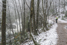
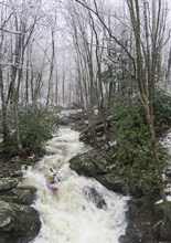
What we found was a healthy, but still runnable, flow on the falls. I decided it wasn't for me at that flow. I haven't been feeling super strong lately, so instead, after taking some photos of Jim, Caleb, and Trembly running it, I put on below the falls for the worthwhile in their own right rapids between the falls and the confluence. A few hazardous spots exist, but those rapids are much less serious than the falls, but still IV to IV+ in their own right. I thought that this is an interesting alternative for the days when Tremont is just medium or medium low, to add some rapids. I am not sure when I will go back up there, but it is worth doing, even if you don't run the falls.
The other exciting news from this day, just as a side note, earlier that morning Diane and I had our second ultra sound and found out that Baby Brasuell is going to be a girl! So, yea, great day I would say!
Mi -0.2:
- Double Drop (?). I know there is a double drop another quarter mile or so up the trail, but we did not go all the way up there so I am uncertain what it is like. I know Jim ran it solo and not Kick Yer Dog a couple years back, so it must be easier than the falls.
- Kick Yer Dog Falls (V+). One of the biggest rapids in the Smokies, this drop is the real deal. There are two parts, the entrance ledges which end in a non-vertical falls that you want to run right, and then the final ramping falls that you again, want to run right. It is all easily scoutable from the trail, safety is good on the top non-vertical falls as it can pack a good size hole, as it is on the bottom slide in case anyone flips at the bottom and is unconscious.
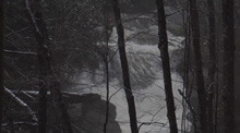
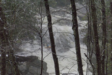
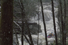
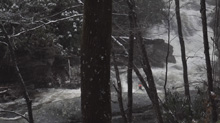
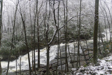
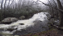
- Shoulder Boof (IV). This drop isn't terrible, it is short but it has had wood in it for years so the line must be hit correctly. The river goes down, and pillows up on a shoulder before slopping off to the left into a trough. The trough has had wood, so you need to get on the shoulder to boof and stay right throughout the trough.
Slide (IV to IV+). Immediately below is the next drop of note. A small tier is run left of center before it then drops off an off angle ledge and onto a slide. It is fast and dynamic, run far left of center. This then lands on a slide which fans off left and right from the center peak. Our day there was bad wood on the left, and mellower wood on the right, so it was imperative that you stayed high on the slide.
- Confluence Rapid (IV+ to V-). This rapid isn't all that tough, but it is manky and hard to clean. Scout it from the bridge on the way up. Basically run down and try to boof right of center and clear the rocks on the left while trying to minimize the impact on the right shore's rock as well.
Take-out: Heading East out of Townsend on US-321 continue to the Y and turn right (turning left takes you up the Little River Gorge). In about 100 yards turn left on Tremont Rd to continue up the Middle Prong. Continue for 4.3 miles until the road dead-ends. Park there. (Realistically, you are going to likely continue down to the Tremont Institute back 3.2 miles).
Put-in: Cross the foot bridge and bear left, going straight would take you up the Thunderhead Prong. So, go left and walk the 0.45 miles up to Kick Yer Dog Falls. It is a decommissioned forest road so the hiking is easy.
HTML Comment Box is loading comments...

