Little River (Terminus)
| Stretch: | Co Op Rd to Sweet Peas |
| Difficulty: | Class 0 |
| Distance: | 2.8 miles |
| Flows: | If the lake is low, you will want a few hundred cfs in this gauge. Lake level max is 813 ft elevation, you can get current level here |
| Gradient: | ~0 fpm average |
| Put-in: | Boat Ramp at Co Op Rd in Rockford |
| Take-out: | Boat Ramp across from Sweat Peas on TN-33 |
| Shuttle: | 1.8 miles, (2 minutes one-way) |
| Season: | Year Round |
| Written: | © 2020 |
So, this is the first of the Aster era new runs. It has been a year since my last PFD, after averaging 27 a year for the past 10 years. I guess having a kid makes it tougher! Plus having to cancel vacations due to Covid. Oh well. Enjoy the new phase of class 1-2 whitewater that will be getting added to the site :)
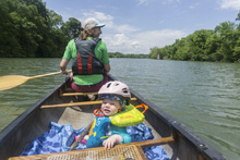
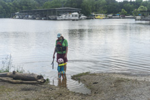
OK so, this was Aster's first day on the water just one day shy of her first bday. There are no rapids, so there is nothing to worry about there. If the lake level is low you will get current for more of it, as it was when we did it, it had current to the first corner and then became a lake paddle. It was pretty though, several little islands to paddle along, most of the development you see on google earth is not visible due to thick greenery, and for us we were also racing a thunder storm. Anyways, it was a nice point to point paddle with a very short shuttle, so it was a nice day out for us. And, overall Aster enjoyed it though after a mile she wanted to climb over the wall of the canoe into the water... which of course we would not allow. And she did not appreciate that!
Just one note, there is a low dam 1.15 miles above this put in, which is below the next put-in above this. So, be warned... don't paddle the dam!


Take-out: From Knoxville, head south on US-129 for 5.0 miles. Turn left onto TN-168, AKA John Sevier Highway. Drive another 1.0 miles before turning right onto Old Maryville Pike followed quickly by another right onto TN-33, AKA Maryville Pike. Follow this for 1.0 miles. When you see Sweet Peas on the right, go another 100 yards to the far side of Stock Creek and park at the public boat ramp.

Put-in: Continue another 1.8 miles to the boat ramp on your right.

HTML Comment Box is loading comments...
