
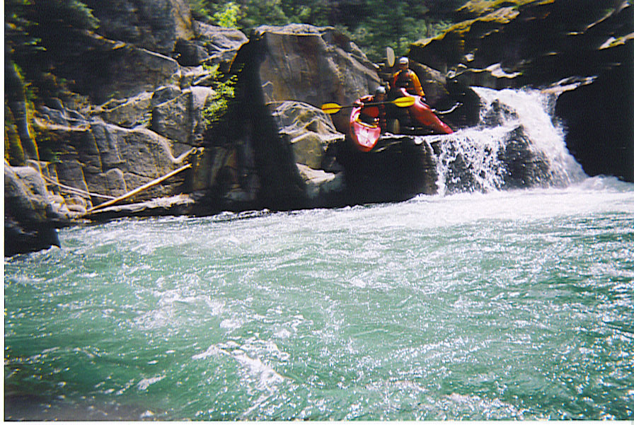
Lavezolla Creek
| Stretch: | To Downieville |
| Difficulty: | Class IV with one portage |
| Distance: | 3.5 miles, half day |
| Flows: | 150 - 300 cfs. Current Dreamflows (est) gauge |
| Gradient: | 120 fpm |
| Put-in: | Lavezolla bridge |
| Take-out: | Confluence of Downieville and Pauley creeks |
| Shuttle: | 5 miles (10 minutes) |
| Season: | Winter and Spring, from snowmelt |
| Written: | © 2004 & 2006 |
| Featured in Video One. | |
Recommend: Run with Pauley Creek on a double header.
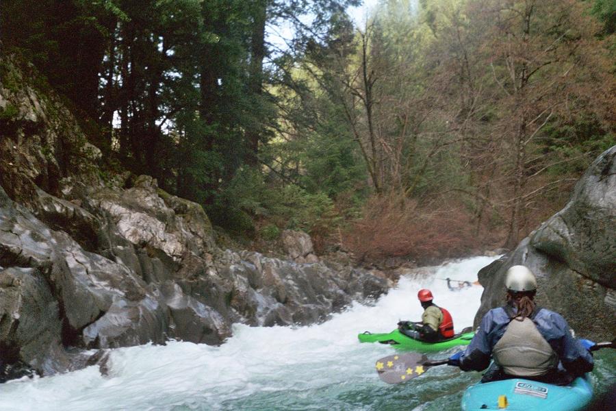
This was a great creeking run, steep drops in quick succession involving maneuvers. The best part of this run however is its proximity to Pauley Creek. This is a great morning run to be followed by Pauley in the afternoon. For only being one ridge away from Pauley, the river's style is drastically different. Instead of river wide fifteen- foot drops, Lavezolla has half-mile stretches of drop after drop, all of which have multiple routes, some being safer while others being more fun. Logjams are definitely a hazard on this run so exercise caution around blind corners. The scenery on this run is excellent, you feel completely secluded and are surrounded by the greens of the forest and moss through its entirety.
Mi 1:
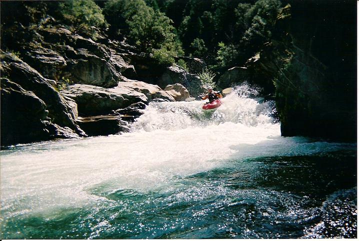
- Granite Gorge (IV+). The first big rapid on the run, a horizon line with two apparent
drops, upon scouting two or three more drops come into sight around the corner.
It is easier to scout on left but the last two drops are hard to see, so a precarious
scout on the right may be needed.
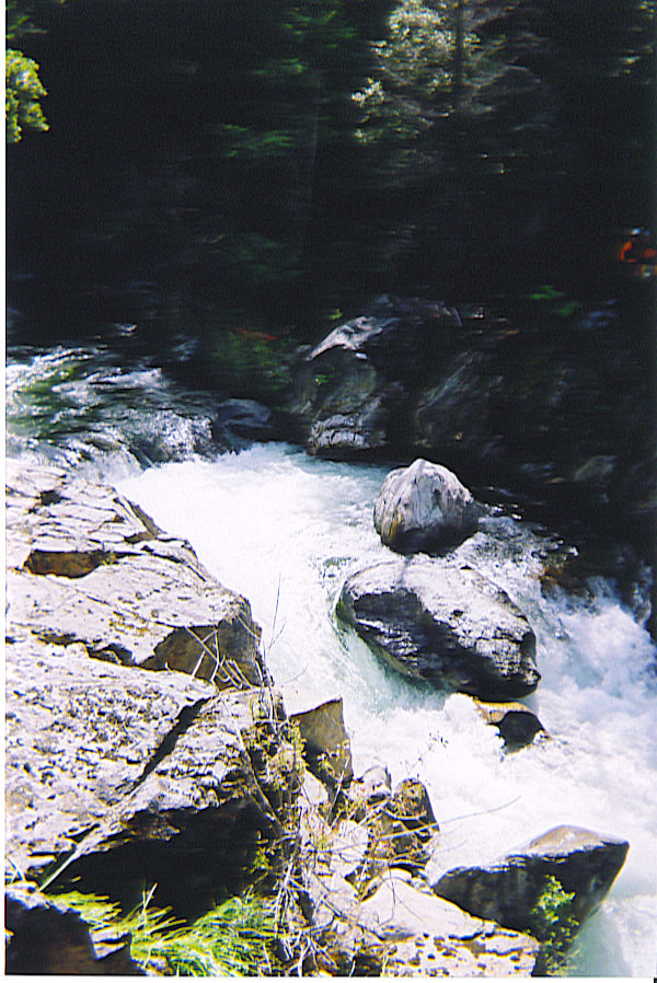
Boulder Bar Boof (IV). About a half mile later the river enters a boulder bar rapid. There is a large eddy on the left just above the steeper part of the rapid, scout from the left bank. The crux of the rapid is just to hit the large pour over hole straight in order to boof over it, a melted boof could cause a difficult swim.
Caution: There is steel debris in the water just past "Boulder Bar Boof." Swimmers could face severe consequences if not able to get an eddy or rescued before the debris. There is a small opening on center-left of the debris.
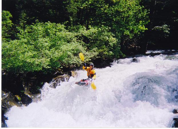
- Double Drop (IV). The river splits into two channels for the initial drop. The left drops
into a corral, the right slides down into a two-foot drop. The creek then pours over
a rock. On the right there is a undercut rock with a nasty hole. Hit any part of the
drop left of center.
The Crack (V). As our D.A.R.E officers taught us in elementary school, crack is whack. So this is a Portage. The river bends a sharp right turn over a gravel bar, eddy out on the right. There is then a three-foot drop, and twenty foot pool, then "The Crack" itself. If you end up in the pool, at lower water levels there is a small eddy directly above and to the right of the drop, however this is not a recommended target. Portage on the right bank, lining may be needed if you are in doubts of your balance.
Take out: Supposedly it is possible to hike up the embankment at the Pauley/Downie Creeks confluence and to the Waterworks parking as in the Pauley take out. Or you can take an enjoyable paddle though the small town of Downieville and take out on river right just after the confluence with the North Fork of the Yuba.
Put in: 100 yards past the Second Divide as described in the Pauley Creek, the road descends and crosses Lavezolla Creek. You can put in here or people have driven further and put in further up.
View Lavezolla Creek (North Yuba) in a larger map
HTML Comment Box is loading comments...