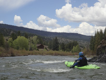
Lake Fork of the Gunnison River (Box)
| Stretch: | High Bridge to The Gate |
| Difficulty: | Class I to II |
| Distance: | 10.9 miles |
| Flows: | 500 to ~3,000 cfs (would probably be harder at the high flows). USGS Lake Fork of the Gunnison River at Gateview gauge |
| Gradient: | 33 fpm average |
| Put-in: | Recreation Access at High Bridge Gulch |
| Take-out: | The Gate Campground |
| Shuttle: | 9.4 miles, (12 minutes one-way) |
| Season: | Spring off snowmelt |
| Written: | © 2021 |
-
Colorado Road Trip 2021: Day 7 Aftenroon
This run was reported in the book to be 11 miles of class III. So, since the “Canyon” section was spot on with its class III-IV rating we had high hopes for the box and the rapids within. While the scenery was very special, I would hardly call it a box and I would hardly call it more than class I to II. There was for sure, out 750 cfs, not a single instance of class III. Furthermore, I could only imagine it being class III at really high flows as at a few short stretches the river does bounce from wall to wall, which are all a little undercut, and I could see the boils and reactionaries becoming an issue. But, that is the nature of running rivers at very high flows.
So, would I recommend this run? Sure, with the understanding it is mellow. I would take Aster in a ducky on it if it was a warm day and I had warm clothes for her. That would be a great way to see the river. But for what we were expecting, it left us a little disappointed. On the bright side, we literally had no better options so it isn't like we had Fear of Missing Out or anything.
Be on your toes though, there are private property signs all over the place, and one barb wire fence that we had to duck on the edge just barely clearing under it. At high flow this could be an issue.
After the river, we drove up and over Windy Pass to a hail storm and decided to push on a little further to drop down past the Upper Rio Grande, towards Creede to camp in slightly warmer weather rather than up above 10,000 ft.
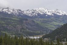
Note: This was a class I to II run, so I am not going to describe rapids. Just general sections.
Mi 0.1:
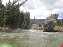
- First Gorge (II- to II). This first few miles is the most consequential of the run. The river bounces off shear walls which are all undercut and holding the occasional pocket or sieve from a wall side rock fall. The moves are very basic to avoid them, anyone with any river experience should have no problems. The only thing I could see is if the water gets high, perhaps having boils present would add another layer of difficulty to negotiate. But, at this flow the section was mellow but the scenery spectacular. Worth doing once just for the scenery in these miles!
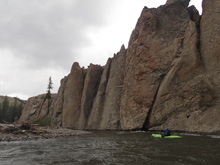
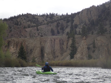
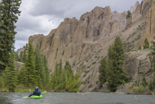
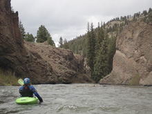
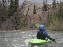
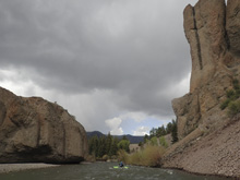
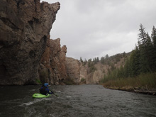
- Walls Back Off (I to II-). After a few miles the shear walls with undercuts stop and you have wonderful scenery and mellow rapids. Keep an eye out for fences as we had one barb wire fence to duck when we were there.
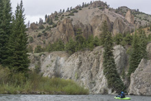
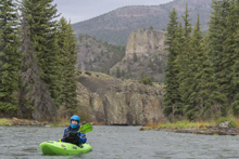
- Small Dam (II). OK, so not all class I... but this is the exception as I recall. It is immediately after the bridge. In any other state you would take out here. But, in Colorado there is no easement under the highway and barbwire preventing access to the river at the bridge. So, keep going...
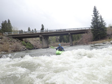
Boogie (I to I+).
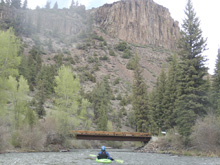
Take-out: From Gunnison, head west on US-50 for 9.5 miles. Turn left onto CO-149 at the top of Blue Mesa Reservoir. Continue on this road for 28.7 miles. Turn right to drop down to the campground, park just outside the campground entrance.
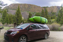

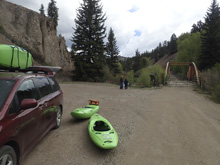
Put-in: Continue upriver, south on CO-149 for 9.4 miles. Look for the steeply descending dirt road to the access at the closed bridge.
HTML Comment Box is loading comments...

