Klamath River (Hell's Corner)
| Stretch: | Frain Ranch to Stateline |
| Difficulty: | Class IV to IV+ |
| Distance: | 5.9 miles (or up to 16.5 miles) |
| Flows: | 1,700-15,000+ cfs. Current Dreamflows gauge |
| Gradient: | 69 fpm average (31 fpm above Frain Ranch / 22.5 fpm below Stateline) |
| Put-in: | Frain Ranch |
| Take-out: | Stateline River Access |
| Shuttle: | 6 Miles (45 minutes one-way - rough dirt road) |
| Season: | Year round off of release |
| Written: | © 2011 |
Have you ever been grateful that for the most part our sport is not like that of many other adventure/extreme sports? The Bro mentality present in snowboarding, or the territorial nature of surfing? In my experience, the professional level boaters that I have met have all been some of the nicest people and certainly very friendly whenever they are encountered. Even when spotted on rivers far below their ability, most are eager to embrace conversation and share their enthusiasm in boating. It is one of the things I have always liked most about this sport and still amazes me. But enough of the tangent, no one is interested in my ramblings.
The Klamath has less than a full, warm hearted endorsement in the bible, something about a "warning to the unwary" and "only reason" for being included. That with the mention of a multiple hour shuttle or super rowdy 4x4 shuttle has kept me from making the 5.5 hour drive to the upper Klamath. This (2011) winter however, we are approaching the end of December and still are without natural flowing rivers. The memories of last winter are quickly fading and desperation for boating is quickly setting in. With that, as the unexpected flows on the North feather and San Joaquin dropped out, the only option for entertainment was the Klamath with its dependable release. So the drive was made under the pressuring of Darin's "But it is my birthday, so you have to come." Once at the river, we found the rapids to be fun and continuous class IV. However, due to the nature of the rapids, flipping is a big time no-no. The muddy water hides many rocks just under the surface level. Flipping would be a roll of the dice on whether you would develop an intimate relationship with a rock. Also, several rapids are over a quarter mile long. The longest, Hell's Corner, is a half mile long of non-stop action. This of course brings me to my next point, that swimming is also a non-option. Cacreeks tells a story about a raft swimmer Hells Corner which after going to the river, I fully believe (not that I didn't before).
At one turbine (1,700 cfs) I thought the run was comparable in difficulty to Chamberlain, though significantly more consequential. At two turbines, I imagine the run is a blast of big water features pushing you all across the river. I can't see the river getting unmanageable though. There really isn't a whole lot of potential for holes to form with more water so I imagine it becomes big and splashy and likely a little more consequential due to the duration that a swim would result in. We put in at Frain Ranch which is about 6 miles below the powerhouse. This cuts off those miles of flat water (class II). We also took out at Stateline which is at mile 11 of the book run, this too cuts off miles of flat water. The section in between is full of rapids, start to finish and the most bang for the buck while also simplifying the shuttle. There are lots of read and run wave trains, so I am only going to discuss the few highlights.
Mi 0.5:
- Caldera (IV+). Putting in at Frain Ranch means that after a class I riffle, you paddle across a short flat water pool and enter the gorge. This rapid is the biggest set of moves, though it is pretty open. Several lines were available, kayakers could move left or right around the large midstream wrap-rock and then finish center away from the shallow shores. Rafts would have a much harder time with this rapid as many rocks could dump paddlers are wrap rafts.
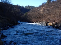
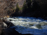
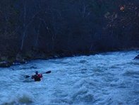
- Hells Corner (IV to IV+). This is a long rapid. The rapid starts on a strong right turn, this rapid is big splashy fun best run down the right. It lightens up for a hundred yards before you get into the main section of the rapid. Run down the center. From there you read and run through three corners. We started kind of center, then right, and then left. If you want to scout this one, it will be a 20 minute walk to see it all.
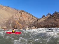
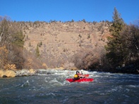
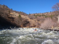
- Snag Island (III-IV). The main channel is right and is straight forward class III. The left channel braids up but recombines to a nice bouldery affair. At one turbine the left was a little boney, at two turbines I have been told it is the hardest rapid of the run.
- Stateline Falls (III). You will see a old bridge foundation on the left with a road rising up, this is actually quicker up to the car than running the rapid, but the rapid is fun. The right side is a clean ramp. The mniddle has a boof and large hole if you mess it up. The left side has a huge curler that caught me by surprise and just how deep the curler was. The take out is 100 feet below.
Take-out: Get yourself to Copco Reservoir about thirty minutes East of Yreka. Round the south side of the lake on Ager-Beswick Rd. Follow it around the lake, you can either take out at the river access at the top of the lake, or continue another 5 miles up the road to the Stateline River Access to cut off some flat water.
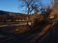
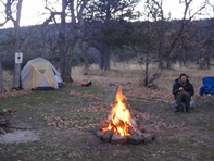
Put-in: Continue up Ager-Beswick which turns into Copco Lake Rd. This is all dirt and there are no signs. From here, the road gets really rough at time. A SUV is a must, during spring and winter, legit 4x4 are needed due to mud. Continue 2 miles and turn left at the fork (Topsy Grade Rd). In 3.6 miles, turn left at the fork which quickly hits a more major rd. Follow this road down to the meadow next to the river. To do the whole run, the shuttle takes a lot longer and involves a lot more to get to the North side of the river and to the powerhouse.
View Klamath, Hell's Corner in a larger map
HTML Comment Box is loading comments...
