Jacks River (Lower)
| Stretch: | Beech Creek to Peavine Sneed Creek Rd |
| Difficulty: | Class II+ to III (IV+) |
| Distance: | 7.5 miles |
| Flows: | No gauge. We had ~800 cfs. And a little less than 2" of rain in the previous 24 hrs. |
| Gradient: | 58 fpm average from 0.3 miles (193 fpm for the first 0.3 mi) |
| Put-in: | "Beech Bottom Trail" / Beech Creek / Jacks Falls |
| Take-out: | Jacks River Trailhead at PEavine Sneed Creek Rd |
| Shuttle: | 5.3 miles, (25 minutes one-way) Dirt Road, but in fairly good shape (my minivan made it). Bring a saw for wood falls! (plus 3-4 miles of hiking) |
| Season: | Fall to Spring, Rain fed... after heavy rain in summer |
| Written: | © 2021 |
Man, where to begin. So, typically the access to Lower Jacks is via the Beech Bottom Trail. This trail his Beech Creek at mile 3.5 or so, and hits Jacks River near mile 4, about a quarter mile above the falls and then goes down the river, crossing Beech at the confluence immediately above the falls. So, a 4 mile and change hike. The alternative is to paddle all of Jacks, which requires a 1.5 hr one way shuttle, and is 17 miles long. This keeps most people off of the river. So enter Kirk Eddlemon and an invite to try an alternate method to access the river...
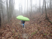
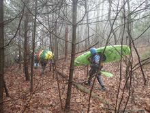
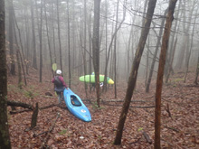
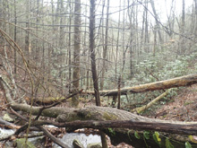
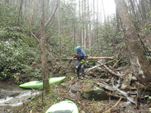
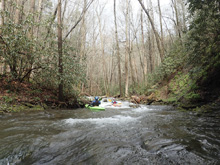
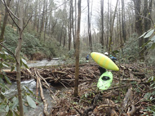
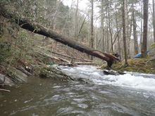
Heavy rain through the night and into the morning made it so a late start was the name of the game. I was a big surprised at 10:30 am when Kirk suggested this run. We met in Ocoee and caravanned into the woods the 7 miles or so of dirt roads to take-out. There, we consolidated and continued up the dirt road which climbed steeply the 5 .5 miles to the Beech Bottom Trailhead. 100 yards later we found the limitation of the Sienna and went back to park at the trailhead and lap up the additional 1.7 miles of road in Mary's 4-Runner. Eek. Losing time already. Once all together, we hiked a short distance on a trail before dropping down a saddle and following a micro creek to its confluence with Beech Creek. That part took only maybe 45 minutes. The plan was to paddle Beech Creek the 1.25 miles to the confluence, and that is where things began to go wrong. The creek was fully log choked. And the shore was full of debris and rhodo. We would paddle 100 ft and then portage 200 ft. And repeat over and over again. We finally hit the Beech Bottom Trail crossing and just walked the last quarter mile. From there, we portaged the falls and the group split up. Kirk and his family, and two friends to portage the rapids below and Diane and I to run the more difficult class IV and IV+ rapids. We met them at the bottom of the rapids and as we pushed off it was 6 pm. Over 4 hours since we left the put-in. So, the lesson there is just hike Beech Bottom Trail. Take a slicey boat and the hike won't be bad. Potentially at mile 3.0 you can downclimb the hill side to short cut the final mile and access the river just below the falls.
But, our story doesn't end there. After racing the length of the run, to ensure we didn't run out of light, we got to take out a mere 1:05 hrs later. That's right... all those miles in just over an hour. This river has no pools, and is non-stop class II and III, a really fantastic treat full of slides, boofs, and surf. So, now we are done, it is a bit after 7 and we load up to go get out cars at the top. Only, one mile in we find a massive new tree has fallen and blocked both parts of a switch back. We try pulling it out of the way but snap straps in the process. So, we resign to go all the way back out the town, some 30 minutes to call a friend (Joe Gruger) to bring us a Chainsaw. He is waiting for us when we hit 411 back out in town. We then go all the way back in and begin to head up the road to put-in again, while our friends are shivering in the dropping temps. When we get to the log, we find that in the 1.5 hours that has elapsed, someone has cut the log out and the road is now clear. Arg. From there, the trip went smoothly, we got the car... mine was left at the Beech Bottom Trailhead, but Kirk and Mary had to jog up to the very top to get the 4-Runner as no other car could do the last 1.7 miles. Everyone made it out though... and for us, we were home a little after midnight. What a mini-epic... on a class II-III run!
As for the rapids, I thought this run was fantastic. I would go back in a heartbeat to do the regular hike in on the trail, with my antix, and just know I wouldn't want to run the big IV+ in that boat but enjoy the surf that filled the miles below it. I think the hike to river miles and river quality fall into the well worth it category, just as long as you do not do our version of the hike in!
Mi -0.1:
- Jacks Falls (P). Its not runnable. Its huge. It lands on rocks everywhere. Walk using the trail on the right which is easily accessible at the Beech Creek confluence.
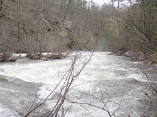
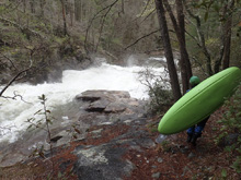
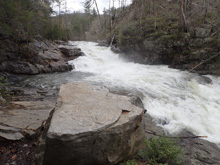
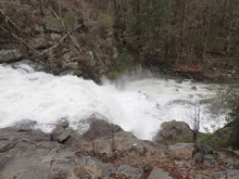
- Ledge #1 (III- to IV-). Putting in at the base of the falls you immediately get to a sticky ledge. There was a sneak in a far left channel which plopped you easily around it. There was also a boof over the meat left of center.
Little Jacks Falls (IV+ to V-). Get out in one of the small eddies on the right to scout. This is a pretty big drop and has two steps. The first step is run pretty far left in the main channel (so, just right of center between the shores). It is a step down bedrock drop that then hits a hole where the flows from either side converge and shove you likely towards the right wall. Immediately below the river spreads out over a bedrock dome and is runnable anywhere, but there are shallow spots in the middle and a bit of a hole just below where the flows again reconverge.
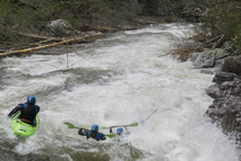
Ledge #2 (IV- to IV). This ledge has more of a low angle dam feel to it. There may be other lines, we boat scouted from the right shore and found a nice slopping spot to boof on the right to ensure we blasted through the towback.
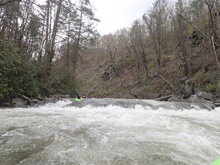
Boulder Garden (III to III+). We ran left to right down a nice boulder garden and boofed the exit on the right.
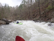
Corner Rapid (III_ to III). A straight forward rapid which we ran down the left wall and lined up to boof the mellow hole at the bottom.
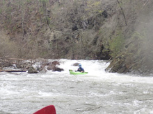
- Most users of the Lower Jacks will put in below the top set of rapids, from here the river is class II and III, with little to no pools until take-out.
Boogie (II to II+). The boogie here starts straight forward and miles tick by quickly.
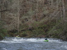
- Diagonal (III- to III). Our day there was a tree to complicate matters off the right shore. But even without the tree, this long rapid had a hole half way down that was off angle that packed a punch. You could sneak it far left if wanted, or just run through the hole!
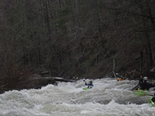
Multi-Step Rapid (III- to III). Not too far below was a nice long rapid that had a moderate hole in the middle and a bit of a boof on the right at the bottom, though you could go left around it.
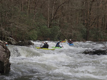
Boogie Continues (II to II+). There area few ledges throughout the run that can have sticky spots if you hit the meat. But there were mellow lines through or around all of them.
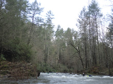
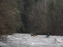
- Cool Gorge (III-). There were some nice walls and a few small rapids that were pretty cool. The rapids were mellow, but it was a unique spot.
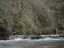
- Slide Section (III). I would say that the slides rapids in this are the hardest on the run. A few had some holes that the deep water funneled you towards, they were fine to go through but they may cause issues for a class II-III type of team. Some of the slides are nice and long, multi-tiered, and just plain and simply fun.
- Around this mileage it gets easier but still moves with plenty of entertainment value. And this is where it became clear we were for sure going to make it out in the daylight!
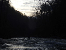
Take-out: From Ocoee, TN on 411, head south on 411 for 6.2 miles. Turn left at the Mapco Gas Station onto Ladd Springs Rd. After about 4 miles it turns to dirt. Continue for another 5.1 miles (9.0 total), eventually going up the river for the last mile to the trailhead right where the road makes a 90 degree turn away from the river.
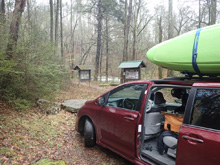
Put-in: Continue away from the river for 1.1 miles and make a hairpin right turn. Climb steeply. There are other roads on the map but they are all gated and/or super minor. So it is obvious how to stay on the main road climbing the mountain. After 4.2 miles you will crest to the parking area on the left, and trailhead on the right.
The Correct Hiking Directions: Checkout the AllTrails map for "Beech Bottom Trail". Notice at mile 3 you are directly uphill from the end of the trail at Jack's Falls. If you can descend safely here, do. If you cannot, notice at mile 3.3 you cross Beech Creek. You can walk down river right on a game trail to just above the confluence, we boated the last rapid and immediately eddied out on the right at the confluence. Or, continue for the full 4.0 miles where the trail hits Jacks River naturally. (please note, I have not hiked this trail, so the down climb may be dangerous, use your judgement. I did however walk from the Beech Creek crossing to the confluence and that is totally fine)
HTML Comment Box is loading comments...
