Jones Fork of Silver Creek
| Stretch: | Road 32 to Ice House Rd or so |
| Difficulty: | Class IV to IV+ |
| Distance: | 2.7 miles (+2 miles to lower take-out) |
| Flows: | ? 30 cfs to 75 cfs ? (need high water earlier in season than South Silver) |
| Gradient: | 177 fpm average (the first 0.6 miles are 356 fpm) |
| Put-in: | Clearing half a mile off of Road 32 near South Silver put-in |
| Take-out: | First road access |
| Shuttle: | 0-10 miles depending on the decision. Some is dirt road. |
| Season: | Spring/Summer from snowmelt |
| Written: | © 2014 |
| Featured in A Wet State #87 | |
Well Damn. Best laid plans. So I originally found this run as part of my search for a waterfall that was featured in the kayak video Twitch IV. In that video they say they have come to Cali and found a cool granite waterfall that lands in a foot of water. Finally after 8 years, when a friend mentioned that she had gone hiking over the weekend with her family at Bassi Creek I pulled up Google Earth and quickly found the lower falls on Bassi Creek which is the falls that I had been looking for, but also found that in that area was Big Silver Creek, an unnamed tributary of it, and Jones Fork of Silver Creek all in the immediate vicinity. And thus a plan was born.
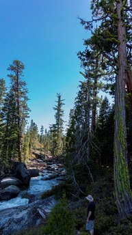
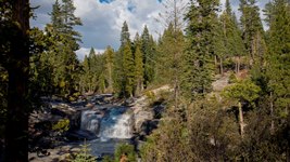
I pinged Jared Noceti who seems to have done ever random creek in the American and Cosumnes drainages, and sure enough he reported that he had done it and although he did not endorse it he also did not wave me off. Fast forward a few months, and as the spring melt began and with the crazy low snow pack this year (2014), Jeff Wheeler and I took an afternoon/after-work hike to check out the river. We found some fun boogie and cool section of bedrock that we estimated needed 3-4x the water to be ideal. The following day I ran South Silver which was very low... and Kyburz was reading 70 cfs. So logic would bring me to 4 weeks later, as Kyburz is reading 700 cfs and South Silver is high, you would think that Jones Fork would budge. Alas, no luck. Jones Fork was just as low as a month prior. This drainage is just that much smaller. I think you need a healthy snow pack to get in on this one with proper flows.
So in all honesty, this run is never going to be a classic, or even a "go-to." It might be a nice class IV slides warm up for those will to walk their laps though... the hike out from the bottom only takes 15 minutes or so. With proper flow it would be awesome to see what the two lower rapids look like, the bottom one looks in google earth to have high potential to be really fun.
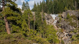
Something to note: Just at the top of the granite section, the river fans out super wide and shallow and goes down a slide before dropping over a class V+ with a log and lots of rock hazard in the landing of a 25 foot falls. Don't run the wide shallow slide. Get out on the left above.
Another thing, our original plan for this day was to boat down the Jones Fork for 2.7 miles to where a road comes in and it is a mere third of a mile walk to Big Silver Creek. Although the rivers enter Union Valley Reservoir on their own arms of the lake, some 2.3 miles apart, they get as close as just a few hundred yards, separated only by a small hill. Big Silver looks mellow with one or two larger rapids (perhaps portages) prior to hitting Bassi Creek. There is a trail up Big Silver that I scouted by foot the month prior and found some nice class IV+. How often do you get to do two rivers with one shuttle and only a quarter mile of a hike? Not very often in my experience. Oh well, maybe next time the flows will be higher.
Mi 0.0:
- First Gorge (IV to IV+). At low flow, we had to portage the second rapid. Below was a fun slide, then a fun boof, then exited through a double drop. As flows come up and this links up I bet it would feel more class IV+. Maybe not though.
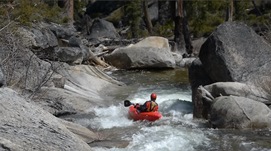
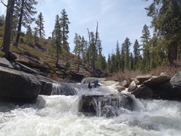
Easy Bed Rock (III). A fun long rapid that was mellow bed rock emptied into a pool. Get out on the left below.
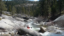
- Portage (V+ to U). Maybe if the log was gone and the flow was high enough the line would open up. The drop has a 4 foot entrance drop directly into a 20 footer that has a shelf on the left and some juts on the right. I think the line would be to get right and skip down the juts. Would need more water, and would be stout. Easy walk on the left.
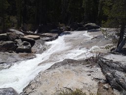
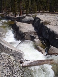
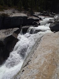
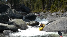
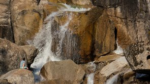
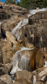
- Granite Section (IV to IV+). At the low flow each of the slides was probably class III to III+, but due to the continuous nature of the section I am inclined to upgrade the section as a whole. Also, as flows come up a few of the holes probably get more mean making it harder.
First Slide (III). Simple down the middle. Eddy out right or left if the water is low to portage.
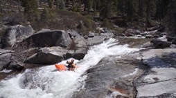
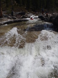
Needs More Water Slide (IV to Bad Idea). The second tier would go with more water. At low flow the water slides into a slab of rock that is actually a sieve. You can see under it. It is bad. At higher flow you could get around the rock sliding down the right, and the rock would create a cushion that would divert you away from it I think.
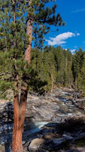
Slide to Hole (III). A long low angle slide culminates in a small ramp to a hole. At low flow down the middle was ok, at higher flow you probably want to get far left.
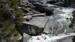
Sideways (III). A small slide leads to a 6 foot tall steep slide that then hits the wall and splits the flow either 90 degrees right or into an eddy.
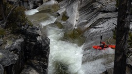
Finale (III+). Straight forward down the center. The hole was surprisingly punchier than we anticipated even at the low flow. Good fun and a nice way to end the bedrock.
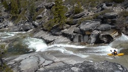
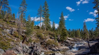
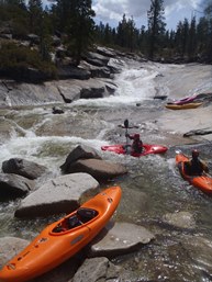
Exit (IV). Granite slabs blown down the bed rock section make this a somewhat junky (at low water) affair. We entered center and exited left.
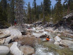
- Slides (?). On google earth there is another brief section of what appear to be low angle slides
- Is It Good? (?). On google earth there is a multi tiered drop that looks like it has potential. The exit looks like it might be good size but is in the shadows.
Some Bonus Info since I am moving to Tennessee in a few weeks and likely won't be getting back into Big Silver or Bassi Creek.
Big Silver Creek
Big Silver Creek looks to be mellow with perhaps one or two potential portages down to the confluence of Bassi Creek. Immediately below is what looks to be a fun section of whitewater that last about a third of a mile. There is also a trail up from a day use area near Ice House Road (Bassi Falls Trailhead) if you want to scout it prior or just hike up and run it. Also, there is a tributary that has some potential, though I haven't hiked it. There is a road that comes into the bottom of what might be a good bedrock section, perhaps worth a hike in to see.
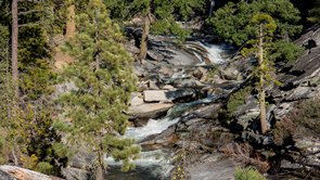
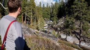
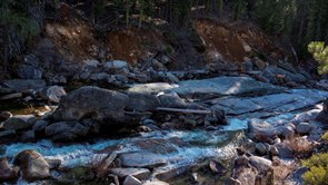
- Bassi Creek
Above the confluence of Big Silver Creek, Bassi Creek is steep and continuous with one falls that I first saw in Twitch IV. Be aware that the falls lands in shallow water. I think the real gem though would be above the Falls... on google earth it looks like a lot of bed rock. But it would be a hike your boat all the way up sort of affair.
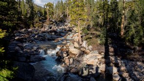
Take-out: Take-out: If you are looking to do just Jones, consider just running through the slides and hiking back out to put-in. If you want to run down you can use a road access that has a seasonal crossing where I was planning on taking out or an even lower (though adds lots of flat and what look like 2 portages on google earth). To get there, from Highway 50 go 12.2 miles to where you cross Jones Fork. 100 yards or so later there is a gated road (closed until April 1) that quickly drops down and crosses the river. This is the "lower" take out. Continue up this dirt road for 2.5 miles to where it T's and to the left quickly hits the river. No idea what the quality of this road was. If you want to do the Jones Fork and then Big Silver double day, this is where you exit Jones on the North side of the river. To set that shuttle, take-out is at the day use area on Ice House Rd immediately after you cross Big Silver Creek, a few miles further up Ice House Rd.
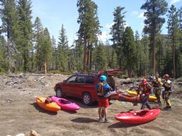
Put-in: continue back towards Highway 50 and turn towards Ice house Reservoir on Wright's Lake Rd. As you get to the lake in 1.2 miles, turn left rather than dropping down to the boat ramp. Continue around the lake for 1.7 miles until Rd 32 goes off to the left. Take this up for 2.6 miles to a fork that is a three way fork, with the middle being a dirt road. Take the far left. After 0.3 miles a dirt road goes off to the left and goes a quarter mile to a clearing where we parked and put-in.
HTML Comment Box is loading comments...
