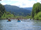
Hayfork Creek (Lower)
| Stretch: | Bridge on Hyampom Rd to Bridge in Hyampom |
| Difficulty: | Class IV to V |
| Distance: | 15.1 miles |
| Flows: | 450 to 2,000+ cfs. Dreamflows est |
| Gradient: | 52 fpm average (3 miles in gorge #1 average 95 fpm, Gorge #2 is 100 fpm) |
| Put-in: | Bridge on Hyampom Rd 15 miles south of town |
| Take-out: | Bridge in Hyampom |
| Shuttle: | 15 miles (25 minutes one-way) |
| Season: | Winter from rain, Spring from snowmelt |
| Written: | © 2010 |
| Featured in Video Twenty-Nine | |
Something about the write-ups online at cacreeks and jscreekin have kept my desire for this run low. In one they talk about portaging many sieve piles while the other talks about running many a class V sieve piles. On the other hand, Stanley and Holbek don't really mention sieves at all. For some reason this year I decided to forget all my preconceived apprehension towards the sieves and decided that Lower Hayfork Creek sounded like a good idea. Furthermore, I also had a change of heart on the 1.5 hour drive from my folks place in Weaverville, suddenly it didn't seem like it was as far out of the way (let just ignore the fact that Weaverville is some 4 hours away from my house in Sacramento, that makes it seem horrible).
I think the disparity in the beta is due to river flows. Cacreeks had 300-400 and reported sieves, Stanley and Holbek had 2,000-3,000 and reported pushy whitewater. Jscreekin on the other hand had ~1,000 and reported runnable sievy rapids. Our flow was an easier version of the latter. We had 650 on the gauge and thought that by take-out this was an accurate estimate. At this flow, the rapids tended to be boulder bars with many good boofs and sieves to avoid. Luckily most of the moves had time to set-up for or due to the lower flow were less pushy that they would be with more water. Furthermore, some of the most in play sieves were actually just filling in with water resulting in reactionaries that would actually aid in moving you away from them. With less water I can think of at least one rapid that would result in a portage.
At 650 I was say that there were two class V-ish rapids in the first gorge and one in the second gorge (Griz Falls). Though there are certainly many others I would rank as class IV+ with V consequence. Not the place to be swimming nor out of control (though I did run a rapid or two backwards, but luckily it was after the crux moves were complete). Also, as several others have reported there are a few unportagable rapids; however the big rapids were all portageable (Griz Falls looked to be a challenging portage, but possible). While on the topic of Griz Falls, I think this rapid must have changed over the past several years. No longer is it a 10 foot drop onto rocks, instead there is a 5-6 foot boof at the entry to a ramp which deflects on a rock with ~75% of the water heads right (to safety) and 25% of the water heading left to a bad sieve. If you are upright and pointed right, I think there no way you would end up in the sieve. Even if you were upside down I think the hole above would move you to the right and away from the sieve. In all, it is no longer a V+ nor a mandatory portage (or at least not at these flows).
In conclusion, this day was interesting. The two gorges offered many good rapids, several of which will get the heart pumping though only a few of which would be deemed classic. The scenery was spectacular, picture the best sections of Burnt Ranch on the Trinity and that is what you have for the majority of the run. When the run is not in steeper more gorged out sections, you maintain pleasant scenery. Although the paddle in (7 miles) to the first gorge is class II (with a small mini gorge of class III-IV) is goes surprisingly quick. However, the 2 miles between the first and second gorge go surprisingly slow as the water pools up much more requiring active participation in the downstream progress. In all, this run is very worth doing. If timed properly with the surrounding rivers you could easily make a three day weekend out of this run, New River Gorge, and North Fork Trinity. That would make for what would surely be a fun filled exciting weekend. We got there a bit early in the season (May 9, 2010 - 140% snow pack year and still cold) and ran this run, New River Gorge and Coffee Creek since the North Trinity wasn't going (and actually, do to a shoulder injury relapse I opted out of the New River Gorge). Anyways, a nice place to see with some fun rapids. I am sure I will boat it again at some point.
Mi 0:
- The first 4.3 miles are pretty mellow. Mostly class II though the 43 fpm gradient makes the miles to the first real gorge tick by. There is one mini gorge that I have seen referred to as Gorge #0 that has a few decent rapids in it.
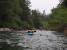
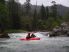
- A Rock (IV-). An obvious horizon line will let you know that you are at the this rapid. Also, the towering walls should warn you of its approach. We went down the left into the cushion forming off the rock. Downstream the wall was a little undercut. I think the right would have been a perfectly clean line as well.
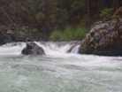
Boof (III-). Just downstream is a rapid that we boofed the middle of. Straight forward even though the horizon from upstream looks formidable.
Mellow stuff continues for another 2 miles.
- Miner's Creek on your right signals the beginning of Gorge #1. The rapids are evenly spaced through the next 3 miles.
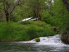
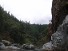
Down the Right (III+ to IV). A fun rapid run down the right side near the wall. If I remember correctly there was a pocket or two to avoid against the wall.
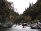
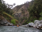
Boof (IV-). I honestly don't remember what the beginning of this rapid was like but I remember boofing the exit and then paddling away from the wall on the left. I also remember this rapid links with the next two.
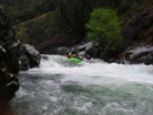
Chute (IV-). I remember this part of the rapid is only actually class III+ but you will want to catch and eddy on the right to plan your moves down the next step of the rapid.
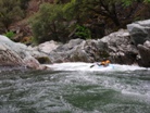
Now we are on the Left (IV+). The right side of the rapid is pretty junky. The crux is to get to the left side of the river via a ferry though some junky rocks. There is a nice eddy on that side to then pause. We then boofed two drops in the left channel. The second one had a shallow rock in the landing on the left side.
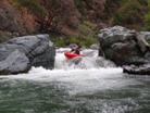
Triple Drop (V- to V). It would be best to scout on river left (and portage if so inclined). We ran the left side of the first drop, avoiding the mid river flake. Then made a 90 degree right turn around some sieves and headed downstream to two stout holes. These may turn into bad holes with more water, even at these flows you wanted to get your nose up to get through them.
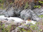
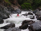
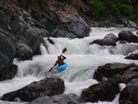
Backwards Double Drop (IV to IV+). Lucky for Mike and I the hole at the bottom will flush you. The first boof is taken off the curler on the left , I caught and edge and spun backwards while recovering dropping through the final hole backwards. Mike flipped and was briefly tossed around before fighting his way out.
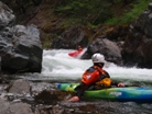
Bad Sieve (IV+ to V-). At our flows, this was only a big consequential IV+. Many holes push you to the left where there is a very bad and very in play sieve. The key was to work right. At higher flows I can see this drop being more difficult and more dangerous.
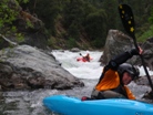
Less Clean Then "Not all that Clean" (IV). A very junky rapid, we ran it straight down the center. This rapid also dented the heck out of our probes boat as he located the way not to go down this cascade.
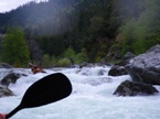
Not all that Clean (IV). Don't you hate when you see the undercut and it seems to just tractor-beam you into it? We entered the brush on the far right which then opens up into a shallow bouldary rapid with an undercut near the bottom on the right shore. I think the left was a better and cleaner drop.
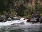
Double Boof (III to IV-). Several different lines. Some boofed the center with 90 degree right angle. Some entered shallow on the right. Finish boofing the bottom hole avoiding getting pushed into the wall and pulled back into the hole. At the end of the short pool is a very sievy rapid.
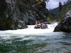
A Very Sievy Rapid (IV+ to V). It looks horrible, but it really went easier than it looked like it would. So I am torn on calling it a IV+ or a V-. At higher flow I can see it getting bad. Boof on the right, avoid sieve on right shore 25 feet downriver, then work back left. Scout on the left, the portage is not too bad if so inclined.
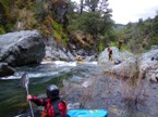
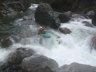
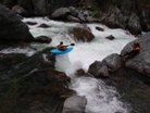
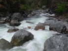
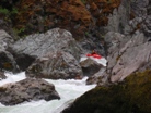
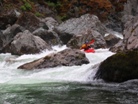
Just a Fun Class III (III-). A fun boof which half of us plugged.
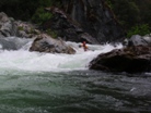
Just Another Boof (III-). A fun boof with a decent hole at the base.
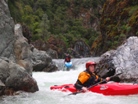
- Corral Creek Enters on the right signifying the end of the first gorge, well there is the one last rapid just downstream. Then it is done.
Corral Creek (III+ to IV). Most of the water pushes into a pretty bad undercut. We all just went down the far left side into the left channel.
The next 2.75 miles are really mellow with flat water and class II. The gradient is only 36 fpm.
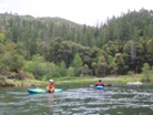
- Gorge #2 starts and last for 1.0 miles and drops 105 feet or so.
Boof (?). I don't remember the details of this one. I remember smiling at the end. It wasn't big, maybe class III-IV?
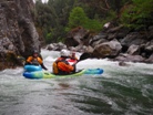
Cascade (IV to IV+). A fun boof right of center heading a little right. I remember there were lots of rocks and a good size hole or two. Though I was backwards for some reason so maybe it wasn't as bad as it seemed to me.
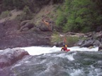
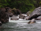
Entry Hole (III+). A straight forward hole at these flows. Be on your toes. Just downstream is a serious hole drop which is then quickly followed by Griz Falls.
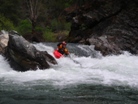
A Serious Hole Drop (IV+). A tricky lateral entrance drops you into a large hole and put me in a tail stand. Strangely no one else had these problems. Go figure.
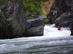
Griz Falls (V to V+). Scout on the river left, then maybe send someone to the right to scout if it is lower enough to get on the bog boulder. Then look at the portage and see it is heinous. A 6 foot drop lands you onto a ramp, as the hole thankfully moves you right with 75% of the water you are in the clear. As I ask Ben who was on the large rock midstream, "what is to the left?" He replies with his hand across his throat, the clarifies, "you might survive" with inflection to make it seem unlikely. Below the main drop there are a few more sieves in class III water to avoid.
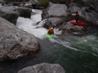
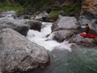
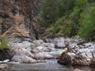
The Last But By Far Not The Worst (IV to IV+). Paul and Ben ran down the right and that looked fun. I boofed the left and landed myself in a chute against the left rock. From there, there was some rock dodging. Great drop and good end to the run!
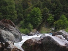
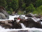
Take-out: From Redding, take 299 to Highway 3 just before Douglas City. Take Highway 3 twenty-four miles to Hayfork and in Hayfork turn right on Hyampom Rd. Take Hyampom Road fifteen miles Hyampom. Just as you enter town you will see a road (Underwood Mountain?) to you right with a bridge immediately over the creek.
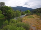
Put-in: Head back towards Hayfork 15 miles. 200 yards after the bridge over creek you will see a dirt road drop down to your right. Take this a few hundred feet to the nice river access.
HTML Comment Box is loading comments...

