Gunnison River (Black Canyon)
| Stretch: | East Portal to Chukar Trail |
| Difficulty: | Class IV to V |
| Distance: | 14.3 miles |
| Flows: | 550 to 2,000? cfs. Current American Whitewater gauge |
| Gradient: | 156 fpm from mile 2.2 to 7.3. 35 fpm paddle in and 38 fpm paddle out |
| Put-in: | East Portal Campground |
| Take-out: | Chukar Trailhead |
| Shuttle: | ~20 miles (30 minutes one-way, high clearance required for Chakar Trail access) |
| Season: | Summer and fall from dam release |
| Written: | © 2016 |
| Featured in A Wet State #120 and in the classic video The Next Generation | |
I have no idea where I first heard of this river. It was a long time ago. That much I am sure. I remember seeing pictures of the canyon and thinking that it looked like such a cool place. A few years later I hear the story of Chuck Kern drowning while with his brothers in the canyon. A few years later still I hear stories about the portage and how heinous it is, stories ranging from 1 to 2 miles, and of poison ivy fields that were overhead height. Needless to say, with the latter of those stories I wrote it off as something I would never see in person.
It is amazing how getting older, despite the rumors of getting wiser, instead make you weight decisions and find yourself finding worth in things that before you didn't. So with that, a year or two ago I decided Poison Ivy be damned, and that I wanted to do this run. The plan was originally to make it out there at the end of this summer. But as the summer began I broke some ribs and suddenly my fall trip to Quebec was in question, and the end of summer trip to Colorado was out the door. However, then Jim Janney called me and invited me for an October trip... and I was sold.
The trip started off poorly. The plan was to meet at Jim and Ben at Jim's place in Oak Ridge. Meet at 3:45 pm and leave by 4. In my typical fashion I arrived at 3:35, Jim at 3:40, Ben... 4:15. granted he had a 2.5 hour drive compared to my 20 minute. But not the way to start a 2-hour drive to the airport in Nashville. We chose to use Nashville because we could take out boats and fly Southwest. Neither of which was an option in Knoxville. The original 4 pm departure time gave us 4 hours to make our flight. So we had 2.0 hours of pad. And by the time we left, that was now down to 1.5 hours. Driving up the plateau we soon hit some traffic, which ended up to be a road closure due to a fire. 30 minutes into the wait I called Southwest to find out if there were later flights. Nope. We called Tom in Denver and he wanted to bail all together rather than picking us up at 8 am and drive the 5 hours to the canyon. We looked up concerts in Nashville. We tossed around the idea of bailing all together and going to the Russell Fork. After more than 1 hour we finally began to move. At this point we had 1 hour and fifteen minutes before our flight was to leave... and we had 1 hour of driving left. We call Tom and ask him to arrange for spare paddling and overnight gear as in the off chance we make it on the plane, there is no chance our gear will. Thanks to Ben driving like a maniac (mostly because Jim was aggressively encouraging him to go faster) we find ourselves at the curb with 25 minutes before our flight was to depart. I hop in the driver's seat as I have TSA pre-check and can get through security quicker. Jim and Ben run into the airport and check our bags. They tell us there is no promise on the gear. I park in short term parking which is the nearest to the terminal, cost be damned. I take off running through the garage and hop in security to find Ben half way through it and Jim at the end of it. Once through, I run to the very last gate in the terminal (of course it was the farthest) and get to the gate as the C group was beginning to board. 5 minutes to spare before the scheduled departure time. Thankfully, they were delayed by 10 or 15 minutes! Arriving in Denver we peek out the window to see if our bags come... and after a few minutes we see it, the definite form of our paddle bag. We high-five and celebrate and head to the baggage claim to collect our gear, all of which somehow made it on the plane. Thank you Southwest! The adventure didn't stop there though. Moments after Tom picks us up, we get an alert that after 2 months of holding at 800 cfs it has dropped to 600 cfs. Will it hold? We drive to Tom's house to sleep hoping to find it holding in the morning. The next morning we woke up at 4 am and headed out of town happy to see that the flow is holding, low but ok. Picking up Nick on the way, we drive for 5 hours and arrive at the National Park at about 10 o'clock. Everyone is there, ready for the adventure.
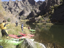
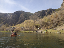
The canyon itself is known for the scenery and less for the whitewater. And the scenery did not disappoint. The whitewater was entertaining enough when it was present. The thing that surprised me was how long the flat water paddle out was (AW's write-up has the camp only a mile from take-out rather than the paddle out being 7 miles). I was also surprised to find out that there are lots of other portages. I had heard "every time to get to a horizon on day 1, just portage" and had though "nah, I will run some." The only one that looked ok was Day Wrecker. But I opted to walk with most of our group. It turns out there are more portages downstream that are almost always walked... Triple Drop, a random one above Ball Crusher to name two. Ok, so maybe it is only those two in addition. But with Ball Crusher... that is now 4 portages and we haven't even gotten to "the portage." The Portage was every bit of what I expected. Tough, tiring, and Poison Ivy filled. It took me 1.5 hours. Some in our group got done in 45 minutes. Ben I finished last. I can see how it can take 3 hours if you wonder off of the "trail." The next morning you continue portaging, then seal launch, and then portage. Then run a class III and thanks to the low water... portage quickly. Downstream a ways you get Great Falls and again portage. One that was longer (but easy) than I anticipated as I didn't realize there was a long section of class V leading into the final falls I had seen in video. And then, just like that. 7 miles of paddle out.
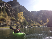
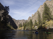
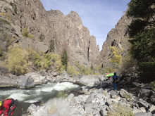
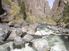
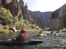
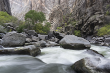
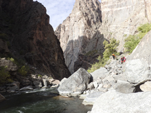
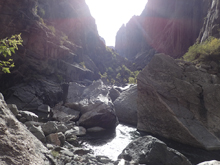
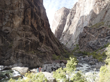
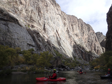
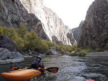
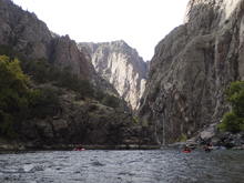
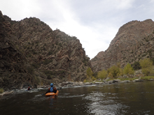
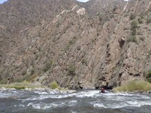
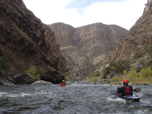
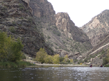
Man... that was a bitch fest. But, ask me, was it worth it? Oh it was so worth it. The scenery is that dang good. Other worldly. The only places that compared to me are Cherry Bomb Gorge on UCC and the canyon in the depths of the Kiyotsugawa. For miles, the canyon rises above you 1,500 feet, straight out of the river. Looking up and down the canyon you are able to see walls at the ends, towering above you, painted with shining quartz bands adding accent to the pink granite that surrounded you. If only the beauty would be enough to full distract you from the fact that those beautiful walls are also the things that make this canyon all the more committing. The walls form a barrier, from the real world finding you for those two days, but also from the help that the real world may contain should you need it. If you bring an ego and not a minimum set of skills into this canyon, you and your ego will be stuck, I figure only one of them will make it out.
As much as the portaging does suck, I also feel like it adds a bit of the "you have to earn it" to the experience. It isn't easy. If it wasn't for the portaging a class IV to IV+ boater could do most of it. Though a swim is completely a no go in most as sieves are plentiful.
The final point of discussion is how to exit the canyon for take-out. There is a trail... that is the standard method. You can hike for an hour up and out about 1,000 ft. Or you can paddle out (in addition to the 7 miles of paddle out to get to the trail head) an additional 14 miles through the class II to III Gunnison Gorge. We choose the latter. We were able to arrange a shuttle to the rafting company at the Gunnison Gorge take-out, so by doing that we actually saved time, and got to see a new river. However, that final day of 30-45 minutes of portaging followed by 21 miles of mellow whitewater definitely wrecked my body a bit. I would be feeling that for a few days!
In total, I thought that 600 cfs was a fine flow though I could also tell it was low. For a first (and maybe only) time it was still fine though. It didn't feel like it was too low to be fun. I imagine at high flows the whole thing gets scarier and harder.
Mi 0.9: Mi 2.2:
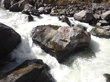
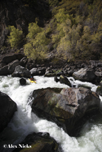
- Day Wrecker (V). On a blind right hand turn is day wrecker. The rapid starts off on either side of a gravel bar island. Scout (and walk if inclined) on the right. There are last minute eddies on the right. Whatever you do, do not drop in blind as there are sieves everywhere on this one. The line is to start far left and then boof the edge of the mid river truck sized rock. Do this in control as downstream all of the channels on the left end in sieves. You want to do the 2nd of four channels from the right and exit right. The far right channel also goes but is harder to get to.
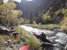
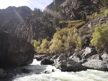
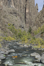
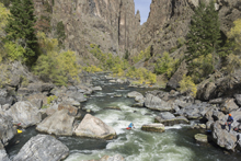
- Off Ramp w/ S-Turn (IV). Downstream you get to two walled out rapids that are bigger horizon lines than the rest of the boogie. Both are run right to left to avoid flakes in the middle. These rapids change from time to time apparently.
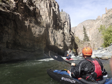
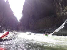
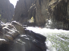
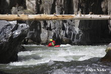
- Island Split (IV). A gravel bar splits the river, left is best. Once the waters recombine you enter a small rapid that has a few good size holes, the biggest is at the bottom on the right.
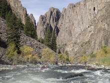
- Double Trouble (IV). After some nice scenery and mellow II to III whitewater, you get to this nice double boof. Run far right on both tiers. Note that the rock below the bottom tier is very undercut.
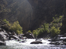
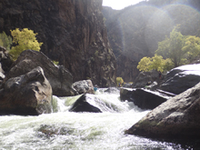
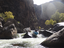
- Lower Intestine (IV+). Scout from the right if it is your first time. The river drops down into a large rock and diverts 90 degrees. You want to use this current and drive to the far right and boof the ledge into the eddy on the right below. Melting off early can result in a bit of a working so if you feel that happening... try harder to get right or straighten out and commit! Downstream there is a bit of a caldron before a small exit hole at the pinch.
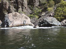
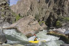
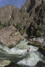
- Triple Drop (V+). Big and ugly. The middle drop has a bad hole that also looks like it may be sucking down into a sieve. On the right of the entire rapid are sieves. 99% will portage this drop on the right. It is kinda of a pain in the a$$ portage. Lots of big rocks to clamber over.
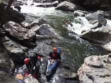
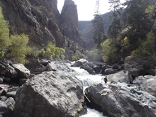
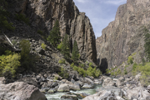
Principal's Office (IV+). This is really just the run-out of Triple Drop. So, seal launch in below the portage, then you want to either run middle driving left or if the water is up sneak around the lead in by going far left. Below, don't get pushed right as that ends in the Principal's Office which has a nasty sieve backing up the eddy. If you are upright you can eddy out in it and ferry out, but swimming that way is no go. Just avoid the right. The left side at the bottom has a lateral hole you want to drive through to get against the left wall and drop through a small slot. That is the exit.
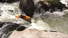
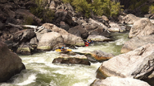
- Boogie (IV). Scout on the left. A typical line is to bang down the left shore in the entrance. At our lower flow we decided to enter right, eddy out, and then drive into the main middle channel. This is backed up by a rock so I think at higher flow it becomes a bit sketchier. The danger in this rapid is downstream on the right as the wall is badly undercut. So, exit any of the three channels on the left away from that wall.
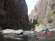
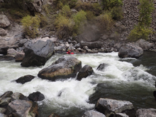
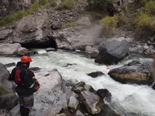
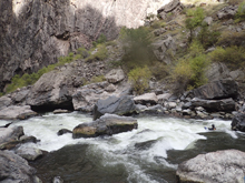
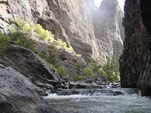
Narrows Entrance (III). This is where you enter the narrows proper. This small rapid is at the base of huge walls. Just run it with the water then along the wall. Don't forget to look around!
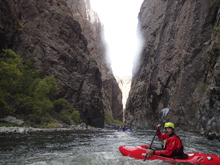
- Portage (V). The wood changed in this rapid and the left channel looks to be runnable again. But we didn't know that when we portaged. It is a tall single move drop where the river splits around a large midstream boulder. The right is a sieve. The left is a ramp to a ledge... which then needs to be exited around some sieves. Still a serious drop, even now with the wood clear making it runnable. We portaged on the right.
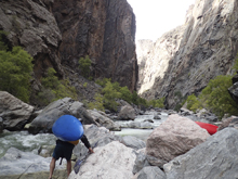
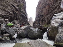
- Lost Boy Slots (IV). Downstream is the best section of whitewater I am actually completely unsure which rapid is Lost Boy Slots. The first rapid is class III go with the flow. The second has some blind house boulders, we worked behind them from right to left and ran down some slots (maybe it is that one?), and the final rapid was a ledge that we ran down the far left that flipped a good portion of the group. The final rapid I have seen people run far left against the wall off a weird flake. We ran far right to far left coming in below the flake. Run against the wall to exit.
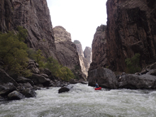
- Ball Crusher (V+). Immediately below the last boogie rapid the walls open slightly and the river is surrounded by rocks that have fallen in. This is Ball Crusher. Scout right. Portage left. It changed for the worse a year or two ago and is less runnable. It used to be a boof down the middle and then a negotiation of small chutes.
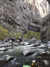
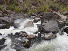
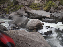
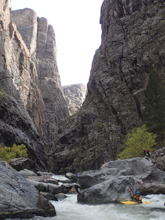
Boogie (IV+). One boogie rapid in here, you want to start far right and boof the flake far left at the top. This lands you in an eddy on the far left before the exit. The exit is a sieve on the far right, so don't get pushed that way in the top. Instead exit the small slot in the middle.
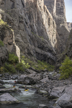
- 18 Footer (IV+). Don't go with the main flow. Instead go with the small spout in the center. Boof it driving left with left angle as the right lands on shallow rock. At low water you may choose to wheelchair the far left onto a seal launch slide rather than risk your ankles.
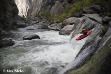
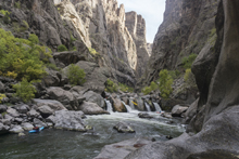
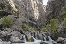
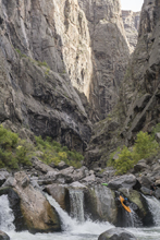
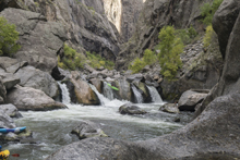
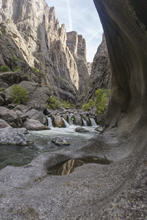
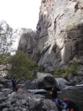
- Portage (V+ to U). At the end of the pool below the 18 footer, get out on the right. The portage goes up and over 5 hills of rubble that has fallen in from the walls surrounding you. There is a "trail" that although is harder to follow on the first two gets more obvious on the last three hills. The first two hills are topped out nearly to the peaks. The third is the tallest of the hills and doesn't have to be topped out but you still have to climb a good amount up it. Descend the third hill against the wall on the right. The fourth hill was a big of a bush whack but also doesn't have to be topped out. The final hill needs to be topped at a specific spot for the best results. There is a rock outcropping and a pine tree just 5 feet away. Top out there. Then work right a little to the trail down to the camp below. Descending to the left is a pain over large boulders. People who are in great shape and know the route take ~45 minutes. 1.5 hours is a descent enough time for your first time. Stories of people taking 3 hours also aren't unheard of. However, take note... you can do the whole portage with your boat on your shoulder. So if you get to boulder fields and are lowering and raising your boat, you likely need to get further up the mountain side.
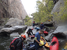
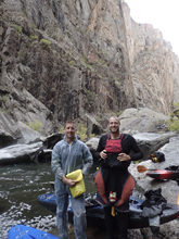
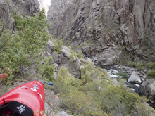
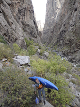
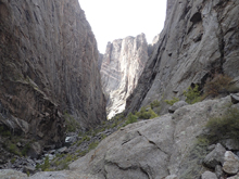
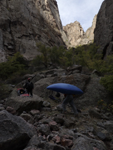
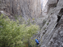
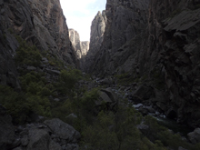
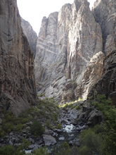
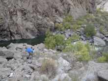
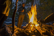
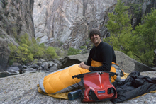
Cave Camp. A great way to break up the portage, this camp offers a nice beach, nice overhanging rocks to camp under, or a nice rock ledge to camp out over the river.
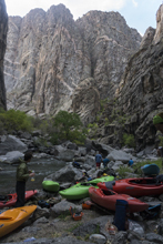
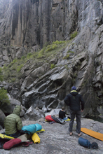
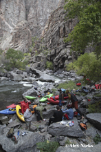
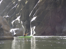
- Portage (U). Start the day by running a small class III and then get out on the left. This one can be portaged for 50 feet at river level before climbing up 20 feet. It is then a straight shot on top of the boulders which the river has going subterranean under to a seal launch at the bottom. Seal launch in from 10-15 feet (depending on the spot you choose), paddle out of the flat water 100 feet and exit on the right when the river once again disappears. This one is short to the top of "Next Generation." However, the top is rarely run so that adds 100 feet more to the walk. Or if you choose to walk the rapid, continue on the "trail" around it dropping down below. The portage from Cave Camp takes maybe 30 minutes. Oh and bring some long sleeves to portage in as well as soap to rinse off afterwards, you will be walking through poison ivy, it is a guarantee!
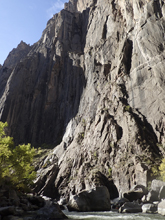
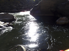
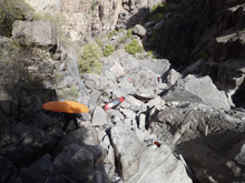
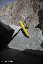
Next Generation (V+). This is a big rapid. Arguably (apparently) the biggest rapid in Colorado. The top drop is rarely run and is a center chute that needs to be driven right across. The bottom gets run more often these days. It is a 15 foot boof on the right which threads the needle in the landing between piton rocks. Downstream are two ledges, the first is run center (the right lands in sieves) and the second is run left (the right lands in a piton). You are free. The runout is where you put-in below the portage and is 100 feet of class III to IV.
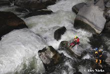
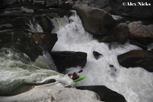
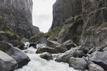
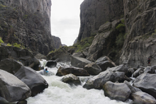
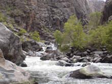
- Sieve (IV- to U). Downstream is a boogie rapid with bad undercut, run to the right of it. Then downstream is a rapid that at lower flows is a sieve pile. With more water you can run it (not sure where). Portage either side. It is a quick and easy one.
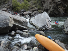
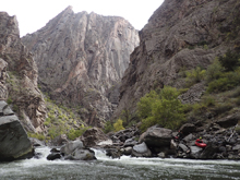
Beach Camp. Beach camp is located on the right... it may actually be just above the sieve rapid. Nah, I think it is directly below it. It is obvious as it is also in a pond of flat water. A nice camping spot though but certainly less spectacular of scenery.
- Life in the Fast Lane (IV+). Smallish boogie leads a ramp to a ledge. The main channel is the middle/right one. A small chute then moves you back towards the center for this ledge. The ledge is offangle so T it up to the right. At higher flow you can apparently boof the left edge of it. At the lower flow we had to just delay boof it down the middle.
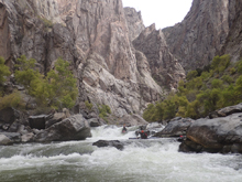
- Sieve City (IV+ to V-). A long rapid that will be confusing if you don't have someone who knows it. The lead in is on main channel. Follow it. Then you get to some slack water on the left. The move here is to ferry all the way to the right. The water that moves left early drops into sieves. Once in the eddy on the right, you can see the main channel which is middle though with a sorta shitty rock on the right, so I ferried across the lip of the drop to get to the left of said shitty rock. Below, we exited down the right to where it opened. Then, get to the left channel as soon as possible as the right just gets shallow and shitty. The rest of the rapid over on the left goes anywhere, but it too is a bit manky.
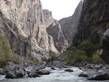
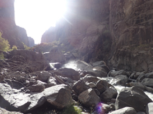
- Great Falls (V+ to U). A short section of mellow water leads to a VERY obvious pinch, the hole river goes from 50 feet wide to 3 feet wide and you can tell you are at the top of something very serious. Scout on the right on loose rock debris. Everyone walked it in our group. It has changed for the worse the last few years. It is also way longer than I realized. There are like 4 or 5 solid class IV to V rapids with sieves all over that then lead to the main falls that I have seen in video. However, something changed last year and the main falls is also now dry of water. Jim and Rolf scouted for maybe an hour on the far right, but there was a mid river island that blocked any of that from view so I have no idea how reasonable it was. The portage can start in the pond on the left, or directly at the lip on the left.
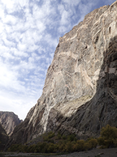
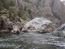
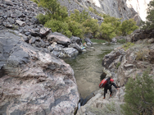
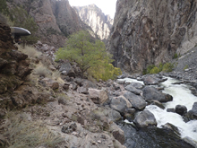
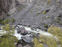
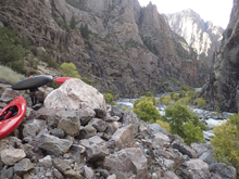
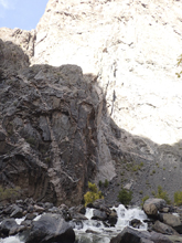
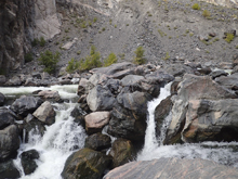
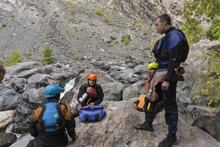
- Ledge (IV). After putting back on there was a small ledge downstream that we ran far left.
Final Rapid (IV). This led to one more rapid before the river finished with a long and mostly flat paddle out. This final rapid was run on the right or middle at the top and down the left at the bottom. There were of course a few sieves to avoid, I had to back paddle out of one as I got pushed to the left between the two tiers.
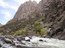
- Paddle out. Lots of flat water. The take-out is obvious as there is a permit stand and even an outhouse looking structure. However, the paddle out takes longer than you would think.
Take-out: So we actually didn't use the Chakar trail take-out so this is what I have pieced together from other sources. One mile south of the town of Olathe, turn off of Highway 50 onto Falcon Rd. That is all the info that I have for sure. It says follow the signs to Chakar Trail. Looking at the map... it looks like after 3.8 miles the road changes names Peach Valley. I would assume after 1.3 miles on that, you take a right on a road which looks to be a major dirt road. The info says you will need high clearance. It looks like you want to stay left at a few intersections. It looks to be maybe 10 miles out to the parking place. I imagine they are slow miles.
Put-in: Go back out to Highway 50 and take it south to Montrose where the highway bears east. 5.8 miles East of Montrose turn left onto CO-347 N. follow this for 5.7 miles. Enter the park and pay the entrance fee. Then continue on E Portal Rd for another 5.2 miles down into the canyon. Once you arrive at the river, turn left and go downriver a few hundred yards to the parking just past the camp area.
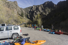
Shuttle Service: We used "Gunnison River Pleasure Park" to run our shuttle. It was somewhere near $120 if I recall correctly for the full shuttle for Black Canyon and Gunnison Gorge. We just drove to put-in for the Black Canyon and then car was at take-out for the Gunnison Gorge.
HTML Comment Box is loading comments...

