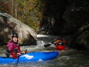
Green River (Narrows Pre-Helene)
| Stretch: | Summersville Dam to Mason Branch |
| Difficulty: | Class IV to V+ |
| Distance: | 2.9 miles |
| Flows: | 7" to 14"+. Current AW gauge |
| Gradient: | 176 fpm average (max of 346 fpm) |
| Put-in: | Gallimore Rd |
| Take-out: | Green River Cove Rd |
| Shuttle: | 7 miles, 20 minutes One Way |
| Season: | Dam Release, Year Round! |
| Written: | © 2011 & 2014 |
| Featured in Video A Wet State #53 and A Wet State #94 | |
Arguably the most famous river in the United States, certainly the popularity of the race each fall puts it in the minds of people as often as the classics in California's High Sierra, perhaps though for different reasons. I wouldn't say that the run has the most amazing scenery; it is of course nice East Coast dense forest; however this forest also tends to block the views of the surrounding mountains. The rapids are mixed, some are extremely fun, some are a bit manky. However, the one thing that is undeniable that makes the Green as good as it is, is that it has water for upwards of 300 days out of the year! How many other 400 fpm creeks with no mandatory portages can say that? I don't think any... and that count certainly dwarfs the California steep creeks which at low elevations may get 45 days of boatable flows or in the High Sierra get as few as 4 or 5. Now am not drawing any conclusions on which is better, the folks back east love their Green, and rightfully so... as do the folks here in Cali love their once a year runs in the High Sierra... so, perhaps they are both good.
Anyways, enough of that discussion... Flows on the Green although dependable, vary in time of day and once Fall comes around, dwindle. We had hoped to boat the green during the middle of the week while on the East Coast, however, the water never came, so instead we went from the Gauley to the Russell Fork. Luckily for us, the water did come to the Green the final two days of our trip, thus we headed down the Asheville to meet up with our friends Taylor Fearrington and Daniel Stewart as well as our new friend Kurt who we met on the Gauley a week prior. There is a great website called boaterbeta.com that has 3 day look outs for flows and is the definitive word on flows on the Green, so look there for your last minute planning.
An interesting thing about the Green is how many people go to it. Here in Cali I would say there are only 100 or so boaters who are class IV-V boaters (maybe a few more, but also maybe a few less). On the Green on a daily basis, you will see 40 or 50 people enjoying the river. The Green River race has over 100 participants each year... 100!!! Put that in comparison with Cali's largest race, the North Feather which pulls some 20-30 racers and you see how much stronger the scene on the East Coast is. It is amazing.
So in conclusion, this run is quite good. Our first day on the river I was a little less impressed, the steep creek nature of the boulder piles didn't seem that fun. Though returning a day later though with the lines fresh in my mind, we had significantly more fun routing through the run knowing which channels had piton rocks to avoid. That brings me to my next point, if you boat the Green enough, you will break a boat... parts are clean, parts are less so. Will I go back? Certainly, if I find myself anywhere near the Carolinas.
2014 Update So I am sure I will be making more updates now that I live near the Green and will no doubt be getting plenty of laps. I hope I do anyways, I just bought a key to the gate! Anyways, I now have done the run at a much lower flow thanks to a last minute reduction in the flow by Duke Energy. At 5 inches many rapids changed... and we added several portages. Chiefs becomes a bit tighter and more pinny... so we walk that one. Also we went right at Boof or Consequency as apparently that gets a bit dicey as well to take the middle/left line. And the big three (Go Left, Gorilla, and Sunshine) also were walks for us. Possible, perhaps... but Go Left has a ridge of rock now kicking you off line, Gorilla has a full on hole on the launch ramp, and Sunshine is hard to drive hard enough either left or right to avoid the rock in the landing. It was certainly a bit of a bummer, but still nice to get on the river.
There is no shortage of names for rapids on this run. Every rapid has a name, and different moves within those rapids have names. I am not going to cover them all... These rapids are rated with 7.5 on the gauge, no doubt they will get harder higher. Also, just because I don't rate many class V, doesn't mean that the day doesn't have a class V feel to it. The rapids are all linked together and being out of control would suck.
2024 Note: This write-up is from pre-Helene. The reports are of drastic changes. I will try to get updates as they become available.
Mi 0.5: Mi 0.5:
- Frankenstein (IV+). Just downstream is a boulder choke. Enter right and then drive left off of the boof to avoid the undercut immediately downstream on the right.
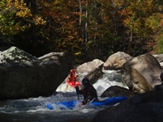
Inbetween stuff that has names on AW...
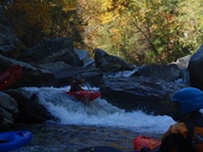
- Go Left (V). It is junky, on any other run it would like be a portage. Enter right and drive left over the tree and straighten out for the chute below. Or sneak it easily down the right micro channel.
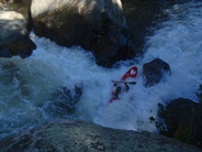
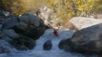
- Zwick's (IV+). So apparently the top move is considered a different rapid (Reverse Boof) but it is all one rapid when you are there. So enter left and boof then drive down into the pillow hole below. From there the river makes a 90 degree left turn into a large hole. Boof the right side of it... we had 5 people pile up in here our first run due to one person flipping in the hole and everyone else dropping in on them. Somehow only one person swam... I expected it to be all five.
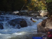
- Gorilla (V+). This rapid is the real deal, and looks huge and worse in person. The entry ledge has several lines, the notch should be run far right. And then Gorilla proper should be run off the ramp. At flows below 7.5 a hole forms at the lip making it much harder. There is an easy walk on the left with a fun sliding seal launch.
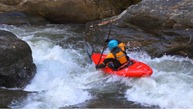
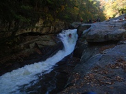
- Scream Machine and Nies' Pieces (IV+). We ran center down both. Both get large holes at higher flow thus making you want to go a little more right. There are other lines available for those who want to mix it up too.
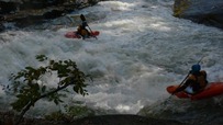
- Power Slide (IV). Drive left to right across the top, punch the curler and slide down. If you are left at the bottom there is a good size hole.
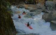
- Rapid Transit (IV+). A fun slide that was easy if you started in the right place. Enter just right of center. Too far left and you fall off unto an undercut. Also, try to stay off the right wall as there is a cracl over there.
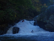
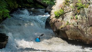
- Nutcracker (P). I think sometimes without this boulder jumble can be banged down. It is an easy walk on the left.
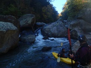
Grovetube (IV+). Put in at the lip of the drop. The tube is run far left, left angle and a left stroke gets a nice boof. There is also a center boof line. Catch the eddy just below on the right to scout or portage Sunshine.
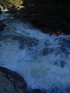
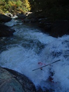
Sunshine (V+). Another ugly drop. Not sure I should rate a one move rapid V+, but alas, I think most would portage it on most runs. Drive hard right or hard left. Or walk on the right, lower boats down the cliff and then walk up and around it.
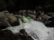
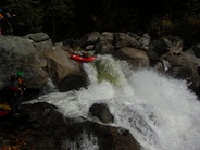
- Things get easier no, some mank is around for sure. Just before you finish you get one last good rapid.
- Toilet Bowl and Hammer Factor (IV+ to V-). Toilet Bowl is the entry and has a double drop that I enjoyed boof off the right wall for. The river then drops over a hole onto a slide fading off the right into a big hole and undercut. I found it much easier to enter Hammer Factor far right moving left which allowed for me to stay on the slide and out of the hole. Otherwise you fade off earlier than you might like.
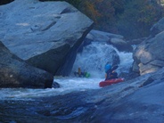
For more details on the run, see the AW write-up...
Take-out: from Asheville, head East on Highway 26 for 30 miles. Just after Hendersonville, look for exit 59 toward Saluda. Turn left on Holbert Cove Road and then take your first left on Green River Cove Rd. Follow this 2.2 (very windy) miles down to the dirt parking on the left at the bottom of the hill.
Put-in: Head back towards Asheville on highway 26. After 6.1 miles exit on exit #53 for Upward Rd. Follow Upward rd for 1.8 miles. Turn right on Big Hungry Rd and follow for 0.5 miles, turn left to stay on big Hungry and follow for another 0.3 miles and then again turn right to stay on Big Hungry. After 0.5 miles, turn right on Gallimore Rd and follow for 0.6 miles to the gated lot. (You need a key to park here, so hit up your friends that live nearby. Otherwise, you will need to paddle the Upper Green to get to the Narrows).
HTML Comment Box is loading comments...

