Gragg Prong
| Stretch: | Roseboro Rd to Wilson Creek |
| Difficulty: | Class IV to V |
| Distance: | 2.1 miles + 2.9 miles on Lost Cove Creek |
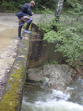
| Flows: | Steps upstream of put-in bridge act as gauge. 2 inches below the top step is low, even the top landing is high. |
| Gradient: | 223 fpm average on Gragg, 111 fpm overall |
| Put-in: | Bridge on Roseboro Rd |
| Take-out: | Bridge on route 90 |
| Shuttle: | 4.2 miles, all dirt, some not great, 15 minutes one way |
| Season: | Fall to Spring from rain... like +2 inches in the past 6 hours |
| Written: | © 2018 |
| Featured in Video A Wet State #144 | |
I remember, not long after moving to the South East seeing a pick of the biggest drop on this run, Dragstrip, and thinking how fun the drop looked. I ask Jim about it, I believe he said the run was ok, but also was mostly not like the nice bedrock drops. I still put the run on my list, with hopes of getting it some time along with Wilson Creek. The drive is just far enough from Knoxville that it is a bit hard to prioritize itself, since the 3.5 hrs that it takes to drive there you drive past numerous other rivers that are likely in as well.
Well, finally, the opportunity arose. Hurricane Florence (2018) came through this fall, making landfall in South Carolina before slamming into the Appalachian mountains and running North along the Eastern side of them. That meant that Gragg Prong and Wilson took a good hit! In the morning, with nothing certain, Ben Warf and I made plans to head that way with hopes that someone would post a visual at some point in the morning to confirm the plan. A visual did come, though there seem to be some confusion as to if it was high or low. Arriving at the put-in, I can see that there is water, the group that posted the visual explained the uncertainty, which made a lot of sense. The guidebook talks about steps but implies 1 step, and there are several, and doesn't explain if the top landing counts as a step either. I will explain that all later. Anyways, it didn't look high, it looked low, but boatable.
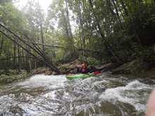
After setting our shuttle, Ben and I started down. One nice thing about this run is that there is a trail on river left which makes scouting super easy. Though, as we got to the first bedrock run, we seemed to neglect this fact. We scouted and found that there was blind wood on one of the tight corners, requiring a portage. We then used the same scouting route for our portage which required lowering with ropes and raising back up with ropes our boats, through roto hell. Of course, we could have taken a stroll on the path and would have saved 20 minutes likely. Oh well. The next bedrock was clean thankfully and then we scouted on the left, where the group that was ahead of us had their boats parked on a beach. Scouting down showed us one sorta manky drop, one nice triple drop, and then the famous dragstrip. We headed down and had a great time through the section, and spent some time taking photos and video of the group we had caught. Dragstrip is a big, steep drop, but realistically it is super straight forward, just enter and hold on. We all went for the left entrance. One or two went backwards as they spun out at the top. But everyone came through with big smiles.
We then headed down stream with hopes of hiking up Lost Cove Creek for an afternoon run. Arriving at the confluence, the instructions were that there was a trail on the right. We exited our boats and then spent a half hour bushwhacking around and up to the base of the hill looking for said trail, but, never found it. As I am sitting here writing this, I decided to look up the trail online. Sure enough, the trail is on the inside of the confluence (between the two creeks) and then crosses Lost Cove Creek not far upstream. Damn it. I would have liked to have gotten that run. You can run the "Lower" section of the creek with just a mile or so of hiking with limited climbing on the trail. Seems like something that would have been right up my alley!
Oh well, in the end, we gave up and headed to our car for beers. I got some of the contact info from the group that was ahead of us, as several of them were planning to boat the next day. Ben and I went for dinner and then I found a place to sleep along the Blue Ridge Parkway, as I firmed up the plans to boat Wilson Creek in the morning.
Mi 0.0:
- Boogie (III to III+). Boogie starts immediately below put-in. Be careful for wood on this run, as it is plentiful. There are a couple of blind corners, but in this section, you should be able to stay in your boat the whole time and boat scout using the eddies.
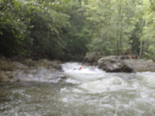
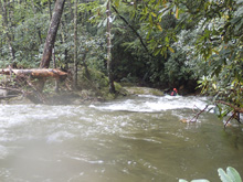
- S-turn (IV+ to V). Get out and scout on the left when you get to the first bedrock drops. For us, it was a walk due to the wood. The trail is along the river on the left making scouts and portages easy. The drop s-turns to the left, over a pinched ledge, back to the right, and then over a cascade with a thin line just left of center between larger impacts. Our day, the wood was hidden on the pinch on the left. If we had not scouted we could have been in a very bad way. Even scouting, it was hard to fully see.
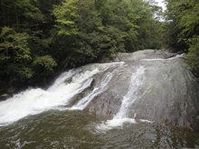
Cave Drop (IV+). Immediately downstream is another drop which we ended up having to portage due to wood. Normally it is a slide that moves you left to right and into a cave. Therefore you want to be running it with right to left. But out day, there was a tree in that line. So we walked.
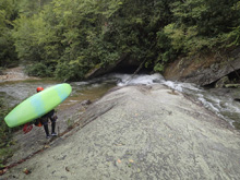
- Bedrock Gorge (III+ to IV). Around the corner you enter a cool small bedrock gorge. There was a nice ledge that we ran far right on and then lined up for a small hole below. The left wall here was quite pretty.
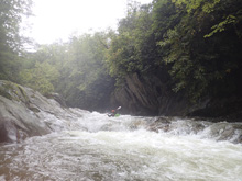
- Double Drop (IV+). I bet at higher flows, the hydraulics here get worse. For us, they weren't bad. The top is a river wide ledge formed by a pothole. We boof middle off of the lip the water formed and headed right. The right side of the slide immediately below was broken, shallower, and lacking a hydraulic at the bottom. The left side was shear and landed in a good sized hydraulic. I bet it still went at the lower flows though. I should note, scouting this one would have been a bit of a challenge as getting out at the lip would be tough. So we didn't.
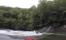
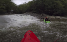
Exit Slide (IV). The exit of the Double Drop was a nice little slide that we ran left of center. The hole wasn't bad at all. Scouting this was a non-option once dropped through the Double Drop. We then hoped out on the left for a longer scout below.
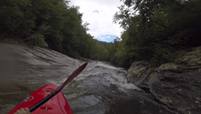
- Junky (IV to IV+). A junky rapid was downstream with a few options for lines. There are a lot of rocks, so scout and pick your line.
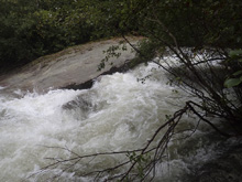
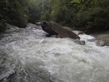
Sieve Slide (IV+). Immediately below was a slide that had a large rock against the right wall that formed a sieve, right where the majority of the water wanted to go. The issue at the low flow was that the bedrock was exposed which formed a ridge which would deflect you harder right and more into the sieve. It would probably be ok... but we didn't like the look of it. More water would help this one for sure as you could get further left on the sheet of rock above the sieve.
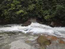
Small Boof (III). A small pocketed boof that we ran on the right.
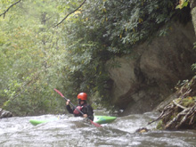
Triple Drop (IV+ to V). This is the drop that is described in Kirk's book as a donut in a semi convoluted analogy due to the center hole having a rock filling. Anyways, scout it left from the pool below the previous rapid using the trail. The line was right, right, right. The top move was the easiest, the second move wanted to push you middle, and the hole there has a rock in it, so being right is important. Then, the final ledge is the narrowest and has an undercut rock immediately to your left that could cause problems. I faded a boof off the left side of that right channel and it worked well. Below, scout using the trail down to Dragstrip.
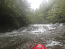
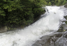
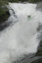
- Dragstrip (IV+ to V). So, it isn't hard... but it is big. If you aren't accustomed to big drops this will make you pucker for sure. Most run far left which can spin you out up top if you aren't careful. If you are careful, and then straighten yourself back downstream after the initial entrance step, you then have a straight away which will see you accelerate radily through two exploding bumps and finally into the small hole below. Scouting is easy via the trail which gets you to the lip with ease. Getting to the bottom is much, much harder. If you walk, just continue on the trail until it drops to the river 200 yards downstream below the last slide.
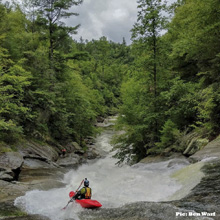
Small Slide (III to IV-). Immediately below is a small slide, just run with the water.
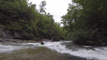
- Final Slide (IV-). After the river bends left, you get the last bedrock drop. We entered center and slide down into the converging currents and through the splashy runout.
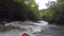
- Junky (IV). Immediately below the pool below the final slide was an island drop. We went down the left. It was junky and I am sure, prone to wood. Below, boogie gets mellower and shallower.
- Lost Cove Creek Confluence, flow is doubled thanks to the creek entering on the right. From here, the name of the creek is Lost Cove Creek. The rapids are also much mellower, but stay on your toes for wood.
Take-out: Get yourself to the town of Mortimer, head north on Brown Mountain Beach Rd and turn left on NC-90 W. Continue for 2 miles to the bridge over Lost Cove Creek. Turn left on Roseboro Rd and park immediately on the left. Note, that from Knoxville, we came in from the town of Linville and came down Roseboro Rd from the top.
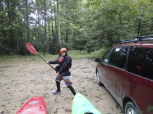
Put-in: Continue up the dirt road, Roseboro Rd, up Lost Cove Creek and then up Rockhouse Creek for 3.2 miles. At the Y, turn left, this junction needed some clearance (Ben's minivan barely made it). Continue for 1.0 miles down to the parking area just before the bridge over Gragg Prong.
HTML Comment Box is loading comments...
