Goose Creek (Lower)
| Stretch: | Saddle Rd to Steven's Memorial Bridge |
| Difficulty: | Class IV to V |
| Distance: | 4.4 miles (then .6 miles on the S. Smith) |
| Flows: | 2,700-5,000+ cfs (on the S. Smith) or estimate 350-900 on Goose. Current Dreamflows S. Smith est |
| Gradient: | 92 fpm average |
| Put-in: | Saddle Rd |
| Take-out: | Steven's Memorial Bridge |
| Shuttle: | 3.7 Miles (10 minutes one-way) plus 3.4 miles of hiking |
| Season: | Winter and Spring from Rain |
| Written: | © 2012 |
| Featured in Video A Wet State #56 | |
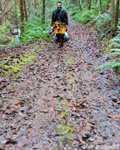
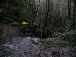
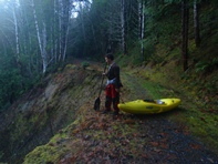
Waking up on New Year's (2012), with the huge storm that came through behind us and flows dropping steadily and predictably down, we decide to do either Hardscabble, Hurdygurdy, or Goose Creek. By the time we left the hotel, it was after 10 am, so we resigned to the easiest and least mission-y of the runs, Goose. I had tried to do this run 3 years ago, but the road to put-in had recently been blocked in, affectively closing the road for all motorized travel. Without knowledge of how long the hike was, we backed out and boated on the South Smith instead. This time around, we knew the hike was going to be about 2.5 miles (actually 3.4 miles) and were prepared mentally for it. So arriving at put-in at about noon, we hiked an hour down the perfectly drivable road to the creek far far below. The only reason for the road closure is a washout that happens at mile 2.8 or so. About a quarter mile before that there is also a creek crossing that would be tricky in the car. But there were plenty of turnouts up-road from those two points... so if you can manage your way around the dirt pile blocking the road, I would knock off a mile or two of the drive...
The run starts off really mellow. Class II continues for a mile and half to the first horizon line and the start of the good section. All the rapids are scoutable though portaging would be tougher. The good section lasts for less than a third of a mile and contains two big rapids and one smaller rapid. Below, the river continues to be class II-III until out of nowhere you will be surprised by the last big rapid. A log blocks the obvious route on the far right. I ran a center line, left of two large flake rocks. Others in our group ferried right in front of the flakes just downstream of the tree and finished on the right. It was a fun rapid, and technically the most challenging of the run. Below, a short distance more of mellow riffles leads you to the confluence with the South Fork of the Smith and an easy half mile float to the bridge downstream.
I feel like we had optimum flow for the run. The South Fork of the Smith was running about 3,000 cfs after a recent large rain storm that took it well over 25k cfs. I know folks run it lower, but I think the in between stuff would become very tedious. The big rapids were not pushy nor sticky at this flow also leading me to believe more water could be handled as well, though perhaps different lines would be chosen. At our flow, and with getting out to take pictures/video in the first gorge, we will were only on the water for just under an hour. This makes me want to go into the Upper Goose Creek next time and just add this run to the end of it, as 45 minutes is much better than hiking up and out and the lower run's put-in.
As Always, thanks to Darin McQuoid for his contribution of photos. Also check out his write-up for many more great pictures!
Mi 0.0:
- There is literally nothing to worry about for the first mile and half. Eddy out on the right to scout the first drop which has an obvious horizon line.
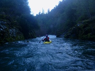
- Gander (IV+). The top is split into the channels. Both probably go. At our flow the right side had a cross feeding hole that could feed you into a pocket in the wall. I was the only one to hop out to scout/film from the top and thought it was more trouble that it was worth to explain the line to them. The left side was straight forward ramp to a hole. The second tier was a nice boof in the middle. At lower flows I know you are forced into the meet of the ledge a little more. Downstream is 100 yards of read and run class III-IV that leads to the lip of Honker.
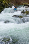
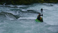
Honker (V). The crux of Honker is the entry boof which lands directly in front of a badly undercut rock. To make matters a little worse there is also a cave behind the falls. We found the far right side friendly to boof and clear the hole without a worry. We then ran down the right side of the next tier which was rocky but uncongested. This then leads to the exit boulder garden which was cleanest on the far right. There was also a center line that looked like it might be a sieve just under water, but we couldn't confirm it was even that clean until we were below. In the future, I think that line looked like the most fun and involved a double boof and good hole.
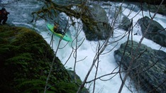
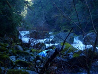
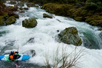
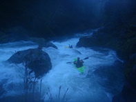
- Easy rapids again tick the miles by quickly.
- Ugly Duckling (V-). Perhaps this rapid isn't as hard as it seemed to us. We thought we had gone past all the big rapids. As we round a willow chocked corner, we are greeted with the site of a large rapid quickly approaching us at the end of the class II we were currently in. I thought I saw an eddy in the willows on the left, but the view was misleading and I was forced to enter the rapid blind. The obvious line is on the right, but a large tree was down blocking most of the channel, forcing us into the boulder choke below. I opted for a fun line that involved fading between two large boulders in amongst the spray from a large flake, and then finished left. The rest of the group behind me didn't have faith and opted to ferry in front of the flake and move right just downstream of the log. Both worked out just fine at these flows.
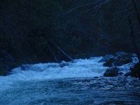
Downstream class III rapids continue to the confluence and a quick 0.6 mile paddle to the bridge.
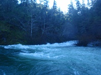
Take-out: Drive up the South Fork Road some 14 miles from Highway 199. Come to Steven's Memorial Bridge (sign on the far side of the bridge). There is a small turn-out on the right just past the bridge or a large gravel parking area 100 feet further on the left. There is a nice trail that comes up river right as well.
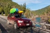
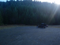
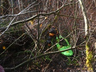
Put-in: Continue up the South Fork Rd for another mile and turn right over the river. Continue for 2.8 miles up to the large gravel lot on the right. Park at the far side of it. The trail is on the far side and follows a nice road for 3.2 miles. At that point, we dropped off a spur rd to the right and followed it down to where we could see the river. We then bushed whacked 50 feet to the river. I think this is where I got a bad case of poison oak. A few mile markers for the hike: 1.5 miles to the overlook on the right, 2.2 miles to the creek crossing, 2.7 miles to the washout, and 3.2 miles to the spur road with the water coming 0.2 miles later.
View Goose Creek, Lower in a larger map
HTML Comment Box is loading comments...
A Wet State - Home Page
