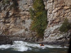
Gauley River (Lower)
| Stretch: | Wood's Ferry to Upper Swiss |
| Difficulty: | Class III to IV |
| Distance: | 12.75 miles |
| Flows: | ~1,000 to 1?,000 cfs (2,800 cfs is normal). Current AW gauge |
| Gradient: | 25.7 fpm average (through 10.1 miles, not including the flat at the end) |
| Put-in: | Wood's Ferry Access |
| Take-out: | Just up river of the town of Swiss |
| Shuttle: | 19.6 miles (45 minutes one way, some dirt) |
| Season: | Year Round (Fall dam release) |
| Written: | © 2014 |
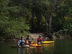
4 years ago when we took a road trip from California I tried to get my friends to do this section one of the days rather than spending 4 on the Upper. Alas, I had no luck. But this year, on the way back from a Upper Yough roadtrip we decided to spend Sunday on the Lower Gauley as a way to break up the drive. Karl Whipp and I were joined by our friends Steve Sanburn and Dan Wallen for what proved to be an enjoyable day with some great play boating.
For a California comparison, I would say this run is somewhere between Chili Bar and the Lower Tuolumne. Certainly Pure Screaming Hell is every bit as big as drops like Sunderland falls on the Tuolumne, but most of the others are class III+ big water affairs. There is some great catch on the fly waves, a few amazing eddy service waves, and of course countless great waves for downriver play... I can imagine doing this run more often would get anyone comfortable with kickflips and wavewheels.
The downside is a relatively long shuttle and of course plenty of flat water, especially at the end. However... the trade-off is worth it. Did I mention that the scenery on the lower is actually much nicer than that of the Upper? We it is. Truly a pretty place. So, will I hurry back... probably not due to a 5 hour distance from Knoxville and the shuttle and the fact it hurts my cricky old knees and ankles to be in the playboat that long... but I will certainly not avoid it and will vouch for my friends to go run it. It is worth it for sure.
Mi 0.9:
- Woods Ferry (III-). A fun wave train run down the left of center.
- Backender (III). Enter middle-ish avoiding the big poor over on the right at the top. At the bottom, drive far right to avoid the big hole at the bottom.
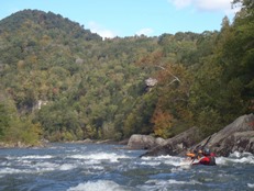
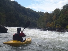
- Koontz Flume (IV). We ran down the middle, heading a bit right down a nice big fluffy ramp through a couple of nice holes. The danger here is the right wall which is badly undercut.
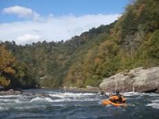
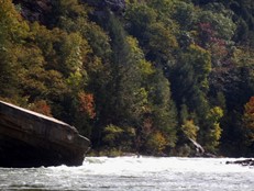
- Junkyard (III-). Several lines exist, we ran down the middle-right chute which was mellow wave train. Apparently an easier line exists on the far right.
- Upper Mash (III+). A complex rapid, we ran it down the middle moving just a smidge left for a great boof. The hazard here is a sieve on the right at the bottom. Below is swift moving water into what I consider the second largest rapid of the run.
Lower Mash (IV). What a hoot. We started right and drove center down the main ramp into a large wave that crashed on my lap standing me straight on my back end. Below the big wave, drive right away from the rocks as they are badly undercut.
- Diagonal Ledges (III-). A great play spot with eddy service on the left. Be aware that not far downstream are two very sticky holes. As you run the run out drive right to avoid these holes.
- Heaven's Gate (IV-). We entered left and stayed middle until it was time to drive far left to avoid the hole at the bottom. Hug the left side of the giant rock at the bottom or go around it to the left all together.
- Roller Coaster (III+). A great large wave train... the main wave is huge and so much fun to punch. Just go down the gut.
- Cliff Side (III). The next set of rapids start along the cliff. I don't remember specifics as at this point my legs were killing me in my playboat. I remember stay left throughout all of the rapids.
- Pure Screaming Hell (IV+). The last rapid is also the biggest. At the bottom you don't want to be right, there is a giant hole as well as a sieve. Just above it you have Purgatory Hole on the left that keeps you from being able to move left early. Run down the middle and wait to see Purgatory, hit the edge or delay a second to pass it and then drive far left.
For more details on the run, see the AW write-up...
Take-out: Depending on if you are in Summersville or Fayetteville, you would approach it from different directions. Either you take 129 from the Summersville Dam and turn on Highway 39 or you can come in Highway 60 from Fayeteville. Whatever the direction... google Swiss. As highway 39 pulls away from the river S Swiss Rd follows the river up a few hundred yards to the parking just across the rail road tracks.
Put-in: go back out to Highway 39 and follow east it 13.7 miles to highway 129. Follow that for 5.6 miles to Panther Mountain Road. Follow this past the Upper Gauley Take out at Mason's until you get to the access at the end.
HTML Comment Box is loading comments...

