Fordyce Creek
| Stretch: | Lake Fordyce to Lake Spaulding |
| Difficulty: | Class IV-V |
| Distance: | 12.5 miles |
| Flows: | 350 - 600 cfs. Current Dreamflows gauge |
| Gradient: | 121 fpm average (two miles 200+) |
| Put-in: | Lake Fordyce Dam |
| Take-out: | Lake Spaulding Boat ramp |
| Shuttle: | ~15 miles (40-60 minutes one-way), dirt road 4-wheel drive needed. |
| Season: | Whenever they release water (Spring and occasionally in the Fall) |
| Written: | © 2010 & 2013 |
| Featured in A Wet State #30, A Wet State #77 and in A Wet State's contribution to World Kayak's Video Guide | |
It is amazing how long some runs take to get on. For the past five years it seems it was not in my stars to get on this creek. Either I was out of town when releases were announced, I was injured, or the group decided to try to find the trail head to take out a few miles early and forgo the mank at the end in addition to the paddle out, only to spend the entire day driving dirt roads and only succeeding in getting lost... only to be followed by an early morning departure the next day for an out of town wedding. Whatever the case may be, it is safe to say that with everything that had popped up and prevented me from boating Fordyce, I began to get nervous if it was some sort of warning that I should not boat this run. Luckily all that was unfounded and we had a great day on the water.
The river has some of the most spectacular scenery you can get for a class IV-V river. Normally to get granite scenery like this you would have to be a class V-V+ boater. However with Fordyce, a class IV+ boater can enjoy the feeling of being in the middle of nowhere, buried deep in the sierras. The river for the most part is class IV-IV+ with several long sections of class II that are occasionally interrupted by a quick III-IV. The exceptions are the start and the end which are action packed and are where the bulk of the time spent on the run will occur. The rapids in these sections are mostly class IV+ with a few V and a few V+ that many/most folks portage. All the hard drops on this run are portagable, and I believe all would be pretty simple to portage. If you don't know the lines, expect to take a full day to do this run. We had Hunkapillar, Bruckner and Tulley with us who had done the run before but with a large group and several of us documenting the river (pictures and video) in addition to a 45 minute lunch, took nearly 6 hours to complete the run including the lake paddle. With a smaller group and less picture taking you could finish in 3-4 hours your first time down I think. But then again, why hurry through such a pretty place?
Also, as of 2010 the worst part of the shuttle road was improved and is now the nicest part of the road. A Land Rover had no problem getting down the road and I would even say any SUV could make it down though I would still shy from a Outback style car as there are still a few rough places... though an Outback could still probably do it. The other nice thing about the improved road is that the shuttle now only takes about 40 minutes where as it took 1:10 minutes just a year ago.
2013 Flow Update: I updated the boatable flow... I had the minimum at what the S/H had it at, 250 cfs. However, after going in at 350 I am going to say it is about the minimum. 300 for desperate boaters... but in a group of 5 we had 2 broken boats to go with the many many brief hangups in rapids. Yes the big rapids all go low, but the in between miles of flat water become just too tedious.
Mi 0:
- 2010 Log (IV+). Just around the corner from the put-in are two very serious logs. You can run to the far left of them both down a small micro channel around the second. The rapid above the logs is class III-IV so be careful. We had a person scout it before we put on by walking down the river 25 yards while I ran back up to the car to fetch my spray skirt.
Eraserhead (IV+ to V). Just downstream of the logs is an obvious horizon line with the pool far below and downriver. The two entry holes are not bad, best run on the left followed by a slide with a kicker in the middle that one in our group pitoned. It is best to get left on the slide and keep it straight to punch the hole (more bark and bite) down below. From there the river splits around some rocks and drops a few more feet. Either side is fine to run.
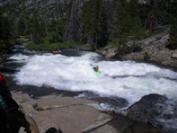
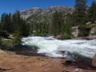
Fountain (III+ to IV). We ran down the far right where a clean line down the rock jumble exists. On the far left a piton rock is very in play.
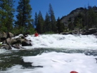
Fast and Furious (IV). A fun double drop. I landed on some shallow rocks in the first ledge, maybe going further left is cleaner, I don't know. I think I am the only one that landed on the rock... go figure, the man with an aching bum is the one to land directly on the rock.
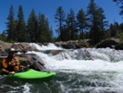
- Old Man (IV- to IV+). Several lines were available to challenge yourself. We ran down the right and moved center at the bottom. That was by far the easiest line but may not be open at low flows. There was also a start left and move right as well as a down the right that looked a lot harder. Just downstream of Old Man the river enters a wonderful pool with an amazing view a Manzanita covered granite slope. This is also an indication to get out on the right or left to portage.
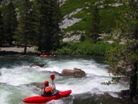
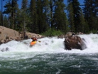
Insanity Falls (V+). I wish all the folks in my group weren't such pansies cause I would have loved to see this run (ok, the folks were much better boaters than me, but none with guts enough that day to fire these two drops up). But seeing video of this run only reinforces my choice to walk. The entry drop is large in its own right and leads directly into the main attraction. A sloping 30 foot drop with multiple piton rocks on the way down. Most commonly it is run far right though Taylor Cavin got what was most likely the first descent of the left line last year (photos can be seen on Darin's website). An easy portage on either right or left, though left is probably easier.
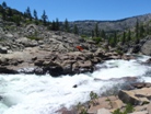
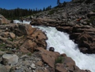
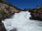
Insanity Falls Gorge (IV+). Putting in below the falls still allows for a fun drop to exit the gorge. The drop consists of a 3-4 foot boof followed by a 6-7 foot drop just below. The second drop needs to be run center or left, just not right. The right side tractor beams people into a crack and massive piton and has caused a fair share of ankle injuries. If desired, safety is easily set from above (the portage) or below after someone runs the drop.
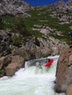
Bishop's Balcony (III). Some might argue with the rating of this, but unless you try to be a hero and boof the hole and avoid the piton rocks, at 400 cfs the line was really easy. Just boof right into the eddy, then run down the balcony and scrape over the lip to clear the rapid. You can up the challenge by ferrying across at the lip or by running the meat. Scout on the left once you realize you are there (end of the straight away below the Gorge).
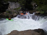
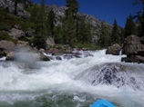
Tailstand (IV+). This rapid could easily be considered a quarter mile run out of Bishop's. Below Bishops is a few holes then 20 feet of slack water before the river bends right. Stay to the inside and boof the 5 foot drop. I made the mistake of interpreting the verbal beta as boof the rock on the right (actually the center) and ended up barrel rolling into a piton and if not for a quick roll a beating. Somehow everyone else knew exactly what was intended and aced the drop. Strange how it is usually me that mucks drops up, weird.
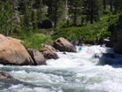
Mini Gorge (IV). Just after Tailstand the river bends sharp left. Just below is a fun read and run drop with a large off angle curler hole combo. The rapid is not hard though be on your toes as Rotator Cuff is just downstream.
- Rotator Cuff (V- to V). Yes that mileage is correct, you have only gone a half mile from Old Man. It's a crazy good section of river. Catch the eddy on the left before you drop over the 3 foot ledge and commit to running the rapid. Below the ledge the river loses 6-7 feet down a ramp before dropping off a 10 foot ledge into a powerful hydraulic named after the numerous shoulder injuries.
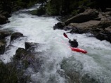
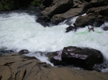
The next 6 miles are much slower. Long stretches of class II-III stand between the occasional rapid. Though those occasional rapids are of very high quality!
- Double Drop (IV). A Straight forward drop with two powerful hydraulics. The first one we ran down the right and the second down the left.
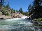
- Mini Gorge (IV+). I think this was my favorite rapid. We had the eight in our group plus two in the group behind us all dropping into this long gorged out rapid all at once. Some entered right while others hit the huge flake boof in the center before working our ways through the many holes and around the many rocks. The river then made a sharp left turn with an accompanying hole or two needing to be punched before the action ceased. This was a really good drop, we were all smiles from ear to ear.
- Squirt (III to IV). A big horizon line marks this misleadingly easy rapid. If you run down the right side you will find a little kicker boof to clear you of the large hole below. If you run center or the left you will plug very deep.
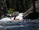
- Log Danger 2010 (IV). A very dangerous log is completely blind from above in the middle of what would be an easy read and run class III. After a easy lead there is a large eddy on the right before a small cascade of about 5 feet. A log stretched across the entire channel though you could get over it on the far left. This log may move, but goes to show you need to keep your eyes open on runs like this.
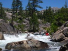
- Little Squeeze (IV-). Totally straight forward, a short ramp drops you into a deep and power hole boxed between two walls. This would be a easy place to get stuck but luckily if you are on this run it shouldn't be a big deal at all.
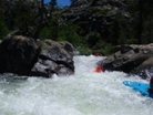
A great lunch spot exists where the river bends sharp left and a log portage use to be.
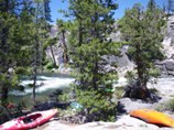
Ramp (III). A fun ramp drop that looks like it will be bigger from above is then morphed into a drop that looks like you will take a big hit. It works out just fine though.
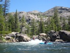
- Big Squeeze (IV+). A few drops lead to a last minute chicken eddy on the right that you can hop out and look at the crux and most walled out section of the drop. Or you can just drop into the chute that has vertical walls 6 feet apart and punch the two large hydraulics held between its granite boundaries. Another really fun and unique rapid.
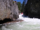
Two Part Rapid (IV+). Somewhere in the next mile was a fun two part rapid. The first part involved boof far right over a large hydraulic and into an eddy that proved to be not trivial to get out of for some (me). The second part was a short ramp with a rock in the pillow in the center at the bottom.
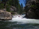
- Where's Berry? (IV+). A short ramp quickly brings you to the lip of a pothole that is best run far left using the wall to grind around the hole below. The entry drop can be run on the right or left.
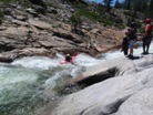
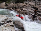
- Bad Seed (V+). It is hard to give a rapid whose sole challenge is to enter at the correct spot a class V+ rating, but this rapid has so much consequence with it that I just can't bring myself to give it a class V rating. Plus, it is much bigger in person that any picture or video has ever made it look. Drop over the flake and slide down between all the piton and pin rocks until you are at the bottom. Scout or portage on the right.
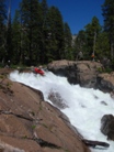
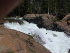
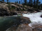
- A Foot Bridge crosses overhead marking the start of the remaining hard section of rapids starting with Sidewinder just 0.1 miles downstream.
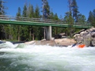
Sidewinder (IV+). A nice long multi move rapid, this rapid is best run avoiding the sieves. To do that, avoid the rocky places. Ok, seriously, it is straight forward, follow the current and right at the end, boof the highest part of the hump to clear the hole below.
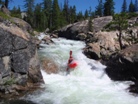
Pierce Meadow Trailhead is on the left somewhere down here. I didn't see it though I wasn't really looking for it.
- Typewriter (IV to IV+). As you round a right corner you will see a walled in rapid with two large looking hydraulics and an eddy on the right. You can scout from the last minute eddy if you want. The first hole is best run far left as no matter what it will typewriter you all the right and possibly flip you against the wall before dropping you over the bottom hole that is very shallow and packs a hole of its on as well as a pocket for the unwary.
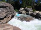
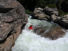
- Fordyce Falls (IV+). Enough spice added to make it fun but still keep it easy enough for all to enjoy! The entry can be skipped if you don't want to clutter your mind, or you can run either of the two channels leading down to the final eddy. On the main drop, don't drop far left as you will land on rock and don't drive far right as it will be even worse. Just cut behind the rock at the lip and head straight downriver. It really is easy and really is a hoot!
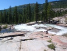
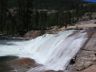
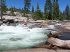
- Just a Big Class III (III). Just head down the ramp... so easy and yet so fun! Don't go over the next horizon though, as 0.05 miles downriver is Split Falls.
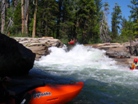
Split Falls (V). Just line it up, not too far left or you will meet the overhang at the bottom, not too far right or you will meet the shelf underwater. Just down the green tongue into the goodness and rollup below.
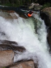
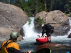
Narrows (III to IV). A fun short section of rapids in and amongst the granite.
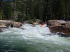
- The Hole That Ate the Donner Party (V to V+). High flows actually cleans this rapid up as at low water the bottom hole is boxed in and ferocious. At 425 cfs however the bottom hole flushes and has a window to avoid it completely. Just run the good size hole and steep ramp down the right. Easy right? We scouted on the right followed by most of us portaging on the same side. The remaining rapids all link together with only minimal recovery pools.
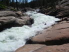
Knobs (IV+ to V-). A bit manky for my taste, a short slide leads to a rocky rapid. The crux is just to thread the needle to the right of the rock at the top and the granite outcropping to the right.
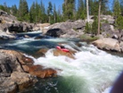
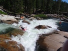
Just a Big Class IV (IV+). A short mank rapid is run before catching the eddy on the left. From there, run the ramp into the good size hole below followed immediately by another ramp. We all worked right to avoid the flake in the second drop but I don't think everyone else cares that much. Just below is a small exit drop that we ran on the left.
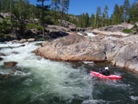
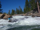
Hide and Seek (V-). The beginning of the mank will drive many to the shore to start portaging. This rapid was scouted by Nathan and gave the "Marginal on the left sign" (he looked like Doctor Zoidberg from Futurama but we knew what he meant). After a probe went and the movements became more exaggerated several of us portaged on the left while others ran it or portaged easier on the right. The folks on the right put back on to run the exit on the right.
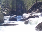
Ninja (IV+ to V-). Very blind from above, some of us has enough and walked with effort on the left. In hindsight, the actual mank doesn't fully start for another few hundred yards so we put back on and ran the exit and the next drop. It would be easier to just run this drop. Enter far right and run the steep pinch. Immediately catch an eddy on the left which is not a trivial move. Exit far left over the flake boof. UPDATE (DANGER) In 2011 a sieve appeared in the normal line at the pinch on the right. It is boatable, but also has pinned a few folks badly. Scout from the right to take a look at before dropping in.
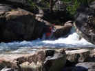
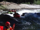
An Easy Class IV (IV-). I don't remember the details. It was easy. Most of us got out on the left below in the clearing and began hiking.
No Man's Land (IV+ to V). Blind, occasional woody, very sievy rapids continue for a quarter mile (if the lake is full). We didn't find a real trail on the left but found a trail that seemed to have been used by kayakers in the past.
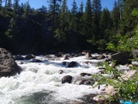
- The Lake Spaulding high water mark ends whitewater and begins the paddle across the lake. The paddle is about 2.25 miles depending on the lake level.
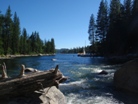
Take-out: From Highway 80, take Highway 20 towards Grass Valley a few miles. Just after Camp Marine Sierra take a right on Lake Spaulding Road and follow to the boat ramp. Parking is $7 for the day.
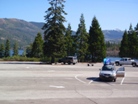
Put-in: Get back on Highway 80 and the Cisco Grove Exit. Cross the freeway (and South Yuba) to the North side and turn left. Take the first right after a few hundred feet. Quickly, s you pass some houses, stay right on Fordyce Lake Road (Road 85). This part of the road is dirt and is possible with a civic or minivan though I would certainly prefer more clearance. After you follow a cool creek a short ways you will climb up and over a ridge. Soon after the road forks, stay left. From this point, stay on the main road which involves staying left at a small fork or two which I believe are just campsites though I may be mistaken. As you climb one last time the road again gets bad. As you crest the ridge and start to drop down the rockiness continued. We passed a minivan with some kayakers beginning to hike from this point. What once was the worst part of the road was up next though now it is regarded and totally mellow. Drop down to the lake and continue at lake level until you reach the dam. Park at the end of the gravel lot. A trail starts on the far side of the trees at the end. Follow the arrows down the granite to the cable crossing. Put-in there. The drive is about 6.6 miles from the Highway to the lake and another 1.6 miles around the lake to the dam from there. Although the road has been improved, I would still shy away from taking my Highlander in as I still baby it a little. Any pickup truck or Range Rover would be fine. An Outback could also make it depending on the how much the owner babies it.
HTML Comment Box is loading comments...
