
Elkhorn Creek
| Stretch: | South Fork / North Fork Confluence to AW Acres Access |
| Difficulty: | Class II (P) |
| Distance: | 4.9-7.55 miles |
| Flows: | 250 to ~6,000 cfs (limitation is the portage around the dam, which becomes impossible above 6k). American Whitewater's gauge. |
| Gradient: | 14.5 fpm average |
| Put-in: | Access on N Scruggs Lane, just off of Goergetown Rd. At the Confluence. |
| Take-out: | Access on Peaks Mill Rd is limited to just a few cars. AW bought land downstream at the bridge over the river on Peaks Mill Rd, downstream river left of the bridge. |
| Shuttle: | 6.6 miles, 10 minutes one way |
| Season: | Year round... though less common in summer |
| Written: | © 2019 |
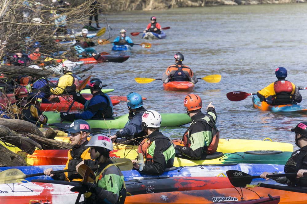
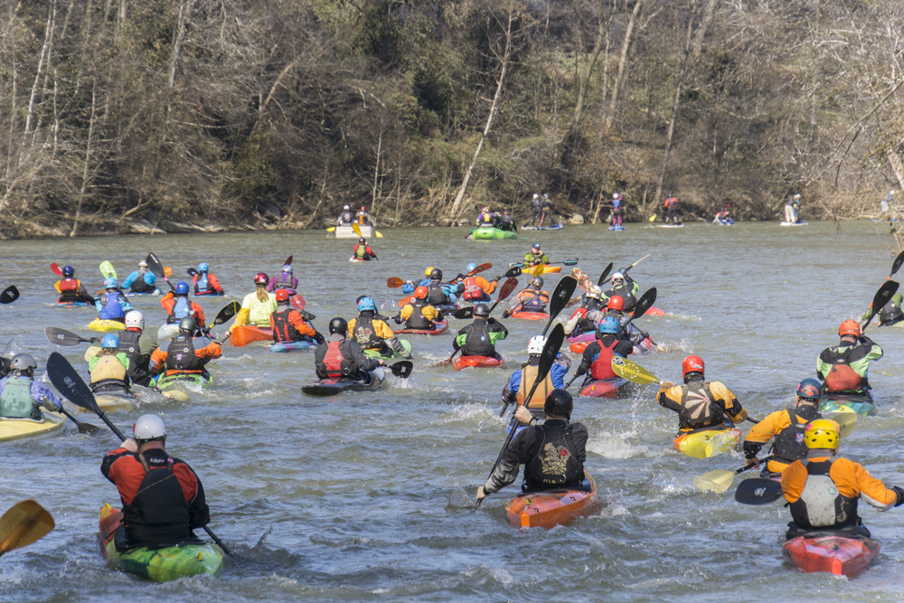
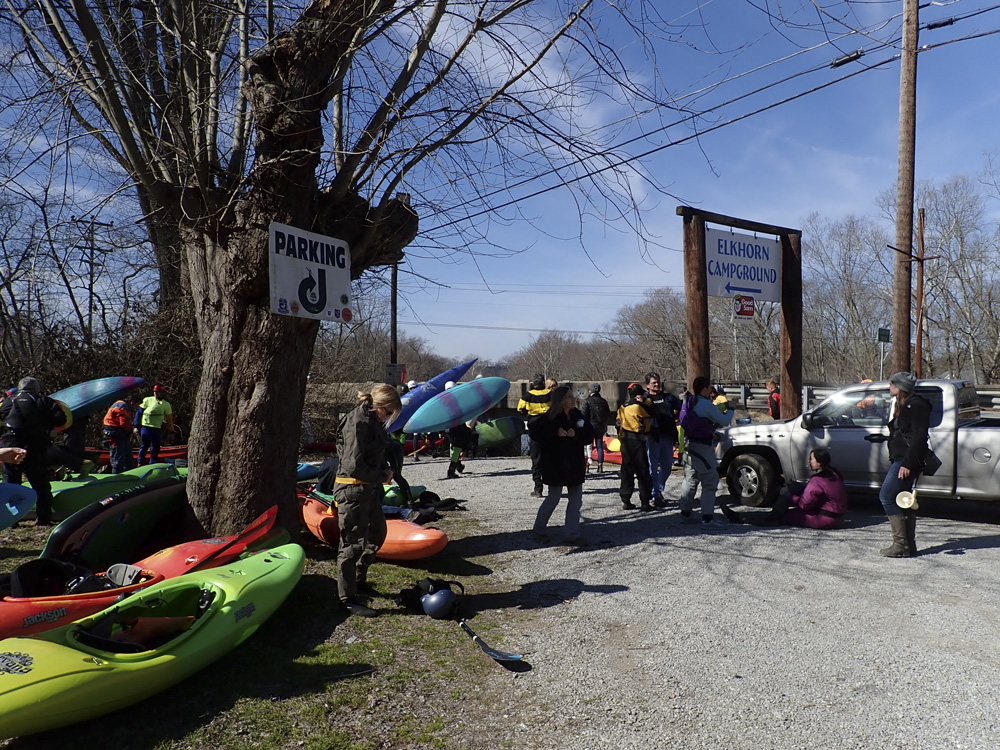
I honestly hadn't heard of this little creek before Diane was invited to speak at the National Paddling Film Festival which occurs in Frankfort KY. On the Saturday of the festival, there is an unaffiliated race that has been getting put on by two of the areas clubs for several years. Since I like doing new runs, we thought we would float this river while there.
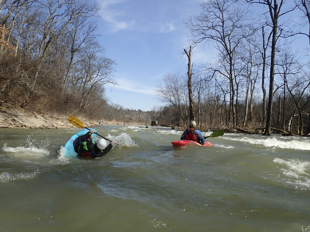
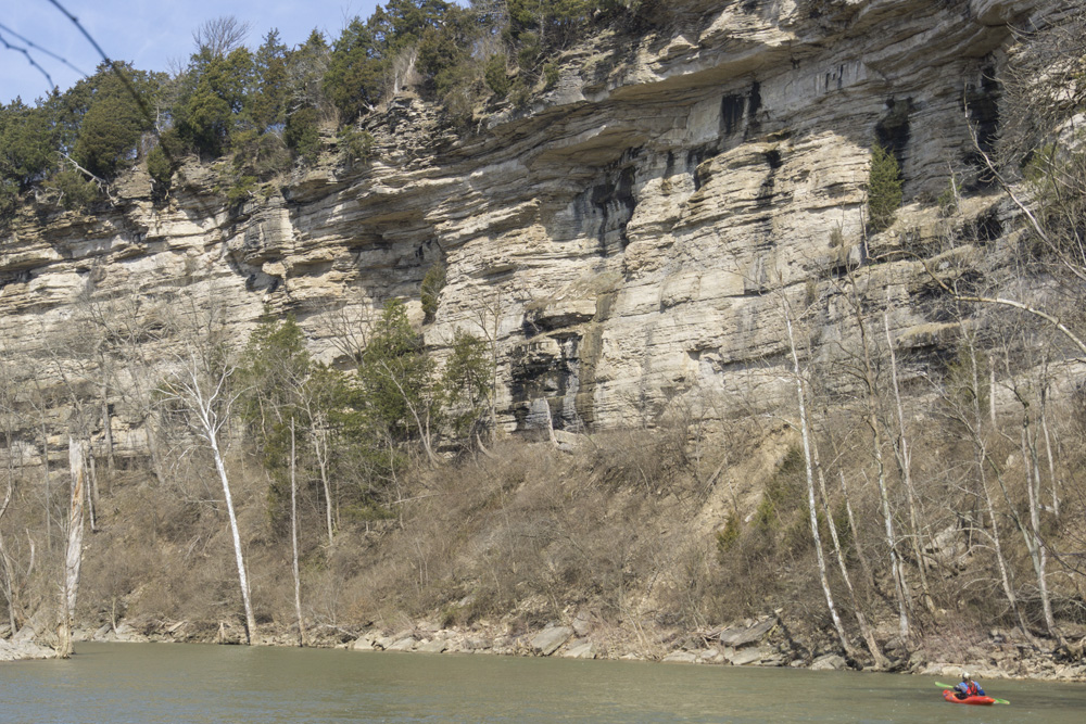
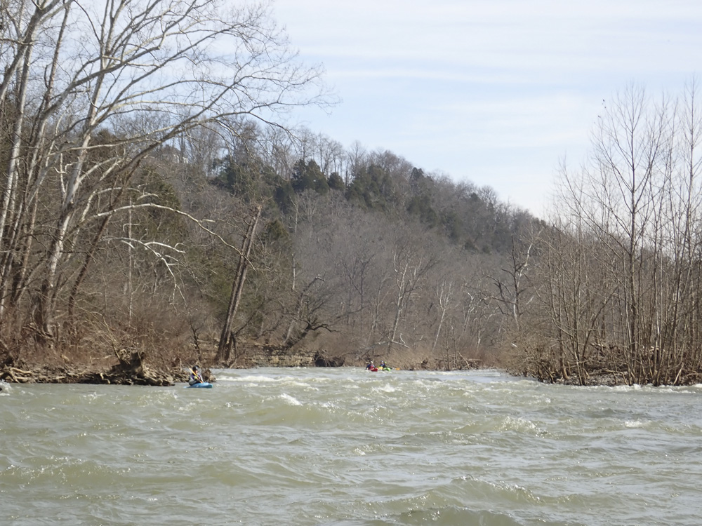
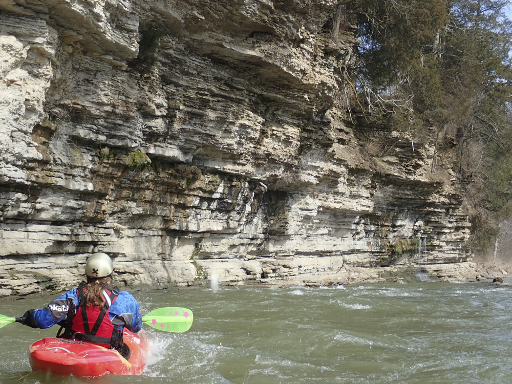
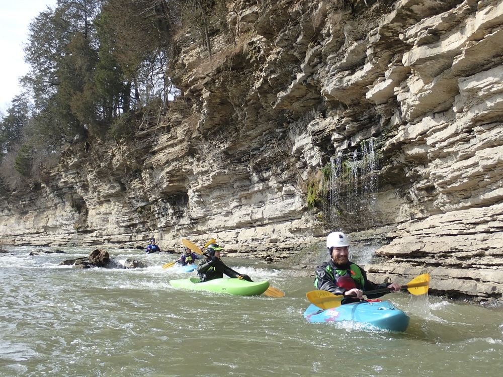
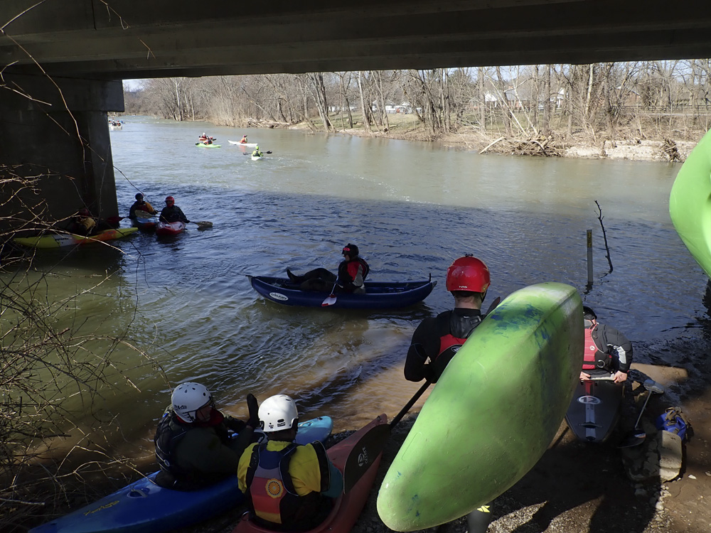
The river is just class II, but it has water for much of the year, and as such is a mainstay of the area's boating scene. It does however offer a great intro experience. There are straight forward rapids that are hazard free, there are surf waves, and there are nice eddy lines. Everything you could want in a river. But the special thing about this run, is the scenery. This part surprised me completely. It has some nice walls, straight out of the plateau, though less tall, but just as scenic. For that reason, I feel that the run is worth doing, even if class II isn't your normal jam.
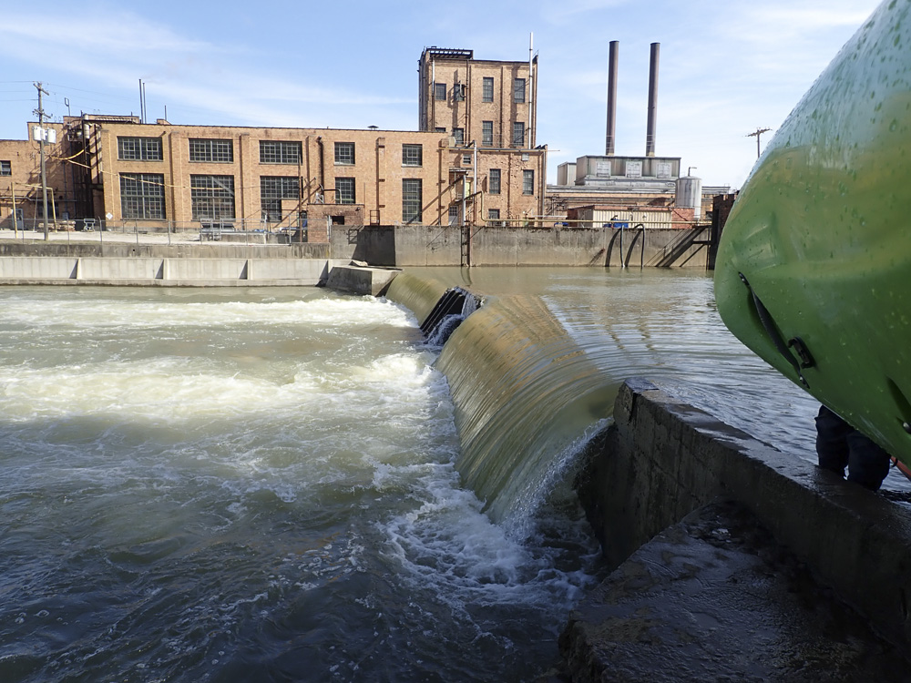
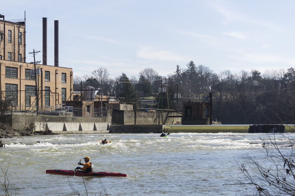
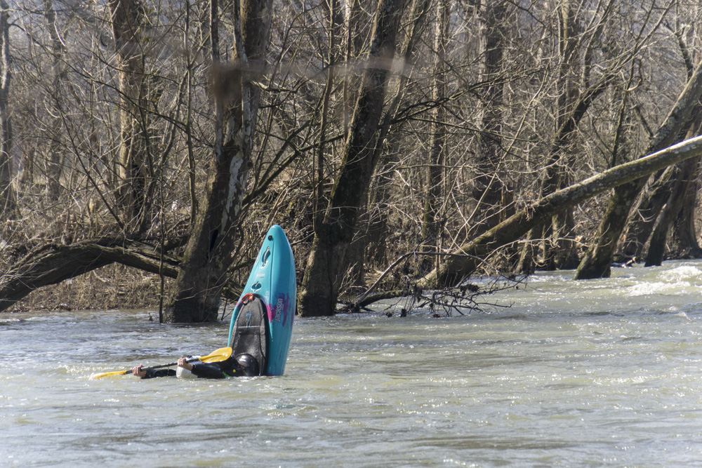
We had ~1,550 cfs, which I was told was a little high for the really nice play. But I believe there are a couple of features that really come into their own in the 3,000 range. The one major and significant hazard on the run happens early on, with the low head dam right behind the Jim Beam Factory. This dam, though an easy portage at regular flows, becomes unportageable at flows around 6,000 cfs I am told. At that flow, it is a river wide pour over that is very deadly. Even at our 1,500 cfs, the hole was not to be trifled with. Runnable, sure, but worth the risk, not in my opinion. Portage it on the left.
Mi 0.15:
- Church Wave (I+). Just a stones throw downriver from put-in is the first great play feature. This is a wonderful small flatspin spot that is in the center of the river.
- Jim Beam Dam (P). This is a deadly hydraulic. It is runnable at lower flows, but it is dangerous at all flows, especially so at high flows. It is a low head dam. Portage on the left. However, above 4k cfs the portage is a little sketchy, and above 6k cfs it is impossible. Walk down 50 feet to slide back in, the toe back any earlier is significant and dangerous.
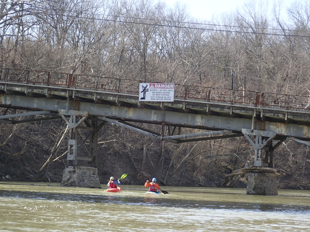
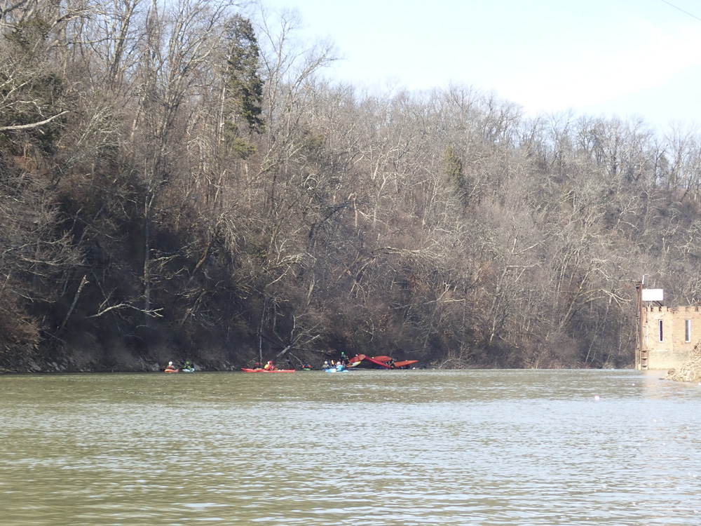
Dam Wave (II). The runout of the dam is a pair of great surf waves. Both have eddy service on the right.
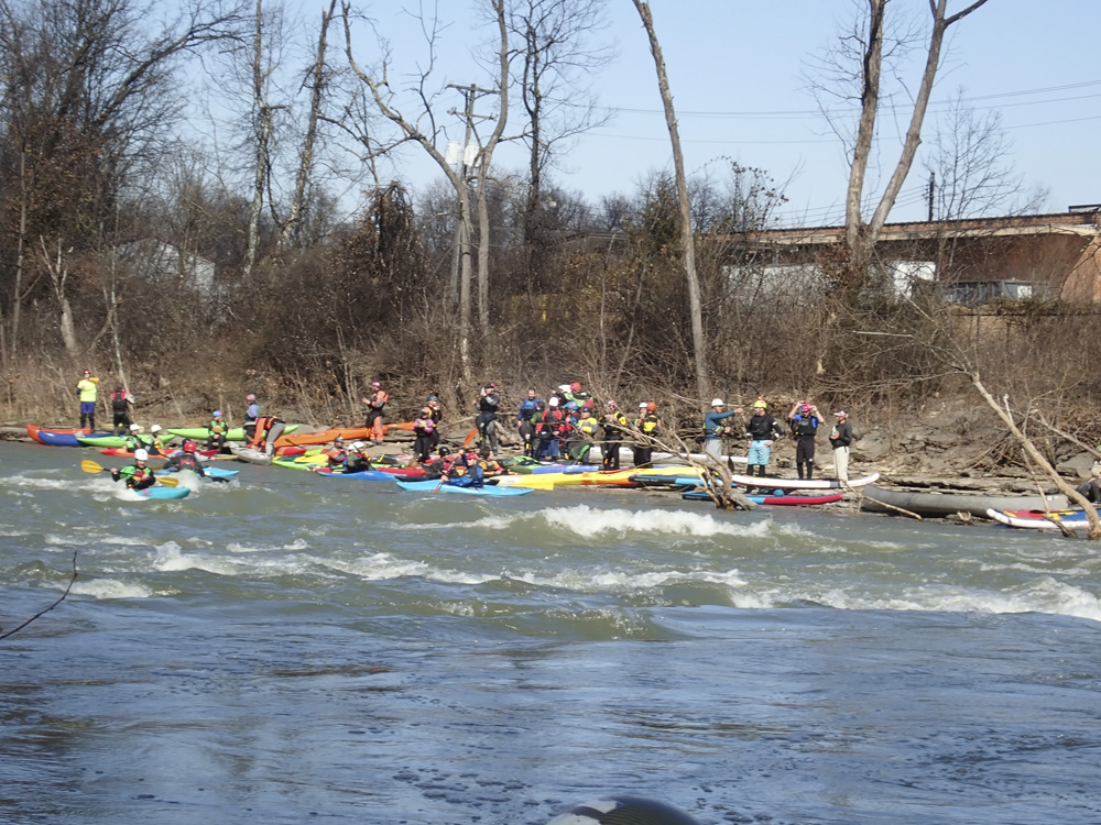
- S-Turn (II). Perhaps the biggest rapid on the run, it is also the first you come to below the Dam Wave. It is long contains some big waves at the top. As the flow bends back to the right, the left side is shallow.
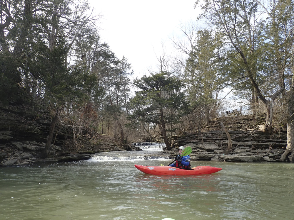
- Lunch Spot (I+). Another nice mellow surf spot at the right flows.
- Wall Ride (II). After a flatter section along the gloriously pretty right wall, you come to a rapid that runs down the right walled shore. Stay off the right bank as it is jagged and perhaps a smidge undercut.
- Angioplasty / Surf City (II). An island splits the right, left is Surf City and Right is Angioplasty which has a small boof to hit in the middle of it.
- Saufleys (II). After a small creek enters on the left, you will run down a small rapid along the shear left wall. The left channel is clean and fun and a little creeky as it gets smaller and smaller the further down you go. Other channels also go just fine.
- Optional Take-out. Apparently the local community isn't stoked on kayakers... some people take out here but parking is limited. Instead, it is recommended to continue down to the AW owned property downriver.
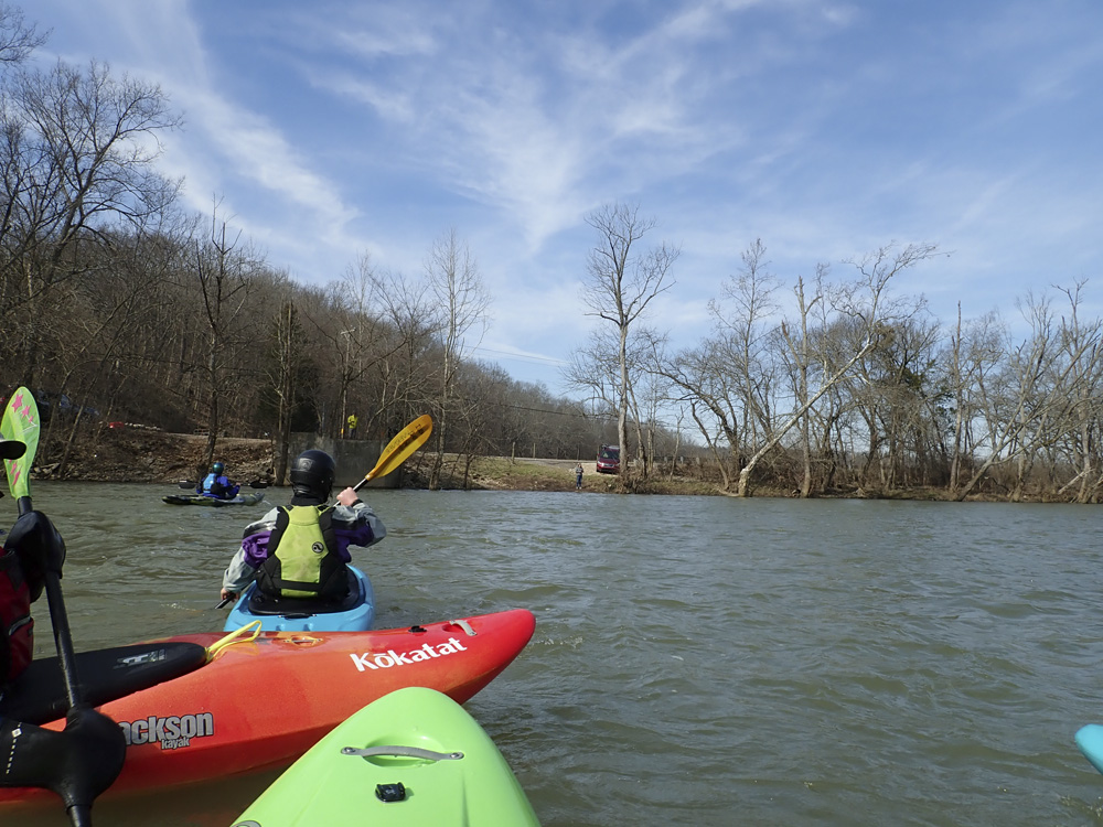
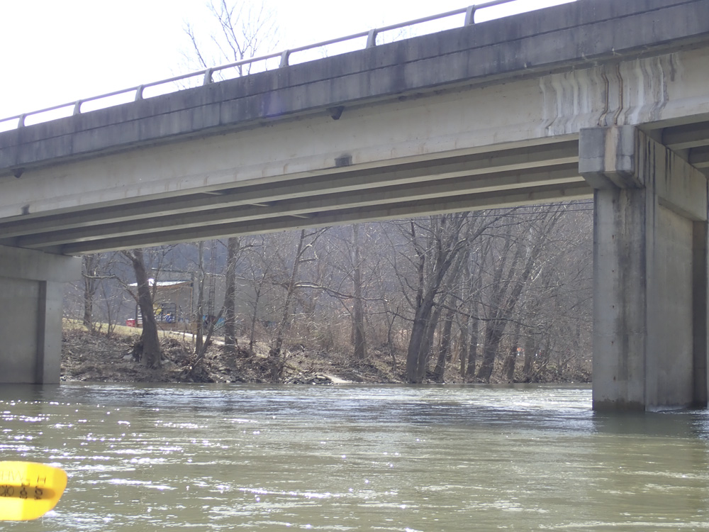
Take-out: Just north of Frankfort KY, take KY-1900 (Peaks Mille Rd) to the north. Follow this 7.2 miles to the AW owned access just before, to the left, of the bridge over the creek. The Optional access is back the way you came a few miles, where the road first comes along the creek.
Put-in: Head back towards Frankfort on KY-1900. Follow this for 2.3 miles, turn left onto Steadmantown Ln. Follow this for 1.9 miles before turning left to stay on the same road. After 1.1 more miles, turn left onto East Main St / Goergetown Rd / US-460. Follow this for 1.2 miles, immediately after the bridge, park on the right at N Scruggs Lane. Apparently if you leave a car here, it costs a few dollars, pay at the campground at the end of the road.
HTML Comment Box is loading comments...