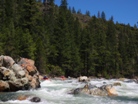
East Fork of the Trinity
| Stretch: | Mumbo Creek to Alpen Cellars |
| Difficulty: | Class IV to IV+/V- |
| Distance: | 8.2 (or shorter) miles |
| Flows: | 800-2,000+ cfs on the Upper Trinity. Current Dreamflows gauge |
| Gradient: | 119 fpm |
| Put-in: | Mumbo Creek (or Lower) |
| Take-out: | Alpen Cellars Winery |
| Shuttle: | 25 (or 8) miles (60 minutes or 20 minutes one-way) . |
| Season: | Spring from snowmelt |
| Written: | © 2010 |
| Featured in Video Twenty-Nine and Forty-Two | |
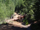
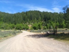
This run was on my mind for the past 6 years, but due to the difficulty of finding flows on the water while the road is clear I never motivated a mission to give getting on the water a try. This year though, some friends from Weaverville were motivated to encourage the mission and we made the drive to the far side of the lake to give the run a try. Due to a large snow pack in the Trinity Alps, overhead drifts at 4,000 ft on Memorial day we knew that going over Ramshorn to get to Mumbo Creek was not an option. Several resources mention a way in on the East side of the river using dirt roads to head up the river. Each resource states that you can't get to Mumbo Creek but state that the goods are all below where the East side road drops you off. Looking at the maps it looks like you can get all the way to Mumbo Creek and higher on the East side. We however got stopped a little over 4 miles up the road due to a huge downed log. I am not sure if this is the same reason as everyone else not getting all the way to the top, but it was certainly bigger than our truck or our chainsaw could handle. There was an established trail, so I am thinking this spot gets some use, though perhaps just from fisherman.
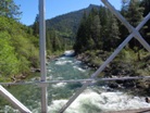
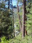
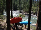
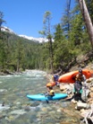
So anyways, we still got many good rapids and had a worthwhile day. In typical Upper Trinity fashion, the rapids were continuous affairs with a few sections that stood out as harder. For the most part the run was class continuous III with a few sections that peaked as class IV (plus one long IV that deserves a class IV+ rating). At mile 5.7 from Mumbo Creek you enter a gorge that has 4 rapids that all are in the class IV to IV+ range and link together. This gorge is also reported to get stouter as flows increase. The crux was the second rapid in the gorge which was a boof over a large hole. To make matters worse, at higher flows the portage for this would be very difficult and would likely require a complete gorge portage. Anyways, the scenery was great, where we put in you can tell that upriver the scenery must be world class. The rapids were fun, and I am certainly going to try to get back to get on the complete run.
One final note, we had 1,050 cfs on the Upper Trinity gauge the day we did it. We thought it was low but good for a class IV run for folks ok with a few IV+. I think 1,200 or 1,300 would be optimum on that gauge (which is more than you actually have in the East Fork of course).
Update 2011/2012: Since that first year, I have gone back each of the following two years. This run really is quite fun. As I initially anticipated, 1,300 is a fantastic flow though certainly the class IV boaters in our group did have some struggles and added a few portages. We also managed to put in a half mile further up and we found this to add another "big" rapid that saw a recirculation swim in our group and a tandem long surf in the hole at the exit rapid. That rapid was immediately below where we put in. The first part should be boofed on the left of the right channel, the second slide down the far right.
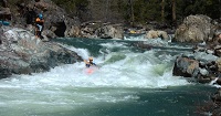
Mi 0-4:
- See Dan Menton's write-up for a few brief words on the upper 4 miles. It starts steep with a few good drops and then eases up after a mile when the gradient drops from 116 to 79 fpm.
- Long One (IV+). This rapid starts out fairly wide and drops over a rocky section and then splits around a small undercut. From there the left side drops over a series of ledges with some decent holes before leading to a rocky jumble that can be taken down the center. Small eddies exist all along the rapid to eddy hop down.
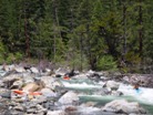
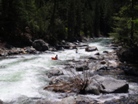
A few fun class III-IV drops
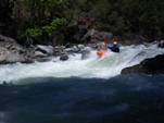
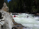
Gorge #1 (IV to IV+). Two distinct tiers. The first one can be run just about anywhere. The second one we ran far left around the flake in the center of the river. This then bounced you off the left wall and into the corridor below. It would be wise to eddy out on the left to scout the rapid below. The start of the gorge is signaled by an old concrete dam structure on the right shore, also there was a tree spanning the river just above it that we could duck on the far left. And easy scout of this rapid in on the right though you get cliffed out as you look around the corner to the next rapids.
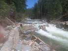
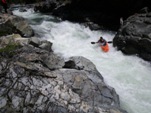
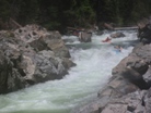
Gorge #2 (IV+ to V-). By far the crux of the run. A boof over a sticky hole that flushes quickly downstream into the next rapid. I would scout this rapid and if possible get a rope near it. At our flows there was a small eddy at the lip of the ramp on river right that allowed one person to precariously get out to set safety (and later for others to portage). At higher flows this eddy would not be present. An easy scout of the rapid in on river left via the large eddy. Portaging on that side would require portaging high around the entire quarter mile gorge.
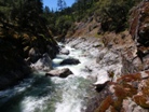
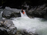
Gorge #3 (IV). A fun boof best taken with a little left angle to avoid the cross current pushing into the wall on the right.
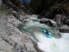
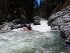
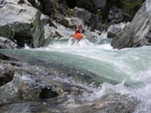
Gorge #4 (IV-), Exit the gorge by avoiding the wall on the left and the pocket on the right. You are free, the river opens up and fun boogie continues.
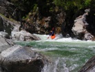
- Tree (III). A long shallow rapid leads to a log jam (2010) that could be ducked on the far left or perhaps should be portaged on the left. You can see this one from the road if you are paying enough attention.
The rest of the run has some fun class III rapids, none have all that much individual character, but still are good fun.
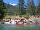
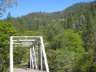
Take-out: On the North/East side of Trinity lake, turn off of Highway 3 on East Side Road. Follow this 8 miles until you cross the East Fork. Just past it there is a sign pointing to the left towards Whipple Ranch. Turn left and follow this to Alpen Cellars. Park before the bridge on the right, the river access is just upstream.
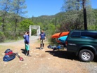
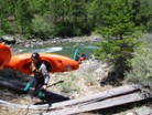
Put-in: 1) We went back about 1 miles and turned on the road marked 37N08Y. Follow this a mile or two. You will crest a hill and see a large turnout on your left followed by a road dropping down to your left labeled XXXXXX. Take the left. Follow this as far as you can, if possible all the way to the East Fork one mile upstream of Mumbo Creek. 2) Go back to Highway 3, head north towards Callahan. After 8 miles, turn right on Ramshorn Road. Follow this 7-8 miles to put-in. The elevation is over 5,500 feet so this road tends to be snowed in while the river is running. Later in the season the better I guess.
HTML Comment Box is loading comments...

