Cuyahoga River (Cuyahoga Falls / Sheraton)
| Stretch: | Sheraton Falls |
| Difficulty: | Class IV to V |
| Distance: | 100 yards (park n huck), 0.3 miles (hike out), or 1.25 miles (w/ lake paddle) |
| Flows: | 250-1,300 cfs (local a-teamers run higher) (class V above 900). Check out USGS's current flow gauge. |
| Gradient: | 191 fpm average (from falls to lake, the two falls are steeper) |
| Put-in: | Sheraton Access at Broad Blvd |
| Take-out: | Either park-n-huck using put-in, hike out to near HiHo Brewery, or paddle lake to Gorge Metro Park |
| Shuttle: | 1.2 miles, (2 minutes one-way) |
| Season: | Fall to Spring, off rain, holds well... low water available during summer |
| Written: | © 2022 |
In 2020 we made plans to head up for the weekend of the Cuyahoga Falls Festival. But due to Covid 19 outbreak, the trip was canceled. Then in 2021 we went to Maine instead. Finally, in 2022 the plans worked out for us to finally head up this way, using the Cuyahoga Falls as an excuse to also visit the Cuyahoga Valley National Park as well. Regretfully though, with our need to ask for time off of work a few months in advance, we accidentally ended up being a week early to the falls festival when the dates for the festival were finally announced.
I spoke with some friends who were familiar with the area before going up there. I was told 600-900 is an ideal fun flow, few run it above 1,000 but certainly people do. And it can be scrapped down in the 300 range. I was told above 1,000 we likely wouldn't want to take turns soloing it. So to my frustration the day we arrive it was running 1,200. Two days later we scout it at the 980 or so range in the evening after hiking in the nearby Cuyahoga Valley National Park. To our surprise the second drop had a huge boil and looked super hard to have a clean line on. I guess AW's write up is more in alignment with the average local user and doesn't account for these higher water runs. To make matters worse, "The Jumble" (which is just the second have of the second drop) had a tree and picnic table in it making a right line very very dangerous indeed, honestly probably highly likely of a bad outcome. So we decide to put it off another 2 days instead of organizing a group for the following day. 2 days later, flows have now dropped to 840, its our last day, so we have to pull the trigger... assuming worst case scenario we run the first drop and then eddy out, scout, and potentially portage the second drop.
Don Howdyshell helped us get in with locals Ross and Nic Williams so that we didn't have to go solo. Awesome! And then the morning of, he also volunteered to babysit the kids on the Sheraton deck overlooking the falls! Ohio hospitality is amazing!
Scouting the falls can be a bit difficult to do well before putting on, the reason being is that the highway borders the cliffs on river left and the Sheraton hotel lines (and overhangs) the cliffs on the right. So the best way to scout is (I really don't know how acceptable it is) from within the Sheraton. Walk in the main entrance, take a right, go down a long hall way, and on your left there will be an elevator down to the falls viewing area. This gives you a good view of Rookie Drop and the ledge of Second drop, but out of sight is The Jumble. But this will give you an overall idea if you want to run it. For us, when we scouted it around 1,000 and saw the boil in second drop, we said no and waited for lower water.
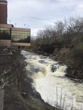
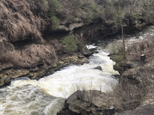
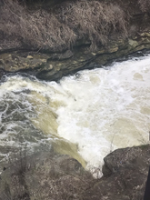
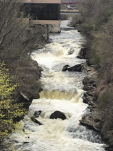
Once on the water, you can scout the first drop on the right, and the second on the left. Similarly if you want to run laps, the walks back to the top are on those sides as well. That means if you just park at put in, you have to ferry after walking up river left for second drop, catch an eddy on the right between the two (not a mellow spot), and then get out and walk up first drop on river right.
Other options for shuttle are to hike out just below the last rapid. A small ravine/creek thingy breaks the cliff line. You can scramble up that and it deposits you at a parking area next to HiHo Brewing. This is then easily walkable (0.6 miles) back up to the put-in (Old Portage Trail Rd). The other option is to paddle 0.8 miles of flat water to the Gorge Metro Park. This is then a 1.3 mile walk back to put-in.
While I don't want to dwell on it anymore than I have in my own mind, I do want to share about The Jumble. We scouted and saw the best boof on Second Drop was pretty far right. We talked it over and watched Ross and Nic run it and easily in their half slice boats, and make the move using the boil to get pushed far left upon landing. I think because of the scouting two days prior and seeing the nasty hole, both Diane and I in our creek boats, carried more momentum to the lip then we should have. Diane blasted up and over the boil upon landing and had to quickly whip around a ferry angle to make it left. I took note and landed with more left angle and onto a harder edge to kill my speed. However, in my creek boat and with my (I am fat currently) momentum, I still cleared the boil, but being as I was not stationary, fading off the side of the boil, sideways, I was unable to turn my bow onto the boil to set a favorable angle and instead quickly was moved towards the nasty right channel. I was paddling hard the moment I landed to not mess around, and as I began to move to the nasty spot I continued paddling. I knew there was guard rock to the middle channel which I quickly spotted and drove beneath as I didn't want it to reject me to the right. I was able to just claw enough to the center to single point broach the rock that splits the two channels. I threw my weight forward and grabbed for the edge of the rock for all the extra help I could get to rotate off the point into the correct channel. I slowly felt my boat rotating favorably. After a few seconds it was clear I was going to go down the center, much more acceptable channel. From there I just had to figure out how to project out a little and get my hand back on my paddle, before dropping down into a recessed ledge, overhang feature in that center channel. Thankfully that all worked out. Anyways, this freaked me out. It was a lapse in concentration that made me carry too much momentum, perhaps some nerves thrown in due to our less frequent boating these days and from scouting it at higher flows 2 days prior, and because of all that, I had the closest call that I can recall... 650 some odd rivers into my paddling life. And in Ohio of all places... not New Zealand, not California, not North Carolina, not Norway... Ohio. Crazy.
On a totally unrelated note, you should also look into the Cuyahoga River fires of the 1960s. The river was so polluted back then, that it actually burned multiple times downriver near Cleveland. This was part of the impetus of the creation of the EPA, or Environmental Protection Agency. Seeing the river today it is mind blowing how bad it once was. Even the Beaver Marsh in the Cuyahoga Valley National Park, not far away, was drained and used as a auto shop and junk yard as recently as the 1980s. Just impressive to see the turn around an ecosystem can make when there is some regulation protecting it.
Note: For the life of us we can't find the point and shoot camera that we had with us in Ohio... did we lose it? This means that there is no pictures sadly of the rest of the run.
Mi 0.0:
- Warm-up (II). A small riffle is all that stands between you and the falls from the put-in. There are some nice eddies to catch in it as well as a wave or two to surf. On the right there is a big staging eddy below a concrete structure, this is the remnants of the old dam that was taken out in 2013.
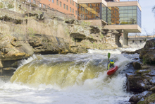
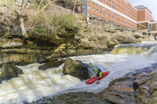
Rookie Drop (IV- to IV+). At most flows it is a mellow drop. You can enter right and go around the old diversion structure that creates a uniform ledge which is a sneak of sorts. Or you can go far left and ferry back to the right below the diversion ledge. Left is best at higher levels as at the top of the slide there is a green wave that curls to the left. Starting left gives you nice right momentum to "T" up the wave and punch through it. It wants to kick you left and also is known for flipping folks onto their heads. On the slide, you want to work right a bit so that you line up the flake to autoboof off of. At low flows it is all much mellower. And the recovery time below is more significant. Scout on the right. Below, eddy out on the left just below the entrance above the second drop, to scout second drop. At flows below 700 there are two eddies to use to walk laps. The low water eddy is just below the drop, but as the eddies shelf gets covered the current gets too strong to park there. 700-~1000 it is only one eddy and more difficult, it is located between the two rapids as you enter the lead in of the second drop. Over about 1,000 there are no good lapping eddies which also means you have to head down to at least the hike out take-out option rather than park and huck back to the put-in car.
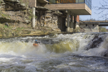
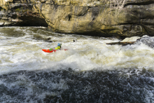
- Second Drop / The Jumble (IV+ to V). These rapids are one rapid, so I am going to describe them as such. The top part which is "Second Drop" proper is a river wide ledge. A few small holes start off the entrance, run far left or right on the hole just above the ledge, depending on which side you run the main ledge on. There is a boof 6 feet off the right shore that is nice, and there is "the staircase" on the far left. The left is safer, but harder to have a clean line on at higher flows as it just pits you. The right slides to the boof so you are going fast and has a friendly lip to water boof off of to clear the hole below. At high flows this hole is super legit and scary and packs a huge boil that would create a life changing experience if you were to get stuck in the hole. So, why is one side safer than the other? That is because of the second half of the rapid, "The Jumble." This rapid has a main left channel, a smaller center channel, and a smaller right channel. The left channel is the safest and most straight forward, a ramp to the convergence of all the channels and into a small hole. The center is safe enough, a small ledge to a weird curler, if you mess this one up a lot you could get worked a few spots and I am sure it isn't super deep in here and if you do an absolutely terrible job perhaps there is pin potential, but overall, it is run on purpose often. Lastly, the right. This is a sieve pile that depending on the year, sometimes can be ok(ish) but this year had a tree and a picnic table in it, making it overall a very deadly channel. It changes from year to year with high flow, so scouting is worthwhile and safety for sure is helpful. With that said, at 840 cfs there was very very little time for safety to matter as it only takes a second or two to go from the ledge to the jumble. Anyways, the rapid overall felt class IV+ to me at that flow, but for sure it has class V consequences. At low flows, it all is slower, less sticky, less pushy... and therefore less dangerous as there is time to get where you want.
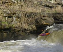
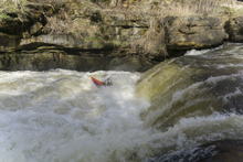
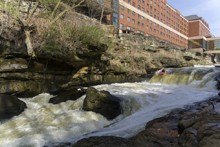
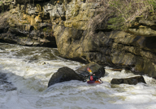
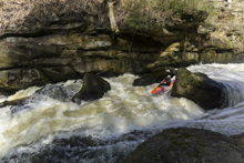
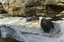
- Weeping Cliff Rapid (III-). The final rapid is the next bend in the river, which is to the right. Stay off the far right and the far left as the left has a high water sieve and the right has an undercut. Down the middle goes great.
Anchor Rock (II-). Immediately below is another small rapid that runs into a huge slab of rock. Just stay right. It then quickly hits the flat water of the lake.
Full Take-out: Across from the Gorge Metro Park, on river left, just upstream of the bridge there is a parking area. To get there, from Broad Blvd in downtown Cuyahoga Falls, take 2nd St south which turns into Front St, for a total of 1.2 miles. Cross the water and turn left to the small parking area. This gets you the last rapid and a short lake paddle.
Hike-out Take-out: 0.5 miles south of Broad Blvd on 2nd St, you will pass HiHo Brewing. Just past this is a parking area on the left. There is a ravine "trail" that you can climb up to this parking area. Using this parking gets you the last rapids and no lake paddle.
Put-in/Park and Huck: Next to Broad Blvd is a side parking area within the Sheraton Property. Currently, they are ok with you parking here. There is a stair case down to the wooden walkway which has a break in it which allows you to descend down to the river level. If you are parking and hucking, the first drop can be walked up on river right, the second drop on river left. You will want lower flows as you will have to attain up the warmup drop, also the eddy between the two rapids is sketchy with higher water.
HTML Comment Box is loading comments...
