Crystal River (Upper Bogan Canyon)
| Stretch: | Marble Mill Site Park to Bogan Flats Campground |
| Difficulty: | Class III to IV |
| Distance: | 4.8 miles |
| Flows: | 500 to ~3,000 cfs. USGS Crystal River above Avalanche Creek gauge |
| Gradient: | 75 fpm average (100 fpm in the rapid sections) |
| Put-in: | Marble Mill Site Park in Marble Co |
| Take-out: | Shoulder and the entrance of Bogan Flats Campground |
| Shuttle: | 4.7 miles, (15 minutes one-way) |
| Season: | Spring off snowmelt |
| Written: | © 2021 |
-
Colorado Road Trip 2021: Day 11 Morning
My big hope for the Crystal drainage was to run Crystal Mill Falls. But after posting on a local forum I found out that the AW estimate of 1,000 cfs for the min was off and 1,500 is more likely an accurate estimate for a worthwhile minimum. So, luckily I had looked into some of the other runs in the area as well so we had backup plans.
Our initial plan for the day was to do the Narrows. But, with the river dropping we scouted it from the road and decided it wouldn't hurt it any to drop more so we went upstream to Bogan Gorge which we were more concerned about getting too low. We got there and found a nice medium flow going through the canyon. On the drive up we scouted the lower part of the canyon, below Bogan Flats but the river was 90% mellow, 100% roadside, and 10% great looking rapids. With my parents in tow and knowing that we planned to boat the Narrows, go back to camp, and then play at the Glenwood Springs wave and cookout, we decided the lower section just didn't look good enough to warrant pushing out timeline for the rest of the day. If you aren't planning a full day of extra activities though, I would for sure add the lower part of the canyon and just be on your toes for the highway culvert which you may need to portage.
Putting in at Marble is interesting. Continue on the dirt road for a few miles and you get to Yule Creek. Go the otherway and get to Crystal Mill Falls and Punchbowl Falls on the South Crystal. Both of those need some clearance on your vehicle apparently. But maybe most interesting (for the nerd types out there, me included) is that the quarry in Marble is where all the marble for the Lincoln Memorial and the Tomb of the Unknown Solider in DC came from. So, woohoo, fun fact!
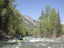
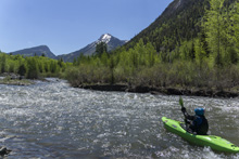
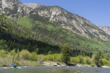
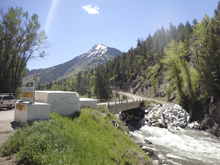
The river begins with occasional “road blast" of marble which is kinda cool and quickly you hit your first bigger section. This then dies down and you enter a beautiful wide valley. As you exit the valley you will cross under the road you came up on, some use this as a put-in. The action pics up just below and continues at a nice clip down to Bogan Flats Campground where we took out.
A story about Bogan Flats Campground. So to preface this, on a previous river we parked at a campground and I told my parents to apologize profusely if confronted by the hosts, move the car if asked, offer to pay to use it as a day use, and leave if need be, preferably heading up river if possible to at least notify us of the change while we were on the water. When they arrived at Bogan Flats after dropping us off at the top, Aster was hungry and grumpy. They went to park in the 3/4rs empty campground (all were reserved and anticipated to fill, but at this point it was 11 am so that wouldn't happen for several hours). The camp ground host saw them and began to yell at them, aggressively approaching my dad like he wanted to engage the 73 year old man in a fight. They asked to just finish feeding the baby first to which the host responded “get out of my fucking campground" to which my dad apparently dropped his own suggestion for the host's sex life. The host then said he was going to call the sheriff. My parents left and parked outside the entrance. Aster was now on the side of the highway. The host leaves to get service to get cell service and comments on the toddler on the side of the highway. Apparently a few minutes later Diane and I arrive and find them and carry out boats up. We skedaddle relatively quickly to just get out of there before any further altercations occur, or god forbid a local sheriff shows up and takes the host's side. On our way out we see the Sheriff, he pulls over as we pass, but does not turn his lights on and lets us be. Thankfully. That night my parents call the National Forest Service Superintendent's office to file a complaint. Citing 1) There was a baby, the aggression and swearing was unwarranted 2) they could have come to an agreement in a much more calm manner 3) the campground was mostly empty 4) it is not the hosts campground to call “my campground" since we are all tax payers. The Superintendent's office was local to the area and knows that kayakers use that location and promised to look into it further. A few days later they call back and say that the hosts have been fired. While I am not a fan of anyone losing their job, especially knowing that my parents didn't follow my previous instructions to not force the issue and we would figure it out, but I am guessing that these hosts did not help their own case when the office investigated them. Anyways, I am just relaying this interaction as a comment… there was shoulder parking on the highway, use that, or consider paddling all the way down through the lower portion of Bogan and take out on a shoulder along the highway down lower.
For flow, we had 1,200 cfs and dropping from the diurnal of the day. I thought this was a great flow, not too high and not low.
Mi 0.5:
- First Gorge (III to IV). Perhaps the hardest rapid on the section, this rapid is the first you come to. It typical Colorado fashion, it is continuous read and run, with hole or rock dodging depending on the flow. There is marble road blast lining the right shore through parts of this rapid which is kinda cool and unique.
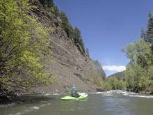
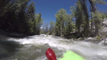
- Not There Yet (III- to III). You will cross under a bridge and then shortly thereafter enter another set of rapids which was the easiest set of rapids on the run.
- Bridge (III- to III). This is the bridge that you cross over on the way up. A small rapid is under it, just follow the flow.
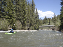
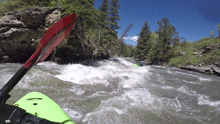
- Let the Fun Begin (III to IV). The main canyon of the section, this rapid goes on for about a half mile and is non-stop. It was read and run at our flow with a few holes to punch and rocks to avoid. Really nice section, and the road is pulled away more or less for it so you have some feeling of solitude.
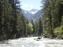
- Group Campsite: After a half mile the main canyon winds down and you quickly moves through class II+ boogie to the signs of the campground. The first obvious camp that you see is the group campsite which is actually not connected to the main campground location. So continue to the next signs of a campground which will be small trails up from the river and the view of the tops of tents assuming the campsites are occupied.
Take-out: From the town of Redstone, head south on CO-133 for 5.1 miles. Turn left on County Road 3 (paved) towards Marble and follow for 1.5 miles. Park on the shoulder near the entrance Bogan Flats Campground. See the story above regarding driving into the campground even when it was nearly empty.
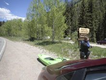
Put-in: Continue south on County Rd 3 towards Marble. As you enter the town the speed limit drops so be respectful. Once in town, turn right onto Park St and follow this to the park which is 100 feet before the bridge over the river.
HTML Comment Box is loading comments...

